

Drive from Kathmandu to Besisahar and on up the Marsyangdi valley to Dharapani, at 1,860 m, a long day of nine to ten hours on winding roads. The valley is steep and green, with waterfalls and terraced villages, and the road continues beyond Besisahar on jeep track. Dharapani has a few lodges beside the river and is the junction with the trail to Manaslu. If you want an easier first day you can begin walking at Besisahar or Bulbule instead. Check your gear, drink plenty of water and get an early night; tomorrow's walk is the first full day on foot.
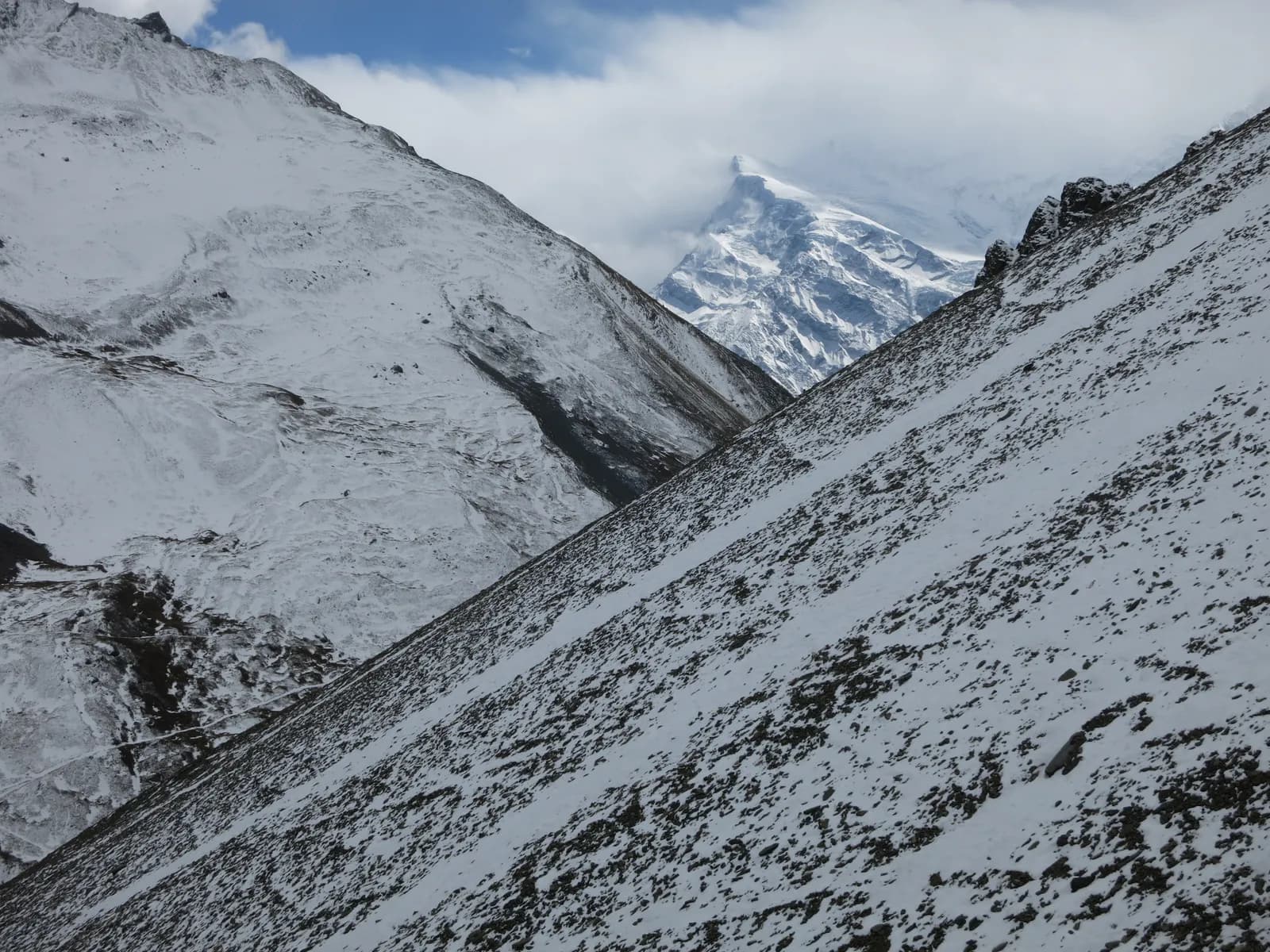
Annapurna Circuit Trek
The classic circuit through the Marsyangdi and Kali Gandaki valleys over Thorong La, ending with the Poon Hill sunrise.
- 天数14
- 最高海拔5,416 米
- 距离175 公里
- 爬升9,492 米
- 难度困难
- 最佳月份Mar–May, Oct–Nov
- 许可证2
照片:Vaupk12 · CC BY-SA 4.0
以英文显示——尚未翻译。
Written by FindTrekkingPartner team审核人:FindTrekkingPartner team我们如何审核FindTrekkingPartner
Annapurna Circuit Trek是尼泊尔Annapurna地区一条为期 14 天的徒步路线,最高海拔 5,416 米。外国徒步者可以在 FindTrekkingPartner 上发布行程,写明日期、预算和节奏,为这条路线寻找搭档。在双方徒步者都同意之前,匹配信息保持私密,且服务免费。 按中档价格计算,持证向导在 14 天内的费用为:四名徒步者分摊时每人约 88 美元,一人独自出行则为 350 美元。最佳季节为Mar–May, Oct–Nov。 这里实际上需要持证向导:据2026年的运营商反映,尼泊尔旅游局2023年4月的规定在国家公园和保护区的检查站得到执行,其中朗唐最严格,安纳布尔纳也会检查(2026年10月19日核查)。请通过注册旅行社聘请向导,并向他们确认。 这条路线的开放行程列在下方,包含出发月份、团队人数和剩余名额。 最后核实:2026年10月21日。资料来源:尼泊尔旅游局、DNPWC、移民局。
资料来源:Department of Immigration, NepalNepal Tourism BoardDepartment of National Parks and Wildlife Conservation
为Annapurna Circuit Trek寻找搭档
- 为Annapurna Circuit Trek寻找搭档4 个开放行程
- 为Annapurna Base Camp Trek寻找搭档25 个开放行程
- 为Poon Hill Trek (Ghorepani)寻找搭档3 个开放行程
- 为Tilicho Lake Trek寻找搭档5 个开放行程
- 为Mardi Himal Trek寻找搭档27 个开放行程
- 为Khopra Ridge Trek寻找搭档暂无开放行程
概览
从 Kathmandu 出发垭口:Thorong La14 天 · 最高 5,416 米
最佳季节:Mar–May, Oct–Nov · 许可证:Annapurna Conservation Area entry permit, TIMS card where required
The Annapurna Circuit is a loop around the Annapurna massif that crosses Thorong La, at 5,416 m, between the Marsyangdi valley in the east and the Kali Gandaki valley in the west. This 14-day plan starts with a drive to Dharapani, follows the Marsyangdi through Chame and Upper Pisang to Manang, spends a day acclimatising, and crosses the pass from Thorong Phedi to Muktinath. It then follows the Kali Gandaki through Kagbeni, Jomsom and Marpha, passes Kalopani to Tatopani's hot springs, and climbs to Ghorepani for the Poon Hill sunrise. Roads now cover much of the valleys, so this plan uses jeeps on a few sections, and you walk the best of the route. The pass crossing and the altitude make it a serious trek. It suits strong walkers with some previous altitude experience, and a guide or guide-porter is wise for the pass day and for winter conditions.
What the trek is like
The Marsyangdi valley is wet and forested at first, with waterfalls, and gradually becomes drier and more Tibetan in character beyond Chame, with chortens, mani walls and apple orchards. Upper Pisang, Ghyaru and Ngawal sit above the main valley, and the high trail through them has the best views of Annapurna II and Annapurna IV. Manang is a Tibetan-influenced village at about 3,540 m with a famous acclimatisation day. Above it, the trail climbs through Yak Kharka and Thorong Phedi to the pass. After Muktinath, a pilgrimage site sacred to Hindus and Buddhists, the Kali Gandaki gorge is windy and dry. Below Marpha you walk into deep, forested valleys again.
Highlights
- The high trail through Ghyaru and Ngawal
- Manang and the hike to Gangapurna Lake or Ice Lake
- Thorong La at 5,416 m
- Muktinath, Kagbeni and the Kali Gandaki gorge
- Marpha's apple orchards and Tatopani's hot springs
- Poon Hill sunrise to end the trek
Permits and rules
You need an Annapurna Conservation Area entry permit and a TIMS card where required, available from the Nepal Tourism Board. Checkposts are at Besisahar, Chame and elsewhere. The Nepal Tourism Board April 2023 rule requires foreign trekkers to use a licensed guide in national parks and conservation areas, and 2026 operator reports say checkpoints enforce it in Annapurna (ACAP), Langtang (the strictest) and most other parks, but not in Khumbu, where the municipality opted out (checked 19 October 2026). See the guide rule by region. A guide or guide-porter is recommended for the pass day. Check current permit costs with the issuing offices.
Roads and how the trek has changed
Jeep roads now follow the Marsyangdi valley to Manang and the Kali Gandaki valley beyond Muktinath, so large stretches of the original trail are shared with vehicles or have been replaced. Many people therefore start at Chame or Dharapani and finish at Jomsom or Muktinath, which shortens the walk to eight to twelve days. The Thorong La crossing and the Ghorepani to Poon Hill section remain trail only. This plan uses the road on days 1 and 12 and keeps the walking on footpaths wherever possible.
Best season
October and November have the most reliable weather and the most trekkers. March to May is a good alternative, with flowers and a warmer climate. Winter brings deep snow and avalanches on the pass and the pass can be closed. The monsoon (June to August) is wet in the south but much drier in the north.
Acclimatisation and the pass day
You gain altitude rapidly after Manang, so respect the rest day and use it for a short hike. Sleeping at Yak Kharka (4,050 m) and Thorong Phedi (4,540 m) is a standard sequence, and some groups sleep at High Camp, 4,880 m. The crossing begins before dawn, climbs about 1,000 m to the top and descends 1,600 m to Muktinath, which is a long day of eight to ten hours. A blizzard in October 2014 killed dozens of people near the pass. Watch the weather, carry warm layers and be willing to turn back.
Lodges and food
Lodges are plentiful, with some offering hot showers and Wi-Fi. Marpha is known for apples, and Manang has bakeries and a small cinema. Carry cash because machines in Besisahar, Manang and Jomsom can run out.
Packing list
Waterproof boots, warm layers, a down jacket, insulated gloves, thick hat, goggles or sunglasses for the pass, a sleeping bag rated to about -10 C, trekking poles, a headlamp, water purification and a first-aid kit.
Who this trek suits and how to prepare
The circuit suits experienced walkers who are comfortable with long days and who have acclimatised well before. Prepare for two to three months with long hill walks, stair climbing and some cardio. If you have not been above 4,000 m, consider a shorter trek first. The pass day demands good cold-weather gear and a plan for turning back.
The plan at a glance
Day 1 drives to Dharapani, and days 2 to 5 walk through Chame, Upper Pisang and Ngawal to Manang (3,540 m). Day 6 is a rest day. Day 7 climbs to Yak Kharka, day 8 to Thorong Phedi, and day 9 crosses Thorong La to Muktinath. Day 10 reaches Jomsom, day 11 Kalopani, and day 12 drives to Tatopani. Day 13 climbs to Ghorepani, and day 14 finishes with Poon Hill and the descent to Nayapul.
Ways to shorten or change the trek
Many people start at Chame, Pisang or Manang to avoid road sections, which saves two to four days. Others end at Muktinath or Jomsom and fly or drive to Pokhara, saving the Kali Gandaki walk. A popular variation adds the side trip to Tilicho Lake, a glacial lake at about 4,920 m, which needs two or three more days. Discuss options with your guide.
Practical tips from the trail
- Take the Manang rest day seriously, and attend the altitude talk at the HRA post.
- Carry a warm layer, a windproof jacket and goggles for Thorong La.
- Leave very early on the pass day, and do not stop for long at the top: it is cold and windy.
- In Marpha, buy apple pie and apple brandy as a reward.
- Be careful on road sections: jeeps and motorbikes use the same track.
Responsible trekking
Support family lodges, carry out waste, and avoid taking jeeps where the trail is safer and quieter. Treat guides and porters well, especially on the pass day.
亮点
- Ghyaru and Ngawal high trail
- Manang acclimatisation hike
- Thorong La (5,416 m)
- Muktinath and the Kali Gandaki gorge
- Tatopani hot springs and Poon Hill sunrise
路线地图
路线数据来自 OpenStreetMap,尚未经我们团队核实。请仅用于规划,不要用于导航。
逐日行程
你的住宿海拔比前一晚高出 810 米,超过了通常 500 米的建议上限。请放慢节奏,多喝水,并留意头痛或恶心。
Walk up the Marsyangdi valley through Bagarchhap, Danaque and Timang, where Manaslu and Peri Himal appear to the north. The path follows the road in places and keeps to the river in others; the forest of pine and oak thins as you climb. Chame, at 2,670 m, is the headquarters of Manang district and has a bank machine, shops and hot springs a short walk from the village. The air is thinner here, and the first views of Lamjung Himal and Annapurna II appear. Rest and watch the evening light on the peaks.
你的住宿海拔比前一晚高出 630 米,超过了通常 500 米的建议上限。请放慢节奏,多喝水,并留意头痛或恶心。
Continue along the Marsyangdi, crossing to Bhratang and walking through a dry pine forest below the huge curved rock face of Paungda Danda. The valley opens at Dhikur Pokhari, with its views of Annapurna II, and the trail climbs to Upper Pisang, at 3,300 m, a village of stone houses above the road. The village has a small monastery and wide views. The landscape is now Tibetan in character, with chortens, prayer flags and apple orchards. Decide here whether to take the high trail through Ghyaru tomorrow; it is worth the effort.
Take the upper route from Upper Pisang, a steep climb through juniper to Ghyaru, at about 3,700 m, and onward along the ridge to Ngawal at 3,600 m. The path is one of the finest on the circuit: Annapurna II, Annapurna III, Gangapurna and Tilicho Peak fill the view south, and you can see the entire Manang valley below. The villages are old and the houses are stacked up the hillside. The lower route through Humde is faster but less scenic. The altitude gain is modest, but the path is steep, so go slowly and keep your water close.
Descend gently from Ngawal to Braka, pass Mugje, and walk into Manang, at 3,540 m, via the airstrip at Humde. Manang is a Tibetan-influenced village with stone alleys, bakeries and a small cinema, and the view of Gangapurna and Annapurna III from the lodges is spectacular. In the afternoon, visit the Himalayan Rescue Association post, which gives a talk on altitude sickness in the trekking seasons. It is a short day and a chance to rest, wash your clothes and explore. Drink water throughout, and watch for headaches.
A rest day at Manang. Choose a short acclimatisation hike: up to the viewpoint above Gangapurna Lake, a glacier-fed lake with a broad view of the glacier, or the longer climb to Ice Lake (Kicho Tal) at about 4,600 m. Return to sleep at 3,540 m. Do not push hard; the purpose of the day is to prepare for Thorong La. Also attend the altitude talk at the HRA post if you have not already. Spend the afternoon resting, drinking and eating well, and checking your gear for the pass.
你的住宿海拔比前一晚高出 510 米,超过了通常 500 米的建议上限。请放慢节奏,多喝水,并留意头痛或恶心。
Leave Manang and climb through scrub and juniper to Gunsang, then up the valley to Yak Kharka, at 4,050 m. The valley is open and windy, with yaks grazing on the hills, and Chulu peaks and Gangapurna in the view. It is a short day of about four hours, designed for acclimatisation. Take a stroll up the hill behind the lodge in the afternoon, and then rest. The nights are cold and the altitude begins to be felt, so drink plenty of water and watch for headaches or poor sleep. Eat as much as you can.
Walk up the valley to Thorong Phedi, at 4,540 m, climbing a steep slope with views of Thorong Peak and the pass above. The path crosses a small bridge and passes a rock face where landslides sometimes close the trail. Thorong Phedi is a cluster of lodges at the foot of the climb, and some groups continue up to High Camp at 4,880 m for a shorter crossing the next day. Others stay here and sleep. Rest, eat and prepare your clothes and headlamp for the early start. The lodges are busy and basic.
Start by 4 or 5 am and climb a steep zigzag path to the top of Thorong La, at 5,416 m, with prayer flags at the top and views of Dhaulagiri and the Mustang peaks. The climb takes four to five hours from Thorong Phedi. From the top, a long descent of about 1,600 m takes you to Muktinath, at 3,800 m, a temple complex sacred to Hindus and Buddhists. The descent is hard on the knees, so use poles and keep going. It is a very long day of eight to ten hours. Turn back if the weather closes in.
Walk from Muktinath through Jharkot and Kagbeni, a medieval village at the gateway to Upper Mustang, and follow the Kali Gandaki valley to Jomsom, at 2,720 m. The wind rises through the morning, so start early. The trail runs along a jeep track in the riverbed and at times on footpaths. Jomsom is a busy town with an airport, shops and lodges. Many trekkers end their walk here and fly to Pokhara. If you continue, buy supplies, check the wind and rest. It is a fine day with a strong sense of arriving in a different landscape.
Follow the Kali Gandaki south through Tukuche and Marpha, a tidy Thakali village known for apples and apple brandy, and walk on to Kalopani, at 2,530 m, with views of Dhaulagiri and Annapurna I. The valley changes from high desert to pine forest, and the wind drops. Marpha is a good lunch stop with its whitewashed houses and orchards. In some seasons jeeps are available for part of the day. It is a long, mostly flat walk of five to six hours. Kalopani has several lodges and the views from the village are fine.
Drive from Kalopani down the Kali Gandaki gorge, one of the deepest in the world, to Tatopani, at 1,190 m, about three hours by road. The road is rough and scenic, with waterfalls and terraced fields. Tatopani means hot water, and the hot springs by the river are a welcome treat after the pass. The hot pools are shared and are busy in the evening. The warmer climate and the lower altitude help you sleep. Wash your clothes, rest your legs and enjoy the oranges and the garden restaurants. Tomorrow's climb to Ghorepani is long.
你的住宿海拔比前一晚高出 1,670 米,超过了通常 500 米的建议上限。请放慢节奏,多喝水,并留意头痛或恶心。
A long climb of about 1,700 m from Tatopani to Ghorepani, at 2,860 m, through Ghara, Shikha and Chitre, where stone steps lead through rhododendron forest. It is a tiring day of seven to eight hours, and the trail is shared with trekkers on the Poon Hill route. Start early and take breaks to drink water. Ghorepani is a large village of lodges at a pass, with big views to the north when the clouds lift. Eat well and rest. Set your alarm for the Poon Hill sunrise walk tomorrow, if the weather looks good.
Climb Poon Hill, at 3,210 m, before dawn in about 45 minutes for sunrise over Dhaulagiri, Annapurna I and Machhapuchhre, then return for breakfast. Walk down through Ulleri, with its long stone staircase of thousands of steps, to Tikhedhunga and Nayapul, where jeeps wait for the drive to Pokhara. The descent is steep, with views of the Bhurungdi valley. The drive to Pokhara takes about 1.5 hours. In Pokhara you can finally enjoy a hot shower, a meal by the lake and rest. This ends the circuit.
高原适应
逐晚的住宿海拔。红色柱表示比前一晚上升超过 500 米;休息日已标出。
- 住宿海拔
- 上升超过 500 米
- 休息日
费用
每人全包费用估算:按海拔计的客栈和餐饮、交通、许可证,以及向导和挑夫。共用向导和挑夫的徒步者越多,每人付得越少。 截至 2026年10月。
| 风格 | 1 位徒步者分摊 | 2 位徒步者分摊 | 4 位徒步者分摊 |
|---|---|---|---|
| 经济 | US$640–US$940* | US$500–US$730* | US$430–US$620* |
| 中档 | US$1,050–US$1,600* | US$740–US$1,100* | US$630–US$940* |
| 舒适 | US$1,150–US$1,750* | US$940–US$1,400* | US$830–US$1,250* |
共用向导,省钱
中档风格下,独自徒步者约付 US$1,050–US$1,600;四位徒步者共用一名向导和两名挑夫,每人约付 US$630–US$940(区间上限处少 40%)。
2 位徒步者分摊的明细
| 项目 | 经济 | 中档 | 舒适 |
|---|---|---|---|
| 客栈和餐饮 | US$310–US$440 | US$390–US$570 | US$490–US$710 |
| 交通 | US$10–US$40 | US$80–US$130 | US$80–US$130 |
| 许可证 | US$30–US$40 | US$30–US$40 | US$30–US$40 |
| 向导 | US$140–US$210 | US$140–US$210 | US$140–US$210 |
| 挑夫 | — | US$90–US$160 | US$180–US$310 |
经济风格乘坐公共交通且不请挑夫;中档风格两位徒步者共用一名挑夫并使用包车;舒适风格每位徒步者各配一名挑夫。在要求有向导或选择中档、舒适风格时包含向导。
每晚客栈和餐饮(房间加一份 dal bhat)
2 晚Below 2,500 m:房间 US$2–US$6,dal bhat US$4–US$7 · 9 晚2,500 to 3,800 m:房间 US$4–US$9,dal bhat US$5–US$9 · 2 晚Above 3,800 m:房间 US$10–US$15,dal bhat US$10–US$12
许可证费用(官方来源)
未包含
未找到以下项目的公开价格:Besisahar to Dharapani jeep; Tatopani to Pokhara bus or jeep。标有 * 的总额不含这些项目,请向旅行社询问。
费用来源
- PriceNepal: Nepal Travel Cost Guide 2026 (2026-05-14)
- Third Rock Adventures: Nepal trek budget planner (2026-05-09)
- Himalayan Partner: Guide and porter price in Nepal 2026 (2026-02-10)
- Shikhar Adventure: Annapurna Circuit trek cost (2026-02-03)
估算来自运营商指南,并非报价。小费、保险、装备和加德满都酒店不包含在内;美元按平台汇率换算。
照片
常见问题
This plan takes 14 days from Kathmandu. Starting at Chame or Pisang and ending at Jomsom or Muktinath takes 8 to 12 days.
It is a long day of eight to ten hours, climbing about 1,000 m and descending 1,600 m, at up to 5,416 m. It needs good acclimatisation and good weather.
Counter-clockwise (Manang to Muktinath) is the standard direction, because the gain is gradual and the descent to Muktinath is steep but short.
Yes. Jeep roads reach Manang and Muktinath. Thorong La and the Ghorepani section have no road.
October and November, and March to May. Winter can close the pass.
A licensed guide is required in practice: the Nepal Tourism Board April 2023 rule is enforced at checkpoints in Annapurna and Langtang and most parks (2026 operator reports, checked 19 October 2026). A guide is recommended for the pass day and in winter.
Altitude, cold and sudden storms, including the October 2014 blizzard. Start before dawn and turn back if conditions deteriorate.
Not reliably. Winter, December to February, can close the pass, and storms can shut it suddenly, so the best seasons are March to May and October to November. Check conditions in Manang the day before you cross and keep spare days (as of November 2026).
来源
- Annapurna Conservation Area (Wikipedia)
- National Trust for Nature Conservation (ACAP)
- Department of National Parks and Wildlife Conservation, Nepal
- Nepal Tourism Board
- Annapurna Circuit (Wikipedia)
- Thorong La (Wikipedia)
- Muktinath (Wikipedia)
- Thorong La: Thorong Phedi and High Camp elevations (Wikipedia)
- OpenStreetMap (elevation tags of passes, peaks and villages)
沿途
路线每一天的住宿、医疗救助、饮水和景点。
1. Kathmandu → Dharapani
- Tribhuvan International Airport · 机场与交通 · 1,340 米
2. Dharapani → Chame
- Hayenga Waterfall · 自然 · 2,053 米
- Viewpoint · 观景点 · 1,840 米
- ACAP Safe Drinking Water Station · 实用信息 · 2,162 米
- Hotel Four Seasons · 住宿 · 2,676 米
- Moonlight Hotel · 住宿 · 2,676 米
- Hotel Manasulu View · 住宿 · 2,678 米
- Trekkers Holiday Holtel · 住宿 · 2,678 米
Show all 23 places
- Hayenga Waterfall · 自然 · 2,053 米
- Manaslu Hotel Restaurant · 住宿 · 1,820 米
- Hayat Guest House · 住宿 · 1,818 米
- Viewpoint · 观景点 · 1,840 米
- Peaceful Hotel · 住宿 · 1,876 米
- Gyasumda Hotel & Restaurant · 住宿 · 1,877 米
- Dafne Hotel · 住宿 · 1,881 米
- Marsyangdi Lodge · 住宿 · 2,076 米
- Pasang · 住宿 · 2,082 米
- Eco Holiday home · 住宿 · 2,081 米
- Tilicho Hotel · 住宿 · 2,099 米
- ACAP Safe Drinking Water Station · 实用信息 · 2,162 米
- Hotel Manaslu · 住宿 · 2,172 米
- Mt Kailash · 住宿 · 2,200 米
- Potala · 住宿 · 2,208 米
- Happy Home Cottage · 住宿 · 2,601 米
- Tibet Lhasa Guest House · 住宿 · 2,601 米
- Snowland Hotel · 住宿 · 2,602 米
- Hotel Four Seasons · 住宿 · 2,676 米
- Moonlight Hotel · 住宿 · 2,676 米
- Hotel Manasulu View · 住宿 · 2,678 米
- Trekkers Holiday Holtel · 住宿 · 2,678 米
- Potala Guest House & Restaurant · 住宿 · 2,680 米
3. Chame → Upper Pisang
- Chame Hot springs · 自然 · 2,697 米
- Manang District Hospital · 医疗 · 2,732 米
- Viewpoint · 观景点 · 2,516 米
- Drinking Water · 实用信息 · 3,801 米
- Hotel Nirvana · 住宿 · 3,281 米
- Hotel Narbulinka Pisang · 住宿 · 3,291 米
- Hotel Royal Nyeshang · 住宿 · 3,290 米
- Hotel Alobar 3300 · 住宿 · 3,288 米
Show all 24 places
- Hotel Marshyangdi Mandala · 住宿 · 2,664 米
- Chame Hot springs · 自然 · 2,697 米
- Royal Garden Hotel · 住宿 · 2,670 米
- Manang District Hospital · 医疗 · 2,732 米
- Sangso Guest House · 住宿 · 2,673 米
- White Stupa · 住宿 · 2,690 米
- Happy Guest House · 住宿 · 2,696 米
- New Mount View · 住宿 · 2,774 米
- Talekhu · 住宿 · 2,776 米
- Campsite · 住宿 · 2,694 米
- Viewpoint · 观景点 · 2,516 米
- Drinking Water · 实用信息 · 3,801 米
- Sworgadwari Hotel & Restaurant · 住宿 · 3,188 米
- Gangapurna · 住宿 · 3,186 米
- Kamala · 住宿 · 3,197 米
- Maya Hotel & Restaurant · 住宿 · 3,186 米
- Hotel Nirvana · 住宿 · 3,281 米
- Hotel Narbulinka Pisang · 住宿 · 3,291 米
- Hotel Royal Nyeshang · 住宿 · 3,290 米
- Hotel Alobar 3300 · 住宿 · 3,288 米
- Hilltop Hotel Upper Pisang · 住宿 · 3,298 米
- Happiness Guest house · 住宿 · 3,303 米
- Royal mountain · 住宿 · 3,310 米
- Hotel Mountain Bridge · 住宿 · 3,326 米
4. Upper Pisang → Ngawal
- Viewpoint · 观景点 · 3,301 米
- Green lake · 自然 · 3,262 米
- Water tap (Disfunctional July 2019) · 实用信息 · 3,449 米
- Drinking Water · 实用信息 · 3,603 米
- Nagwal Cottage · 住宿 · 3,658 米
- Himalaya Hotel · 住宿 · 3,657 米
- New Annapurna · 住宿 · 3,651 米
- Tibet Guest House & Restaurant · 住宿 · 3,671 米
Show all 18 places
- Campsite · 住宿 · 3,422 米
- Viewpoint · 观景点 · 3,301 米
- Hotel Mringkyo · 住宿 · 3,266 米
- Green lake · 自然 · 3,262 米
- Camping · 住宿 · 3,271 米
- Water tap (Disfunctional July 2019) · 实用信息 · 3,449 米
- Drinking Water · 实用信息 · 3,603 米
- Pema guest house · 住宿 · 3,697 米
- Yak Ru Hotel · 住宿 · 3,702 米
- Gorkhali Hotel · 住宿 · 3,704 米
- Annapurna Hotel · 住宿 · 3,716 米
- New Annapurna guest house · 住宿 · 3,721 米
- Hôtel Mount View · 住宿 · 3,665 米
- Nagwal Cottage · 住宿 · 3,658 米
- Himalaya Hotel · 住宿 · 3,657 米
- New Annapurna · 住宿 · 3,651 米
- Manang Airport · 机场与交通 · 3,353 米
- Tibet Guest House & Restaurant · 住宿 · 3,671 米
5. Ngawal → Manang
- Viewpoint · 观景点 · 3,632 米
- Hotel Manang · 住宿 · 3,533 米
- Hotel Mountain Lake · 住宿 · 3,537 米
- Hotel Nilgiri · 住宿 · 3,539 米
- HRA Manang Aid Post · 医疗 · 3,540 米
- Hotel Yeti · 住宿 · 3,537 米
Show all 21 places
- Buddha Kitchen Hotel · 住宿 · 3,658 米
- Royal Nyeshyang · 住宿 · 3,655 米
- Ngawal · 住宿 · 3,673 米
- Shanti Hotel · 住宿 · 3,675 米
- Viewpoint · 观景点 · 3,632 米
- Hotel New Yak · 住宿 · 3,472 米
- Hotel Buddha & peace cafe · 住宿 · 3,473 米
- Himalayan lodge · 住宿 · 3,474 米
- Namaste trekkers homestay · 住宿 · 3,485 米
- Hotel Manang · 住宿 · 3,533 米
- Hotel Mountain Lake · 住宿 · 3,537 米
- Hotel Nilgiri · 住宿 · 3,539 米
- HRA Manang Aid Post · 医疗 · 3,540 米
- Hotel Yeti · 住宿 · 3,537 米
- Tilicho Hotel & Restaurant · 住宿 · 3,538 米
- Hotel Marsyangdi · 住宿 · 3,545 米
- Yak Hotel · 住宿 · 3,544 米
- Alpine home · 住宿 · 3,544 米
- Gangapurna Hotel Lodge · 住宿 · 3,543 米
- Ghyalchan & Sister · 住宿 · 3,543 米
- Ghale guest house · 住宿 · 3,544 米
6. Manang
- Manang Health Post · 医疗 · 3,558 米
- Hotel North Pole · 住宿 · 3,550 米
- Moon Light hotel · 住宿 · 3,550 米
- ACAP Safe Drinking Water Station · 实用信息 · 3,550 米
- Moon Light Hotel & Restaurant · 住宿 · 3,550 米
- Hotel Royal Manang · 住宿 · 3,552 米
- Safe Drinking Water Station · 实用信息 · 3,550 米
- Viewpoint · 观景点 · 3,673 米
Show all 9 places
- Manang Health Post · 医疗 · 3,558 米
- Hotel North Pole · 住宿 · 3,550 米
- Moon Light hotel · 住宿 · 3,550 米
- ACAP Safe Drinking Water Station · 实用信息 · 3,550 米
- Moon Light Hotel & Restaurant · 住宿 · 3,550 米
- Hotel Royal Manang · 住宿 · 3,552 米
- Safe Drinking Water Station · 实用信息 · 3,550 米
- Himalayan Singi Hotel · 住宿 · 3,547 米
- Viewpoint · 观景点 · 3,673 米
7. Manang → Yak Kharka
- Xchongla Homestay · 住宿 · 3,547 米
- Thorong La · 住宿 · 3,549 米
- Viewpoint · 观景点 · 3,594 米
- Dhading Lodge · 住宿 · 4,024 米
- Hotel Gangapurna · 住宿 · 4,022 米
- Safe Drinking Water Station · 实用信息 · 4,024 米
Show all 10 places
- Xchongla Homestay · 住宿 · 3,547 米
- Thorong La · 住宿 · 3,549 米
- Manaslu · 住宿 · 3,554 米
- Viewpoint · 观景点 · 3,594 米
- Chulu West · 住宿 · 3,919 米
- Marshiangdi Hotel · 住宿 · 3,931 米
- Yak Hotel · 住宿 · 4,020 米
- Dhading Lodge · 住宿 · 4,024 米
- Hotel Gangapurna · 住宿 · 4,022 米
- Safe Drinking Water Station · 实用信息 · 4,024 米
8. Yak Kharka → Thorong Phedi
- Dhading Laxmi Hotel · 住宿 · 4,202 米
- Snowland · 住宿 · 4,219 米
- New Chuli Base Camp · 住宿 · 4,217 米
- Churi Ledar · 观景点 · 4,215 米
- ACAP Safe Drinking Water Station · 实用信息 · 4,214 米
- Hotel Churi Lattar · 住宿 · 4,215 米
- Small wooden bridge at river level. · 观景点 · 4,354 米
Show all 13 places
- Thorong Peak Hotel · 住宿 · 4,028 米
- Hotel Nyeshyang · 住宿 · 4,033 米
- Hotel Dream Home · 住宿 · 4,053 米
- Himalayan View Hotel · 住宿 · 4,107 米
- Saino Lodge · 住宿 · 4,145 米
- Dhading Laxmi Hotel · 住宿 · 4,202 米
- Snowland · 住宿 · 4,219 米
- New Chuli Base Camp · 住宿 · 4,217 米
- Churi Ledar · 观景点 · 4,215 米
- ACAP Safe Drinking Water Station · 实用信息 · 4,214 米
- Hotel Churi Lattar · 住宿 · 4,215 米
- Hotel Trekkers · 住宿 · 4,231 米
- Small wooden bridge at river level. · 观景点 · 4,354 米
9. Thorong Phedi → Muktinath
- Drinking Water · 实用信息 · 4,549 米
- Viewpoint · 观景点 · 5,218 米
- Thorang Lha · 住宿 · 4,168 米
- Nice View · 住宿 · 4,156 米
- Paradise · 住宿 · 4,143 米
- Panorama Inn · 住宿 · 4,118 米
Show all 11 places
- Hotel New Phedi · 住宿 · 4,549 米
- Thorong Base Camp Lodge · 住宿 · 4,535 米
- Drinking Water · 实用信息 · 4,549 米
- Thorong High Camp Hotel · 住宿 · 4,800 米
- Thorong-ra High Camp · 住宿 · 4,882 米
- Yakawa Thorung Guest House · 住宿 · 5,069 米
- Viewpoint · 观景点 · 5,218 米
- Thorang Lha · 住宿 · 4,168 米
- Nice View · 住宿 · 4,156 米
- Paradise · 住宿 · 4,143 米
- Panorama Inn · 住宿 · 4,118 米
10. Muktinath → Jomsom
- Jharkot Health Post · 医疗 · 3,530 米
- Safe drinking water station · 实用信息 · 2,856 米
- Viewpoint · 观景点 · 2,798 米
- Peace And Heaven Guest House And Restaurant · 住宿 · 2,752 米
- Cold Desert · 住宿 · 2,751 米
- Hotel Naulo · 住宿 · 2,751 米
- Pride N Spa · 住宿 · 2,746 米
Show all 22 places
- Jharkot Health Post · 医疗 · 3,530 米
- Layers · 住宿 · 2,850 米
- Show Boat Hotel - Ama chorten cafe · 住宿 · 2,859 米
- Red House · 住宿 · 2,857 米
- Safe drinking water station · 实用信息 · 2,856 米
- Lhasa · 住宿 · 2,838 米
- Yak Donalds · 住宿 · 2,835 米
- Mount Everest · 住宿 · 2,834 米
- Monalisa · 住宿 · 2,834 米
- Jabyang · 住宿 · 2,835 米
- Shangri La · 住宿 · 2,836 米
- Paradise · 住宿 · 2,842 米
- Nilgiri Hotel · 住宿 · 2,841 米
- Viewpoint · 观景点 · 2,798 米
- Peace And Heaven Guest House And Restaurant · 住宿 · 2,752 米
- Cold Desert · 住宿 · 2,751 米
- Hotel Naulo · 住宿 · 2,751 米
- Pride N Spa · 住宿 · 2,746 米
- New Galaxy Guest House · 住宿 · 2,748 米
- Jomsom Paradise · 住宿 · 2,752 米
- Thak Khola Lodge&Restaurant · 住宿 · 2,749 米
- Hotel Cold Desert · 住宿 · 2,737 米
11. Jomsom → Kalopani
- Mustang District Hospital · 医疗 · 2,740 米
- ACAP Safe Drinking Water Station · 实用信息 · 2,747 米
- Viewpoint · 观景点 · 2,697 米
- Marpha Palace · 住宿 · 2,694 米
- Mount Villa · 住宿 · 2,694 米
- Hotel Sonam · 住宿 · 2,682 米
- Marpha Health Post · 医疗 · 2,701 米
- The blue star · 住宿 · 2,681 米
Show all 27 places
- Mustang District Hospital · 医疗 · 2,740 米
- ACAP Safe Drinking Water Station · 实用信息 · 2,747 米
- Trekkers Inn · 住宿 · 2,746 米
- Hotel Trekkers Inn · 住宿 · 2,744 米
- Hotel Mustang Monalisha · 住宿 · 2,743 米
- Hotel Mountain View · 住宿 · 2,741 米
- Xanadu Homes · 住宿 · 2,747 米
- Neeru · 住宿 · 2,748 米
- Kali Gandaki Guest House · 住宿 · 2,748 米
- Jomsom Airport · 机场与交通 · 2,743 米
- Hotel Airport Inn · 住宿 · 2,749 米
- Shavana · 住宿 · 2,754 米
- Dumba Lake · 自然 · 2,828 米
- Viewpoint · 观景点 · 2,697 米
- Hotel Royal Snow Leopard · 住宿 · 2,705 米
- Snow Leopard II · 住宿 · 2,692 米
- Dhaulagiri Guest House · 住宿 · 2,691 米
- Hotel Sunrise · 住宿 · 2,690 米
- Hotel Tanpopo · 住宿 · 2,690 米
- Paradise Guest House · 住宿 · 2,694 米
- Neeru Guest House · 住宿 · 2,695 米
- Marpha Palace · 住宿 · 2,694 米
- Mount Villa · 住宿 · 2,694 米
- Hotel Sonam · 住宿 · 2,682 米
- Marpha Health Post · 医疗 · 2,701 米
- The blue star · 住宿 · 2,681 米
- Primary Health Care Center · 医疗 · 2,658 米
12. Kalopani → Tatopani
这一天还没有标注任何地点。这一天还没有标注任何地点。13. Tatopani → Ghorepani
- Viewpoint · 观景点 · 1,576 米
- Mina Restaurant & guest house · 住宿 · 1,604 米
- Laxmi Lodge · 住宿 · 1,678 米
- Drinking Water · 实用信息 · 2,006 米
- Tourist Checkpoint · 医疗 · 2,041 米
- Medical Dental Lab · 医疗 · 2,401 米
- New Dhaulagiri · 住宿 · 2,397 米
- Namaste Lodge · 住宿 · 2,440 米
Show all 20 places
- Viewpoint · 观景点 · 1,576 米
- Mina Restaurant & guest house · 住宿 · 1,604 米
- Laxmi Lodge · 住宿 · 1,678 米
- Excellent View Guest House · 住宿 · 1,692 米
- Rejina Guest House &Restaurant · 住宿 · 1,790 米
- New Mountain Lodge · 住宿 · 1,785 米
- New Hotel Annapurna · 住宿 · 1,797 米
- Namaste Shika · 住宿 · 1,900 米
- Hotel Monalisa · 住宿 · 1,952 米
- Moon Light Guest House · 住宿 · 1,967 米
- Super View Guest House · 住宿 · 1,992 米
- Drinking Water · 实用信息 · 2,006 米
- Dhaulagiri View · 住宿 · 2,019 米
- Shanti View Lodge · 住宿 · 2,022 米
- See You Lodge · 住宿 · 2,042 米
- Tourist Checkpoint · 医疗 · 2,041 米
- Chitre · 住宿 · 2,361 米
- Medical Dental Lab · 医疗 · 2,401 米
- New Dhaulagiri · 住宿 · 2,397 米
- Namaste Lodge · 住宿 · 2,440 米
14. Ghorepani → Pokhara
- Drinking Water · 实用信息 · 2,093 米
- Shree Karwakeli Health Post · 医疗 · 2,051 米
- Gaughar Clinic · 医疗 · 1,723 米
- Tap · 实用信息 · 1,010 米
- Amrti lodge & Restaurant · 住宿 · 1,029 米
- Annapurna Lodge & Restaurant · 住宿 · 1,035 米
- Sandesh Khaja Ghar & Lodge · 住宿 · 1,040 米
- DILAMUNI CAFE restaurant and LODGE · 住宿
Show all 35 places
- Purnima guest house and restrurent · 住宿 · 2,099 米
- Drinking Water · 实用信息 · 2,093 米
- Bipin Restaurant · 住宿 · 2,077 米
- Shree Karwakeli Health Post · 医疗 · 2,051 米
- Kamala Guest House · 住宿 · 2,056 米
- Hotel Curious Camel · 住宿 · 2,033 米
- Viewpoint · 观景点 · 2,030 米
- Superview Hotel · 住宿 · 2,024 米
- Indra Guest House · 住宿 · 1,541 米
- Laxmi Lodge · 住宿 · 1,506 米
- Hotel Peaceful Garden and Restaurant · 住宿 · 1,479 米
- Annapurna Guest House (campground) · 住宿
- Mamta Guest House · 住宿 · 1,480 米
- Green View Lodge · 住宿
- Gaughar Clinic · 医疗 · 1,723 米
- Bhukatangle Health Post · 医疗 · 1,658 米
- Fishery · 自然 · 1,308 米
- Hotel Evergreen birethanti · 住宿
- GhaunGhar Clinic · 医疗 · 1,034 米
- Riverside Lodge and Restaurant · 住宿 · 1,032 米
- New River View Lodge & Restaurant · 住宿
- Fishtail lodge and Restaurant · 住宿
- Moonlight Hotel & Restaurant (Birethanti) · 住宿
- Hotel Mountain Lodge and Restaurant · 住宿 · 1,042 米
- Dimax Pharmacy · 医疗 · 1,037 米
- Tap · 实用信息 · 1,010 米
- Maikaney Kuwa · 自然 · 1,239 米
- Amrti lodge & Restaurant · 住宿 · 1,029 米
- Royal Medical Hall · 医疗 · 1,032 米
- Annapurna Lodge & Restaurant · 住宿 · 1,035 米
- Shristi Medical Hall · 医疗 · 1,029 米
- Sandesh Khaja Ghar & Lodge · 住宿 · 1,040 米
- Milan Medical Hall · 医疗 · 1,024 米
- Samudayek Swasthiye Ikai · 医疗 · 1,245 米
- DILAMUNI CAFE restaurant and LODGE · 住宿
最后核实于 2026年10月21日报告过时信息