

Drive from Kathmandu to Besisahar and on up the Marsyangdi valley to Dharapani, at 1,860 m, a long day of nine to ten hours on winding roads. The valley is steep and green, with waterfalls and terraced villages, and the road continues beyond Besisahar on jeep track. Dharapani has a few lodges beside the river and is the junction with the trail to Manaslu. If you want an easier first day you can begin walking at Besisahar or Bulbule instead. Check your gear, drink plenty of water and get an early night; tomorrow's walk is the first full day on foot.
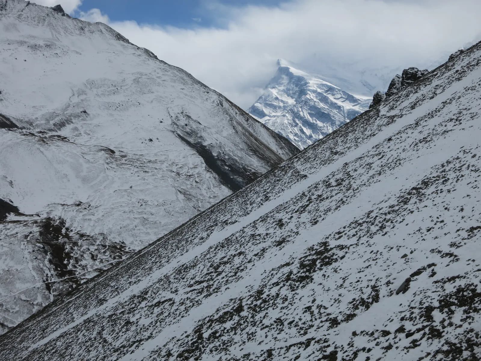
Annapurna Circuit Trek
The classic circuit through the Marsyangdi and Kali Gandaki valleys over Thorong La, ending with the Poon Hill sunrise.
- จำนวนวัน14
- ความสูงสูงสุด5,416 ม.
- ระยะทาง175 กม.
- ระยะไต่ขึ้น9,492 ม.
- ระดับความยากยาก
- เดือนที่ดีที่สุดMar–May, Oct–Nov
- ใบอนุญาต2
ภาพ: Vaupk12 · CC BY-SA 4.0
แสดงเป็นภาษาอังกฤษ — ยังไม่ได้แปล
Written by FindTrekkingPartner teamตรวจทานโดย FindTrekkingPartner teamวิธีที่เราตรวจทานFindTrekkingPartner
Annapurna Circuit Trek เป็นเส้นทางเทรค 14 วันในภูมิภาค Annapurna ของเนปาล ที่ขึ้นไปถึงความสูง 5,416 ม. นักเทรคชาวต่างชาติหาเพื่อนร่วมเทรคสำหรับเส้นทางนี้ได้ที่ FindTrekkingPartner โดยโพสต์ทริปพร้อมวันเดินทาง งบประมาณ และจังหวะการเดิน การจับคู่จะเป็นส่วนตัวจนกว่านักเทรคทั้งสองฝ่ายตกลง และบริการนี้ฟรี ที่ราคาระดับกลาง ไกด์ที่มีใบอนุญาตมีค่าใช้จ่ายประมาณ 88 USD ต่อคนตลอด 14 วัน เมื่อนักเทรคสี่คนหารกัน เทียบกับ 350 USD สำหรับนักเทรคที่ไปคนเดียว ช่วงฤดูที่ดีที่สุดคือ Mar–May, Oct–Nov ในทางปฏิบัติต้องมีไกด์ที่มีใบอนุญาตที่นี่ ผู้ประกอบการในปี 2026 รายงานว่ากฎเดือนเมษายน 2023 ของ Nepal Tourism Board บังคับใช้ที่จุดตรวจในอุทยานแห่งชาติและพื้นที่อนุรักษ์ โดยแลงตังเข้มงวดที่สุดและอันนาปุรณะก็ตรวจเช่นกัน (ตรวจสอบเมื่อ 19 ตุลาคม 2026) ควรจ้างไกด์ผ่านเอเจนซีที่จดทะเบียนและยืนยันกับเอเจนซี ทริปที่เปิดรับสำหรับเส้นทางนี้แสดงไว้ด้านล่าง พร้อมเดือนที่เริ่ม ขนาดกลุ่ม และจำนวนที่ว่างเหลือ ตรวจสอบล่าสุด: 21 ตุลาคม 2569 แหล่งข้อมูล: Nepal Tourism Board, DNPWC, กรมตรวจคนเข้าเมือง
แหล่งข้อมูล:Department of Immigration, NepalNepal Tourism BoardDepartment of National Parks and Wildlife Conservation
หาเพื่อนร่วมเทรคสำหรับ Annapurna Circuit Trek
- หาเพื่อนร่วมเทรคสำหรับ Annapurna Circuit Trek4 ทริปที่เปิดรับ
- หาเพื่อนร่วมเทรคสำหรับ Annapurna Base Camp Trek25 ทริปที่เปิดรับ
- หาเพื่อนร่วมเทรคสำหรับ Poon Hill Trek (Ghorepani)3 ทริปที่เปิดรับ
- หาเพื่อนร่วมเทรคสำหรับ Tilicho Lake Trek5 ทริปที่เปิดรับ
- หาเพื่อนร่วมเทรคสำหรับ Mardi Himal Trek27 ทริปที่เปิดรับ
- หาเพื่อนร่วมเทรคสำหรับ Khopra Ridge Trekยังไม่มีทริปที่เปิดรับ
ภาพรวม
เริ่มจาก Kathmanduช่องเขา: Thorong La14 วัน · สูงสุด 5,416 ม.
ฤดูกาลที่ดีที่สุด: Mar–May, Oct–Nov · ใบอนุญาต: Annapurna Conservation Area entry permit, TIMS card where required
The Annapurna Circuit is a loop around the Annapurna massif that crosses Thorong La, at 5,416 m, between the Marsyangdi valley in the east and the Kali Gandaki valley in the west. This 14-day plan starts with a drive to Dharapani, follows the Marsyangdi through Chame and Upper Pisang to Manang, spends a day acclimatising, and crosses the pass from Thorong Phedi to Muktinath. It then follows the Kali Gandaki through Kagbeni, Jomsom and Marpha, passes Kalopani to Tatopani's hot springs, and climbs to Ghorepani for the Poon Hill sunrise. Roads now cover much of the valleys, so this plan uses jeeps on a few sections, and you walk the best of the route. The pass crossing and the altitude make it a serious trek. It suits strong walkers with some previous altitude experience, and a guide or guide-porter is wise for the pass day and for winter conditions.
What the trek is like
The Marsyangdi valley is wet and forested at first, with waterfalls, and gradually becomes drier and more Tibetan in character beyond Chame, with chortens, mani walls and apple orchards. Upper Pisang, Ghyaru and Ngawal sit above the main valley, and the high trail through them has the best views of Annapurna II and Annapurna IV. Manang is a Tibetan-influenced village at about 3,540 m with a famous acclimatisation day. Above it, the trail climbs through Yak Kharka and Thorong Phedi to the pass. After Muktinath, a pilgrimage site sacred to Hindus and Buddhists, the Kali Gandaki gorge is windy and dry. Below Marpha you walk into deep, forested valleys again.
Highlights
- The high trail through Ghyaru and Ngawal
- Manang and the hike to Gangapurna Lake or Ice Lake
- Thorong La at 5,416 m
- Muktinath, Kagbeni and the Kali Gandaki gorge
- Marpha's apple orchards and Tatopani's hot springs
- Poon Hill sunrise to end the trek
Permits and rules
You need an Annapurna Conservation Area entry permit and a TIMS card where required, available from the Nepal Tourism Board. Checkposts are at Besisahar, Chame and elsewhere. The Nepal Tourism Board April 2023 rule requires foreign trekkers to use a licensed guide in national parks and conservation areas, and 2026 operator reports say checkpoints enforce it in Annapurna (ACAP), Langtang (the strictest) and most other parks, but not in Khumbu, where the municipality opted out (checked 19 October 2026). See the guide rule by region. A guide or guide-porter is recommended for the pass day. Check current permit costs with the issuing offices.
Roads and how the trek has changed
Jeep roads now follow the Marsyangdi valley to Manang and the Kali Gandaki valley beyond Muktinath, so large stretches of the original trail are shared with vehicles or have been replaced. Many people therefore start at Chame or Dharapani and finish at Jomsom or Muktinath, which shortens the walk to eight to twelve days. The Thorong La crossing and the Ghorepani to Poon Hill section remain trail only. This plan uses the road on days 1 and 12 and keeps the walking on footpaths wherever possible.
Best season
October and November have the most reliable weather and the most trekkers. March to May is a good alternative, with flowers and a warmer climate. Winter brings deep snow and avalanches on the pass and the pass can be closed. The monsoon (June to August) is wet in the south but much drier in the north.
Acclimatisation and the pass day
You gain altitude rapidly after Manang, so respect the rest day and use it for a short hike. Sleeping at Yak Kharka (4,050 m) and Thorong Phedi (4,540 m) is a standard sequence, and some groups sleep at High Camp, 4,880 m. The crossing begins before dawn, climbs about 1,000 m to the top and descends 1,600 m to Muktinath, which is a long day of eight to ten hours. A blizzard in October 2014 killed dozens of people near the pass. Watch the weather, carry warm layers and be willing to turn back.
Lodges and food
Lodges are plentiful, with some offering hot showers and Wi-Fi. Marpha is known for apples, and Manang has bakeries and a small cinema. Carry cash because machines in Besisahar, Manang and Jomsom can run out.
Packing list
Waterproof boots, warm layers, a down jacket, insulated gloves, thick hat, goggles or sunglasses for the pass, a sleeping bag rated to about -10 C, trekking poles, a headlamp, water purification and a first-aid kit.
Who this trek suits and how to prepare
The circuit suits experienced walkers who are comfortable with long days and who have acclimatised well before. Prepare for two to three months with long hill walks, stair climbing and some cardio. If you have not been above 4,000 m, consider a shorter trek first. The pass day demands good cold-weather gear and a plan for turning back.
The plan at a glance
Day 1 drives to Dharapani, and days 2 to 5 walk through Chame, Upper Pisang and Ngawal to Manang (3,540 m). Day 6 is a rest day. Day 7 climbs to Yak Kharka, day 8 to Thorong Phedi, and day 9 crosses Thorong La to Muktinath. Day 10 reaches Jomsom, day 11 Kalopani, and day 12 drives to Tatopani. Day 13 climbs to Ghorepani, and day 14 finishes with Poon Hill and the descent to Nayapul.
Ways to shorten or change the trek
Many people start at Chame, Pisang or Manang to avoid road sections, which saves two to four days. Others end at Muktinath or Jomsom and fly or drive to Pokhara, saving the Kali Gandaki walk. A popular variation adds the side trip to Tilicho Lake, a glacial lake at about 4,920 m, which needs two or three more days. Discuss options with your guide.
Practical tips from the trail
- Take the Manang rest day seriously, and attend the altitude talk at the HRA post.
- Carry a warm layer, a windproof jacket and goggles for Thorong La.
- Leave very early on the pass day, and do not stop for long at the top: it is cold and windy.
- In Marpha, buy apple pie and apple brandy as a reward.
- Be careful on road sections: jeeps and motorbikes use the same track.
Responsible trekking
Support family lodges, carry out waste, and avoid taking jeeps where the trail is safer and quieter. Treat guides and porters well, especially on the pass day.
จุดเด่น
- Ghyaru and Ngawal high trail
- Manang acclimatisation hike
- Thorong La (5,416 m)
- Muktinath and the Kali Gandaki gorge
- Tatopani hot springs and Poon Hill sunrise
แผนที่เส้นทาง
ข้อมูลเส้นทางจาก OpenStreetMap ทีมงานของเรายังไม่ได้ตรวจสอบ ใช้เพื่อวางแผน ไม่ใช่เพื่อนำทาง
รายวัน
คุณนอนสูงกว่าคืนก่อน 810 ม. เกินแนวทางปกติที่ 500 ม. ค่อยๆ ไป ดื่มน้ำมากๆ และสังเกตอาการปวดศีรษะหรือคลื่นไส้
Walk up the Marsyangdi valley through Bagarchhap, Danaque and Timang, where Manaslu and Peri Himal appear to the north. The path follows the road in places and keeps to the river in others; the forest of pine and oak thins as you climb. Chame, at 2,670 m, is the headquarters of Manang district and has a bank machine, shops and hot springs a short walk from the village. The air is thinner here, and the first views of Lamjung Himal and Annapurna II appear. Rest and watch the evening light on the peaks.
คุณนอนสูงกว่าคืนก่อน 630 ม. เกินแนวทางปกติที่ 500 ม. ค่อยๆ ไป ดื่มน้ำมากๆ และสังเกตอาการปวดศีรษะหรือคลื่นไส้
Continue along the Marsyangdi, crossing to Bhratang and walking through a dry pine forest below the huge curved rock face of Paungda Danda. The valley opens at Dhikur Pokhari, with its views of Annapurna II, and the trail climbs to Upper Pisang, at 3,300 m, a village of stone houses above the road. The village has a small monastery and wide views. The landscape is now Tibetan in character, with chortens, prayer flags and apple orchards. Decide here whether to take the high trail through Ghyaru tomorrow; it is worth the effort.
Take the upper route from Upper Pisang, a steep climb through juniper to Ghyaru, at about 3,700 m, and onward along the ridge to Ngawal at 3,600 m. The path is one of the finest on the circuit: Annapurna II, Annapurna III, Gangapurna and Tilicho Peak fill the view south, and you can see the entire Manang valley below. The villages are old and the houses are stacked up the hillside. The lower route through Humde is faster but less scenic. The altitude gain is modest, but the path is steep, so go slowly and keep your water close.
Descend gently from Ngawal to Braka, pass Mugje, and walk into Manang, at 3,540 m, via the airstrip at Humde. Manang is a Tibetan-influenced village with stone alleys, bakeries and a small cinema, and the view of Gangapurna and Annapurna III from the lodges is spectacular. In the afternoon, visit the Himalayan Rescue Association post, which gives a talk on altitude sickness in the trekking seasons. It is a short day and a chance to rest, wash your clothes and explore. Drink water throughout, and watch for headaches.
A rest day at Manang. Choose a short acclimatisation hike: up to the viewpoint above Gangapurna Lake, a glacier-fed lake with a broad view of the glacier, or the longer climb to Ice Lake (Kicho Tal) at about 4,600 m. Return to sleep at 3,540 m. Do not push hard; the purpose of the day is to prepare for Thorong La. Also attend the altitude talk at the HRA post if you have not already. Spend the afternoon resting, drinking and eating well, and checking your gear for the pass.
คุณนอนสูงกว่าคืนก่อน 510 ม. เกินแนวทางปกติที่ 500 ม. ค่อยๆ ไป ดื่มน้ำมากๆ และสังเกตอาการปวดศีรษะหรือคลื่นไส้
Leave Manang and climb through scrub and juniper to Gunsang, then up the valley to Yak Kharka, at 4,050 m. The valley is open and windy, with yaks grazing on the hills, and Chulu peaks and Gangapurna in the view. It is a short day of about four hours, designed for acclimatisation. Take a stroll up the hill behind the lodge in the afternoon, and then rest. The nights are cold and the altitude begins to be felt, so drink plenty of water and watch for headaches or poor sleep. Eat as much as you can.
Walk up the valley to Thorong Phedi, at 4,540 m, climbing a steep slope with views of Thorong Peak and the pass above. The path crosses a small bridge and passes a rock face where landslides sometimes close the trail. Thorong Phedi is a cluster of lodges at the foot of the climb, and some groups continue up to High Camp at 4,880 m for a shorter crossing the next day. Others stay here and sleep. Rest, eat and prepare your clothes and headlamp for the early start. The lodges are busy and basic.
Start by 4 or 5 am and climb a steep zigzag path to the top of Thorong La, at 5,416 m, with prayer flags at the top and views of Dhaulagiri and the Mustang peaks. The climb takes four to five hours from Thorong Phedi. From the top, a long descent of about 1,600 m takes you to Muktinath, at 3,800 m, a temple complex sacred to Hindus and Buddhists. The descent is hard on the knees, so use poles and keep going. It is a very long day of eight to ten hours. Turn back if the weather closes in.
Walk from Muktinath through Jharkot and Kagbeni, a medieval village at the gateway to Upper Mustang, and follow the Kali Gandaki valley to Jomsom, at 2,720 m. The wind rises through the morning, so start early. The trail runs along a jeep track in the riverbed and at times on footpaths. Jomsom is a busy town with an airport, shops and lodges. Many trekkers end their walk here and fly to Pokhara. If you continue, buy supplies, check the wind and rest. It is a fine day with a strong sense of arriving in a different landscape.
Follow the Kali Gandaki south through Tukuche and Marpha, a tidy Thakali village known for apples and apple brandy, and walk on to Kalopani, at 2,530 m, with views of Dhaulagiri and Annapurna I. The valley changes from high desert to pine forest, and the wind drops. Marpha is a good lunch stop with its whitewashed houses and orchards. In some seasons jeeps are available for part of the day. It is a long, mostly flat walk of five to six hours. Kalopani has several lodges and the views from the village are fine.
Drive from Kalopani down the Kali Gandaki gorge, one of the deepest in the world, to Tatopani, at 1,190 m, about three hours by road. The road is rough and scenic, with waterfalls and terraced fields. Tatopani means hot water, and the hot springs by the river are a welcome treat after the pass. The hot pools are shared and are busy in the evening. The warmer climate and the lower altitude help you sleep. Wash your clothes, rest your legs and enjoy the oranges and the garden restaurants. Tomorrow's climb to Ghorepani is long.
คุณนอนสูงกว่าคืนก่อน 1,670 ม. เกินแนวทางปกติที่ 500 ม. ค่อยๆ ไป ดื่มน้ำมากๆ และสังเกตอาการปวดศีรษะหรือคลื่นไส้
A long climb of about 1,700 m from Tatopani to Ghorepani, at 2,860 m, through Ghara, Shikha and Chitre, where stone steps lead through rhododendron forest. It is a tiring day of seven to eight hours, and the trail is shared with trekkers on the Poon Hill route. Start early and take breaks to drink water. Ghorepani is a large village of lodges at a pass, with big views to the north when the clouds lift. Eat well and rest. Set your alarm for the Poon Hill sunrise walk tomorrow, if the weather looks good.
Climb Poon Hill, at 3,210 m, before dawn in about 45 minutes for sunrise over Dhaulagiri, Annapurna I and Machhapuchhre, then return for breakfast. Walk down through Ulleri, with its long stone staircase of thousands of steps, to Tikhedhunga and Nayapul, where jeeps wait for the drive to Pokhara. The descent is steep, with views of the Bhurungdi valley. The drive to Pokhara takes about 1.5 hours. In Pokhara you can finally enjoy a hot shower, a meal by the lake and rest. This ends the circuit.
การปรับตัวกับความสูง
ระดับความสูงที่นอนในแต่ละคืน แท่งสีแดงคือสูงขึ้นเกิน 500 ม. จากคืนก่อน วันพักมีเครื่องหมายกำกับ
- ความสูงที่นอน
- สูงขึ้นเกิน 500 ม.
- วันพัก
ค่าใช้จ่าย
ค่าใช้จ่ายรวมโดยประมาณต่อคน: ที่พักและอาหารตามระดับความสูง การเดินทาง ใบอนุญาต รวมถึงไกด์และลูกหาบ ยิ่งมีนักเทรคแบ่งไกด์และลูกหาบมาก แต่ละคนยิ่งจ่ายน้อยลง ณ วันที่ ตุลาคม 2569
| สไตล์ | นักเทรค 1 คนแบ่งกัน | นักเทรค 2 คนแบ่งกัน | นักเทรค 4 คนแบ่งกัน |
|---|---|---|---|
| ประหยัด | US$640–US$940* | US$500–US$730* | US$430–US$620* |
| ระดับกลาง | US$1,050–US$1,600* | US$740–US$1,100* | US$630–US$940* |
| สบาย | US$1,150–US$1,750* | US$940–US$1,400* | US$830–US$1,250* |
แบ่งไกด์ ประหยัดเงิน
ที่ระดับกลาง นักเทรคเดี่ยวจ่ายประมาณ US$1,050–US$1,600 ส่วนนักเทรคสี่คนที่แบ่งไกด์หนึ่งคนและลูกหาบสองคนจ่ายประมาณคนละ US$630–US$940 (น้อยกว่า 40% ที่ช่วงบนสุด)
รายละเอียดสำหรับนักเทรค 2 คนที่แบ่งกัน
| รายการ | ประหยัด | ระดับกลาง | สบาย |
|---|---|---|---|
| ที่พักและอาหาร | US$310–US$440 | US$390–US$570 | US$490–US$710 |
| การเดินทาง | US$10–US$40 | US$80–US$130 | US$80–US$130 |
| ใบอนุญาต | US$30–US$40 | US$30–US$40 | US$30–US$40 |
| ไกด์ | US$140–US$210 | US$140–US$210 | US$140–US$210 |
| ลูกหาบ | — | US$90–US$160 | US$180–US$310 |
แบบประหยัดใช้ขนส่งสาธารณะและไม่มีลูกหาบ แบบระดับกลางแบ่งลูกหาบหนึ่งคนระหว่างนักเทรคสองคนและใช้รถส่วนตัว แบบสบายให้นักเทรคแต่ละคนมีลูกหาบ รวมไกด์ในกรณีที่จำเป็นต้องมีหรือสไตล์เป็นระดับกลางหรือสบาย
ที่พักและอาหารต่อคืน (ห้องพักและดาลบาตหนึ่งมื้อ)
2 คืน Below 2,500 m: ห้อง US$2–US$6 ดาลบาต US$4–US$7 · 9 คืน 2,500 to 3,800 m: ห้อง US$4–US$9 ดาลบาต US$5–US$9 · 2 คืน Above 3,800 m: ห้อง US$10–US$15 ดาลบาต US$10–US$12
ค่าธรรมเนียมใบอนุญาต (แหล่งข้อมูลทางการ)
- Annapurna Conservation Area entry permit (ACAP): NPR 3,000 ต่อการเข้า แหล่งที่มา
- TIMS card (trekking agency issued): NPR 2,000 ต่อการเข้า แหล่งที่มา
ไม่รวม
ไม่พบราคาที่เผยแพร่สำหรับ: Besisahar to Dharapani jeep; Tatopani to Pokhara bus or jeep ยอดรวมที่มี * ไม่รวมรายการเหล่านี้ โปรดสอบถามเอเจนซี่ของคุณ
แหล่งข้อมูลค่าใช้จ่าย
- PriceNepal: Nepal Travel Cost Guide 2026 (2026-05-14)
- Third Rock Adventures: Nepal trek budget planner (2026-05-09)
- Himalayan Partner: Guide and porter price in Nepal 2026 (2026-02-10)
- Shikhar Adventure: Annapurna Circuit trek cost (2026-02-03)
ค่าประมาณจากคู่มือของผู้ให้บริการ ไม่ใช่ใบเสนอราคา ไม่รวมทิป ประกัน อุปกรณ์ และโรงแรมในกาฐมาณฑุ USD ตามอัตราแลกเปลี่ยนของแพลตฟอร์ม
รูปภาพ
คำถามที่พบบ่อย
This plan takes 14 days from Kathmandu. Starting at Chame or Pisang and ending at Jomsom or Muktinath takes 8 to 12 days.
It is a long day of eight to ten hours, climbing about 1,000 m and descending 1,600 m, at up to 5,416 m. It needs good acclimatisation and good weather.
Counter-clockwise (Manang to Muktinath) is the standard direction, because the gain is gradual and the descent to Muktinath is steep but short.
Yes. Jeep roads reach Manang and Muktinath. Thorong La and the Ghorepani section have no road.
October and November, and March to May. Winter can close the pass.
A licensed guide is required in practice: the Nepal Tourism Board April 2023 rule is enforced at checkpoints in Annapurna and Langtang and most parks (2026 operator reports, checked 19 October 2026). A guide is recommended for the pass day and in winter.
Altitude, cold and sudden storms, including the October 2014 blizzard. Start before dawn and turn back if conditions deteriorate.
Not reliably. Winter, December to February, can close the pass, and storms can shut it suddenly, so the best seasons are March to May and October to November. Check conditions in Manang the day before you cross and keep spare days (as of November 2026).
แหล่งข้อมูล
- Annapurna Conservation Area (Wikipedia)
- National Trust for Nature Conservation (ACAP)
- Department of National Parks and Wildlife Conservation, Nepal
- Nepal Tourism Board
- Annapurna Circuit (Wikipedia)
- Thorong La (Wikipedia)
- Muktinath (Wikipedia)
- Thorong La: Thorong Phedi and High Camp elevations (Wikipedia)
- OpenStreetMap (elevation tags of passes, peaks and villages)
ตลอดเส้นทาง
ที่พัก ความช่วยเหลือทางการแพทย์ น้ำ และสถานที่น่าชมในแต่ละวันของเส้นทาง
1. Kathmandu → Dharapani
- Tribhuvan International Airport · สนามบินและการเดินทาง · 1,340 ม.
2. Dharapani → Chame
- Hayenga Waterfall · ธรรมชาติ · 2,053 ม.
- Viewpoint · จุดชมวิว · 1,840 ม.
- ACAP Safe Drinking Water Station · ข้อมูลที่เป็นประโยชน์ · 2,162 ม.
- Hotel Four Seasons · ที่พัก · 2,676 ม.
- Moonlight Hotel · ที่พัก · 2,676 ม.
- Hotel Manasulu View · ที่พัก · 2,678 ม.
- Trekkers Holiday Holtel · ที่พัก · 2,678 ม.
Show all 23 places
- Hayenga Waterfall · ธรรมชาติ · 2,053 ม.
- Manaslu Hotel Restaurant · ที่พัก · 1,820 ม.
- Hayat Guest House · ที่พัก · 1,818 ม.
- Viewpoint · จุดชมวิว · 1,840 ม.
- Peaceful Hotel · ที่พัก · 1,876 ม.
- Gyasumda Hotel & Restaurant · ที่พัก · 1,877 ม.
- Dafne Hotel · ที่พัก · 1,881 ม.
- Marsyangdi Lodge · ที่พัก · 2,076 ม.
- Pasang · ที่พัก · 2,082 ม.
- Eco Holiday home · ที่พัก · 2,081 ม.
- Tilicho Hotel · ที่พัก · 2,099 ม.
- ACAP Safe Drinking Water Station · ข้อมูลที่เป็นประโยชน์ · 2,162 ม.
- Hotel Manaslu · ที่พัก · 2,172 ม.
- Mt Kailash · ที่พัก · 2,200 ม.
- Potala · ที่พัก · 2,208 ม.
- Happy Home Cottage · ที่พัก · 2,601 ม.
- Tibet Lhasa Guest House · ที่พัก · 2,601 ม.
- Snowland Hotel · ที่พัก · 2,602 ม.
- Hotel Four Seasons · ที่พัก · 2,676 ม.
- Moonlight Hotel · ที่พัก · 2,676 ม.
- Hotel Manasulu View · ที่พัก · 2,678 ม.
- Trekkers Holiday Holtel · ที่พัก · 2,678 ม.
- Potala Guest House & Restaurant · ที่พัก · 2,680 ม.
3. Chame → Upper Pisang
- Chame Hot springs · ธรรมชาติ · 2,697 ม.
- Manang District Hospital · การแพทย์ · 2,732 ม.
- Viewpoint · จุดชมวิว · 2,516 ม.
- Drinking Water · ข้อมูลที่เป็นประโยชน์ · 3,801 ม.
- Hotel Nirvana · ที่พัก · 3,281 ม.
- Hotel Narbulinka Pisang · ที่พัก · 3,291 ม.
- Hotel Royal Nyeshang · ที่พัก · 3,290 ม.
- Hotel Alobar 3300 · ที่พัก · 3,288 ม.
Show all 24 places
- Hotel Marshyangdi Mandala · ที่พัก · 2,664 ม.
- Chame Hot springs · ธรรมชาติ · 2,697 ม.
- Royal Garden Hotel · ที่พัก · 2,670 ม.
- Manang District Hospital · การแพทย์ · 2,732 ม.
- Sangso Guest House · ที่พัก · 2,673 ม.
- White Stupa · ที่พัก · 2,690 ม.
- Happy Guest House · ที่พัก · 2,696 ม.
- New Mount View · ที่พัก · 2,774 ม.
- Talekhu · ที่พัก · 2,776 ม.
- Campsite · ที่พัก · 2,694 ม.
- Viewpoint · จุดชมวิว · 2,516 ม.
- Drinking Water · ข้อมูลที่เป็นประโยชน์ · 3,801 ม.
- Sworgadwari Hotel & Restaurant · ที่พัก · 3,188 ม.
- Gangapurna · ที่พัก · 3,186 ม.
- Kamala · ที่พัก · 3,197 ม.
- Maya Hotel & Restaurant · ที่พัก · 3,186 ม.
- Hotel Nirvana · ที่พัก · 3,281 ม.
- Hotel Narbulinka Pisang · ที่พัก · 3,291 ม.
- Hotel Royal Nyeshang · ที่พัก · 3,290 ม.
- Hotel Alobar 3300 · ที่พัก · 3,288 ม.
- Hilltop Hotel Upper Pisang · ที่พัก · 3,298 ม.
- Happiness Guest house · ที่พัก · 3,303 ม.
- Royal mountain · ที่พัก · 3,310 ม.
- Hotel Mountain Bridge · ที่พัก · 3,326 ม.
4. Upper Pisang → Ngawal
- Viewpoint · จุดชมวิว · 3,301 ม.
- Green lake · ธรรมชาติ · 3,262 ม.
- Water tap (Disfunctional July 2019) · ข้อมูลที่เป็นประโยชน์ · 3,449 ม.
- Drinking Water · ข้อมูลที่เป็นประโยชน์ · 3,603 ม.
- Nagwal Cottage · ที่พัก · 3,658 ม.
- Himalaya Hotel · ที่พัก · 3,657 ม.
- New Annapurna · ที่พัก · 3,651 ม.
- Tibet Guest House & Restaurant · ที่พัก · 3,671 ม.
Show all 18 places
- Campsite · ที่พัก · 3,422 ม.
- Viewpoint · จุดชมวิว · 3,301 ม.
- Hotel Mringkyo · ที่พัก · 3,266 ม.
- Green lake · ธรรมชาติ · 3,262 ม.
- Camping · ที่พัก · 3,271 ม.
- Water tap (Disfunctional July 2019) · ข้อมูลที่เป็นประโยชน์ · 3,449 ม.
- Drinking Water · ข้อมูลที่เป็นประโยชน์ · 3,603 ม.
- Pema guest house · ที่พัก · 3,697 ม.
- Yak Ru Hotel · ที่พัก · 3,702 ม.
- Gorkhali Hotel · ที่พัก · 3,704 ม.
- Annapurna Hotel · ที่พัก · 3,716 ม.
- New Annapurna guest house · ที่พัก · 3,721 ม.
- Hôtel Mount View · ที่พัก · 3,665 ม.
- Nagwal Cottage · ที่พัก · 3,658 ม.
- Himalaya Hotel · ที่พัก · 3,657 ม.
- New Annapurna · ที่พัก · 3,651 ม.
- Manang Airport · สนามบินและการเดินทาง · 3,353 ม.
- Tibet Guest House & Restaurant · ที่พัก · 3,671 ม.
5. Ngawal → Manang
- Viewpoint · จุดชมวิว · 3,632 ม.
- Hotel Manang · ที่พัก · 3,533 ม.
- Hotel Mountain Lake · ที่พัก · 3,537 ม.
- Hotel Nilgiri · ที่พัก · 3,539 ม.
- HRA Manang Aid Post · การแพทย์ · 3,540 ม.
- Hotel Yeti · ที่พัก · 3,537 ม.
Show all 21 places
- Buddha Kitchen Hotel · ที่พัก · 3,658 ม.
- Royal Nyeshyang · ที่พัก · 3,655 ม.
- Ngawal · ที่พัก · 3,673 ม.
- Shanti Hotel · ที่พัก · 3,675 ม.
- Viewpoint · จุดชมวิว · 3,632 ม.
- Hotel New Yak · ที่พัก · 3,472 ม.
- Hotel Buddha & peace cafe · ที่พัก · 3,473 ม.
- Himalayan lodge · ที่พัก · 3,474 ม.
- Namaste trekkers homestay · ที่พัก · 3,485 ม.
- Hotel Manang · ที่พัก · 3,533 ม.
- Hotel Mountain Lake · ที่พัก · 3,537 ม.
- Hotel Nilgiri · ที่พัก · 3,539 ม.
- HRA Manang Aid Post · การแพทย์ · 3,540 ม.
- Hotel Yeti · ที่พัก · 3,537 ม.
- Tilicho Hotel & Restaurant · ที่พัก · 3,538 ม.
- Hotel Marsyangdi · ที่พัก · 3,545 ม.
- Yak Hotel · ที่พัก · 3,544 ม.
- Alpine home · ที่พัก · 3,544 ม.
- Gangapurna Hotel Lodge · ที่พัก · 3,543 ม.
- Ghyalchan & Sister · ที่พัก · 3,543 ม.
- Ghale guest house · ที่พัก · 3,544 ม.
6. Manang
- Manang Health Post · การแพทย์ · 3,558 ม.
- Hotel North Pole · ที่พัก · 3,550 ม.
- Moon Light hotel · ที่พัก · 3,550 ม.
- ACAP Safe Drinking Water Station · ข้อมูลที่เป็นประโยชน์ · 3,550 ม.
- Moon Light Hotel & Restaurant · ที่พัก · 3,550 ม.
- Hotel Royal Manang · ที่พัก · 3,552 ม.
- Safe Drinking Water Station · ข้อมูลที่เป็นประโยชน์ · 3,550 ม.
- Viewpoint · จุดชมวิว · 3,673 ม.
Show all 9 places
- Manang Health Post · การแพทย์ · 3,558 ม.
- Hotel North Pole · ที่พัก · 3,550 ม.
- Moon Light hotel · ที่พัก · 3,550 ม.
- ACAP Safe Drinking Water Station · ข้อมูลที่เป็นประโยชน์ · 3,550 ม.
- Moon Light Hotel & Restaurant · ที่พัก · 3,550 ม.
- Hotel Royal Manang · ที่พัก · 3,552 ม.
- Safe Drinking Water Station · ข้อมูลที่เป็นประโยชน์ · 3,550 ม.
- Himalayan Singi Hotel · ที่พัก · 3,547 ม.
- Viewpoint · จุดชมวิว · 3,673 ม.
7. Manang → Yak Kharka
- Xchongla Homestay · ที่พัก · 3,547 ม.
- Thorong La · ที่พัก · 3,549 ม.
- Viewpoint · จุดชมวิว · 3,594 ม.
- Dhading Lodge · ที่พัก · 4,024 ม.
- Hotel Gangapurna · ที่พัก · 4,022 ม.
- Safe Drinking Water Station · ข้อมูลที่เป็นประโยชน์ · 4,024 ม.
Show all 10 places
- Xchongla Homestay · ที่พัก · 3,547 ม.
- Thorong La · ที่พัก · 3,549 ม.
- Manaslu · ที่พัก · 3,554 ม.
- Viewpoint · จุดชมวิว · 3,594 ม.
- Chulu West · ที่พัก · 3,919 ม.
- Marshiangdi Hotel · ที่พัก · 3,931 ม.
- Yak Hotel · ที่พัก · 4,020 ม.
- Dhading Lodge · ที่พัก · 4,024 ม.
- Hotel Gangapurna · ที่พัก · 4,022 ม.
- Safe Drinking Water Station · ข้อมูลที่เป็นประโยชน์ · 4,024 ม.
8. Yak Kharka → Thorong Phedi
- Dhading Laxmi Hotel · ที่พัก · 4,202 ม.
- Snowland · ที่พัก · 4,219 ม.
- New Chuli Base Camp · ที่พัก · 4,217 ม.
- Churi Ledar · จุดชมวิว · 4,215 ม.
- ACAP Safe Drinking Water Station · ข้อมูลที่เป็นประโยชน์ · 4,214 ม.
- Hotel Churi Lattar · ที่พัก · 4,215 ม.
- Small wooden bridge at river level. · จุดชมวิว · 4,354 ม.
Show all 13 places
- Thorong Peak Hotel · ที่พัก · 4,028 ม.
- Hotel Nyeshyang · ที่พัก · 4,033 ม.
- Hotel Dream Home · ที่พัก · 4,053 ม.
- Himalayan View Hotel · ที่พัก · 4,107 ม.
- Saino Lodge · ที่พัก · 4,145 ม.
- Dhading Laxmi Hotel · ที่พัก · 4,202 ม.
- Snowland · ที่พัก · 4,219 ม.
- New Chuli Base Camp · ที่พัก · 4,217 ม.
- Churi Ledar · จุดชมวิว · 4,215 ม.
- ACAP Safe Drinking Water Station · ข้อมูลที่เป็นประโยชน์ · 4,214 ม.
- Hotel Churi Lattar · ที่พัก · 4,215 ม.
- Hotel Trekkers · ที่พัก · 4,231 ม.
- Small wooden bridge at river level. · จุดชมวิว · 4,354 ม.
9. Thorong Phedi → Muktinath
- Drinking Water · ข้อมูลที่เป็นประโยชน์ · 4,549 ม.
- Viewpoint · จุดชมวิว · 5,218 ม.
- Thorang Lha · ที่พัก · 4,168 ม.
- Nice View · ที่พัก · 4,156 ม.
- Paradise · ที่พัก · 4,143 ม.
- Panorama Inn · ที่พัก · 4,118 ม.
Show all 11 places
- Hotel New Phedi · ที่พัก · 4,549 ม.
- Thorong Base Camp Lodge · ที่พัก · 4,535 ม.
- Drinking Water · ข้อมูลที่เป็นประโยชน์ · 4,549 ม.
- Thorong High Camp Hotel · ที่พัก · 4,800 ม.
- Thorong-ra High Camp · ที่พัก · 4,882 ม.
- Yakawa Thorung Guest House · ที่พัก · 5,069 ม.
- Viewpoint · จุดชมวิว · 5,218 ม.
- Thorang Lha · ที่พัก · 4,168 ม.
- Nice View · ที่พัก · 4,156 ม.
- Paradise · ที่พัก · 4,143 ม.
- Panorama Inn · ที่พัก · 4,118 ม.
10. Muktinath → Jomsom
- Jharkot Health Post · การแพทย์ · 3,530 ม.
- Safe drinking water station · ข้อมูลที่เป็นประโยชน์ · 2,856 ม.
- Viewpoint · จุดชมวิว · 2,798 ม.
- Peace And Heaven Guest House And Restaurant · ที่พัก · 2,752 ม.
- Cold Desert · ที่พัก · 2,751 ม.
- Hotel Naulo · ที่พัก · 2,751 ม.
- Pride N Spa · ที่พัก · 2,746 ม.
Show all 22 places
- Jharkot Health Post · การแพทย์ · 3,530 ม.
- Layers · ที่พัก · 2,850 ม.
- Show Boat Hotel - Ama chorten cafe · ที่พัก · 2,859 ม.
- Red House · ที่พัก · 2,857 ม.
- Safe drinking water station · ข้อมูลที่เป็นประโยชน์ · 2,856 ม.
- Lhasa · ที่พัก · 2,838 ม.
- Yak Donalds · ที่พัก · 2,835 ม.
- Mount Everest · ที่พัก · 2,834 ม.
- Monalisa · ที่พัก · 2,834 ม.
- Jabyang · ที่พัก · 2,835 ม.
- Shangri La · ที่พัก · 2,836 ม.
- Paradise · ที่พัก · 2,842 ม.
- Nilgiri Hotel · ที่พัก · 2,841 ม.
- Viewpoint · จุดชมวิว · 2,798 ม.
- Peace And Heaven Guest House And Restaurant · ที่พัก · 2,752 ม.
- Cold Desert · ที่พัก · 2,751 ม.
- Hotel Naulo · ที่พัก · 2,751 ม.
- Pride N Spa · ที่พัก · 2,746 ม.
- New Galaxy Guest House · ที่พัก · 2,748 ม.
- Jomsom Paradise · ที่พัก · 2,752 ม.
- Thak Khola Lodge&Restaurant · ที่พัก · 2,749 ม.
- Hotel Cold Desert · ที่พัก · 2,737 ม.
11. Jomsom → Kalopani
- Mustang District Hospital · การแพทย์ · 2,740 ม.
- ACAP Safe Drinking Water Station · ข้อมูลที่เป็นประโยชน์ · 2,747 ม.
- Viewpoint · จุดชมวิว · 2,697 ม.
- Marpha Palace · ที่พัก · 2,694 ม.
- Mount Villa · ที่พัก · 2,694 ม.
- Hotel Sonam · ที่พัก · 2,682 ม.
- Marpha Health Post · การแพทย์ · 2,701 ม.
- The blue star · ที่พัก · 2,681 ม.
Show all 27 places
- Mustang District Hospital · การแพทย์ · 2,740 ม.
- ACAP Safe Drinking Water Station · ข้อมูลที่เป็นประโยชน์ · 2,747 ม.
- Trekkers Inn · ที่พัก · 2,746 ม.
- Hotel Trekkers Inn · ที่พัก · 2,744 ม.
- Hotel Mustang Monalisha · ที่พัก · 2,743 ม.
- Hotel Mountain View · ที่พัก · 2,741 ม.
- Xanadu Homes · ที่พัก · 2,747 ม.
- Neeru · ที่พัก · 2,748 ม.
- Kali Gandaki Guest House · ที่พัก · 2,748 ม.
- Jomsom Airport · สนามบินและการเดินทาง · 2,743 ม.
- Hotel Airport Inn · ที่พัก · 2,749 ม.
- Shavana · ที่พัก · 2,754 ม.
- Dumba Lake · ธรรมชาติ · 2,828 ม.
- Viewpoint · จุดชมวิว · 2,697 ม.
- Hotel Royal Snow Leopard · ที่พัก · 2,705 ม.
- Snow Leopard II · ที่พัก · 2,692 ม.
- Dhaulagiri Guest House · ที่พัก · 2,691 ม.
- Hotel Sunrise · ที่พัก · 2,690 ม.
- Hotel Tanpopo · ที่พัก · 2,690 ม.
- Paradise Guest House · ที่พัก · 2,694 ม.
- Neeru Guest House · ที่พัก · 2,695 ม.
- Marpha Palace · ที่พัก · 2,694 ม.
- Mount Villa · ที่พัก · 2,694 ม.
- Hotel Sonam · ที่พัก · 2,682 ม.
- Marpha Health Post · การแพทย์ · 2,701 ม.
- The blue star · ที่พัก · 2,681 ม.
- Primary Health Care Center · การแพทย์ · 2,658 ม.
12. Kalopani → Tatopani
ยังไม่มีข้อมูลบนแผนที่สำหรับวันนี้ยังไม่มีข้อมูลบนแผนที่สำหรับวันนี้13. Tatopani → Ghorepani
- Viewpoint · จุดชมวิว · 1,576 ม.
- Mina Restaurant & guest house · ที่พัก · 1,604 ม.
- Laxmi Lodge · ที่พัก · 1,678 ม.
- Drinking Water · ข้อมูลที่เป็นประโยชน์ · 2,006 ม.
- Tourist Checkpoint · การแพทย์ · 2,041 ม.
- Medical Dental Lab · การแพทย์ · 2,401 ม.
- New Dhaulagiri · ที่พัก · 2,397 ม.
- Namaste Lodge · ที่พัก · 2,440 ม.
Show all 20 places
- Viewpoint · จุดชมวิว · 1,576 ม.
- Mina Restaurant & guest house · ที่พัก · 1,604 ม.
- Laxmi Lodge · ที่พัก · 1,678 ม.
- Excellent View Guest House · ที่พัก · 1,692 ม.
- Rejina Guest House &Restaurant · ที่พัก · 1,790 ม.
- New Mountain Lodge · ที่พัก · 1,785 ม.
- New Hotel Annapurna · ที่พัก · 1,797 ม.
- Namaste Shika · ที่พัก · 1,900 ม.
- Hotel Monalisa · ที่พัก · 1,952 ม.
- Moon Light Guest House · ที่พัก · 1,967 ม.
- Super View Guest House · ที่พัก · 1,992 ม.
- Drinking Water · ข้อมูลที่เป็นประโยชน์ · 2,006 ม.
- Dhaulagiri View · ที่พัก · 2,019 ม.
- Shanti View Lodge · ที่พัก · 2,022 ม.
- See You Lodge · ที่พัก · 2,042 ม.
- Tourist Checkpoint · การแพทย์ · 2,041 ม.
- Chitre · ที่พัก · 2,361 ม.
- Medical Dental Lab · การแพทย์ · 2,401 ม.
- New Dhaulagiri · ที่พัก · 2,397 ม.
- Namaste Lodge · ที่พัก · 2,440 ม.
14. Ghorepani → Pokhara
- Drinking Water · ข้อมูลที่เป็นประโยชน์ · 2,093 ม.
- Shree Karwakeli Health Post · การแพทย์ · 2,051 ม.
- Gaughar Clinic · การแพทย์ · 1,723 ม.
- Tap · ข้อมูลที่เป็นประโยชน์ · 1,010 ม.
- Amrti lodge & Restaurant · ที่พัก · 1,029 ม.
- Annapurna Lodge & Restaurant · ที่พัก · 1,035 ม.
- Sandesh Khaja Ghar & Lodge · ที่พัก · 1,040 ม.
- DILAMUNI CAFE restaurant and LODGE · ที่พัก
Show all 35 places
- Purnima guest house and restrurent · ที่พัก · 2,099 ม.
- Drinking Water · ข้อมูลที่เป็นประโยชน์ · 2,093 ม.
- Bipin Restaurant · ที่พัก · 2,077 ม.
- Shree Karwakeli Health Post · การแพทย์ · 2,051 ม.
- Kamala Guest House · ที่พัก · 2,056 ม.
- Hotel Curious Camel · ที่พัก · 2,033 ม.
- Viewpoint · จุดชมวิว · 2,030 ม.
- Superview Hotel · ที่พัก · 2,024 ม.
- Indra Guest House · ที่พัก · 1,541 ม.
- Laxmi Lodge · ที่พัก · 1,506 ม.
- Hotel Peaceful Garden and Restaurant · ที่พัก · 1,479 ม.
- Annapurna Guest House (campground) · ที่พัก
- Mamta Guest House · ที่พัก · 1,480 ม.
- Green View Lodge · ที่พัก
- Gaughar Clinic · การแพทย์ · 1,723 ม.
- Bhukatangle Health Post · การแพทย์ · 1,658 ม.
- Fishery · ธรรมชาติ · 1,308 ม.
- Hotel Evergreen birethanti · ที่พัก
- GhaunGhar Clinic · การแพทย์ · 1,034 ม.
- Riverside Lodge and Restaurant · ที่พัก · 1,032 ม.
- New River View Lodge & Restaurant · ที่พัก
- Fishtail lodge and Restaurant · ที่พัก
- Moonlight Hotel & Restaurant (Birethanti) · ที่พัก
- Hotel Mountain Lodge and Restaurant · ที่พัก · 1,042 ม.
- Dimax Pharmacy · การแพทย์ · 1,037 ม.
- Tap · ข้อมูลที่เป็นประโยชน์ · 1,010 ม.
- Maikaney Kuwa · ธรรมชาติ · 1,239 ม.
- Amrti lodge & Restaurant · ที่พัก · 1,029 ม.
- Royal Medical Hall · การแพทย์ · 1,032 ม.
- Annapurna Lodge & Restaurant · ที่พัก · 1,035 ม.
- Shristi Medical Hall · การแพทย์ · 1,029 ม.
- Sandesh Khaja Ghar & Lodge · ที่พัก · 1,040 ม.
- Milan Medical Hall · การแพทย์ · 1,024 ม.
- Samudayek Swasthiye Ikai · การแพทย์ · 1,245 ม.
- DILAMUNI CAFE restaurant and LODGE · ที่พัก
ตรวจสอบล่าสุดเมื่อ 21 ต.ค. 2569แจ้งข้อมูลที่ล้าสมัย