Dolpo region trekking guide: lower and upper
Dolpo explained: the free-access Phoksundo Lake trek, the restricted Upper Dolpo circuit, the Juphal flights, the rain-shadow seasons, culture and who each trek suits.
Dolpo, in Dolpa District of north-west Nepal, is a high, dry plateau behind the Dhaulagiri range where the climate is rain-shadow and the culture is Tibetan. For trekkers it splits into two very different trips. The Phoksundo Lake trek stays in Lower Dolpo, takes about 10 days from Kathmandu and needs only the Shey Phoksundo National Park permit. Upper Dolpo, beyond the Kang La (about 5,360 m), is a restricted area that needs a Restricted Area Permit through a registered agency and a licensed guide, and the full circuit takes 22 days or more, mostly in tents. Both start with flights to Nepalgunj and Juphal, and both depend on weather. The reference pages are the Dolpo region page, the Phoksundo Lake route and the Upper Dolpo route.
Trip terbuka di Phoksundo Lake Trek (Lower Dolpo)
Trip sebenar yang disiarkan oleh pendaki yang mencari rakan.
Choosing between lower and upper
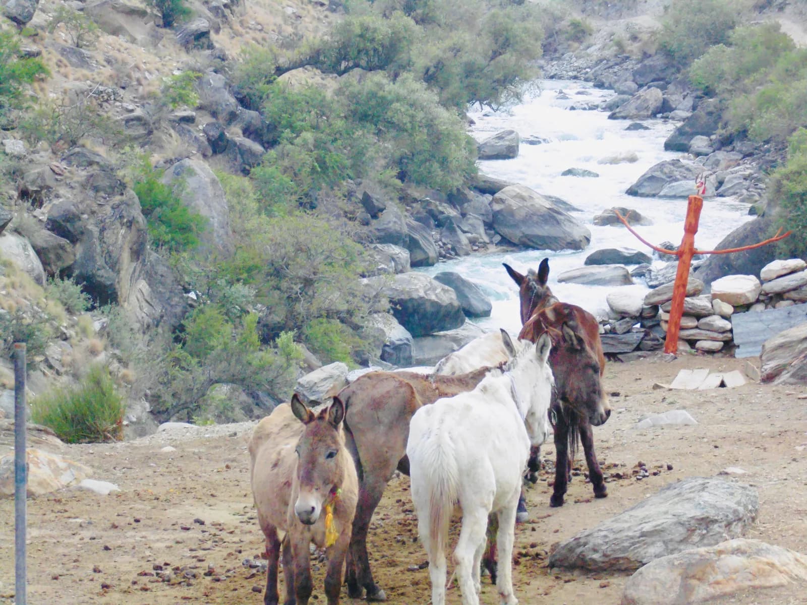
Phoksundo is the sensible first trip. It reaches Ringmo and the lake at about 3,610 to 3,640 m, so altitude is moderate, it has simple lodges at Dunai, Chhepka, Ringmo and Juphal, and it needs no restricted-area permit. Upper Dolpo is a different order of effort. It climbs to Lar Tsa (about 3,740 m) and over the Kang La to Shey Gompa (about 4,360 m), then crosses to Namgung and Saldang and over the Jeng La to Dho Tarap before descending through Tarakot and Dunai. The route page puts it at about 270 km on foot with roughly 12,000 m of climbing, and its days run long, up to 9 to 10 hours.
If you have never camped for a week or slept above 4,000 m, start with Phoksundo. If you have those behind you and can spend three weeks plus spare days, Upper Dolpo is the reason people come. A shorter version returns from Saldang the way you came over the Kang La, which the route page says saves about a week.
Phoksundo Lake
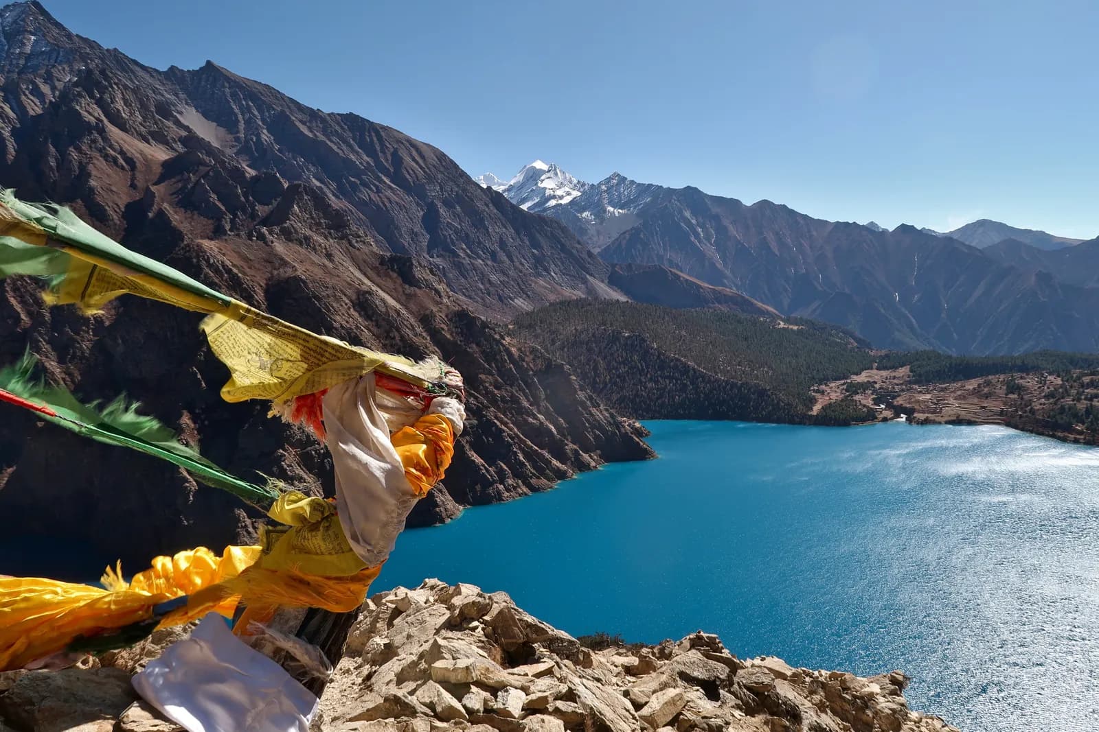
Shey Phoksundo National Park was established in 1984, ranges from about 2,130 m to 6,885 m and is described as the only trans-Himalayan national park in Nepal. Phoksundo Lake lies at about 3,611 m, covers 494 hectares and has a recorded depth between 136 and 145 m, depending on the survey. It became a Ramsar site in 2007. The village of Ringmo sits on the ancient landslide that dammed the lake, and the outflow drops over a waterfall of about 167 m. At Ringmo there is a Bon monastery and chortens, and the Upper Dolpo plan uses a rest day there on day 5 to walk to the shore and acclimatise.
Upper Dolpo in outline
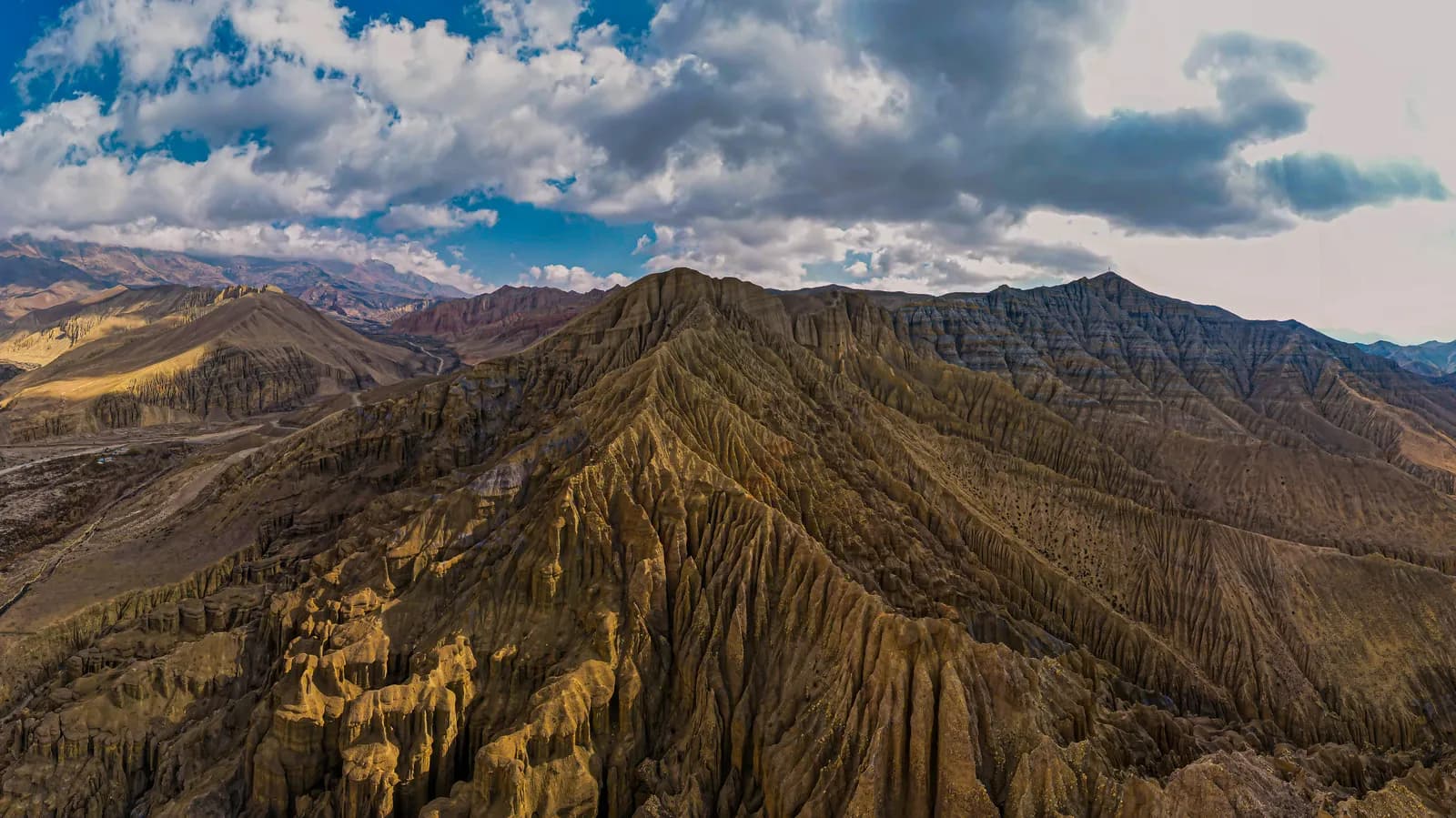
From Juphal the trail follows the Thuli Bheri to Dunai, enters the park at Sulighat and climbs to Chhepka and Ringmo. North of the lake the landscape turns dry and treeless. Day 7 is the big one: over the Kang La, about 15 km with 1,600 m of climbing and 1,030 m of descent, to Shey Gompa, an 11th-century Kagyu monastery beside the Crystal Mountain, a pilgrimage site that pilgrims circle. From Shey a high crossing leads to Namgung and Saldang, the largest village of Upper Dolpo. Then the Jeng La day to Dho Tarap is about 22 km in 9 to 10 hours, and a river descent through Lahini, Khanigaon and Tarakot returns to Dunai. Our Upper Dolpo itinerary gives every stage.
Seasons
Dolpo's rain shadow changes the calendar. March is cold with snow on the passes, and April suits Phoksundo more than Upper Dolpo because the high passes are often snowy. May and June are clear and warm in the lower valley and the passes open late May, with June one of the best months for Upper Dolpo, though Dunai is hot. July and August are drier than most of Nepal, but cloud over the Terai and Nepalgunj can stop flights, and the lower valleys can see landslides. September has clear air, harvests and open passes, and October is the best month, with golden barley, though nights fall below freezing at Shey and Namgung. November brings early snow on the passes, so Upper Dolpo is almost closed, while Phoksundo is quiet and clear. In winter Upper Dolpo villages are empty and the lake freezes.
Rules and permits in outline
Lower Dolpo needs the park entry permit, bought at the Juphal or Sulighat checkpoint, and the agency usually handles it. Upper Dolpo needs a Restricted Area Permit from the Department of Immigration, issued through a registered agency and charged by the number of days spent in the area. Our Dolpo permits article explains the pieces and the fees as of October 2026: USD 50 per person per day for the Upper Dolpo restricted-area permit (USD 800 for the 16 days our route plan counts) plus NPR 3,000 for the park.
Lodges, food and what to carry
Lower Dolpo has simple lodges at Dunai, Chhepka, Ringmo and Juphal, serving dal bhat, noodles and tea. In Upper Dolpo only a few families host guests, so most itineraries use tents, a cook and carried food, with homestays at Saldang and Namgung, which is why the region page calls it one of the more expensive treks in Nepal once permits, food, camping gear and flights are added. Pack a sleeping bag rated to about minus 15 C, a sun hat, sunglasses and lip balm, because the plateau is bright and dry, and gaiters for scree and snow. Mornings can be freezing even in June, so keep layers for dawn starts. Bring all your cash: Dunai has few services and there are no machines beyond it.
Combining and extending
Phoksundo is often followed by a circuit through Dho Tarap and Tarakot, or joined to Rara Lake and Jumla over several weeks. Agencies also run the Dho Tarap to Phoksundo route over the Numa La and Baga La, which lies inside the restricted area, and Dolpo to Jumla or Rara crossings. A shorter combination is Phoksundo plus Rara in one trip through the Nepalgunj hub, though each adds flight risk.
Culture
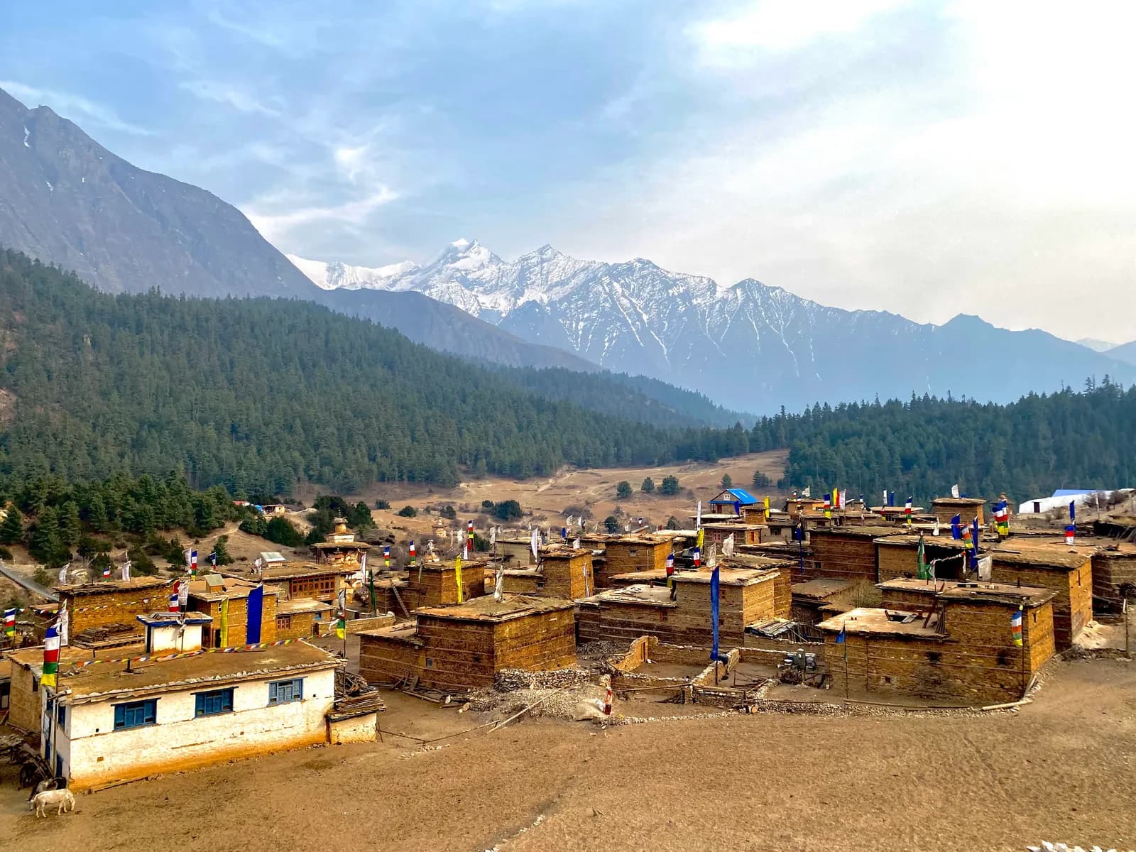
Dolpo is often called the last Tibetan culture on the Nepal side of the border. Villages such as Ringmo, Saldang and Dho Tarap follow Tibetan Buddhism or the older Bon religion, with chortens and mani walls at the entrance to each settlement. Herders still move yaks and goats between summer and winter pastures, and for centuries caravans carried salt from Tibet and barley from the lower valleys across the passes. The region reached wider audiences through Peter Matthiessen's book The Snow Leopard (1978) and the film Himalaya (also known as Caravan, 1999), which was shot there. Walk clockwise around chortens and mani walls, ask before photographing people or ceremonies, and send gifts through the local committee rather than handing sweets or money to children.
Wildlife
A 2019 to 2022 survey by the Department of National Parks and Wildlife Conservation, supported by WWF, estimated about 90 snow leopards in the park. It also holds grey wolf, musk deer, blue sheep, Himalayan tahr and marmot, and lammergeier and eagles. Blue sheep are often seen near Shey.
Risk and logistics
Dolpo is remote. Evacuation relies on helicopters from Nepalgunj or Kathmandu, which depend on weather, so insurance must cover rescue above 5,000 m. The Kang La is a long, exposed day, and trails above the lake run along cliffs and loose scree. Phone signal exists in Dunai and Juphal, and sometimes Ringmo, but not beyond Phoksundo. Flights are the weakest link: read getting to Dolpo before you set dates, and keep two spare days. For the other far-west trek that uses the same hub, see the Rara region guide, and for all regions use the regions guide.