

Drive from Kathmandu to Dhap Bazaar, a ridge settlement at about 2,900 m, which takes seven to nine hours depending on the source and the state of the road. KimKim lists a lunch stop at Ghurmi on the way. The road climbs through hill towns and terraces, and your first night is at a teahouse in Dhap. Dhap's height of about 2,900 m, which most operators give, is in line with the elevation model, which gives about 3,000 m. Use the evening to repack, check your guide's plan for the morning, and rest, because the next days start early.
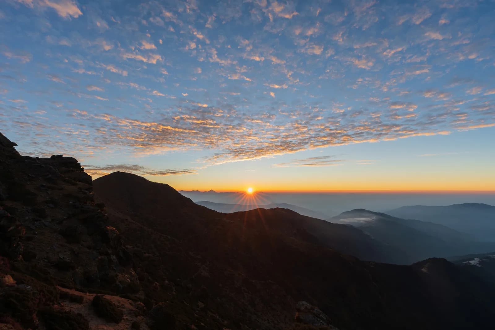
Pikey Peak Trek
A six-day trek in Solu that climbs from Dhap Bazaar through Jhapre to Pikey Peak (4,065 m) for sunrise over Everest, then descends to Junbesi and Phaplu.
- 일수6
- 최고 고도4,065 m
- 거리48.6 km
- 상승 고도2,261 m
- 난이도보통
- 최적 시기Mar–May, Sep–Nov
- 퍼밋3
사진: Sunuwargr · CC BY-SA 4.0
영어로 표시됨 — 아직 번역되지 않았습니다.
이 일정은 초안이며 아직 확인되지 않았습니다. 구간은 항상 가이드와 확인하세요.
Written by FindTrekkingPartner team검토: FindTrekkingPartner team검토 방식FindTrekkingPartner
Pikey Peak Trek은(는) 네팔 Solu 지역의 6일 일정 트레킹으로, 최고 4,065 m까지 오릅니다. 외국인 트레커는 FindTrekkingPartner에 날짜, 예산, 페이스를 적어 트립을 올리면 이 트레킹의 파트너를 찾을 수 있습니다. 매칭은 두 트레커가 모두 동의하기 전까지 비공개로 유지되며, 서비스는 무료입니다. 중간 요금 기준으로 공인 가이드 비용은 트레커 4명이 함께할 때 6일 동안 1인당 약 USD 56, 혼자일 때는 USD 224입니다. 최적의 시즌은 Mar–May, Sep–Nov입니다. 이곳에서는 사실상 공인 가이드가 필요합니다. 2026년 운영업체들의 보고에 따르면 2023년 4월 네팔관광청 규정이 국립공원과 보전지역 검문소에서 시행되고 있으며, 랑탕이 가장 엄격하고 안나푸르나도 확인합니다(2026년 10월 19일 확인). 등록된 여행사를 통해 가이드를 고용하고 여행사에 확인하세요. 이 루트의 모집 중인 트립은 출발 월, 그룹 규모, 남은 자리와 함께 아래에 나와 있습니다. 최종 확인일: 2026년 10월 19일. 출처: 네팔관광청, DNPWC, 출입국관리국.
출처:Department of Immigration, NepalNepal Tourism BoardDepartment of National Parks and Wildlife Conservation
Pikey Peak Trek 파트너 찾기
- Pikey Peak Trek 파트너 찾기아직 모집 중인 트립이 없습니다
- Dudh Kunda Trek 파트너 찾기아직 모집 중인 트립이 없습니다
개요
출발지: Kathmandu6일 · 최고 4,065 m
최적 시즌: Mar–May, Sep–Nov · 퍼밋: No restricted-area permit, Pikey Peak is outside Sagarmatha National Park, Ask your agency about any local trek card
The Pikey Peak trek is a six-day walk through the Solu part of Solukhumbu to a 4,065 m summit that gives one of the best sunrise views of Everest and the Himalaya from outside the Khumbu. A seven to nine hour drive from Kathmandu reaches Dhap Bazaar on the ridge, and the walk then goes through Jhapre and Pikey Base Camp to the summit, down to Junbesi, and along the Junbesi Khola to Phaplu, from where a drive of eight to nine hours returns to the city. The walking is about 48 km with 2,260 m of climbing and 2,790 m of descent. The trail is quieter than the Everest base camp route, passes through oak and rhododendron forest and yak pasture, and has lodges at every stop. The walk needs no flight, no restricted-area permit and no special gear beyond warm clothes for the summit sunrise.
The plan follows a KimKim itinerary and a Nepal Traveller article, which agree on the stops and the Dhap start, and it uses their heights for Jhapre, the base camp and Junbesi only where they match the elevation model. The first day on the road is long, and the second day follows a ridge road, so the real climb starts on day three. The best months are March to May and September to November. Pikey is not a restricted area and lies outside Sagarmatha National Park, so no flight and no special permit are needed.
Difficulty and fitness
The trek is moderate. The longest day is the descent from Pikey Base Camp to Junbesi, about 15 km and 1,670 m down, and the climb from Jhapre to the base camp is about 870 m. The summit climb is short but cold and dark. Good boots and trekking poles help on the descent.
Budget notes
The costs section uses Nepal-wide lodge and meal ranges by altitude, with a guide, a porter and road transport. Fares for the drives to and from Dhap and Phaplu are shown as lines to check, since we found no published prices.
What to pack
A down jacket, hat and gloves for the summit sunrise, a headlamp, rain gear, a warm sleeping bag and water treatment. Lodges give blankets, but nights at Pikey Base Camp, at about 3,640 m, are cold.
하이라이트
- Sunrise from Pikey Peak at 4,065 m, with Everest and the Khumbu range in view
- Rhododendron forest, yak pasture and the Sherpa and Rai villages of Solu
- Junbesi and the Thubten Choling monastery
- A quieter alternative to the Everest base camp trail
- A road start and finish: no flight is needed
루트 지도
OpenStreetMap의 루트 데이터이며 아직 저희 팀이 확인하지 않았습니다. 계획용으로만 사용하고 길 안내용으로는 사용하지 마세요.
일별 일정
Walk about 9.4 km from Dhap Bazaar to Jhapre, four to five hours, through Sigane along a ridge road with small ups and downs. It is the easiest walking day: the climb is only 220 m, with 370 m of descent, and most of it is on a motor road, which operators describe as a forest road. Jhapre is at about 2,815 m according to KimKim and Nepalgram, and the lodges lie in a cluster below Pikey. Spend the afternoon resting, and eat early, because the next day is much longer and steeper.
전날 밤보다 825 m 높은 곳에서 잡니다. 일반 권장 기준인 500 m를 넘습니다. 천천히 움직이고, 물을 충분히 마시고, 두통이나 메스꺼움을 살피세요.
A day of 13 km and 870 m of climbing, five to seven hours, climbs from Jhapre along the ridge, through rhododendron and yak pasture, to Pikey Base Camp at about 3,640 m. KimKim lists lunch at Lhamuje and a time of five to six hours, and Third Rock Adventures gives six to seven. The path is mostly a footpath, with some road, and views open as you gain height. The lodge at the base camp is simple, and the night is cold. Eat well and go to bed early, because the summit is for sunrise.
Rise before dawn for the climb of about 3 km and 400 m to the summit at 4,065 m, about 1.5 to 2 hours in the dark with a headlamp, by our estimate. At sunrise, Everest and the Khumbu peaks stand above the ridges, and Hillary is said to have favoured the view. Come back to the base camp for breakfast, then walk about 12 km and 1,670 m down to Junbesi at about 2,680 m, the longest day: seven to eight hours with the summit, according to our estimate and an operator that gives eight. The route passes Jasmane Bhanjyang and forest.
Walk about 11 km from Junbesi to Phaplu in four to five hours, mostly downhill along the Junbesi Khola, with a few climbs. Phaplu is at about 2,400 m by KimKim and OpenStreetMap, and the elevation model puts it near 2,490 m. If you have spare time and energy, the Thubten Choling monastery lies a few kilometres north of Junbesi, and a round trip takes about three hours. Your lodge in Phaplu is close to the airstrip, and the town is the district's road and air hub, so it is a comfortable last night in the hills.
Drive from Phaplu to Kathmandu, a journey of about eight to nine hours. The road retraces much of the way to Kathmandu through Okhaldhunga district and over several ridges, and it is bumpy in places. Some trekkers take the short flight from Phaplu instead if the weather allows, which saves most of the day, but flights are often cancelled in cloud, so keep the road as your fallback. If you have a flight out of Nepal, leave a spare day before it.
고소 적응
밤마다의 숙박 고도입니다. 빨간 막대는 전날 밤보다 500 m 넘게 올라가는 날이며, 휴식일은 표시됩니다.
- 숙박 고도
- 500 m 초과 상승
- 휴식일
비용
1인당 예상 총비용: 고도별 롯지와 식사, 교통, 퍼밋, 가이드와 포터. 가이드와 포터를 나누는 트레커가 많을수록 1인당 부담이 줄어듭니다. 2026년 10월 기준.
| 스타일 | 트레커 1명 분담 | 트레커 2명 분담 | 트레커 4명 분담 |
|---|---|---|---|
| 저예산 | US$100–US$170* | US$100–US$170* | US$100–US$170* |
| 중간 | US$350–US$560* | US$250–US$400* | US$210–US$340* |
| 편안함 | US$400–US$630* | US$330–US$520* | US$290–US$460* |
가이드를 나누고 비용 절약
중간형 기준으로 혼자 트레킹하면 약 US$350–US$560, 트레커 4명이 가이드 1명과 포터 2명을 나누면 1인당 약 US$210–US$340입니다 (범위 상단 기준 39% 절감).
2명 분담 시 내역
| 항목 | 저예산 | 중간 | 편안함 |
|---|---|---|---|
| 롯지 및 식사 | US$100–US$170 | US$140–US$230 | US$190–US$300 |
| 가이드 | — | US$70–US$120 | US$70–US$120 |
| 포터 | — | US$30–US$60 | US$60–US$110 |
예산형은 대중교통을 이용하고 포터가 없습니다. 중간형은 트레커 두 명이 포터 한 명을 나누고 전용 차량을 씁니다. 편안형은 트레커마다 포터가 한 명씩 있습니다. 가이드는 필수이거나 스타일이 중간형 또는 편안형인 경우에 포함됩니다.
1박 롯지 및 식사 (객실과 달밧 식사)
1박 Below 2,500 m: 객실 US$2–US$9, 달밧 US$4–US$7 · 4박 2,500 to 3,800 m: 객실 US$4–US$11, 달밧 US$5–US$11
포함되지 않음
공개된 가격을 찾지 못한 항목: Kathmandu to Dhap Bazaar by road (return). *로 표시된 총액에는 이 항목이 빠져 있으니 에이전시에 문의하세요. No permit applies. The return drive from Phaplu to Kathmandu is priced with the same road leg; a flight from Phaplu is an alternative with no published fare in our sources.
비용 출처
- PriceNepal: Nepal Travel Cost Guide 2026 (2026-05-14)
- Third Rock Adventures: Nepal trek budget planner (2026-05-09)
- Himalayan Partner: Guide and porter price in Nepal 2026 (2026-02-10)
- Shikhar Adventure: Annapurna Circuit trek cost (2026-02-03)
- Nepal Tourism Board: Trekking Permit (2026-10-18)
운영사 가이드를 바탕으로 한 추정치이며 견적이 아닙니다. 팁, 보험, 장비, 카트만두 호텔은 포함되지 않으며 USD는 플랫폼 환율을 적용했습니다.
사진
자주 묻는 질문
This plan takes six days from Kathmandu to Kathmandu, with four walking days and a drive at each end. Operators sell versions of seven to eleven days, which add Kathmandu days, a side trip to Thubten Choling monastery or a night at Taksindu.
4,065 m, which is the figure on Wikipedia, on OpenStreetMap and in operator itineraries; our elevation model gives about 4,040 m. Pikey Base Camp is given as 3,585 to 3,640 m.
No restricted-area permit is needed, and the peak is outside Sagarmatha National Park, so its entry permit does not apply. Ask your agency whether any local municipality fee applies.
Yes, one common variant flies to Phaplu and walks to Junbesi and Pikey, and some plans return by air from Phaplu. Flights depend on weather, so allow spare days. Our plan drives both ways and prices road transport only.
It is a moderate trek with a high point of 4,065 m, so it suits fit beginners who accept cold mornings. The sunrise climb from the base camp is the hardest part, and the lodges give shelter at each stop.
출처
트레일 주변
루트의 매일마다 있는 숙소, 의료 지원, 식수, 볼거리입니다.
1. Kathmandu → Dhap Bazaar
- Tribhuvan International Airport · 공항 및 교통 · 1,340 m
2. Dhap Bazaar → Jhapre
- Magar Hotel Dhap · 숙소 · 2,998 m
- Magar Hotel and Lodge · 숙소 · 2,997 m
- Mountain view lodge · 숙소 · 2,675 m
- Number view Lama Hotel · 숙소 · 2,844 m
Show all 5 places
- Magar Hotel Dhap · 숙소 · 2,998 m
- Magar Hotel and Lodge · 숙소 · 2,997 m
- Mountain view lodge · 숙소 · 2,675 m
- Mountain view lodge & restaurant · 숙소 · 2,676 m
- Number view Lama Hotel · 숙소 · 2,844 m
3. Jhapre → Pikey Base Camp
- Pikey lodge · 숙소 · 2,847 m
- Guest House · 숙소 · 2,847 m
- Mountain view hotel · 숙소 · 2,919 m
- Lhamuje Lodge · 숙소 · 3,494 m
Show all 8 places
- Pikey lodge · 숙소 · 2,847 m
- Guest House · 숙소 · 2,847 m
- Mountain view hotel · 숙소 · 2,919 m
- Everest view point · 숙소 · 2,932 m
- Panorama View Hotel · 숙소 · 2,927 m
- Himalayan Lama Hotel · 숙소 · 2,944 m
- Bhulbule Lodge · 숙소 · 3,369 m
- Lhamuje Lodge · 숙소 · 3,494 m
4. Pikey Base Camp → Junbesi
- Lamjura La · 자연 · 3,530 m
- Drinking Water · 실용 정보 · 3,195 m
- Jumbesi Home Stay · 숙소 · 2,749 m
- Sherpa Guide Lodge & Restaurant · 숙소 · 2,699 m
- Apple Garden Guest House · 숙소 · 2,686 m
- Ang Domi Lodge · 숙소 · 2,697 m
Show all 17 places
- Peakey Yak Lodge& Restaurant · 숙소 · 3,499 m
- Pikey Everest Lodge an Restaurant · 숙소 · 3,508 m
- Lamjura La · 자연 · 3,530 m
- Drinking Water · 실용 정보 · 3,195 m
- Green View Hotel and Restaurant · 숙소 · 3,131 m
- Tashi Deleg Lodge · 숙소 · 3,178 m
- Shanti Chetra Lodge · 숙소 · 3,115 m
- Suman Lodge · 숙소 · 3,034 m
- Jumbesi Home Stay · 숙소 · 2,749 m
- Sherpa Guide Lodge & Restaurant · 숙소 · 2,699 m
- Apple Garden Guest House · 숙소 · 2,686 m
- Ang Domi Lodge · 숙소 · 2,697 m
- Jumbesi Valley Guest House · 숙소 · 2,682 m
- Ang Chhokpa’s Lodge & Restaurant · 숙소 · 2,689 m
- J.B. Lodge & Restaurant · 숙소 · 2,684 m
- Noryang Hotel · 숙소 · 2,700 m
- Zambala Guest House · 숙소 · 2,708 m
5. Junbesi → Phaplu
- Phaplu Airport · 공항 및 교통 · 2,468 m
- Phaplu Hospital · 의료 · 2,505 m
- Hotel Dream Lodge & Restaurant · 숙소 · 2,472 m
- Green Land Hotel & Lodge · 숙소 · 2,477 m
- Kirat Hotel Lodge and Restaurant · 숙소 · 2,482 m
- Hotel Sunshine · 숙소 · 2,482 m
Show all 21 places
- Sherpa Home Stay · 숙소 · 2,701 m
- Hotel Kunsal · 숙소 · 2,680 m
- Everest Lodge & Restaurant · 숙소 · 2,679 m
- Sagarmatha Lodge & Restaurant · 숙소 · 2,676 m
- Phaplu Airport · 공항 및 교통 · 2,468 m
- Phaplu Hospital · 의료 · 2,505 m
- Hotel Dream Lodge & Restaurant · 숙소 · 2,472 m
- Green Land Hotel & Lodge · 숙소 · 2,477 m
- Kirat Hotel Lodge and Restaurant · 숙소 · 2,482 m
- Hotel Sunshine · 숙소 · 2,482 m
- Rokding Hotel & Lodge · 숙소 · 2,479 m
- Namaste Hotel & Restaurant · 숙소 · 2,480 m
- Hotel Phaplu Lodge & Restaurant · 숙소 · 2,479 m
- Airport Hotel Lodge & Restaurant · 숙소 · 2,479 m
- Bijay & Bikash Hotel · 숙소 · 2,481 m
- Khumbila Hotel & Lodge · 숙소 · 2,481 m
- Hotel Everest · 숙소 · 2,484 m
- Thamserku Lodge & Restaurant · 숙소 · 2,486 m
- Sofiya Hotel & Lodge · 숙소 · 2,486 m
- Shangri-La Guest House · 숙소 · 2,486 m
- Kyirmu Lodge · 숙소 · 2,498 m
6. Phaplu → Kathmandu
이 날에 지도에 표시된 항목이 아직 없습니다.이 날에 지도에 표시된 항목이 아직 없습니다.
2026. 10. 19. 최종 확인오래된 정보 신고