

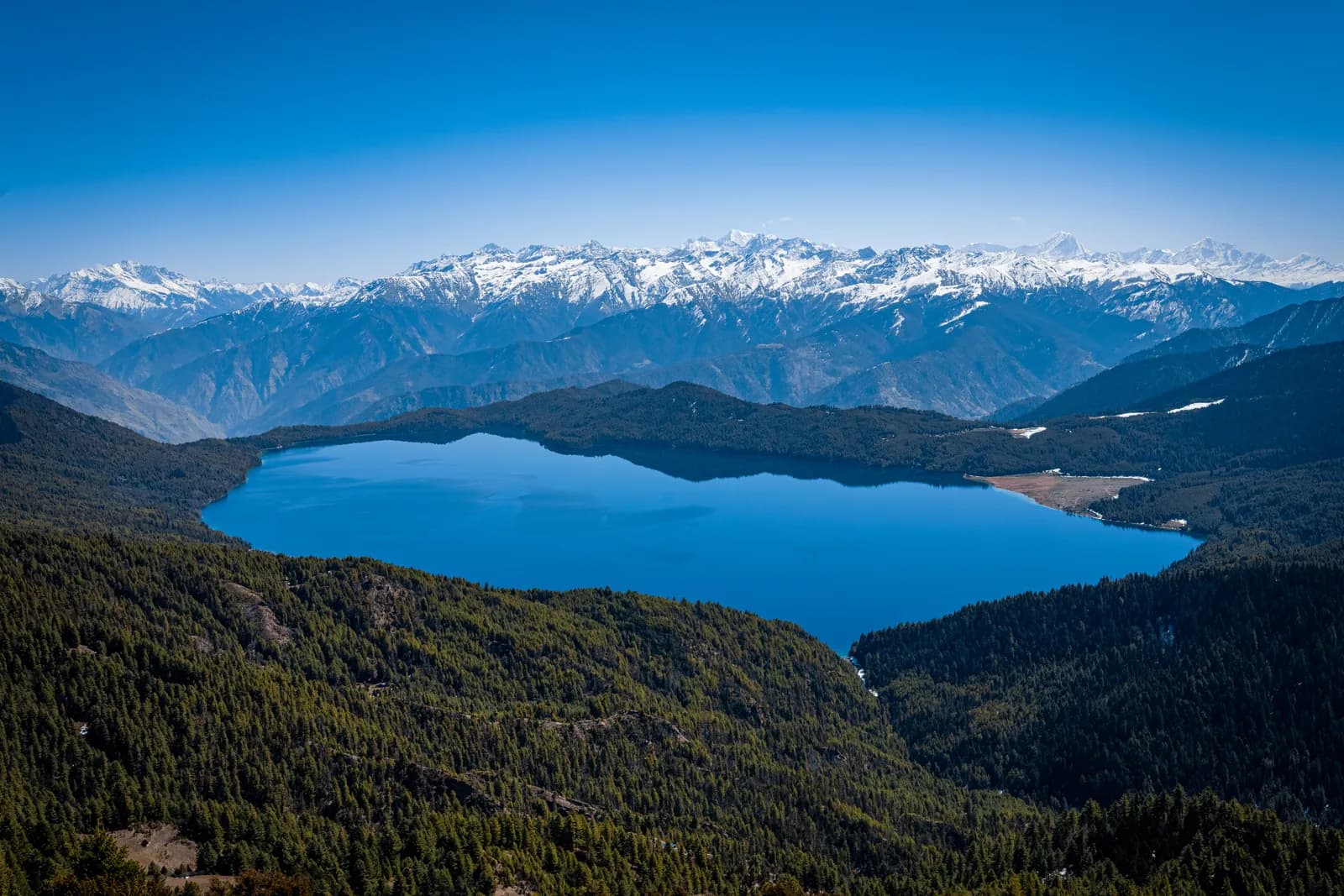
Rara
Rara is Nepal's quiet far-west lake trek: from Jumla through pine and rhododendron forest to Rara Lake, the country's largest lake at about 2,990 m, inside its smallest national park.
- 최고 고도Murma viewpoint above Rara Lake (about 3,630 m)
- 일수8–12
- 난이도보통
- 최적 시기Apr–May, Sep–Nov
- 퍼밋퍼밋 1개
사진: Nirojsedhai · CC BY-SA 4.0
Check that your policy covers helicopter evacuation and trekking at this region's altitude. We don't sell insurance.
What to look forWritten by FindTrekkingPartner team검토: FindTrekkingPartner team검토 방식FindTrekkingPartner
Rara은(는) 네팔의 트레킹 지역으로, 10일 일정의 루트가 있고 최고 3,550 m까지 오릅니다. 외국인 트레커는 FindTrekkingPartner에 날짜, 예산, 페이스를 적어 트립을 올리면 이곳 트레킹의 파트너를 찾을 수 있습니다. 매칭은 두 트레커가 모두 동의하기 전까지 비공개로 유지되며, 서비스는 무료입니다. 중간 요금 기준으로 공인 가이드 비용은 트레커 4명이 함께할 때 10일 동안 1인당 약 USD 76, 혼자일 때는 USD 302입니다. 최적의 시즌은 Apr–May, Sep–Nov입니다. 이곳에서는 사실상 공인 가이드가 필요합니다. 2026년 운영업체들의 보고에 따르면 2023년 4월 네팔관광청 규정이 국립공원과 보전지역 검문소에서 시행되고 있으며, 랑탕이 가장 엄격하고 안나푸르나도 확인합니다(2026년 10월 19일 확인). 등록된 여행사를 통해 가이드를 고용하고 여행사에 확인하세요. 이 루트의 모집 중인 트립은 출발 월, 그룹 규모, 남은 자리와 함께 아래에 나와 있습니다. 최종 확인일: 2026년 10월 19일. 출처: 네팔관광청, DNPWC, 출입국관리국.
출처:Department of Immigration, NepalNepal Tourism BoardDepartment of National Parks and Wildlife Conservation
- Rara Lake Trek 파트너 찾기아직 모집 중인 트립이 없습니다
개요
- 공인 가이드
- 외국인 트레커 필수
- 최소 인원
- 트레커 1명
NTB rule (Apr 2023), enforced at checkpoints in national parks (2026 operator reports). Checked 19 October 2026; see /guide-rule-nepal.
인기 트레킹
출발지
Kathmandu, Nepalgunj, Jumla, Talcha
가는 방법
Fly Kathmandu to Nepalgunj (about an hour) and on to Jumla (about 40 minutes), or fly Nepalgunj to Talcha (Rara) airport beside the lake when flights run. The Karnali Highway links Jumla and Gamgadhi by a rough road, and flights are weather dependent.
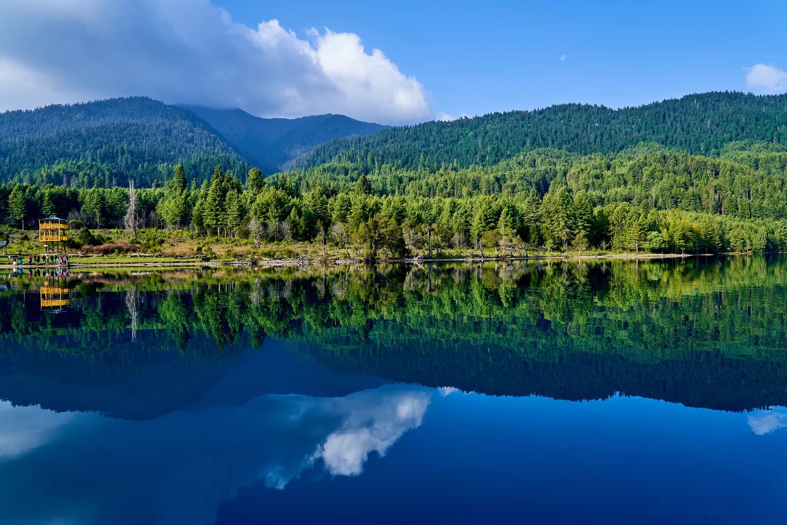
Rara Lake lies in the remote Karnali region of far-west Nepal, on the border of Jumla and Mugu districts, at about 2,990 m. With a surface of 10.8 km2 and a depth of 167 m, it is Nepal's largest lake, and it is the centrepiece of Rara National Park, the country's smallest, at 106 km2. The trek from Jumla crosses rural villages, apple and rice terraces and forested ridges, and takes about five days on foot with the lake as the reward, then a flight out from Talcha. It suits people who want a quieter walk, lower altitude and an unusual region, rather than high passes. You need a Rara National Park permit and a guide is strongly advised. Flights to Jumla and Talcha are weather dependent, so allow spare days. April and May, and September to November, are the best months. This is a moderate trek, with long days and simple lodges.
Overview of Rara
Rara National Park was established in 1976 and ranges from about 2,800 m to just over 4,000 m at Chuchemara Danda. The lake is 5.1 km long and 2.7 km wide, drains into the Mugu Karnali through the Nijar Khola, and was designated a Ramsar site in 2007. The water seems to change colour several times a day depending on the weather. Forested hills of blue pine, spruce, fir and rhododendron surround it, and the viewpoint at Murma, about 3,630 m above the western shore, gives the best view.
The park is home to Himalayan black bear, musk deer, red panda, goral, leopard and tahr, as well as the endemic Rara snow trout and the Rara frog. In 1976 the villagers of Chapra and Rara were resettled to Nepalgunj when the park was created, so the lake shore has no permanent settlement. The park is protected by the Nepali Army, and you may pass checkposts.
Jumla, the usual starting point, is a hill town at about 2,350 m known for apples, walnuts and Marsi rice, grown at one of the highest altitudes in the world. It is in Karnali Province, which has some of the lowest road density in Nepal.
Best time to trek, month by month
- March: cold nights and snow on the higher forest paths. The first rhododendron buds open in the lower forest.
- April: the best spring month, with rhododendron in bloom, clear mornings and the lake bright blue. Murma can still hold patches of snow.
- May: warmer and drier, with the lake at its calmest and the forest green. Pre-monsoon cloud can build late in the month.
- June to August: monsoon. Rain falls on the lower slopes, flights are unreliable and trails are slippery, but the lake and meadows are green and few people visit.
- September: the rains ease and the forest is very green. Mornings are clear, but landslides can still disrupt the roads.
- October: the most popular month, with clear skies, warm days and frosty nights. Autumn colours appear above the lake.
- November: cold and calm. Lodges close toward the end of the month and the lake begins to freeze at the edges.
- December to February: the lake can freeze over, and heavy snow closes some trails and flights. Only for experienced winter travellers.
Routes compared
| Trek | Typical days | Highest point | Character |
|---|---|---|---|
| Rara Lake Trek | 10 | Murma, about 3,000 m at the lakeside lodges | Quiet foothill trek to Nepal's largest lake, with flights each way |
You can walk the whole way from Jumla and return by flight from Talcha, as in the plan above, or add a few days in the Sinja valley, the old capital of the Khasa Malla kingdom. Combining Rara with Dolpo or Humla is a long expedition and needs separate permits.
Permits and rules
Rara National Park charges an entry fee payable at the park office or checkpost, and the area is not a restricted area. Fees for foreigners, SAARC visitors and Nepalis differ and have changed over time, so ask the agency for current amounts and check them with the park or the Department of National Parks and Wildlife Conservation. A TIMS card may be requested by the local office.
Guides. The Nepal Tourism Board April 2023 rule requires foreign trekkers to use a licensed guide in national parks and conservation areas, and 2026 operator reports say checkpoints enforce it in Annapurna (ACAP), Langtang (the strictest) and most other parks, but not in Khumbu, where the municipality opted out (checked 19 October 2026). See the guide rule by region. Reports on enforcement conflict, but in this region trails are poorly signed, local lodges are few and a guide helps with permits and route finding.
Getting there: flights and road
There are two usual access points. The first is a flight from Kathmandu to Nepalgunj in the Terai (about an hour) followed by a flight to Jumla (about 40 minutes), and then a walk of three to four days to the lake. The second is a flight from Nepalgunj to Talcha, the airstrip beside Gamgadhi, 1 to 3 hours on foot from the lake, when it operates. Flights are cancelled by cloud and wind, and Nepalgunj can be extremely hot, so plan a buffer.
The Karnali Highway connects Jumla with Gamgadhi and Rara by a rough road, and jeeps run on it. Trekkers use footpath shortcuts, ridges and village trails to avoid road sections.
Altitude and acclimatisation
The trek is moderate in altitude: Jumla is at about 2,350 m, Patmara about 3,000 m, and the lake at 2,990 m. Altitude sickness is less likely than on higher treks, but flying straight to Jumla and then walking to 3,000 m can cause mild symptoms in some people. Take the first day slowly, drink water, and consider a rest day at the lake.
Lodges, costs and food
Lodges and homestays exist in Jumla and at Pina, the lake area (Murma and the Rara Cultural Resort) and Gamgadhi, and basic meals are available in villages. Between them, there are few options, so many agencies bring tents and a cook for the nights at Patmara and Chautha. Dal bhat, noodles and eggs are standard, and apples and local trout may appear in the lake area.
Connectivity
Mobile coverage is patchy: Jumla and Gamgadhi have signal, and the villages between have it only at some spots. Some lodges sell Wi-Fi. Plan to be offline for much of the trek.
Safety
The region is remote. The nearest hospital is in Jumla or Gamgadhi, and evacuation is by helicopter or by flight from Talcha when the weather allows. Check the insurance includes helicopter rescue. Roads and streams are the main hazards in the monsoon, and in the lake area, cold nights and slippery paths are common.
What to pack
Broken-in boots, waterproof layers, a down jacket, a sleeping bag rated to about minus 10 C, gloves, a warm hat, sun protection, trekking poles, a headlamp, water purification and a first-aid kit. In the monsoon, bring a rain cover and leech socks. A swimsuit is not needed: swimming in the lake is discouraged.
History and culture
Jumla was the seat of the medieval Khasa Malla kingdom, and the valley of Sinja holds the ruins of its capital and its early Nepali-language inscriptions. The Karnali region has Hindu temples, such as Chandannath, and local festivals, and the Thakuri and Chhetri communities dominate. Many people in the area farm apples, buckwheat and potatoes.
Rara is held in high regard by local people, and the park rules keep settlement and farming away from the shore.
Wildlife and nature
The park holds 1,070 plant species and rich forests of blue pine, spruce, fir, juniper and rhododendron, with birch and oak at some elevations. Birdlife includes monal, koklass and snow pigeons. The Rara snow trout and Rara frog exist only here. In spring, wildflowers cover the meadows on the way up from Pina.
Responsible trekking
Do not swim in the lake, wash in it or leave rubbish. Use refillable bottles and a filter, and keep to the trail to protect the forest. Ask before photographing people, and buy supplies from local families. Do not feed wildlife.
Combining treks
Rara can be paired with a Phoksundo Lake trek from Nepalgunj and Dolpo, as both use the same flight hub. Shorter combinations are a day in Jumla, a visit to the Sinja valley, or the ridge walk above the lake to Murma.
Money, insurance and logistics
Bring cash from Kathmandu or Nepalgunj, because Jumla has limited cash machines. Insurance should cover trekking to 4,000 m and helicopter rescue. Flight baggage limits are tight, so use soft bags.
Arranging your trek
Choose a registered agency that holds the park permit, provides insured guides and porters, and has contingency plans for the flights. Ask about camping, rest days, flight changes and how long the lake stay will be, and agree the route and the flight out before you pay.
Jumla before you walk
Jumla is worth a half day. The bazaar in Khalanga sells local apples, dried fruit, walnuts and woollens, the Chandannath temple stands above the town, and the airport stays busy with traders, officials and a few trekkers. If you arrive early, you can still reach the first lodge the same afternoon, but it is wiser to rest, buy water and check the weather forecast for the next days. The Sinja valley, a day trip by jeep, holds the ruins of the Khasa Malla capital.
What to do at the lake
The shore path around Rara Lake takes a few hours and has no steep sections. The Murma viewpoint above the western shore is a short but steep climb, and the view over the lake and across to the Chuchemara ridge is the highlight, best in early morning. Swimming and boating are not part of the usual visit, so spend the time walking and watching. Birds are most active at dawn and dusk, and snow trout can be seen in the clear shallows near the shore.
Food and drink
Lodges serve dal bhat, noodles, fried rice, soup and eggs, with apples in autumn and local trout when the park allows it. Water must be boiled or filtered. Buy snacks in Jumla or Nepalgunj, because supplies at the lake are limited.
Practical tips from the trail
- Carry cash in small notes, because villages seldom have change.
- Take rain gear even in October. Afternoon showers are common in the ridges.
- Start walking early, so you arrive before cloud covers the views.
- Keep spare days in the schedule for flights, particularly at the end of the trek when the Talcha flight is the only way out.
- Respect park rules: no fires, no fishing and no drones without permission.
Kathmandu before and after
Spend at least one night in Kathmandu before the Nepalgunj flight, and keep a spare day in the schedule. Nepalgunj has hotels and restaurants, but expect heat and delays.
이 지역의 모든 루트
이곳에서 다루는 모든 표준 루트입니다. 루트를 눌러 일별 일정을 여세요.
루트 비교
길이, 고도, 난이도, 예상 비용으로 루트를 정렬해 나에게 맞는 루트를 찾으세요.
일수 ↑ 기준 정렬
| 루트 | |||||
|---|---|---|---|---|---|
| Rara Lake Trek | 10 | 3,550 m | 보통 | 74.1 km | NPR 40,000부터 |
비용은 추정치입니다. 해당 지역의 예산형 일일 요금에 일수를 곱한 값이며 항공권과 퍼밋은 제외입니다.
트레킹 최적 시기
강조 표시된 달이 권장 트레킹 시즌입니다. Apr–May · Sep–Nov
최적 시즌그 외 달
Live conditions
Notes entered by our team from the sources linked on each item. Conditions change quickly, so confirm with your guide or lodge before you set off.
Best seasons: Apr–May · Sep–Nov
Nothing recent on file. Check with your guide or lodge before you go.
퍼밋과 요금
요금은 1인 기준이며 국적 그룹에 따라 다릅니다.
| 퍼밋 | 외국인 | SAARC | 네팔인 |
|---|---|---|---|
Rara National Park entry permit | NPR 3,000 | NPR 1,500 | — |
- 구매처
Department of National Parks and Wildlife Conservation
일일 비용
티하우스 트레킹 기준 1인 1일 비용. 가이드와 포터는 그룹/포터 1명당 1일 기준입니다. 2026년 10월 기준.
| 스타일 | 1일 | 가이드 / 일 | 포터 / 일 | 예시 합계 |
|---|---|---|---|---|
| 저예산 | NPR 3,100–4,400 | NPR 4,050 | NPR 2,750 | NPR 81,500–117,400 |
| 중간 | NPR 4,000–5,800 | NPR 4,050 | NPR 2,750 | NPR 89,600–130,000 |
| 편안함 | NPR 5,000–7,300 | NPR 4,050 | NPR 2,750 | NPR 98,600–143,500 |
저예산: Kathmandu to Nepalgunj flight USD 100 to 140 and Nepalgunj to Talcha USD 100 to 150 each way, or Kathmandu to Surkhet by bus then jeep (USD 70 to 110 one way).
중간: Kathmandu to Nepalgunj flight USD 100 to 140 and Nepalgunj to Talcha USD 100 to 150 each way, or Kathmandu to Surkhet by bus then jeep (USD 70 to 110 one way).
편안함: Kathmandu to Nepalgunj flight USD 100 to 140 and Nepalgunj to Talcha USD 100 to 150 each way, or Kathmandu to Surkhet by bus then jeep (USD 70 to 110 one way).
규칙과 올바른 실천
가이드
- 모든 지역
Foreign trekkers must trek with a licensed guide in national parks and conservation areas (in force since April 2023). Enforcement varies by region, so verify the current rule before you go.
퍼밋
- 모든 지역
Carry your permits at all times; they are checked at several checkpoints along every route.
안전 & 고도
- 모든 지역
Buy travel insurance that covers helicopter rescue to at least 6,000 m.
- 모든 지역
Climb high, sleep low: above 3,000 m, avoid raising your sleeping altitude by more than about 500 m per day, and add rest days.
환경 보호
- 모든 지역
Carry out all non-burnable waste (batteries, plastic, wrappers) and use a refillable water bottle.
문화
- 모든 지역
Respect monasteries: walk clockwise around stupas and mani walls, and remove shoes where asked.
- 모든 지역
Ask before photographing people, especially at religious sites and ceremonies.
드론
- 모든 지역
No drones without prior permission from the relevant authority.
사진
자주 묻는 질문
Yes, the Rara National Park entry permit. The area is not a restricted area. Ask your agency for current fees and check them with the park office or the Department of National Parks and Wildlife Conservation.
The Nepal Tourism Board April 2023 rule requires foreign trekkers to use a licensed guide in national parks and conservation areas, and 2026 operator reports say checkpoints enforce it in Annapurna (ACAP), Langtang (the strictest) and most other parks, but not in Khumbu, where the municipality opted out (checked 19 October 2026). Confirm with a registered agency. Trails are poorly marked and lodges are few, so a guide is advisable.
Ten days from Kathmandu on this plan, including the flights to Jumla and from Talcha, with about five days of walking and a rest day at the lake. Delays can add days.
About 2,990 m. Wikipedia gives 2,975 m, and sources vary slightly with the survey.
It covers about 10.8 km2, is up to 167 m deep, and is about 5 km long. It is the largest lake in Nepal.
April and May, and September to November. The monsoon is wet, and the lake can freeze from December to February.
Fly Kathmandu to Nepalgunj and then to Jumla, then walk or take a jeep on the Karnali Highway, or fly Nepalgunj to Talcha, near the lake, when flights run.
It is moderate. The altitude is low, the days are long and the lodges are simple, so you need reasonable fitness but no technical skills.
모집 중인 여행
Rara 가이드
 커버 사진: Ummidnp, CC BY-SA 4.0
 커버 사진: McKay Savage from London, UK, CC BY 2.0
 커버 사진: Nirmal Joshi, CC BY 2.0
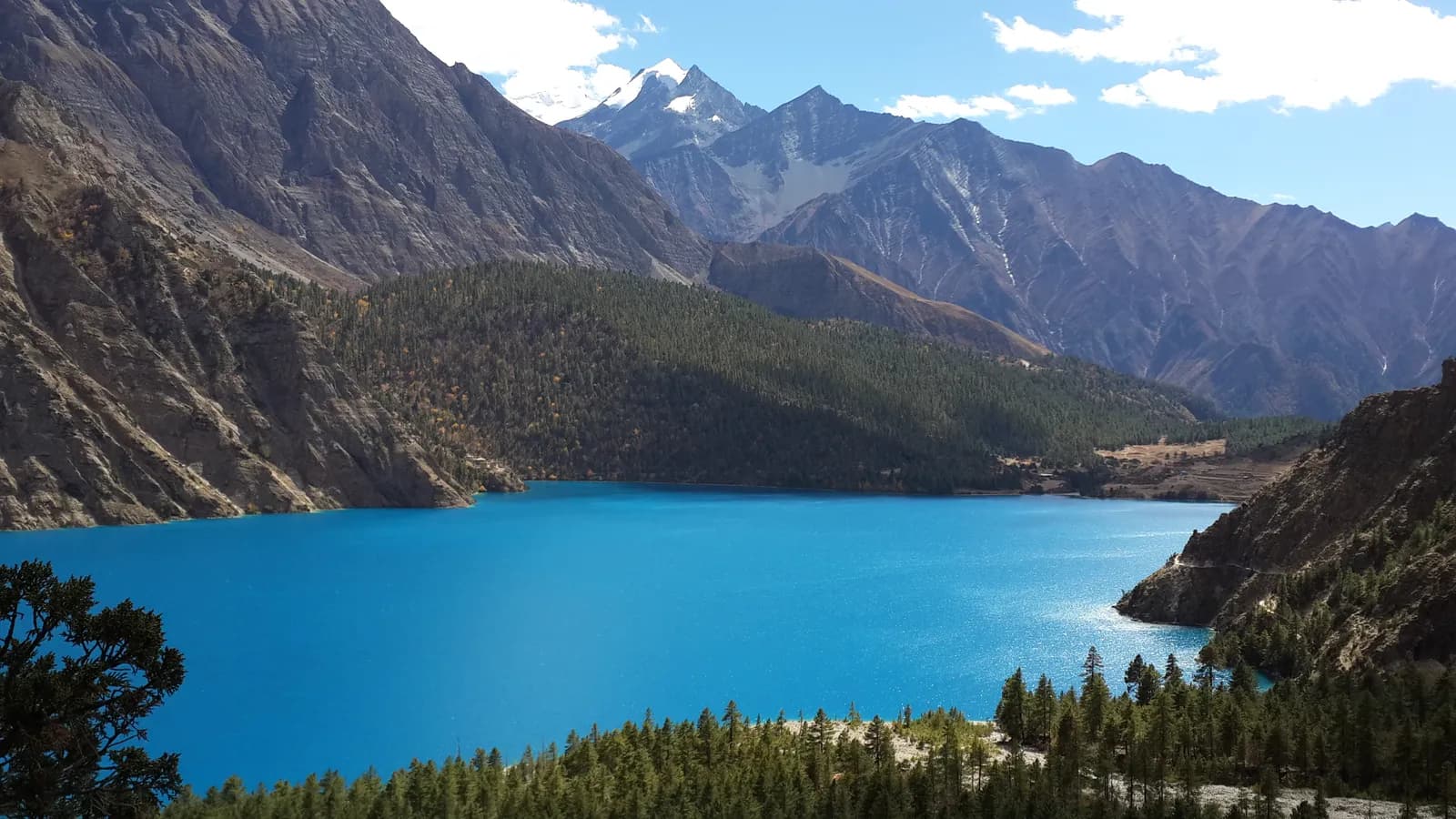 커버 사진: Outlaw Django, CC BY-SA 4.0
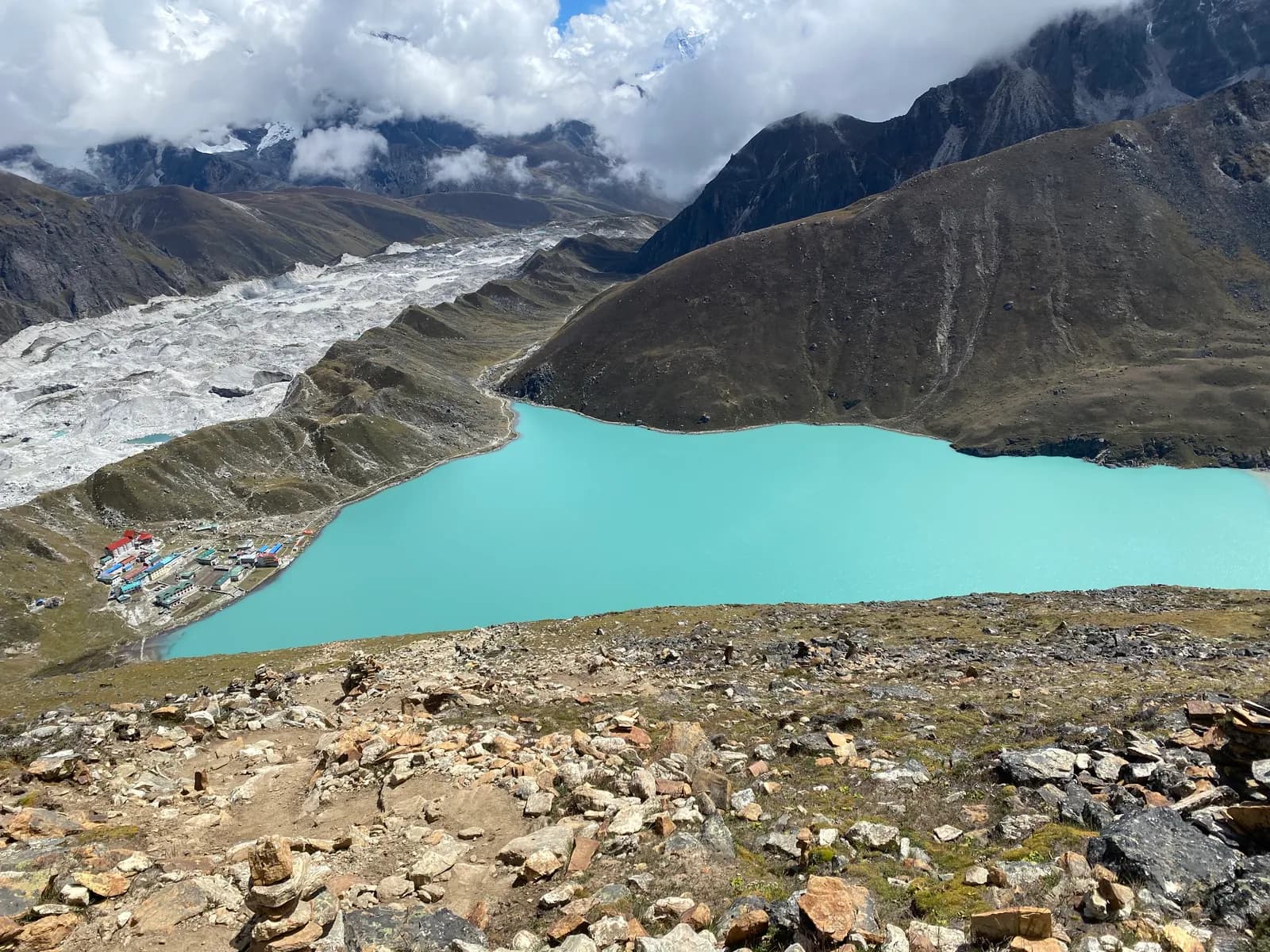 커버 사진: Axmc, CC BY-SA 4.0
 커버 사진: Gaurav Dhwaj Khadka, CC BY-SA 4.0
출처
Rara 트레킹 준비되셨나요?
이 날짜의 트레킹 파트너를 찾거나 나만의 루트 계획을 시작하세요.