Tsum Valley trekking guide: culture and rules
The Tsum Valley is a hidden Buddhist valley reached from Philim: 13 days, Mu Gompa at about 3,700 m, restricted-area permit and licensed guide required.
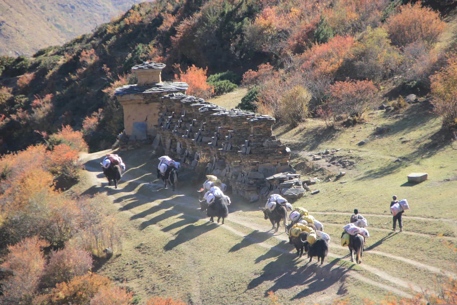
The Tsum Valley is a hidden Buddhist valley in the north of Gorkha District, close to the Tibetan border, reached by branching off the Manaslu trail at Philim. The standard trek takes 13 days from Kathmandu: a drive to Machha Khola, 11 days on foot up the Budhi Gandaki and the Tsum valley to Mu Gompa (about 3,700 m) and back, and a drive home.
It has no passes and a highest point of about 3,700 m, but it is rated hard because the days are long (14 to 17 km on several) and the climbs are steady. It is a restricted area inside the Manaslu Conservation Area, so you need a Restricted Area Permit through a registered agency, the conservation area permit, and a licensed guide. The data sits on the Tsum Valley route page and the Manaslu region page.
Planning Tsum? Find a trekking partner for the Tsum Valley.
This guide explains who the trek suits, what the valley is like, and how it differs from the Manaslu Circuit it branches from.
Tsum Valley Trek के ओपन ट्रिप
पार्टनर खोज रहे ट्रेकर्स के असली ट्रिप।
What kind of trek it is
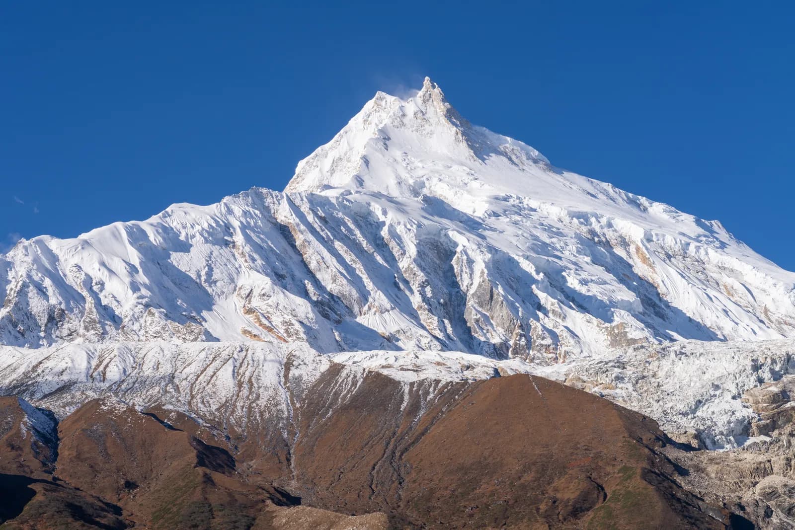
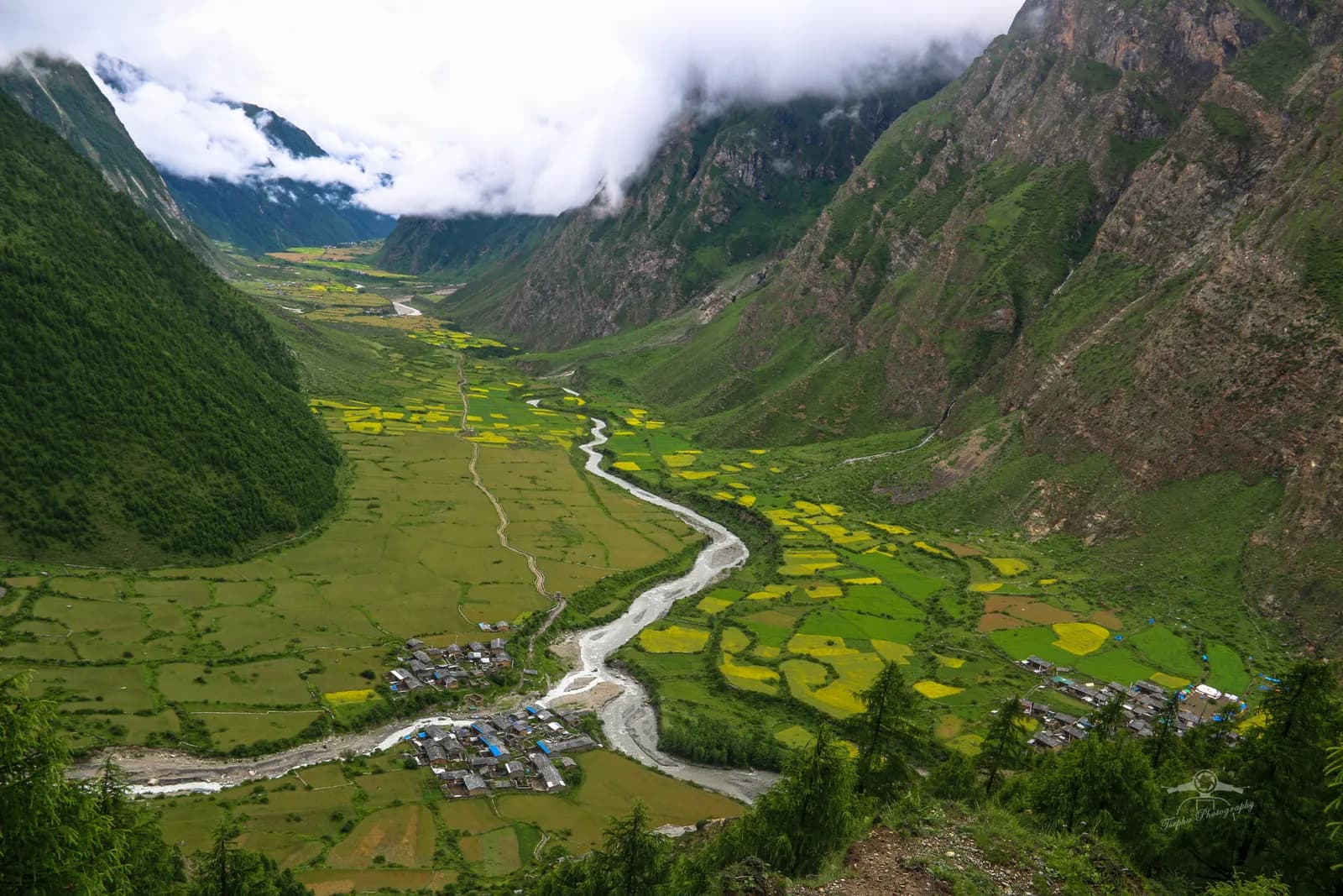
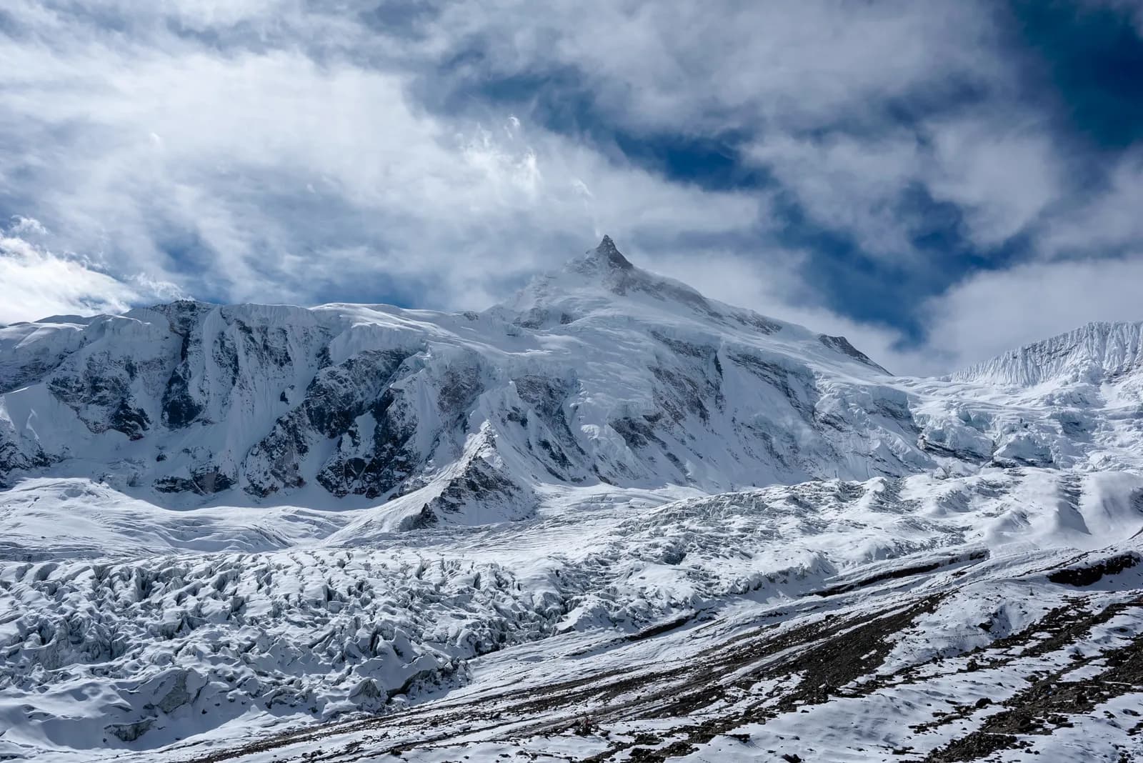
Tsum is a culture trek more than a mountain trek. The walk follows the Budhi Gandaki through steep gorge country with suspension bridges, waterfalls and forest, and some sections now run beside a jeep road. At Philim the Tsum branch turns north through bamboo and oak forest to Lokpha and Chumling (about 2,360 m), the first Tsum village. Above it the valley opens into terraces of barley and buckwheat, stone houses with prayer flags and long mani walls. Chhokangparo (about 3,070 m) and Nile (about 3,300 m) are the bases for the upper valley, and Mu Gompa, near the border, is the last stop. The views are of Ganesh Himal, Sringi Himal and the Boudha Himal range, but the reasons to go are the monasteries and the quiet. The valley opened to trekkers only in 2008.
The monasteries
Mu Gompa, at about 3,700 m, is the highest and most remote monastery in the valley and a centre of Buddhist learning. Rachen Gompa, near Lar at about 3,220 m, is a nunnery, and the Milarepa cave associated with the Tibetan saint is nearby. Visitors are expected to be quiet and respectful, to dress modestly and to ask before photographing inside. The route page suggests carrying a scarf or shawl to wear in monasteries. Walk clockwise around mani walls and chortens. Our monastery etiquette guide covers the customs in more detail.
Rules and permits in outline
The permit set is a Restricted Area Permit from the Department of Immigration, issued through a registered agency, the Manaslu Conservation Area entry permit and a TIMS card where required, plus a licensed guide throughout. Reports of a March 2026 notice say individual foreigners may now apply, but the agency and the guide remain compulsory, and a Kantipur report of 6 May 2026 concerns controlled areas in 13 districts. We could not read the official text of either, so ask your agency to confirm the rule in writing. As of October 2026 the Nepal Tourism Board lists the Tsum permit at USD 40 per person per week plus USD 7 per extra day from September to November, and USD 30 per week plus USD 7 per extra day from December to August: USD 68 or USD 58 for the 11 permit days of our route plan, plus NPR 3,000 for the Manaslu Conservation Area permit. Day counts have changed more than once, so confirm them with your agency. The permit position is close to the Manaslu one, explained in our Manaslu restricted-area permit guide, but Tsum needs its own permit, as the Manaslu region page stresses: it is a separate restricted area that needs extra days, a guide familiar with it and its own paperwork. Check posts are at Jagat and Philim, so carry copies.
Getting there
The road from Kathmandu to Machha Khola runs via Dhading, Arughat and Soti Khola and takes 8 to 9 hours in a jeep, on a rough and dusty surface that landslides can block in the monsoon. Machha Khola is at about 850 m. Some groups use a jeep for part of the Jagat to Machha Khola section on the way out. There is no flight, so a spare day is the only protection against road delays. For comparison with a flight-based trek, see our Kanchenjunga access guide.
Seasons
October and November have the clearest weather. March to May bring rhododendron and warmer days. The monsoon has leeches, landslides and cloud on the Machha Khola road, and winter is cold, with snow around Mu Gompa and many lodges closed. Ask your agency which lodges are open in your month, because upper-valley lodges close in the off season.
Lodges, food and kit
Simple lodges and homestays operate in every village, with dal bhat, noodles, potatoes, tsampa and tea, and rooms with blankets. In the upper valley facilities are basic and some places close in the off season. Prices rise with altitude, and there are no cash machines on the trail. Pack a sleeping bag rated to about minus 10 C, waterproofs, a down jacket, sun cream, leech socks in wet months and a scarf or shawl for monasteries.
Altitude and effort
The valley sleeps between about 850 m at Machha Khola and 3,680 m near Mu Gompa, so altitude is moderate compared with the high passes elsewhere. The effort comes from distance and steady climbing: day 2 is about 17 km with 1,300 m of climbing, day 5 from Chumling to Chhokangparo is about 11 km with 1,050 m of climbing, and the descent on day 9 from Rachen Gompa to Chumling is about 16 km. Watch for headache, nausea and poor sleep, never ascend with symptoms, and descend if they worsen. Our altitude sickness basics explain what to look for.
Extensions and combinations
Add a day at Mu Gompa to explore the upper valley or walk toward the Tibetan border viewpoints, visit the Milarepa cave and Rachen Gompa on an extra night, or continue to the Manaslu Circuit from Philim, which adds about a week and the Larkya La. Check the permits for each route with your agency, since each restricted area has its own paperwork.
Responsible visiting
Take rubbish out, use filtered water and buy from local families. Dress modestly, ask before taking photographs of people and inside monasteries, and do not give sweets or money to children. The valley is small and quiet, and the way visitors behave shapes how it welcomes the next ones.
Tsum compared with the Manaslu Circuit
Both start with the same Machha Khola road and the same first days up the Budhi Gandaki to Jagat and Philim, and both are restricted areas inside the Manaslu Conservation Area. After Philim they diverge. The Manaslu Circuit takes 14 days and crosses the Larkya La at 5,106 m, with the highest sleep at Samdo (3,875 m) and Dharamsala (4,470 m). Tsum takes 13 days, has no pass and never sleeps above about 3,700 m, and its interest is villages and monasteries rather than a big crossing. If you have the time, the combination takes about a week more than either alone. If you must choose one, pick Tsum for culture and a lower, quieter trek, and Manaslu for the pass and the mountain views.
Who it suits
Tsum suits fit trekkers who like culture and quiet trails and do not need a high pass. If you want a pass and a bigger mountain, the Manaslu Circuit is the alternative, and the Manaslu itinerary shows what that involves. The daily plan is in the Tsum Valley itinerary, and the wider picture in the regions guide.