

Take a micro-bus or taxi to Budhanilkantha and walk to the park gate, a short way beyond the temple. Buy your ticket, then follow the park road to Nagi Gompa, where a nunnery sits in the forest, and continue on the forest path through Baghdwar, a source of the Bagmati river, to Shivapuri Peak. The climb is about 6 km, with about 1,090 m of ascent, and takes about four hours. Rest at the summit, which is 2,732 m, then return by the same route, about two to three hours, so that you finish before dark. Carry two litres of water and a lunch.
Shivapuri Peak Day Hike
A one-day hike from the Budhanilkantha gate of Shivapuri Nagarjun National Park through Nagi Gompa to Shivapuri Peak (2,732 m) and back, about 12 km with 1,090 m of climbing.
- 天数1
- 最高海拔2,732 米
- 距离12.2 公里
- 爬升1,089 米
- 难度中等
- 最佳月份Oct–Nov, Mar–Apr
- 许可证1
照片:Alexey Komarov · CC BY-SA 4.0
以英文显示——尚未翻译。
此路线为草稿,尚未核实。请务必与你的向导确认各段行程。
Written by FindTrekkingPartner team审核人:FindTrekkingPartner team我们如何审核FindTrekkingPartner
Shivapuri Peak Day Hike是尼泊尔Kathmandu Valley地区一条为期 1 天的徒步路线,最高海拔 2,732 米。外国徒步者可以在 FindTrekkingPartner 上发布行程,写明日期、预算和节奏,为这条路线寻找搭档。在双方徒步者都同意之前,匹配信息保持私密,且服务免费。 按中档价格计算,持证向导在 1 天内的费用为:四名徒步者分摊时每人约 9 美元,一人独自出行则为 37 美元。最佳季节为Oct–Nov, Mar–Apr。 像这样的开放路线并不强制要求持证向导(2026年10月19日核查):昆布市政当局已退出尼泊尔旅游局2023年4月的规定,一日徒步也无需向导,但仍强烈建议聘请向导,请向你的旅行社确认。 这条路线的开放行程列在下方,包含出发月份、团队人数和剩余名额。 最后核实:2026年10月19日。资料来源:尼泊尔旅游局、DNPWC、移民局。
资料来源:Department of Immigration, NepalNepal Tourism BoardDepartment of National Parks and Wildlife Conservation
为Shivapuri Peak Day Hike寻找搭档
概览
从 Budhanilkantha 出发1 天 · 最高 2,732 米
最佳季节:Oct–Nov, Mar–Apr · 许可证:Shivapuri Nagarjun National Park entry permit (NPR 1,000 for foreigners)
The Shivapuri Peak hike is a one-day walk from the Budhanilkantha gate of Shivapuri Nagarjun National Park to the summit of Shivapuri, 2,732 m, and back, a route of about 12 km with about 1,090 m of climbing that takes six to seven hours for most walkers. The trail follows the park road to Nagi Gompa, a nunnery in the forest, then climbs through Baghdwar, a source of the Bagmati river, to the top, where on a clear morning you see the Kathmandu Valley below and the Langtang and Ganesh Himal ranges beyond. There is no food on the trail, so carry water and lunch. The park entry fee for foreigners is NPR 1,000. It needs no guide, no flight and no gear beyond boots, water and a rain jacket, and the best months are October to November and March to April.
The plan follows operator descriptions that agree on the Budhanilkantha start, Nagi Gompa and the Bagmati source, and on the six to seven hour timing; one of them measures about 16 km and 1,585 m of gain with extra loops, and ours is the direct route. The height of the peak, 2,732 m, comes from Wikipedia, OpenStreetMap and the operators.
What the hike is like
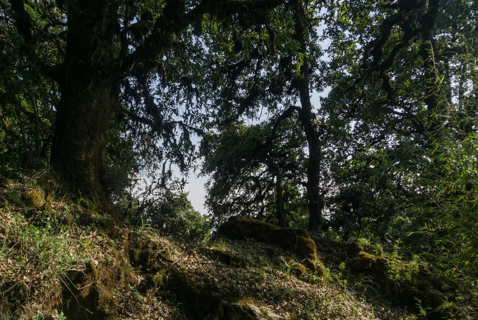
After the gate the path follows the park road to Nagi Gompa, then a path through oak and rhododendron forest, with stone steps near the top. The Baghdwar spring, a stone spout carved as a face, is on the way. Mist can hide the way on the upper ridge, so carry a map. Monkeys live in the forest and should not be fed.
Permits and rules
The park entry fee is NPR 1,000 for foreigners and NPR 600 for SAARC nationals per entry, according to the Nepal Tourism Board. Carry your ticket on the trail.
Best season
October to November and March to April. In the monsoon the trail is slippery and cloud hides the views.
Getting there and away
Take a micro-bus or taxi from Kathmandu to Budhanilkantha, about 30 to 45 minutes. The gate is a short walk beyond the temple, and the return is the same way.
Difficulty and fitness
The hike is moderate: it climbs about 1,090 m, mostly on stone steps and forest paths, and takes six to seven hours. Good boots, two litres of water and a rain jacket are enough. Start by 7 am so that you are down before the afternoon cloud and before dark.
Budget notes
The only fee is the park entry, NPR 1,000 for foreigners. Add a micro-bus or taxi to Budhanilkantha and lunch. The costs section shows the transfer as a line to check.
Guide rule
Buy the park entry ticket at the gate; no guide check is reported on this route (checked 19 October 2026). See the guide rule by region.
亮点
- Shivapuri Peak at 2,732 m, the highest point of the park
- Nagi Gompa, a nunnery in the forest above Budhanilkantha
- Baghdwar, a source of the Bagmati river
- Oak and rhododendron forest within sight of the city
- A full day hike that starts at a city bus stop
路线地图
路线数据来自 OpenStreetMap,尚未经我们团队核实。请仅用于规划,不要用于导航。
逐日行程
费用
每人全包费用估算:按海拔计的客栈和餐饮、交通、许可证,以及向导和挑夫。共用向导和挑夫的徒步者越多,每人付得越少。 截至 2026年10月。
| 风格 | 1 位徒步者分摊 | 2 位徒步者分摊 | 4 位徒步者分摊 |
|---|---|---|---|
| 经济 | US$0–US$10* | US$0–US$10* | US$0–US$10* |
| 中档 | US$50–US$80* | US$30–US$50* | US$20–US$40* |
| 舒适 | US$50–US$80* | US$30–US$60* | US$30–US$50* |
共用向导,省钱
中档风格下,独自徒步者约付 US$50–US$80;四位徒步者共用一名向导和两名挑夫,每人约付 US$20–US$40(区间上限处少 60%)。
2 位徒步者分摊的明细
| 项目 | 经济 | 中档 | 舒适 |
|---|---|---|---|
| 许可证 | US$0–US$10 | US$0–US$10 | US$0–US$10 |
| 向导 | — | US$10–US$30 | US$10–US$30 |
| 挑夫 | — | US$0–US$20 | US$10–US$30 |
经济风格乘坐公共交通且不请挑夫;中档风格两位徒步者共用一名挑夫并使用包车;舒适风格每位徒步者各配一名挑夫。在要求有向导或选择中档、舒适风格时包含向导。
许可证费用(官方来源)
- Shivapuri Nagarjun National Park entry permit: NPR 1,000 每次入园 来源
未包含
未找到以下项目的公开价格:Kathmandu to Budhanilkantha and back。标有 * 的总额不含这些项目,请向旅行社询问。 Park entry ticket at the gate; no guide check reported (checked 19 October 2026).
费用来源
- PriceNepal: Nepal Travel Cost Guide 2026 (2026-05-14)
- Third Rock Adventures: Nepal trek budget planner (2026-05-09)
- Himalayan Partner: Guide and porter price in Nepal 2026 (2026-02-10)
- Shikhar Adventure: Annapurna Circuit trek cost (2026-02-03)
- Nepal Tourism Board: Trekking Permit (2026-10-18)
估算来自运营商指南,并非报价。小费、保险、装备和加德满都酒店不包含在内;美元按平台汇率换算。
照片
常见问题
Six to seven hours for the round trip, according to operators, with about four hours of ascent. Our map shows about 12 km and 1,090 m of climbing each way.
2,732 m, according to Wikipedia, OpenStreetMap and operator pages. One operator listing gives 2,535 m, which looks like an error.
Yes, the Shivapuri Nagarjun National Park entry permit, NPR 1,000 per person for foreigners and NPR 600 for SAARC nationals, per the Nepal Tourism Board. Children under 10 enter free.
No. Operators note that there are no food stops, so carry water and lunch. Nagi Gompa is a nunnery, not a restaurant.
来源
沿途
路线每一天的住宿、医疗救助、饮水和景点。
1. Budhanilkantha
- Camping · 住宿 · 1,858 米
- Drinking Water · 实用信息 · 1,989 米
- Baghdwar · 实用信息 · 2,513 米
- Abandoned Hut · 住宿 · 2,726 米
- View Point · 观景点 · 2,691 米
- Camp · 住宿 · 2,344 米