

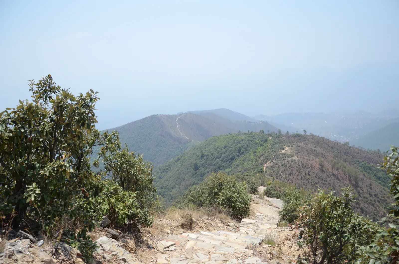
Drive from Kathmandu to Pharping and start walking early. The path climbs through pine forest on stone paving and steps, passes Hattiban Resort about half an hour above the road if you start at Pahiro, and then rises steadily for about three hours to the ridge, where the shrine of Champadevi stands in the open at about 2,285 m. On our map the round trip is 11.2 km with 750 m of climbing from Pharping. Rest at the top for the views of the Langtang and Ganesh Himal ranges, then descend by the same path, or drop steeply to the Champadevi Mai temple and walk about half an hour on the road to Khahare, where your car waits. Carry lunch and water.
Champadevi Day Hike
A one-day hike from Pharping through pine forest to the Champadevi hilltop shrine (about 2,285 m) and back, 11.2 km with 750 m of climbing and views of Langtang, Ganesh Himal and Gaurishankar.
- Ngày1
- Độ cao tối đa2.285 m
- Quãng đường11,2 km
- Độ cao leo747 m
- Độ khóTrung bình
- Tháng đẹp nhấtOct–Nov, Mar–May
Lên kế hoạch chuyến đi theo lịch trình nàyTìm bạn đồng hành cho Champadevi Day HikeXem lịch khởi hành theo tuần
Ảnh: Pratap Baniya · CC BY-SA 4.0
Hiển thị bằng tiếng Anh — chưa được dịch.
Lịch trình này là bản nháp và chưa được xác minh. Luôn xác nhận các chặng với hướng dẫn viên của bạn.
Written by FindTrekkingPartner teamĐược FindTrekkingPartner team kiểm duyệtCách chúng tôi kiểm duyệtFindTrekkingPartner
Champadevi Day Hike là chuyến trek 1 ngày ở vùng Kathmandu Valley của Nepal, leo lên độ cao 2.285 m. Trekker nước ngoài có thể tìm bạn đồng hành cho chuyến này trên FindTrekkingPartner bằng cách đăng chuyến đi kèm ngày đi, ngân sách và tốc độ. Các kết nối được giữ riêng tư cho đến khi cả hai trekker đồng ý, và dịch vụ này miễn phí. Ở mức giá tầm trung, một hướng dẫn viên có giấy phép tốn khoảng 9 USD mỗi người trong 1 ngày khi bốn trekker chia sẻ, so với 37 USD cho một trekker đi một mình. Các mùa đẹp nhất là Oct–Nov, Mar–Apr. Hướng dẫn viên có giấy phép không bị bắt buộc trên các cung đường mở như thế này (kiểm tra ngày 19 tháng 10 năm 2026): chính quyền Khumbu đã không áp dụng quy định tháng 4 năm 2023 của Cục Du lịch Nepal (Nepal Tourism Board) và các chuyến đi bộ trong ngày không cần hướng dẫn viên, nhưng vẫn rất nên có hướng dẫn viên, vì vậy hãy xác nhận với công ty lữ hành của bạn. Xác minh lần cuối: 19 tháng 10, 2026. Nguồn: Cục Du lịch Nepal (Nepal Tourism Board), DNPWC, Cục Xuất nhập cảnh.
Nguồn:Department of Immigration, NepalNepal Tourism BoardDepartment of National Parks and Wildlife Conservation
Tìm bạn đồng hành cho Champadevi Day Hike
- Tìm bạn đồng hành cho Champadevi Day HikeChưa có chuyến đi đang mở
- Tìm bạn đồng hành cho Shivapuri Peak Day HikeChưa có chuyến đi đang mở
- Tìm bạn đồng hành cho Nagarkot to Changu Narayan Day HikeChưa có chuyến đi đang mở
- Tìm bạn đồng hành cho Chisapani Nagarkot TrekChưa có chuyến đi đang mở
- Tìm bạn đồng hành cho Phulchowki Day HikeChưa có chuyến đi đang mở
- Tìm bạn đồng hành cho Namo Buddha Day HikeChưa có chuyến đi đang mở
Tổng quan
Khởi hành từ Pharping1 ngày · tối đa 2.285 m
Mùa đẹp nhất: Oct–Nov, Mar–May
The Champadevi hike is a one-day walk from Pharping, on the southern rim of the Kathmandu Valley, through pine forest to the open hilltop shrine of Champadevi at about 2,285 m, and back. On our map the round trip is about 11.2 km with 750 m of climbing, mostly on a stone-paved path and forest track. Operators put the climb from Hattiban Resort at about three hours and the whole climb from the road at three to three and a half hours; the descent takes one to two hours. Allow five to seven hours for the day, with a 45 minute drive each way from Kathmandu. On a clear morning the view runs from Langtang and Ganesh Himal to Manaslu and Gaurishankar. None of our sources lists a park permit for this hill. Bring water and lunch.
The plan follows two operator itineraries that agree on the Hattiban Resort halfway point and the open shrine at the top. Heights vary between 2,278 and 2,285 m in the sources and OpenStreetMap gives 2,241 m for the summit node, so we say about 2,285 m. Operators start at Pahiro or Hattiban to save time; our map starts lower, at Pharping, and is therefore longer.
What the hike is like
The path climbs steadily through pine forest on stone paving and steps, passes Hattiban Resort and continues to a ridge where the shrine of Champadevi stands in the open. From the ridge you see Chandragiri on one side and Phulchowki on the other, with the Bagmati river and Khokana below. An optional extension continues to Bhasmasur hill, which is higher than Champadevi. Pharping, a Newar village, is worth a stop before or after the walk.
Permits and rules
Neither operator lists a park permit or entrance fee for the hill. Monument fees at Pharping or Dakshinkali temples, if you visit them, are separate. Carry your litter out.
Best season
Operators say the hike can be done in every season and advise an early start for clear skies. Autumn (October to November) and spring (March to May) give the sharpest mountain views; in the monsoon the paving is wet and cloud hides the peaks.
Getting there and away
Drive from Kathmandu to Pharping or to Pahiro, about 45 minutes from Thamel, and finish at Khahare or Machhegaun, about 45 minutes back by road, depending on traffic. A taxi or an operator transfer is the simplest way; no fare is published in our sources, so agree it in advance.
Difficulty and fitness
The hike is gentle to moderate: 750 m of climbing, mostly on paved steps, over five to seven hours. Good shoes, two litres of water and a rain jacket are enough. Leave Pharping by 8 am so that you are on top before the haze builds.
Budget notes
There is no permit fee. Budget for a taxi to the trailhead and a return from Khahare or Pharping, plus lunch. The costs section shows the transfers as lines to check.
Điểm nổi bật
- Champadevi hilltop shrine at about 2,285 m with Himalayan views on clear days
- Stone-paved path and steps through pine forest
- Hattiban Resort halfway up as a rest stop
- Pharping, a Newar village with monasteries and the Dakshinkali temple nearby
- Chandragiri on one side and Phulchowki on the other from the ridge
Bản đồ lộ trình
Dữ liệu lộ trình từ OpenStreetMap, nhóm chúng tôi chưa kiểm tra. Hãy dùng để lên kế hoạch, không dùng để dẫn đường.
Từng ngày
Chi phí
Chi phí trọn gói ước tính cho mỗi người: nhà trọ và ăn uống theo độ cao, di chuyển, giấy phép, hướng dẫn viên và porter. Càng nhiều người trekking chia chung hướng dẫn viên và porter, mỗi người trả càng ít. Tính đến tháng 10 năm 2026.
| Phong cách | 1 người trekking chia chung | 2 người trekking chia chung | 4 người trekking chia chung |
|---|---|---|---|
| Tiết kiệm | — | — | — |
| Tầm trung | 40 US$–80 US$* | 20 US$–40 US$* | 10 US$–30 US$* |
| Thoải mái | 40 US$–80 US$* | 30 US$–50 US$* | 20 US$–40 US$* |
Chia chung hướng dẫn viên, tiết kiệm tiền
Ở mức tầm trung, một người trekking một mình trả khoảng 40 US$–80 US$; bốn người chia chung một hướng dẫn viên và hai porter trả khoảng 10 US$–30 US$ mỗi người (rẻ hơn 66% ở đầu trên của khoảng giá).
Chi tiết cho 2 người trekking chia chung
| Khoản mục | Tiết kiệm | Tầm trung | Thoải mái |
|---|---|---|---|
| Hướng dẫn viên | — | 10 US$–30 US$ | 10 US$–30 US$ |
| Porter | — | 0 US$–20 US$ | 10 US$–30 US$ |
Tiết kiệm dùng phương tiện công cộng và không có porter; tầm trung chia một porter cho hai người trekking và dùng xe riêng; thoải mái cho mỗi người một porter. Hướng dẫn viên được tính khi bắt buộc hoặc khi phong cách là tầm trung hay thoải mái.
Chưa bao gồm
Không tìm thấy giá công bố cho: Kathmandu to Pharping and back by taxi. Các tổng có dấu * chưa tính những khoản này; hãy hỏi công ty du lịch của bạn. A day hike: no lodging and no permit. A guide is optional.
Nguồn chi phí
- PriceNepal: Nepal Travel Cost Guide 2026 (2026-05-14)
- Third Rock Adventures: Nepal trek budget planner (2026-05-09)
- Himalayan Partner: Guide and porter price in Nepal 2026 (2026-02-10)
- Shikhar Adventure: Annapurna Circuit trek cost (2026-02-03)
- Nepal Tourism Board: Trekking Permit (2026-10-18)
Ước tính từ hướng dẫn của nhà điều hành, không phải báo giá. Tiền boa, bảo hiểm, đồ dùng và khách sạn ở Kathmandu không được tính; USD theo tỷ giá của nền tảng.
Ảnh
Câu hỏi thường gặp
Operators give about three to three and a half hours to climb from the road and one to two hours down, so allow five to seven hours for the day. Our map shows 11.2 km and 750 m of climbing from Pharping.
Operators give 2,285 m, or 2,278 to 2,280 m on other pages. OpenStreetMap lists 2,241 m for the summit node. We say about 2,285 m.
Operators start at Pahiro or Hattiban, a 45 minute drive from Thamel, or in Pharping. The Pharping start adds distance but lets you visit the village.
None of our sources lists a permit or park fee for Champadevi. One operator includes a hiking pass in its price but gives no amount. Temple fees at Pharping, if you visit, are separate.
On clear days operators list Langtang, Ganesh Himal, Manaslu and Gaurishankar, with Chandragiri on one side, Phulchowki on the other and the Bagmati river below.
Nguồn
Dọc đường mòn
Chỗ ở, hỗ trợ y tế, nước và cảnh đẹp trong mỗi ngày của lộ trình.
1. Pharping
- Daksinkali Health Post · Y tế · 1.572 m
- Family Guest House · Chỗ ở · 1.574 m
- Pharphing Homestay and Cafe · Chỗ ở · 1.597 m