

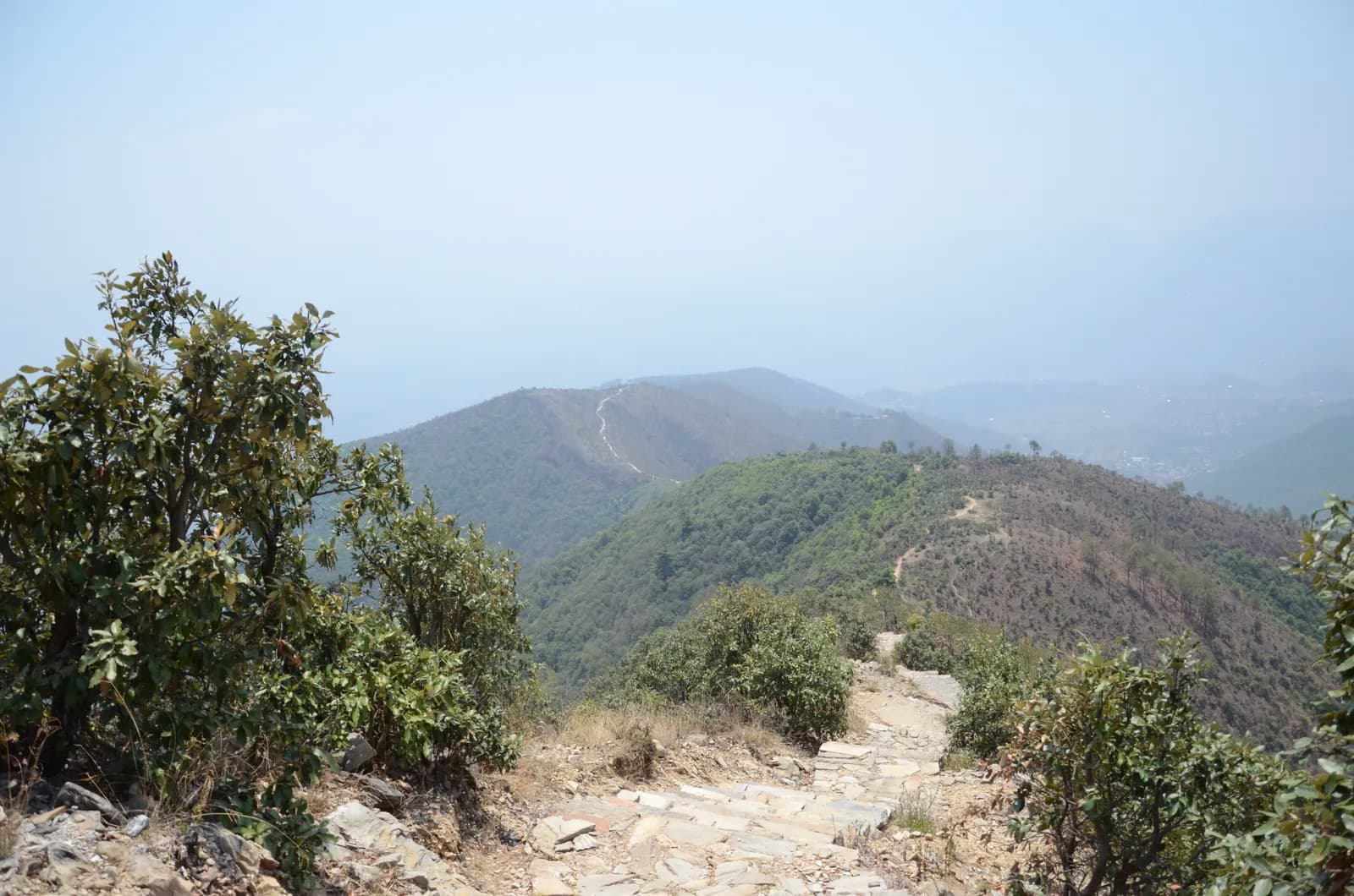
Drive from Kathmandu to Pharping and start walking early. The path climbs through pine forest on stone paving and steps, passes Hattiban Resort about half an hour above the road if you start at Pahiro, and then rises steadily for about three hours to the ridge, where the shrine of Champadevi stands in the open at about 2,285 m. On our map the round trip is 11.2 km with 750 m of climbing from Pharping. Rest at the top for the views of the Langtang and Ganesh Himal ranges, then descend by the same path, or drop steeply to the Champadevi Mai temple and walk about half an hour on the road to Khahare, where your car waits. Carry lunch and water.
Champadevi Day Hike
A one-day hike from Pharping through pine forest to the Champadevi hilltop shrine (about 2,285 m) and back, 11.2 km with 750 m of climbing and views of Langtang, Ganesh Himal and Gaurishankar.
- Gün1
- En yüksek rakım2.285 m
- Mesafe11,2 km
- Yükseliş747 m
- ZorlukOrta
- En iyi aylarOct–Nov, Mar–May
Fotoğraf: Pratap Baniya · CC BY-SA 4.0
İngilizce gösteriliyor — henüz çevrilmedi.
Bu rota bir taslaktır ve henüz doğrulanmadı. Etapları her zaman rehberinle teyit et.
Written by FindTrekkingPartner teamİnceleyen: FindTrekkingPartner teamNasıl inceliyoruzFindTrekkingPartner
Champadevi Day Hike, Nepal’in Kathmandu Valley bölgesinde 2.285 m’ye çıkan 1 günlük bir trekkingdir. Yabancı trekkingciler FindTrekkingPartner’da tarihlerini, bütçelerini ve tempolarını belirterek bir gezi paylaşıp bu rota için partner bulabilir. Eşleşmeler iki trekkingci de kabul edene kadar gizli kalır ve hizmet ücretsizdir. Orta seviye fiyatlarla lisanslı bir rehber, dört trekkingci paylaştığında 1 günde kişi başı yaklaşık 9 USD tutar; tek başına giden bir trekkingci için bu tutar 37 USD’dir. En iyi sezonlar: Oct–Nov, Mar–Apr. Bunun gibi açık rotalarda lisanslı rehber zorunlu tutulmaz (19 Ekim 2026’da kontrol edildi): Khumbu belediyesi Nepal Turizm Kurulu’nun Nisan 2023 kuralının dışında kaldı ve günübirlik yürüyüşler için rehber gerekmez; yine de rehber şiddetle önerilir, bu yüzden acentenle teyit et. Bu rota için açık geziler aşağıda; başlangıç ayı, grup büyüklüğü ve kalan yerlerle birlikte listelenir. Son doğrulama: 19 Ekim 2026. Kaynaklar: Nepal Turizm Kurulu, DNPWC, Göç İdaresi.
Kaynaklar:Department of Immigration, NepalNepal Tourism BoardDepartment of National Parks and Wildlife Conservation
Champadevi Day Hike için partner bul
- Champadevi Day Hike için partner bulHenüz açık gezi yok
- Shivapuri Peak Day Hike için partner bulHenüz açık gezi yok
- Nagarkot to Changu Narayan Day Hike için partner bulHenüz açık gezi yok
- Chisapani Nagarkot Trek için partner bulHenüz açık gezi yok
- Phulchowki Day Hike için partner bulHenüz açık gezi yok
- Namo Buddha Day Hike için partner bulHenüz açık gezi yok
Genel bakış
Başlangıç: Pharping1 gün · maks. 2.285 m
En iyi mevsimler: Oct–Nov, Mar–May
The Champadevi hike is a one-day walk from Pharping, on the southern rim of the Kathmandu Valley, through pine forest to the open hilltop shrine of Champadevi at about 2,285 m, and back. On our map the round trip is about 11.2 km with 750 m of climbing, mostly on a stone-paved path and forest track. Operators put the climb from Hattiban Resort at about three hours and the whole climb from the road at three to three and a half hours; the descent takes one to two hours. Allow five to seven hours for the day, with a 45 minute drive each way from Kathmandu. On a clear morning the view runs from Langtang and Ganesh Himal to Manaslu and Gaurishankar. None of our sources lists a park permit for this hill. Bring water and lunch.
The plan follows two operator itineraries that agree on the Hattiban Resort halfway point and the open shrine at the top. Heights vary between 2,278 and 2,285 m in the sources and OpenStreetMap gives 2,241 m for the summit node, so we say about 2,285 m. Operators start at Pahiro or Hattiban to save time; our map starts lower, at Pharping, and is therefore longer.
What the hike is like
The path climbs steadily through pine forest on stone paving and steps, passes Hattiban Resort and continues to a ridge where the shrine of Champadevi stands in the open. From the ridge you see Chandragiri on one side and Phulchowki on the other, with the Bagmati river and Khokana below. An optional extension continues to Bhasmasur hill, which is higher than Champadevi. Pharping, a Newar village, is worth a stop before or after the walk.
Permits and rules
Neither operator lists a park permit or entrance fee for the hill. Monument fees at Pharping or Dakshinkali temples, if you visit them, are separate. Carry your litter out.
Best season
Operators say the hike can be done in every season and advise an early start for clear skies. Autumn (October to November) and spring (March to May) give the sharpest mountain views; in the monsoon the paving is wet and cloud hides the peaks.
Getting there and away
Drive from Kathmandu to Pharping or to Pahiro, about 45 minutes from Thamel, and finish at Khahare or Machhegaun, about 45 minutes back by road, depending on traffic. A taxi or an operator transfer is the simplest way; no fare is published in our sources, so agree it in advance.
Difficulty and fitness
The hike is gentle to moderate: 750 m of climbing, mostly on paved steps, over five to seven hours. Good shoes, two litres of water and a rain jacket are enough. Leave Pharping by 8 am so that you are on top before the haze builds.
Budget notes
There is no permit fee. Budget for a taxi to the trailhead and a return from Khahare or Pharping, plus lunch. The costs section shows the transfers as lines to check.
Öne çıkanlar
- Champadevi hilltop shrine at about 2,285 m with Himalayan views on clear days
- Stone-paved path and steps through pine forest
- Hattiban Resort halfway up as a rest stop
- Pharping, a Newar village with monasteries and the Dakshinkali temple nearby
- Chandragiri on one side and Phulchowki on the other from the ridge
Rota haritası
Rota verileri OpenStreetMap'ten alındı, ekibimiz henüz kontrol etmedi. Planlama için kullan, navigasyon için değil.
Gün gün
Maliyeti
Kişi başı tahmini toplam maliyet: rakıma göre konaklama ve yemek, ulaşım, izinler, rehber ve porterler. Bir rehberi ve porterleri paylaşan trekkingci sayısı arttıkça kişi başı ödenen azalır. Ekim 2026 itibarıyla.
| Tarz | 1 trekkingci | 2 trekkingci paylaşıyor | 4 trekkingci paylaşıyor |
|---|---|---|---|
| Ekonomik | — | — | — |
| Orta seviye | $40–$80* | $20–$40* | $10–$30* |
| Konforlu | $40–$80* | $30–$50* | $20–$40* |
Rehberi paylaş, tasarruf et
Orta seviyede, tek başına bir trekkingci yaklaşık $40–$80 öder; bir rehberi ve iki porteri paylaşan dört trekkingci kişi başı yaklaşık $10–$30 öder (aralığın üst ucunda %66 daha az).
Paylaşan 2 trekkingci için döküm
| Kalem | Ekonomik | Orta seviye | Konforlu |
|---|---|---|---|
| Rehber | — | $10–$30 | $10–$30 |
| Porterler | — | $0–$20 | $10–$30 |
Ekonomik tarz toplu taşıma kullanır ve porter içermez; orta seviye iki trekkingci arasında bir porter ve özel araç paylaşımı içerir; konforlu tarz her trekkingciye bir porter verir. Rehber, zorunlu olduğunda veya tarz orta seviye ya da konforlu olduğunda dahildir.
Dahil değil
Şunlar için yayımlanmış fiyat bulunamadı: Kathmandu to Pharping and back by taxi. * ile işaretli toplamlar bunları içermez; acentenden sor. A day hike: no lodging and no permit. A guide is optional.
Maliyet kaynakları
- PriceNepal: Nepal Travel Cost Guide 2026 (2026-05-14)
- Third Rock Adventures: Nepal trek budget planner (2026-05-09)
- Himalayan Partner: Guide and porter price in Nepal 2026 (2026-02-10)
- Shikhar Adventure: Annapurna Circuit trek cost (2026-02-03)
- Nepal Tourism Board: Trekking Permit (2026-10-18)
Teklif değil, operatör rehberlerinden tahminlerdir. Bahşişler, sigorta, ekipman ve Kathmandu otelleri dahil değildir; USD platform döviz kuruyladır.
Fotoğraflar
Sık sorulan sorular
Operators give about three to three and a half hours to climb from the road and one to two hours down, so allow five to seven hours for the day. Our map shows 11.2 km and 750 m of climbing from Pharping.
Operators give 2,285 m, or 2,278 to 2,280 m on other pages. OpenStreetMap lists 2,241 m for the summit node. We say about 2,285 m.
Operators start at Pahiro or Hattiban, a 45 minute drive from Thamel, or in Pharping. The Pharping start adds distance but lets you visit the village.
None of our sources lists a permit or park fee for Champadevi. One operator includes a hiking pass in its price but gives no amount. Temple fees at Pharping, if you visit, are separate.
On clear days operators list Langtang, Ganesh Himal, Manaslu and Gaurishankar, with Chandragiri on one side, Phulchowki on the other and the Bagmati river below.
Kaynaklar
Patika boyunca
Rotanın her gününde konaklama, sağlık desteği, su ve görülecek yerler.
1. Pharping
- Daksinkali Health Post · Sağlık · 1.572 m
- Family Guest House · Konaklama · 1.574 m
- Pharphing Homestay and Cafe · Konaklama · 1.597 m