

Take a micro-bus or taxi to Budhanilkantha and walk to the park gate, a short way beyond the temple. Buy your ticket, then follow the park road to Nagi Gompa, where a nunnery sits in the forest, and continue on the forest path through Baghdwar, a source of the Bagmati river, to Shivapuri Peak. The climb is about 6 km, with about 1,090 m of ascent, and takes about four hours. Rest at the summit, which is 2,732 m, then return by the same route, about two to three hours, so that you finish before dark. Carry two litres of water and a lunch.
Shivapuri Peak Day Hike
A one-day hike from the Budhanilkantha gate of Shivapuri Nagarjun National Park through Nagi Gompa to Shivapuri Peak (2,732 m) and back, about 12 km with 1,090 m of climbing.
- จำนวนวัน1
- ความสูงสูงสุด2,732 ม.
- ระยะทาง12.2 กม.
- ระยะไต่ขึ้น1,089 ม.
- ระดับความยากปานกลาง
- เดือนที่ดีที่สุดOct–Nov, Mar–Apr
- ใบอนุญาต1
ภาพ: Alexey Komarov · CC BY-SA 4.0
แสดงเป็นภาษาอังกฤษ — ยังไม่ได้แปล
แผนการเดินทางนี้เป็นฉบับร่างและยังไม่ได้ตรวจสอบ โปรดยืนยันแต่ละช่วงกับไกด์ของคุณเสมอ
Written by FindTrekkingPartner teamตรวจทานโดย FindTrekkingPartner teamวิธีที่เราตรวจทานFindTrekkingPartner
Shivapuri Peak Day Hike เป็นเส้นทางเทรค 1 วันในภูมิภาค Kathmandu Valley ของเนปาล ที่ขึ้นไปถึงความสูง 2,732 ม. นักเทรคชาวต่างชาติหาเพื่อนร่วมเทรคสำหรับเส้นทางนี้ได้ที่ FindTrekkingPartner โดยโพสต์ทริปพร้อมวันเดินทาง งบประมาณ และจังหวะการเดิน การจับคู่จะเป็นส่วนตัวจนกว่านักเทรคทั้งสองฝ่ายตกลง และบริการนี้ฟรี ที่ราคาระดับกลาง ไกด์ที่มีใบอนุญาตมีค่าใช้จ่ายประมาณ 9 USD ต่อคนตลอด 1 วัน เมื่อนักเทรคสี่คนหารกัน เทียบกับ 37 USD สำหรับนักเทรคที่ไปคนเดียว ช่วงฤดูที่ดีที่สุดคือ Oct–Nov, Mar–Apr ไม่มีการบังคับให้มีไกด์ที่มีใบอนุญาตบนเส้นทางเปิดเช่นนี้ (ตรวจสอบเมื่อ 19 ตุลาคม 2026) เทศบาลคุมบูไม่ใช้กฎเดือนเมษายน 2023 ของ Nepal Tourism Board และการเดินป่าแบบไปเช้าเย็นกลับไม่ต้องใช้ไกด์ แต่ยังคงแนะนำอย่างยิ่งให้มีไกด์ จึงควรยืนยันกับเอเจนซีของคุณ ทริปที่เปิดรับสำหรับเส้นทางนี้แสดงไว้ด้านล่าง พร้อมเดือนที่เริ่ม ขนาดกลุ่ม และจำนวนที่ว่างเหลือ ตรวจสอบล่าสุด: 19 ตุลาคม 2569 แหล่งข้อมูล: Nepal Tourism Board, DNPWC, กรมตรวจคนเข้าเมือง
แหล่งข้อมูล:Department of Immigration, NepalNepal Tourism BoardDepartment of National Parks and Wildlife Conservation
หาเพื่อนร่วมเทรคสำหรับ Shivapuri Peak Day Hike
- หาเพื่อนร่วมเทรคสำหรับ Shivapuri Peak Day Hikeยังไม่มีทริปที่เปิดรับ
- หาเพื่อนร่วมเทรคสำหรับ Nagarkot to Changu Narayan Day Hikeยังไม่มีทริปที่เปิดรับ
- หาเพื่อนร่วมเทรคสำหรับ Chisapani Nagarkot Trekยังไม่มีทริปที่เปิดรับ
- หาเพื่อนร่วมเทรคสำหรับ Champadevi Day Hikeยังไม่มีทริปที่เปิดรับ
- หาเพื่อนร่วมเทรคสำหรับ Phulchowki Day Hikeยังไม่มีทริปที่เปิดรับ
- หาเพื่อนร่วมเทรคสำหรับ Namo Buddha Day Hikeยังไม่มีทริปที่เปิดรับ
ภาพรวม
เริ่มจาก Budhanilkantha1 วัน · สูงสุด 2,732 ม.
ฤดูกาลที่ดีที่สุด: Oct–Nov, Mar–Apr · ใบอนุญาต: Shivapuri Nagarjun National Park entry permit (NPR 1,000 for foreigners)
The Shivapuri Peak hike is a one-day walk from the Budhanilkantha gate of Shivapuri Nagarjun National Park to the summit of Shivapuri, 2,732 m, and back, a route of about 12 km with about 1,090 m of climbing that takes six to seven hours for most walkers. The trail follows the park road to Nagi Gompa, a nunnery in the forest, then climbs through Baghdwar, a source of the Bagmati river, to the top, where on a clear morning you see the Kathmandu Valley below and the Langtang and Ganesh Himal ranges beyond. There is no food on the trail, so carry water and lunch. The park entry fee for foreigners is NPR 1,000. It needs no guide, no flight and no gear beyond boots, water and a rain jacket, and the best months are October to November and March to April.
The plan follows operator descriptions that agree on the Budhanilkantha start, Nagi Gompa and the Bagmati source, and on the six to seven hour timing; one of them measures about 16 km and 1,585 m of gain with extra loops, and ours is the direct route. The height of the peak, 2,732 m, comes from Wikipedia, OpenStreetMap and the operators.
What the hike is like
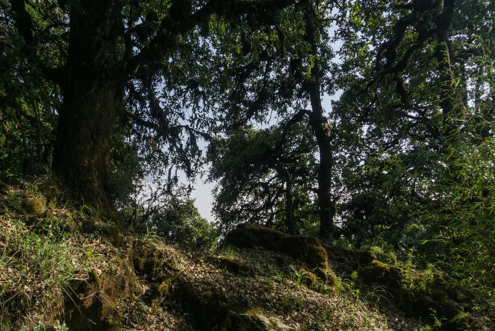
After the gate the path follows the park road to Nagi Gompa, then a path through oak and rhododendron forest, with stone steps near the top. The Baghdwar spring, a stone spout carved as a face, is on the way. Mist can hide the way on the upper ridge, so carry a map. Monkeys live in the forest and should not be fed.
Permits and rules
The park entry fee is NPR 1,000 for foreigners and NPR 600 for SAARC nationals per entry, according to the Nepal Tourism Board. Carry your ticket on the trail.
Best season
October to November and March to April. In the monsoon the trail is slippery and cloud hides the views.
Getting there and away
Take a micro-bus or taxi from Kathmandu to Budhanilkantha, about 30 to 45 minutes. The gate is a short walk beyond the temple, and the return is the same way.
Difficulty and fitness
The hike is moderate: it climbs about 1,090 m, mostly on stone steps and forest paths, and takes six to seven hours. Good boots, two litres of water and a rain jacket are enough. Start by 7 am so that you are down before the afternoon cloud and before dark.
Budget notes
The only fee is the park entry, NPR 1,000 for foreigners. Add a micro-bus or taxi to Budhanilkantha and lunch. The costs section shows the transfer as a line to check.
Guide rule
Buy the park entry ticket at the gate; no guide check is reported on this route (checked 19 October 2026). See the guide rule by region.
จุดเด่น
- Shivapuri Peak at 2,732 m, the highest point of the park
- Nagi Gompa, a nunnery in the forest above Budhanilkantha
- Baghdwar, a source of the Bagmati river
- Oak and rhododendron forest within sight of the city
- A full day hike that starts at a city bus stop
แผนที่เส้นทาง
ข้อมูลเส้นทางจาก OpenStreetMap ทีมงานของเรายังไม่ได้ตรวจสอบ ใช้เพื่อวางแผน ไม่ใช่เพื่อนำทาง
รายวัน
ค่าใช้จ่าย
ค่าใช้จ่ายรวมโดยประมาณต่อคน: ที่พักและอาหารตามระดับความสูง การเดินทาง ใบอนุญาต รวมถึงไกด์และลูกหาบ ยิ่งมีนักเทรคแบ่งไกด์และลูกหาบมาก แต่ละคนยิ่งจ่ายน้อยลง ณ วันที่ ตุลาคม 2569
| สไตล์ | นักเทรค 1 คนแบ่งกัน | นักเทรค 2 คนแบ่งกัน | นักเทรค 4 คนแบ่งกัน |
|---|---|---|---|
| ประหยัด | US$0–US$10* | US$0–US$10* | US$0–US$10* |
| ระดับกลาง | US$50–US$80* | US$30–US$50* | US$20–US$40* |
| สบาย | US$50–US$80* | US$30–US$60* | US$30–US$50* |
แบ่งไกด์ ประหยัดเงิน
ที่ระดับกลาง นักเทรคเดี่ยวจ่ายประมาณ US$50–US$80 ส่วนนักเทรคสี่คนที่แบ่งไกด์หนึ่งคนและลูกหาบสองคนจ่ายประมาณคนละ US$20–US$40 (น้อยกว่า 60% ที่ช่วงบนสุด)
รายละเอียดสำหรับนักเทรค 2 คนที่แบ่งกัน
| รายการ | ประหยัด | ระดับกลาง | สบาย |
|---|---|---|---|
| ใบอนุญาต | US$0–US$10 | US$0–US$10 | US$0–US$10 |
| ไกด์ | — | US$10–US$30 | US$10–US$30 |
| ลูกหาบ | — | US$0–US$20 | US$10–US$30 |
แบบประหยัดใช้ขนส่งสาธารณะและไม่มีลูกหาบ แบบระดับกลางแบ่งลูกหาบหนึ่งคนระหว่างนักเทรคสองคนและใช้รถส่วนตัว แบบสบายให้นักเทรคแต่ละคนมีลูกหาบ รวมไกด์ในกรณีที่จำเป็นต้องมีหรือสไตล์เป็นระดับกลางหรือสบาย
ค่าธรรมเนียมใบอนุญาต (แหล่งข้อมูลทางการ)
- Shivapuri Nagarjun National Park entry permit: NPR 1,000 ต่อการเข้า แหล่งที่มา
ไม่รวม
ไม่พบราคาที่เผยแพร่สำหรับ: Kathmandu to Budhanilkantha and back ยอดรวมที่มี * ไม่รวมรายการเหล่านี้ โปรดสอบถามเอเจนซี่ของคุณ Park entry ticket at the gate; no guide check reported (checked 19 October 2026).
แหล่งข้อมูลค่าใช้จ่าย
- PriceNepal: Nepal Travel Cost Guide 2026 (2026-05-14)
- Third Rock Adventures: Nepal trek budget planner (2026-05-09)
- Himalayan Partner: Guide and porter price in Nepal 2026 (2026-02-10)
- Shikhar Adventure: Annapurna Circuit trek cost (2026-02-03)
- Nepal Tourism Board: Trekking Permit (2026-10-18)
ค่าประมาณจากคู่มือของผู้ให้บริการ ไม่ใช่ใบเสนอราคา ไม่รวมทิป ประกัน อุปกรณ์ และโรงแรมในกาฐมาณฑุ USD ตามอัตราแลกเปลี่ยนของแพลตฟอร์ม
รูปภาพ
คำถามที่พบบ่อย
Six to seven hours for the round trip, according to operators, with about four hours of ascent. Our map shows about 12 km and 1,090 m of climbing each way.
2,732 m, according to Wikipedia, OpenStreetMap and operator pages. One operator listing gives 2,535 m, which looks like an error.
Yes, the Shivapuri Nagarjun National Park entry permit, NPR 1,000 per person for foreigners and NPR 600 for SAARC nationals, per the Nepal Tourism Board. Children under 10 enter free.
No. Operators note that there are no food stops, so carry water and lunch. Nagi Gompa is a nunnery, not a restaurant.
แหล่งข้อมูล
ตลอดเส้นทาง
ที่พัก ความช่วยเหลือทางการแพทย์ น้ำ และสถานที่น่าชมในแต่ละวันของเส้นทาง
1. Budhanilkantha
- Camping · ที่พัก · 1,858 ม.
- Drinking Water · ข้อมูลที่เป็นประโยชน์ · 1,989 ม.
- Baghdwar · ข้อมูลที่เป็นประโยชน์ · 2,513 ม.
- Abandoned Hut · ที่พัก · 2,726 ม.
- View Point · จุดชมวิว · 2,691 ม.
- Camp · ที่พัก · 2,344 ม.