

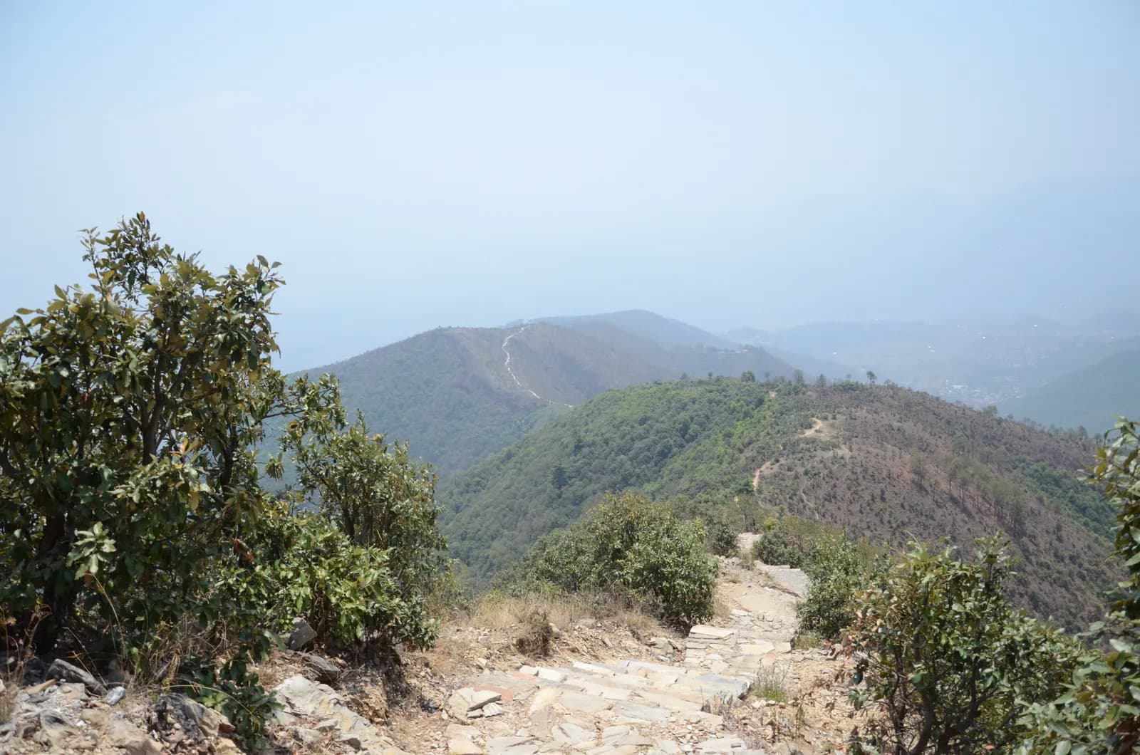
Drive from Kathmandu to Pharping and start walking early. The path climbs through pine forest on stone paving and steps, passes Hattiban Resort about half an hour above the road if you start at Pahiro, and then rises steadily for about three hours to the ridge, where the shrine of Champadevi stands in the open at about 2,285 m. On our map the round trip is 11.2 km with 750 m of climbing from Pharping. Rest at the top for the views of the Langtang and Ganesh Himal ranges, then descend by the same path, or drop steeply to the Champadevi Mai temple and walk about half an hour on the road to Khahare, where your car waits. Carry lunch and water.
Champadevi Day Hike
A one-day hike from Pharping through pine forest to the Champadevi hilltop shrine (about 2,285 m) and back, 11.2 km with 750 m of climbing and views of Langtang, Ganesh Himal and Gaurishankar.
- จำนวนวัน1
- ความสูงสูงสุด2,285 ม.
- ระยะทาง11.2 กม.
- ระยะไต่ขึ้น747 ม.
- ระดับความยากปานกลาง
- เดือนที่ดีที่สุดOct–Nov, Mar–May
ภาพ: Pratap Baniya · CC BY-SA 4.0
แสดงเป็นภาษาอังกฤษ — ยังไม่ได้แปล
แผนการเดินทางนี้เป็นฉบับร่างและยังไม่ได้ตรวจสอบ โปรดยืนยันแต่ละช่วงกับไกด์ของคุณเสมอ
Written by FindTrekkingPartner teamตรวจทานโดย FindTrekkingPartner teamวิธีที่เราตรวจทานFindTrekkingPartner
Champadevi Day Hike เป็นเส้นทางเทรค 1 วันในภูมิภาค Kathmandu Valley ของเนปาล ที่ขึ้นไปถึงความสูง 2,285 ม. นักเทรคชาวต่างชาติหาเพื่อนร่วมเทรคสำหรับเส้นทางนี้ได้ที่ FindTrekkingPartner โดยโพสต์ทริปพร้อมวันเดินทาง งบประมาณ และจังหวะการเดิน การจับคู่จะเป็นส่วนตัวจนกว่านักเทรคทั้งสองฝ่ายตกลง และบริการนี้ฟรี ที่ราคาระดับกลาง ไกด์ที่มีใบอนุญาตมีค่าใช้จ่ายประมาณ 9 USD ต่อคนตลอด 1 วัน เมื่อนักเทรคสี่คนหารกัน เทียบกับ 37 USD สำหรับนักเทรคที่ไปคนเดียว ช่วงฤดูที่ดีที่สุดคือ Oct–Nov, Mar–Apr ไม่มีการบังคับให้มีไกด์ที่มีใบอนุญาตบนเส้นทางเปิดเช่นนี้ (ตรวจสอบเมื่อ 19 ตุลาคม 2026) เทศบาลคุมบูไม่ใช้กฎเดือนเมษายน 2023 ของ Nepal Tourism Board และการเดินป่าแบบไปเช้าเย็นกลับไม่ต้องใช้ไกด์ แต่ยังคงแนะนำอย่างยิ่งให้มีไกด์ จึงควรยืนยันกับเอเจนซีของคุณ ทริปที่เปิดรับสำหรับเส้นทางนี้แสดงไว้ด้านล่าง พร้อมเดือนที่เริ่ม ขนาดกลุ่ม และจำนวนที่ว่างเหลือ ตรวจสอบล่าสุด: 19 ตุลาคม 2569 แหล่งข้อมูล: Nepal Tourism Board, DNPWC, กรมตรวจคนเข้าเมือง
แหล่งข้อมูล:Department of Immigration, NepalNepal Tourism BoardDepartment of National Parks and Wildlife Conservation
หาเพื่อนร่วมเทรคสำหรับ Champadevi Day Hike
- หาเพื่อนร่วมเทรคสำหรับ Champadevi Day Hikeยังไม่มีทริปที่เปิดรับ
- หาเพื่อนร่วมเทรคสำหรับ Shivapuri Peak Day Hikeยังไม่มีทริปที่เปิดรับ
- หาเพื่อนร่วมเทรคสำหรับ Nagarkot to Changu Narayan Day Hikeยังไม่มีทริปที่เปิดรับ
- หาเพื่อนร่วมเทรคสำหรับ Chisapani Nagarkot Trekยังไม่มีทริปที่เปิดรับ
- หาเพื่อนร่วมเทรคสำหรับ Phulchowki Day Hikeยังไม่มีทริปที่เปิดรับ
- หาเพื่อนร่วมเทรคสำหรับ Namo Buddha Day Hikeยังไม่มีทริปที่เปิดรับ
ภาพรวม
เริ่มจาก Pharping1 วัน · สูงสุด 2,285 ม.
ฤดูกาลที่ดีที่สุด: Oct–Nov, Mar–May
The Champadevi hike is a one-day walk from Pharping, on the southern rim of the Kathmandu Valley, through pine forest to the open hilltop shrine of Champadevi at about 2,285 m, and back. On our map the round trip is about 11.2 km with 750 m of climbing, mostly on a stone-paved path and forest track. Operators put the climb from Hattiban Resort at about three hours and the whole climb from the road at three to three and a half hours; the descent takes one to two hours. Allow five to seven hours for the day, with a 45 minute drive each way from Kathmandu. On a clear morning the view runs from Langtang and Ganesh Himal to Manaslu and Gaurishankar. None of our sources lists a park permit for this hill. Bring water and lunch.
The plan follows two operator itineraries that agree on the Hattiban Resort halfway point and the open shrine at the top. Heights vary between 2,278 and 2,285 m in the sources and OpenStreetMap gives 2,241 m for the summit node, so we say about 2,285 m. Operators start at Pahiro or Hattiban to save time; our map starts lower, at Pharping, and is therefore longer.
What the hike is like
The path climbs steadily through pine forest on stone paving and steps, passes Hattiban Resort and continues to a ridge where the shrine of Champadevi stands in the open. From the ridge you see Chandragiri on one side and Phulchowki on the other, with the Bagmati river and Khokana below. An optional extension continues to Bhasmasur hill, which is higher than Champadevi. Pharping, a Newar village, is worth a stop before or after the walk.
Permits and rules
Neither operator lists a park permit or entrance fee for the hill. Monument fees at Pharping or Dakshinkali temples, if you visit them, are separate. Carry your litter out.
Best season
Operators say the hike can be done in every season and advise an early start for clear skies. Autumn (October to November) and spring (March to May) give the sharpest mountain views; in the monsoon the paving is wet and cloud hides the peaks.
Getting there and away
Drive from Kathmandu to Pharping or to Pahiro, about 45 minutes from Thamel, and finish at Khahare or Machhegaun, about 45 minutes back by road, depending on traffic. A taxi or an operator transfer is the simplest way; no fare is published in our sources, so agree it in advance.
Difficulty and fitness
The hike is gentle to moderate: 750 m of climbing, mostly on paved steps, over five to seven hours. Good shoes, two litres of water and a rain jacket are enough. Leave Pharping by 8 am so that you are on top before the haze builds.
Budget notes
There is no permit fee. Budget for a taxi to the trailhead and a return from Khahare or Pharping, plus lunch. The costs section shows the transfers as lines to check.
จุดเด่น
- Champadevi hilltop shrine at about 2,285 m with Himalayan views on clear days
- Stone-paved path and steps through pine forest
- Hattiban Resort halfway up as a rest stop
- Pharping, a Newar village with monasteries and the Dakshinkali temple nearby
- Chandragiri on one side and Phulchowki on the other from the ridge
แผนที่เส้นทาง
ข้อมูลเส้นทางจาก OpenStreetMap ทีมงานของเรายังไม่ได้ตรวจสอบ ใช้เพื่อวางแผน ไม่ใช่เพื่อนำทาง
รายวัน
ค่าใช้จ่าย
ค่าใช้จ่ายรวมโดยประมาณต่อคน: ที่พักและอาหารตามระดับความสูง การเดินทาง ใบอนุญาต รวมถึงไกด์และลูกหาบ ยิ่งมีนักเทรคแบ่งไกด์และลูกหาบมาก แต่ละคนยิ่งจ่ายน้อยลง ณ วันที่ ตุลาคม 2569
| สไตล์ | นักเทรค 1 คนแบ่งกัน | นักเทรค 2 คนแบ่งกัน | นักเทรค 4 คนแบ่งกัน |
|---|---|---|---|
| ประหยัด | — | — | — |
| ระดับกลาง | US$40–US$80* | US$20–US$40* | US$10–US$30* |
| สบาย | US$40–US$80* | US$30–US$50* | US$20–US$40* |
แบ่งไกด์ ประหยัดเงิน
ที่ระดับกลาง นักเทรคเดี่ยวจ่ายประมาณ US$40–US$80 ส่วนนักเทรคสี่คนที่แบ่งไกด์หนึ่งคนและลูกหาบสองคนจ่ายประมาณคนละ US$10–US$30 (น้อยกว่า 66% ที่ช่วงบนสุด)
รายละเอียดสำหรับนักเทรค 2 คนที่แบ่งกัน
| รายการ | ประหยัด | ระดับกลาง | สบาย |
|---|---|---|---|
| ไกด์ | — | US$10–US$30 | US$10–US$30 |
| ลูกหาบ | — | US$0–US$20 | US$10–US$30 |
แบบประหยัดใช้ขนส่งสาธารณะและไม่มีลูกหาบ แบบระดับกลางแบ่งลูกหาบหนึ่งคนระหว่างนักเทรคสองคนและใช้รถส่วนตัว แบบสบายให้นักเทรคแต่ละคนมีลูกหาบ รวมไกด์ในกรณีที่จำเป็นต้องมีหรือสไตล์เป็นระดับกลางหรือสบาย
ไม่รวม
ไม่พบราคาที่เผยแพร่สำหรับ: Kathmandu to Pharping and back by taxi ยอดรวมที่มี * ไม่รวมรายการเหล่านี้ โปรดสอบถามเอเจนซี่ของคุณ A day hike: no lodging and no permit. A guide is optional.
แหล่งข้อมูลค่าใช้จ่าย
- PriceNepal: Nepal Travel Cost Guide 2026 (2026-05-14)
- Third Rock Adventures: Nepal trek budget planner (2026-05-09)
- Himalayan Partner: Guide and porter price in Nepal 2026 (2026-02-10)
- Shikhar Adventure: Annapurna Circuit trek cost (2026-02-03)
- Nepal Tourism Board: Trekking Permit (2026-10-18)
ค่าประมาณจากคู่มือของผู้ให้บริการ ไม่ใช่ใบเสนอราคา ไม่รวมทิป ประกัน อุปกรณ์ และโรงแรมในกาฐมาณฑุ USD ตามอัตราแลกเปลี่ยนของแพลตฟอร์ม
รูปภาพ
คำถามที่พบบ่อย
Operators give about three to three and a half hours to climb from the road and one to two hours down, so allow five to seven hours for the day. Our map shows 11.2 km and 750 m of climbing from Pharping.
Operators give 2,285 m, or 2,278 to 2,280 m on other pages. OpenStreetMap lists 2,241 m for the summit node. We say about 2,285 m.
Operators start at Pahiro or Hattiban, a 45 minute drive from Thamel, or in Pharping. The Pharping start adds distance but lets you visit the village.
None of our sources lists a permit or park fee for Champadevi. One operator includes a hiking pass in its price but gives no amount. Temple fees at Pharping, if you visit, are separate.
On clear days operators list Langtang, Ganesh Himal, Manaslu and Gaurishankar, with Chandragiri on one side, Phulchowki on the other and the Bagmati river below.
แหล่งข้อมูล
ตลอดเส้นทาง
ที่พัก ความช่วยเหลือทางการแพทย์ น้ำ และสถานที่น่าชมในแต่ละวันของเส้นทาง
1. Pharping
- Daksinkali Health Post · การแพทย์ · 1,572 ม.
- Family Guest House · ที่พัก · 1,574 ม.
- Pharphing Homestay and Cafe · ที่พัก · 1,597 ม.