

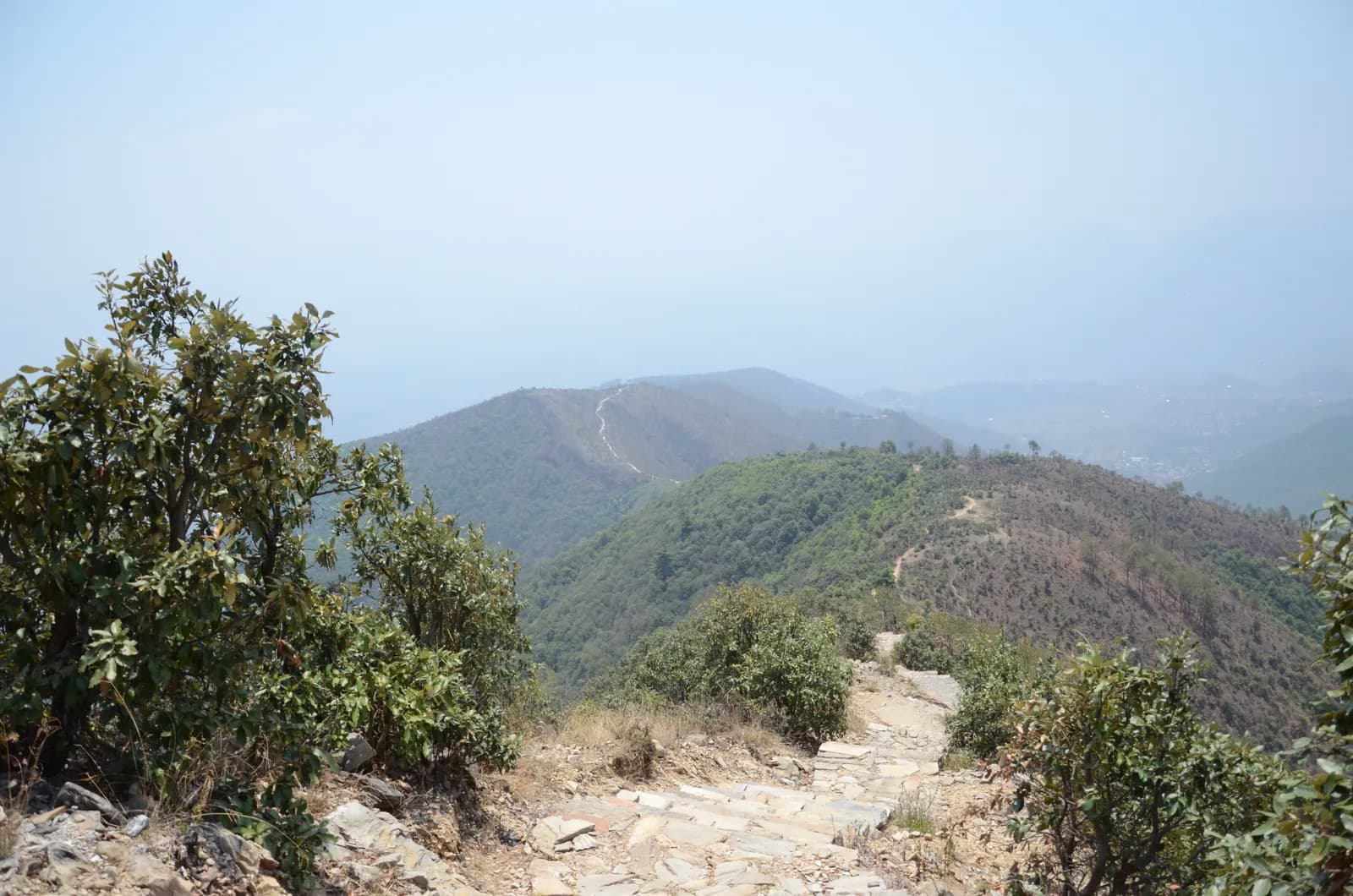
Drive from Kathmandu to Pharping and start walking early. The path climbs through pine forest on stone paving and steps, passes Hattiban Resort about half an hour above the road if you start at Pahiro, and then rises steadily for about three hours to the ridge, where the shrine of Champadevi stands in the open at about 2,285 m. On our map the round trip is 11.2 km with 750 m of climbing from Pharping. Rest at the top for the views of the Langtang and Ganesh Himal ranges, then descend by the same path, or drop steeply to the Champadevi Mai temple and walk about half an hour on the road to Khahare, where your car waits. Carry lunch and water.
Champadevi Day Hike
A one-day hike from Pharping through pine forest to the Champadevi hilltop shrine (about 2,285 m) and back, 11.2 km with 750 m of climbing and views of Langtang, Ganesh Himal and Gaurishankar.
- Days1
- Max altitude2,285 m
- Distance11.2 km
- Ascent747 m
- DifficultyModerate
- Best monthsOct–Nov, Mar–May
Photo: Pratap Baniya · CC BY-SA 4.0
This itinerary is a draft and hasn't been verified yet. Always confirm stages with your guide.
Written by FindTrekkingPartner teamReviewed by FindTrekkingPartner teamHow we reviewFindTrekkingPartner
Champadevi Day Hike is a 1-day trek in the Kathmandu Valley region of Nepal that climbs to 2,285 m. Foreign trekkers can find a partner for it on FindTrekkingPartner by posting a trip with their dates, budget and pace. Matches stay private until both trekkers agree, and the service is free. At mid-range rates a licensed guide costs about USD 9 per person over 1 days when four trekkers share, against USD 37 for one trekker alone. The best seasons are Oct–Nov, Mar–Apr. The Nepal Tourism Board April 2023 rule requires a licensed guide in national parks and conservation areas. Local practice differs (checked 19 October 2026): the Khumbu municipality opted out and issues its own trek card, and day hikes are rarely checked, but follow the rule and hire a guide; confirm with your agency. Last verified: October 19, 2026. Sources: Nepal Tourism Board, DNPWC, Department of Immigration.
Sources:Department of Immigration, NepalNepal Tourism BoardDepartment of National Parks and Wildlife Conservation
Find a partner for Champadevi Day Hike
- Find a partner for Champadevi Day HikeNo open trips yet
- Find a partner for Shivapuri Peak Day HikeNo open trips yet
- Find a partner for Nagarkot to Changu Narayan Day HikeNo open trips yet
- Find a partner for Chisapani Nagarkot TrekNo open trips yet
- Find a partner for Phulchowki Day HikeNo open trips yet
- Find a partner for Namo Buddha Day HikeNo open trips yet
Overview
Starts from Pharping1 day · max 2,285 m
Best seasons: Oct–Nov, Mar–May
The Champadevi hike is a one-day walk from Pharping, on the southern rim of the Kathmandu Valley, through pine forest to the open hilltop shrine of Champadevi at about 2,285 m, and back. On our map the round trip is about 11.2 km with 750 m of climbing, mostly on a stone-paved path and forest track. Operators put the climb from Hattiban Resort at about three hours and the whole climb from the road at three to three and a half hours; the descent takes one to two hours. Allow five to seven hours for the day, with a 45 minute drive each way from Kathmandu. On a clear morning the view runs from Langtang and Ganesh Himal to Manaslu and Gaurishankar. None of our sources lists a park permit for this hill. Bring water and lunch.
The plan follows two operator itineraries that agree on the Hattiban Resort halfway point and the open shrine at the top. Heights vary between 2,278 and 2,285 m in the sources and OpenStreetMap gives 2,241 m for the summit node, so we say about 2,285 m. Operators start at Pahiro or Hattiban to save time; our map starts lower, at Pharping, and is therefore longer.
What the hike is like
The path climbs steadily through pine forest on stone paving and steps, passes Hattiban Resort and continues to a ridge where the shrine of Champadevi stands in the open. From the ridge you see Chandragiri on one side and Phulchowki on the other, with the Bagmati river and Khokana below. An optional extension continues to Bhasmasur hill, which is higher than Champadevi. Pharping, a Newar village, is worth a stop before or after the walk.
Permits and rules
Neither operator lists a park permit or entrance fee for the hill. Monument fees at Pharping or Dakshinkali temples, if you visit them, are separate. Carry your litter out.
Best season
Operators say the hike can be done in every season and advise an early start for clear skies. Autumn (October to November) and spring (March to May) give the sharpest mountain views; in the monsoon the paving is wet and cloud hides the peaks.
Getting there and away
Drive from Kathmandu to Pharping or to Pahiro, about 45 minutes from Thamel, and finish at Khahare or Machhegaun, about 45 minutes back by road, depending on traffic. A taxi or an operator transfer is the simplest way; no fare is published in our sources, so agree it in advance.
Difficulty and fitness
The hike is gentle to moderate: 750 m of climbing, mostly on paved steps, over five to seven hours. Good shoes, two litres of water and a rain jacket are enough. Leave Pharping by 8 am so that you are on top before the haze builds.
Budget notes
There is no permit fee. Budget for a taxi to the trailhead and a return from Khahare or Pharping, plus lunch. The costs section shows the transfers as lines to check.
Highlights
- Champadevi hilltop shrine at about 2,285 m with Himalayan views on clear days
- Stone-paved path and steps through pine forest
- Hattiban Resort halfway up as a rest stop
- Pharping, a Newar village with monasteries and the Dakshinkali temple nearby
- Chandragiri on one side and Phulchowki on the other from the ridge
Route map
Route data from OpenStreetMap, not yet checked by our team. Use it for planning, not navigation.
Day by day
What it costs
Estimated all-in cost per person: lodge and food by altitude, transport, permits, and the guide and porters. The more trekkers share a guide and porters, the less each person pays. As of October 2026.
| Style | 1 trekker | 2 trekkers sharing | 4 trekkers sharing |
|---|---|---|---|
| Budget | — | — | — |
| Mid-range | $40–$80* | $20–$40* | $10–$30* |
| Comfort | $40–$80* | $30–$50* | $20–$40* |
Share a guide, save money
At mid-range, a solo trekker pays about $40–$80; four trekkers sharing one guide and two porters pay about $10–$30 each (66% less at the top of the range).
Breakdown for 2 trekkers sharing
| Item | Budget | Mid-range | Comfort |
|---|---|---|---|
| Guide | — | $10–$30 | $10–$30 |
| Porters | — | $0–$20 | $10–$30 |
Budget uses public transport and no porter; mid-range shares one porter between two trekkers and a private vehicle; comfort gives each trekker a porter. A guide is included where one is required or the style is mid-range or comfort.
Not included
No published price found for: Kathmandu to Pharping and back by taxi. Totals marked * leave these out; ask your agency. A day hike: no lodging and no permit. A guide is optional.
Cost sources
- PriceNepal: Nepal Travel Cost Guide 2026 (2026-05-14)
- Third Rock Adventures: Nepal trek budget planner (2026-05-09)
- Himalayan Partner: Guide and porter price in Nepal 2026 (2026-02-10)
- Shikhar Adventure: Annapurna Circuit trek cost (2026-02-03)
- Nepal Tourism Board: Trekking Permit (2026-10-18)
Estimates from operator guides, not quotes. Tips, insurance, gear and Kathmandu hotels are not included; USD at the platform exchange rate.
Photos
Frequently asked questions
Operators give about three to three and a half hours to climb from the road and one to two hours down, so allow five to seven hours for the day. Our map shows 11.2 km and 750 m of climbing from Pharping.
Operators give 2,285 m, or 2,278 to 2,280 m on other pages. OpenStreetMap lists 2,241 m for the summit node. We say about 2,285 m.
Operators start at Pahiro or Hattiban, a 45 minute drive from Thamel, or in Pharping. The Pharping start adds distance but lets you visit the village.
None of our sources lists a permit or park fee for Champadevi. One operator includes a hiking pass in its price but gives no amount. Temple fees at Pharping, if you visit, are separate.
On clear days operators list Langtang, Ganesh Himal, Manaslu and Gaurishankar, with Chandragiri on one side, Phulchowki on the other and the Bagmati river below.
Sources
Along the trail
Stays, medical help, water and sights on each day of the route.
1. Pharping
- Daksinkali Health Post · Medical · 1,572 m
- Family Guest House · Stays · 1,574 m
- Pharphing Homestay and Cafe · Stays · 1,597 m