

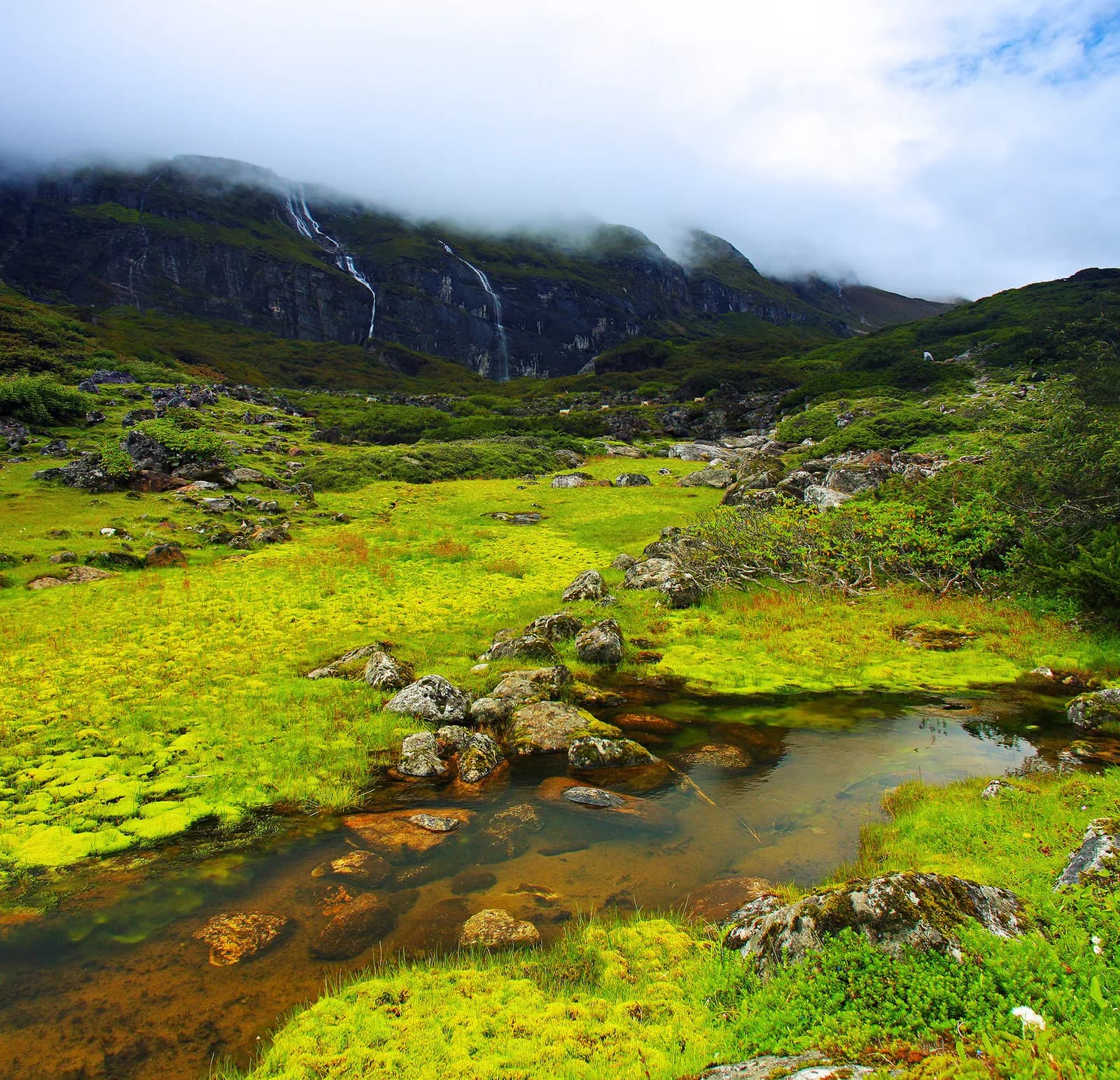
Makalu
Makalu is a wild trek into the Barun valley of Sankhuwasabha, crossing the Shipton La to the base camp of the world's fifth-highest mountain through forests that climb from near-tropical to alpine in a single walk.
- अधिकतम उचाइMakalu Base Camp (about 4,830 m)
- दिन14–20
- कठिनाइकठिन
- उत्तम महिनाMar–May, Oct–Nov
- अनुमतिपत्र३ अनुमतिपत्र
फोटो: Dhilung · CC BY 3.0
Check that your policy covers helicopter evacuation and trekking at this region's altitude. We don't sell insurance.
What to look forWritten by FindTrekkingPartner teamFindTrekkingPartner team द्वारा समीक्षितहामी कसरी समीक्षा गर्छौंFindTrekkingPartner
Makalu नेपालको एउटा ट्रेकिङ क्षेत्र हो, जहाँ 16 दिनका रुटहरू छन् र ४,८३० मिटरसम्म उक्लिन्छन्। विदेशी ट्रेकरहरूले आफ्नो मिति, बजेट र गतिसहित ट्रिप पोस्ट गरेर FindTrekkingPartner मा यहाँका ट्रेकहरूका लागि साथी खोज्न सक्छन्। दुवै ट्रेकर सहमत नभएसम्म म्याचहरू निजी रहन्छन्, र सेवा निःशुल्क छ। मध्यम स्तरको दरमा, चार जना ट्रेकरले बाँड्दा 16 दिनको लागि इजाजतपत्रप्राप्त गाइडको खर्च प्रति व्यक्ति लगभग USD १३१ पर्छ, जबकि एक्लै जाँदा USD ५२५ पर्छ। उत्तम मौसमहरू Mar–May, Oct–Nov हुन्। यहाँ व्यवहारमा इजाजतपत्रप्राप्त गाइड आवश्यक छ: २०२६ का सञ्चालकहरूका अनुसार नेपाल पर्यटन बोर्डको अप्रिल २०२३ को नियम राष्ट्रिय निकुञ्ज र संरक्षण क्षेत्रका चेकपोइन्टहरूमा लागू गरिन्छ, जसमा लाङटाङ सबैभन्दा कडा छ र अन्नपूर्णमा पनि जाँच हुन्छ (१९ अक्टोबर २०२६ मा जाँचिएको)। दर्ता भएको एजेन्सीमार्फत गाइड लिनुहोस् र उनीहरूसँग पुष्टि गर्नुहोस्। पछिल्लो पटक पुष्टि गरिएको: २०२६ अक्टोबर १९। स्रोतहरू: नेपाल पर्यटन बोर्ड, DNPWC, अध्यागमन विभाग।
स्रोतहरू:Department of Immigration, NepalNepal Tourism BoardDepartment of National Parks and Wildlife Conservation
- Makalu Base Camp Trek का लागि साथी खोज्नुहोस्अहिलेसम्म कुनै खुला ट्रिप छैन
परिचय
- इजाजतप्राप्त गाइड
- विदेशी ट्रेकरका लागि अनिवार्य
- न्यूनतम समूह
- १ ट्रेकर
NTB rule (Apr 2023), enforced at checkpoints in national parks (2026 operator reports). Checked 19 October 2026; see /guide-rule-nepal.
लोकप्रिय ट्रेकहरू
सुरु हुने ठाउँहरू
Kathmandu, Tumlingtar, Seduwa
त्यहाँ कसरी पुग्ने
Fly Kathmandu to Tumlingtar (about 45 minutes) and drive to Seduwa via Khandbari and Num, or take a long bus or jeep ride from Kathmandu or Biratnagar. The trail starts at Seduwa; there is no road beyond it.
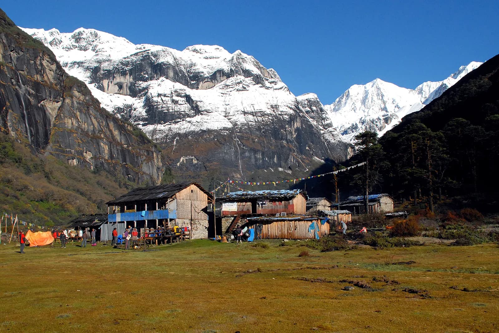
The Makalu region is the Barun valley of Sankhuwasabha District in eastern Nepal, and its classic trek goes from Seduwa up through Tashigaon and Khongma Danda, over the Shipton La, and along the Barun Khola to Makalu Base Camp at about 4,830 m. Makalu, at roughly 8,480 m, is the fifth-highest mountain in the world, and the trek sits inside Makalu Barun National Park, which rises from about 400 m in the Arun valley to the summit in a single protected area. The trail is quiet, with simple lodges, and the forest changes from subtropical to rhododendron, fir and juniper on the way. You need a national park permit and a guide is strongly advised. Plan 16 days from Kathmandu with the flight to Tumlingtar and a day for weather. October to November and March to May are the best months. Treat it as a hard trek with steep climbs and little infrastructure.
Overview of Makalu
Makalu Barun National Park was established in 1992 as the eastern extension of Sagarmatha National Park and covers about 1,500 km2 across Solukhumbu and Sankhuwasabha, with a buffer zone of around 830 km2. It is often described as the only protected area where the elevation gain from valley floor to summit exceeds 8,000 m. The Barun valley is a strict nature reserve, the first in Nepal, so camping and use of the upper valley are tightly controlled.
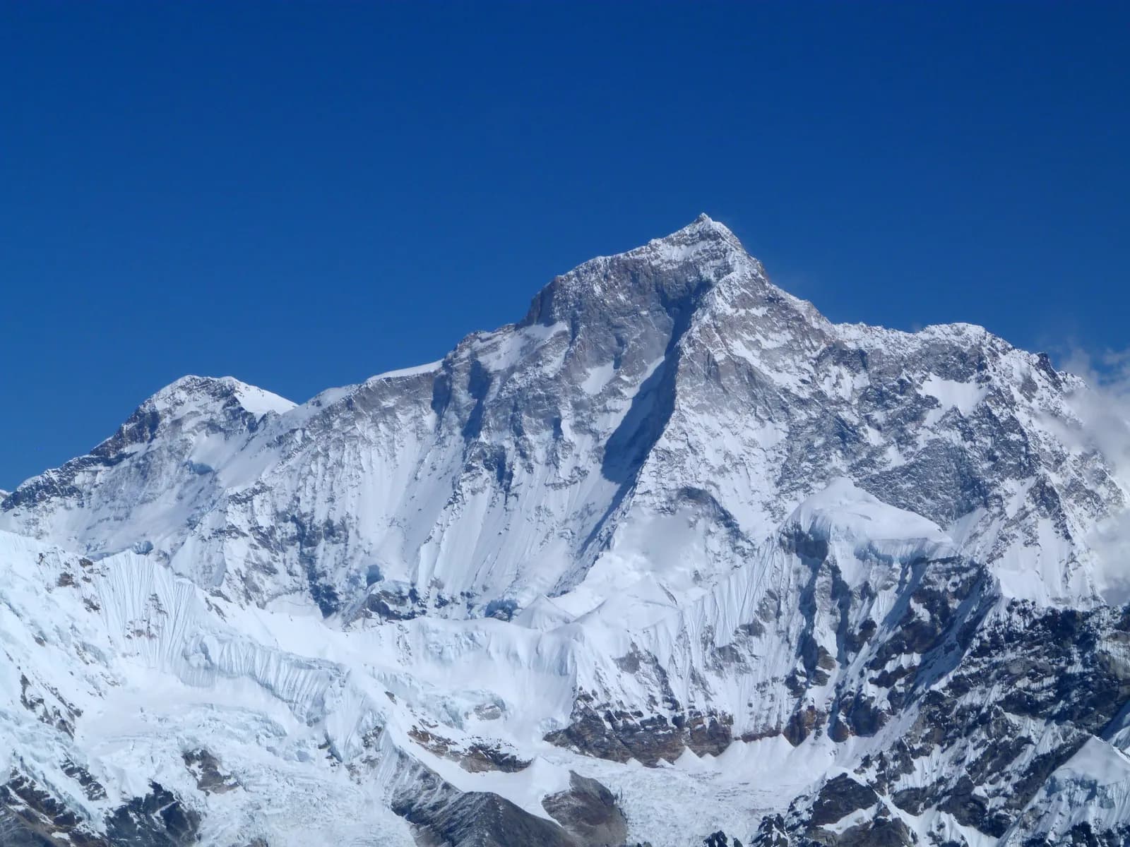
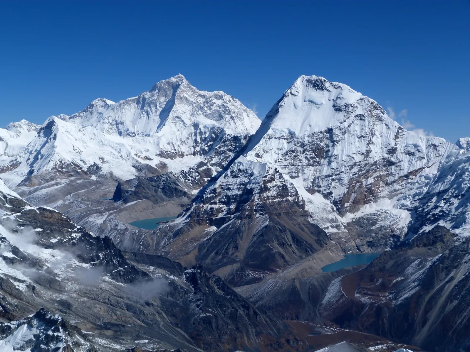
Makalu itself was first climbed on 15 May 1955 by Lionel Terray and Jean Couzy of a French expedition led by Jean Franco. The mountain is a four-sided pyramid; sources quote its height between 8,463 and 8,485 m, so treat any single figure with care. The surrounding peaks include Chamlang (7,319 m), Baruntse (7,129 m) and Mera Peak (6,654 m).
The villages below Khongma Danda are mostly Rai, with Sherpa, Bhotiya, Gurung and Chhetri families, and the economy is millet, maize, cardamom and livestock. The upper valley has no permanent villages, only yak pastures (kharka) and seasonal teahouses.
Best time to trek, month by month
- March: cold nights above 3,500 m and snow on the Shipton La, though rhododendron starts to flower in the lower forest.
- April: the spring peak, with rhododendron and magnolia in bloom, clearer mornings and stable snow. The pass is usually open.
- May: warmer, with afternoon cloud and some haze. Leeches begin to appear in the lower forest late in the month.
- June to August: monsoon, with heavy rain, leeches, slides on the Num road and almost no views. Not recommended.
- September: the rains ease but the trail is wet and slippery, and mist covers the mountain until the end of the month.
- October: the best month, with settled weather, clear views of Makalu and Chamlang and the Rai harvest in the lower villages.
- November: colder and very clear, with frozen mornings at Yangle Kharka and Langmale Kharka and fewer lodges open.
- December to February: very cold, with deep snow on the Shipton La. Only for experienced winter trekkers with camping support.
Routes compared
| Trek | Typical days | Highest point | Character |
|---|---|---|---|
| Makalu Base Camp Trek | 16 | Makalu Base Camp, about 4,830 m | Remote forest and glacier valley, Shipton La, simple lodges |
Longer expeditions go beyond base camp over the Sherpani Col or the Tutu La to Hunku and the Everest region, but those need technical skills, a full camping crew and the right permits. Many trekkers start with the Makalu base camp trek and add Everest or Kanchenjunga another year.
Permits and rules
The park entry permit is issued by Makalu Barun National Park, and a TIMS card may be needed where the local office asks for it. Makalu is generally treated as a national park trek, not a restricted area, but the situation for border districts has changed, and a 2026 press report about controlled areas in 13 districts shows why you should confirm the details with a registered agency. Fees differ for foreigners, SAARC nationals and Nepalis; ask the agency for the current amounts and check them with the park office or the Department of National Parks and Wildlife Conservation.
Guides. The Nepal Tourism Board April 2023 rule requires foreign trekkers to use a licensed guide in national parks and conservation areas, and 2026 operator reports say checkpoints enforce it in Annapurna (ACAP), Langtang (the strictest) and most other parks, but not in Khumbu, where the municipality opted out (checked 19 October 2026). See the guide rule by region. Enforcement reports conflict, but on this trail a guide is sensible anyway: trails are quiet, signs are few and lodges are far apart. Camping in the upper valley is regulated by the park, so book through an agency that has the permits.
Getting there: flight and road
The quickest route is a flight from Kathmandu to Tumlingtar, about 45 minutes, followed by a jeep drive of about 4 to 5 hours through Khandbari and Num to Seduwa at roughly 1,600 m. Flights are weather dependent and are sometimes cancelled in the monsoon, so keep a buffer day. If the plane does not fly, you can take a night bus or jeep from Kathmandu to Khandbari via Biratnagar or Hile, which takes around 20 hours.
At the end of the trek the jeep leaves Seduwa for Tumlingtar, so schedule the return flight for the next morning.
Altitude and acclimatisation
You climb quickly on day four, from Tashigaon at about 2,120 m to Khongma Danda at 3,600 m, a gain of about 1,500 m. Many agencies add a rest day at Khongma Danda for this reason, and the short days that follow help you settle. The pass crossing to Dobate (3,860 m) is a moderate climb, and Yangle Kharka (3,630 m) is lower again, which helps. Langmale Kharka (4,440 m) and base camp (4,830 m) are the highest sleeps, and many guides add a rest day at one of them.
Watch for headache, nausea and poor sleep, never ascend with symptoms, and descend if they worsen. Altitude medicine such as acetazolamide is a decision to make with a doctor before you leave home.
Lodges, costs and food
Lodges operate at Seduwa, Tashigaon, Khongma Danda, Dobate, Yangle Kharka and Langmale Kharka, and there is a small teahouse and camping area at base camp. They are basic: wooden rooms, blankets, dal bhat, noodles and tea. Meals cost more every day you climb, and hot showers are rare above Tashigaon. Some agencies carry tents and a cook for the upper valley, because lodge capacity is low.
Bring snacks and small notes. There are no machines beyond Khandbari.
Connectivity
Mobile signal exists around Seduwa and Tashigaon and fades above Khongma Danda. A few lodges sell internet, usually slow and costly. Plan to be offline for most of the trek, and carry a satellite device if your insurer asks for one.
Safety
The valley is remote, and the nearest hospital is in Khandbari. In an emergency a rescue helicopter can reach the upper valley in good weather, which needs insurance that covers it and a guide who can call for help. Landslides and stream crossings are the lower-valley hazards in the monsoon, and in the upper valley it is cold, wind and altitude. Trails run through forest with leeches in wet months, so carry salt or repellent and wear gaiters.
Sections near the Shipton La can be icy in spring and late autumn. Do not cross alone, and turn back in storms.
What to pack
Broken-in boots, waterproof jacket and trousers, a down jacket, a sleeping bag rated to about minus 15 C for the upper valley, gloves, a warm hat, sunglasses, gaiters, trekking poles, a headlamp, water purification and a first-aid kit. A light pair of microspikes is useful in early spring. In wet months take leech socks.
History and culture
The Arun river cuts one of the deepest gorges in the Himalaya, and for generations Rai, Sherpa and Bhotiya communities used the Arun valley as a trade route to Tibet. The Rai have their own beliefs and festivals, and many villages celebrate Sakela, a harvest dance in spring and autumn. The Barun valley is a sacred valley for local people, and visits are expected to be respectful.
British and New Zealand parties, including one with Edmund Hillary, explored the Barun valley in the early 1950s, and the park created in 1992 now protects it.
Wildlife and nature
The park records more than 3,000 species of flowering plants, including 25 of Nepal's 30 rhododendron species, 48 primulas and 47 orchids. About 440 bird species have been recorded, from sunbirds and kingfishers to raptors. Mammals include snow leopard, red panda, Himalayan black bear, musk deer, tahr and clouded leopard, though most trekkers see only birds, langur and, with luck, tahr above the tree line. Birch, fir and juniper forests dominate between 3,000 and 4,000 m.
Responsible trekking
Stay on the trail, camp only where your agency has permission, take rubbish out and use refillable bottles with a filter. The Barun valley is a strict reserve, so do not light fires or cut wood. Ask before taking photographs of local people, and respect Rai and Sherpa customs, including walking clockwise around chortens and mani walls.
Combining treks
Makalu is often joined to the Everest region by the Tutu La and Hunku routes, or to Kanchenjunga by a long road trip through the east. Shorter additions are a day or two in the Arun valley around Khandbari or the Basantapur ridge, which has views of Makalu and Kanchenjunga on a clear morning.
Money, insurance and logistics
Withdraw cash in Kathmandu or Khandbari before the trek. Your insurance should cover trekking to 5,000 m and helicopter evacuation, and the flight to Tumlingtar needs flexible dates. Small aircraft have tight baggage allowances, so carry soft duffels and keep a day bag with valuables on you.
Arranging your trek
Choose a registered agency that holds park permits, supplies insured guides and porters and has a plan for pass closures. Ask about group size, rest days, tents at base camp, and what happens if the flight is cancelled. A trekking company in Kathmandu or Khandbari can arrange the jeep to Seduwa.
Food and drink
Lodges cook dal bhat (rice, lentils and vegetables, with free refills in most places), noodles, fried rice, potatoes, eggs and pancakes, and some bake bread or serve Tibetan bread at Khongma Danda. Rai villages in the lower valley sell millet beer (tongba) and homemade raksi, which are best avoided at altitude. Boil or filter all water, and carry electrolyte tablets for the long climb days.
Practical tips from the trail
- Start early: mornings are clear and the afternoon cloud rolls in from the valley by about 1 pm.
- Use poles on the steep descent from Khongma Danda to Tashigaon, which is hard on knees on the way home.
- Keep your down jacket and gloves in your day bag from Dobate onward, because temperatures fall quickly when the sun drops.
- Carry a few copies of your permits and passport photo for check posts.
- Pack a small power bank. Charging at high lodges is slow and costs extra.
Kathmandu before and after
Plan a night in Kathmandu before the Tumlingtar flight and a buffer day afterwards. Gear shops and permit offices in Thamel are open until evening, and a rest day around Bhaktapur or Patan helps tired legs.
यस क्षेत्रका सबै मार्ग
यहाँ हामीले समेटेका सबै मानक मार्ग। दिनदिनको यात्रा तालिका खोल्न मार्गमा ट्याप गर्नुहोस्।
मार्गहरू तुलना गर्नुहोस्
आफूलाई मिल्ने मार्ग भेट्न लम्बाइ, उचाइ, कठिनाइ वा अनुमानित खर्चअनुसार मार्ग मिलाउनुहोस्।
दिन ↑ अनुसार मिलाइएको
| मार्ग | |||||
|---|---|---|---|---|---|
| Makalu Base Camp Trek | 16 | ४,८३० मि | कठिन | ९३.८ कि.मि. | NPR ६६,००० देखि |
खर्च अनुमान हो: क्षेत्रको बजेट-शैलीको दैनिक दरलाई दिनले गुणा गरिएको, उडान र अनुमतिपत्रबिना।
ट्रेक गर्ने उत्तम समय
हाइलाइट गरिएका महिनाहरू सिफारिस गरिएका ट्रेकिङ मौसम हुन्। Mar–May · Oct–Nov
उत्तम मौसमअन्य महिना
Live conditions
Notes entered by our team from the sources linked on each item. Conditions change quickly, so confirm with your guide or lodge before you set off.
Best seasons: Mar–May · Oct–Nov
Nothing recent on file. Check with your guide or lodge before you go.
पर्मिट र शुल्क
शुल्क प्रतिव्यक्ति हो र तपाईंको राष्ट्रियता समूहमा भर पर्छ।
| पर्मिट | विदेशी | SAARC | नेपाली |
|---|---|---|---|
Makalu Barun National Park entry permit | NPR ३,००० | NPR १,५०० | — |
Makalu (Sankhuwasabha) restricted-area permit | पहिलो 7 दिनका लागि USD २०, त्यसपछि USD २.८६/दिन | एजेन्सीसँग जाँच्नुहोस् | — |
TIMS card (trekking agency issued) | NPR २,००० | NPR १,००० | — |
- कहाँ किन्ने
Department of National Parks and Wildlife Conservation
Department of Immigration (restricted-area permit, issued through a registered trekking agency)
Trekking agency / Nepal Tourism Board
दैनिक खर्च
टी-हाउस ट्रेकमा प्रतिव्यक्ति प्रतिदिन। गाइड र पोर्टरको खर्च प्रति समूह/पोर्टर प्रतिदिन। २०२६ अक्टोबर सम्मको अनुसार।
Makalu Base Camp Trek को सामान्य जम्मा खर्च, २ ट्रेकर बाँडेर
- किफायती
- US$ ९१०–US$ १,३५०
- मध्यम
- US$ १,१००–US$ १,६५०
- आरामदायी
- US$ १,३५०–US$ २,०००
| शैली | प्रतिदिन | गाइड / दिन | पोर्टर / दिन | नमुना जम्मा |
|---|---|---|---|---|
| किफायती | NPR २,९००–४,८०० | NPR ४,४०० | NPR २,७५० | NPR ८७,९००–१,२६,२०० |
| मध्यम | NPR ४,१००–६,५०० | NPR ४,४०० | NPR २,७५० | NPR १,०३,५००–१,४९,८०० |
| आरामदायी | NPR ५,५००–८,४०० | NPR ४,४०० | NPR २,७५० | NPR १,२३,२००–१,७६,४०० |
किफायती: Kathmandu to Tumlingtar flight about USD 150 to 200 each way; the jeep to Seduwa has no published fare in our sources.
मध्यम: Kathmandu to Tumlingtar flight about USD 150 to 200 each way; the jeep to Seduwa has no published fare in our sources.
आरामदायी: Kathmandu to Tumlingtar flight about USD 150 to 200 each way; the jeep to Seduwa has no published fare in our sources.
नियम र असल अभ्यास
गाइड
- सबै क्षेत्र
Foreign trekkers must trek with a licensed guide in national parks and conservation areas (in force since April 2023). Enforcement varies by region, so verify the current rule before you go.
पर्मिट
- सबै क्षेत्र
Carry your permits at all times; they are checked at several checkpoints along every route.
सुरक्षा र उचाइ
- सबै क्षेत्र
Buy travel insurance that covers helicopter rescue to at least 6,000 m.
- सबै क्षेत्र
Climb high, sleep low: above 3,000 m, avoid raising your sleeping altitude by more than about 500 m per day, and add rest days.
संरक्षण
- सबै क्षेत्र
Carry out all non-burnable waste (batteries, plastic, wrappers) and use a refillable water bottle.
संस्कृति
- सबै क्षेत्र
Respect monasteries: walk clockwise around stupas and mani walls, and remove shoes where asked.
- सबै क्षेत्र
Ask before photographing people, especially at religious sites and ceremonies.
ड्रोन
- सबै क्षेत्र
No drones without prior permission from the relevant authority.
फोटोहरू
प्रायः सोधिने प्रश्नहरू
Yes: the Makalu Barun National Park entry permit, arranged through a registered agency. Ask for current fees, because they differ for foreigners, SAARC nationals and Nepalis, and check them with the park office.
The Nepal Tourism Board April 2023 rule requires foreign trekkers to use a licensed guide in national parks and conservation areas, and 2026 operator reports say checkpoints enforce it in Annapurna (ACAP), Langtang (the strictest) and most other parks, but not in Khumbu, where the municipality opted out (checked 19 October 2026). Confirm with a registered agency. On this remote trail a guide is strongly advised in any case.
Sixteen days from Kathmandu on this plan, including the flight to Tumlingtar, a drive to Seduwa and eight days of walking up, one rest day at base camp and five days back. Many agencies allow 18 to 20.
About 4,830 m according to OpenStreetMap, though trekking guides often quote 4,870 m. There is no fixed marker, so figures differ by up to 50 m.
Between 8,463 and 8,485 m depending on the survey, which makes it the fifth-highest mountain in the world.
October and November, and April and May. The monsoon brings leeches and landslides, and winter closes the Shipton La with snow.
Fly Kathmandu to Tumlingtar (45 minutes) and take a jeep via Khandbari and Num to Seduwa in about 4 to 5 hours. The alternative is an overnight bus or jeep from Kathmandu or Biratnagar.
It is more remote and less developed, with a steep climb to Khongma Danda and basic lodges, and it is rated hard. The altitude is lower than Everest Base Camp, but the trail has fewer services.
खुला ट्रिपहरू
Makalu बारे गाइडहरू
 कभर फोटो: Indra Rai, CC BY-SA 4.0
 कभर फोटो: Craig Taylor, CC BY-SA 2.0
 कभर फोटो: Roman Yahodka, CC BY-SA 4.0
 कभर फोटो: Craig Taylor, CC BY-SA 2.0
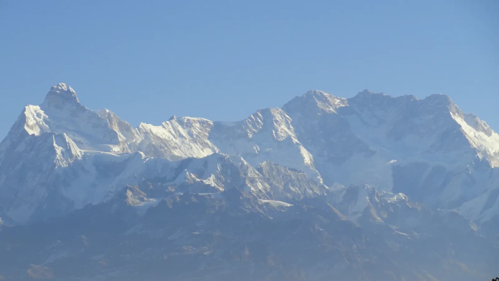 कभर फोटो: Suryakedem555, CC BY-SA 4.0
स्रोतहरू
- Makalu (Wikipedia)
- Makalu Barun National Park (Wikipedia)
- Sankhuwasabha District (Wikipedia)
- Department of National Parks and Wildlife Conservation, Nepal
- Restrictions on trekking for foreigners in controlled areas of 13 districts (Kantipur, 6 May 2026)
- Nepal Tourism Board
- Himalayan Rescue Association
- OpenStreetMap (elevation tags of passes, peaks and villages)
Makalu ट्रेक गर्न तयार हुनुहुन्छ?
यी मितिका लागि ट्रेकिङ साथी भेट्नुहोस् वा आफ्नै मार्गको योजना बनाउन थाल्नुहोस्।