

Leave Kathmandu early for the drive north to Syabrubesi, at about 1,500 m, on the Trisuli road past Trisuli Bazaar and the approach to Langtang. Operators give 6 to 9 hours depending on the vehicle and the state of the road; the bus is slower and cheaper than a jeep. The road is narrow and winding, with some landslide sections. Syabrubesi is the busy start of the Langtang and Tamang Heritage routes, so you will see other trekkers. Check in to a lodge, confirm your permit paperwork with the guide, pack a daypack and have an early night before the first walking day.
Ruby Valley and Ganesh Himal Trek
A 7-day village trek from Syabrubesi over Pangsang Pass to Tipling and Chalish, with a rest day around Chalish and a drive back through Dhading Besi.
- दिन7
- अधिकतम उचाइ३,८५० मि
- दूरी४३.७ कि.मि.
- उकालो३,६३८ मि
- कठिनाइमध्यम
- उत्तम महिनाMar–May, Oct–Nov
- अनुमतिपत्र2
यो यात्रा तालिकासहित ट्रिपको योजना बनाउनुहोस्Ruby Valley and Ganesh Himal Trek का लागि साथी खोज्नुहोस्हप्ताअनुसार प्रस्थान हेर्नुहोस्
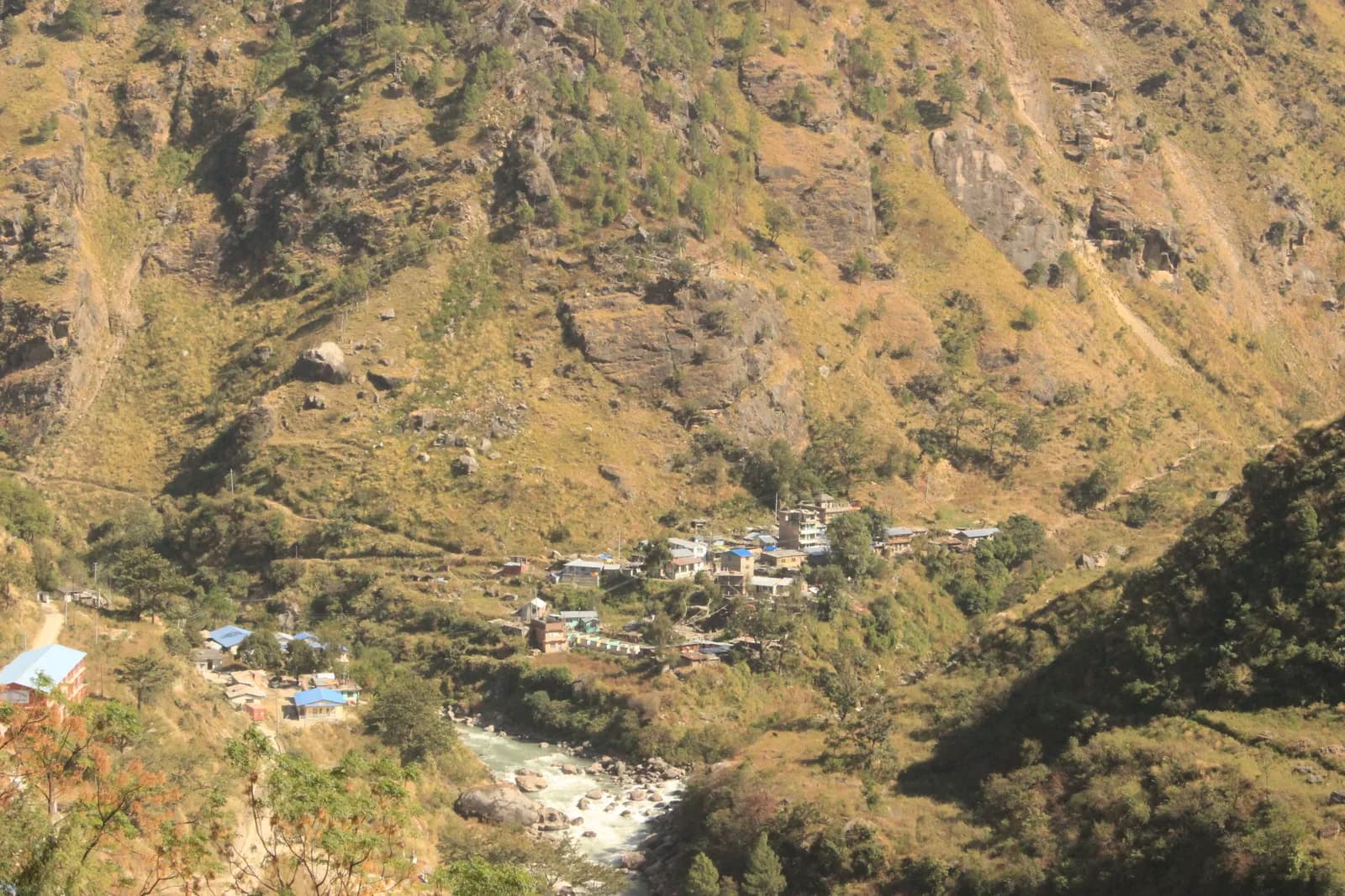
फोटो: Rajivkilanashrestha · CC BY-SA 4.0
चेतावनीRuby Valley: the Syabrubesi start is not currently reliable
This route drives to Syabrubesi on day 1 and finishes at Chalish with a drive back through Dhading Besi. On 26 August 2026 a large rock-and-ice collapse from the north face of Langtang Lirung sent a debris flow down the Lhende Khola into the Bhote Koshi and Trishuli rivers, hitting Rasuwagadhi, Timure, Syabrubesi and Betrawati (ICIMOD). Many bridges and long stretches of the Pasang Lhamu Highway were damaged, and a large number of people died or are missing; reported figures differ by source.
Syabrubesi, the usual Langtang road-head, is reported destroyed or closed as a trekking gateway, with the bridge to it swept away; restoration depends on the Betrawati highway reopening. The Trishuli Bazaar-Betrawati-Dhunche road was reported still closed for repair as of 21 September. A light-vehicle track has reopened, and agencies projected the remaining gaps passable no earlier than mid-October; that is a projection, not an official date.
We found no source on the condition of the Ruby Valley trail itself or a reopening date. We found no official reopening notice. Check current road and trail conditions with Langtang National Park and your trekking agency before booking, and do not rely on this summary alone.
स्थिति 2026-10-19 मा जाँचिएको।
स्रोतहरू: ICIMOD: Kyirong-Rasuwa flood, 26 August 2026 · Nepal Pyramids: Langtang Valley trek update after the 2026 flooding · Republica: locals reopen flood-damaged Langtang trekking route (16 Oct)
अंग्रेजीमा देखाइएको — अझै अनुवाद भएको छैन।
यो यात्रा तालिका मस्यौदा हो र अझै प्रमाणित भएको छैन। चरणहरू सधैं आफ्नो गाइडसँग पुष्टि गर्नुहोस्।
Written by FindTrekkingPartner teamFindTrekkingPartner team द्वारा समीक्षितहामी कसरी समीक्षा गर्छौंFindTrekkingPartner
Ruby Valley and Ganesh Himal Trek नेपालको Ganesh Himal क्षेत्रमा पर्ने 7 दिनको ट्रेक हो, जुन ३,८५० मिटरसम्म उक्लिन्छ। विदेशी ट्रेकरहरूले आफ्नो मिति, बजेट र गतिसहित ट्रिप पोस्ट गरेर FindTrekkingPartner मा यसका लागि साथी खोज्न सक्छन्। दुवै ट्रेकर सहमत नभएसम्म म्याचहरू निजी रहन्छन्, र सेवा निःशुल्क छ। मध्यम स्तरको दरमा, चार जना ट्रेकरले बाँड्दा 7 दिनको लागि इजाजतपत्रप्राप्त गाइडको खर्च प्रति व्यक्ति लगभग USD ६५ पर्छ, जबकि एक्लै जाँदा USD २६१ पर्छ। उत्तम मौसमहरू Mar–May, Oct–Nov हुन्। यहाँ व्यवहारमा इजाजतपत्रप्राप्त गाइड आवश्यक छ: २०२६ का सञ्चालकहरूका अनुसार नेपाल पर्यटन बोर्डको अप्रिल २०२३ को नियम राष्ट्रिय निकुञ्ज र संरक्षण क्षेत्रका चेकपोइन्टहरूमा लागू गरिन्छ, जसमा लाङटाङ सबैभन्दा कडा छ र अन्नपूर्णमा पनि जाँच हुन्छ (१९ अक्टोबर २०२६ मा जाँचिएको)। दर्ता भएको एजेन्सीमार्फत गाइड लिनुहोस् र उनीहरूसँग पुष्टि गर्नुहोस्। पछिल्लो पटक पुष्टि गरिएको: २०२६ अक्टोबर १९। स्रोतहरू: नेपाल पर्यटन बोर्ड, DNPWC, अध्यागमन विभाग।
स्रोतहरू:Department of Immigration, NepalNepal Tourism BoardDepartment of National Parks and Wildlife Conservation
Ruby Valley and Ganesh Himal Trek का लागि साथी खोज्नुहोस्
- Ruby Valley and Ganesh Himal Trek का लागि साथी खोज्नुहोस्अहिलेसम्म कुनै खुला ट्रिप छैन
परिचय
Kathmandu बाट सुरुपासहरू: Pangsang Pass७ दिन · अधिकतम ३,८५० मि
उत्तम मौसम: Mar–May, Oct–Nov · अनुमतिपत्र: Langtang National Park entry permit, TIMS card where required
The Ruby Valley trek is a seven-day walk through the villages and forests on the south-west side of Ganesh Himal. It drives from Kathmandu to Syabrubesi, the Langtang trailhead, walks over Bahun Danda to the Tamang village of Gatlang, climbs to the forest camp at Somdang (about 3,270 m), crosses Pangsang Pass at about 3,850 m and descends to Tipling, then walks through the Tamang village of Sertung to Chalish, with a rest day around Chalish for Sertung and the Tatopani hot spring before a drive back to Kathmandu via Dhading Besi. The walking adds up to about 44 km on our mapped route with roughly 3,600 m of climbing, following the stages of the Nepal Alternative Treks, Himalaya Trip and Peregrine itineraries in the sources. It is a moderate trek, needs the Langtang National Park permit and no restricted-area permit, and runs best from late September to early December and in spring.
What the trek is like
The first day on foot climbs from the Bhote Koshi valley through forest to Bahun Danda and on to Gatlang, a village of dark stone houses at about 2,300 m. The next two days go up into pine and rhododendron forest to Somdang and over Pangsang Pass, where on clear days Ganesh Himal fills the northern horizon. The final descent leads through millet and maize terraces to Tipling and Chalish, villages where local families run homestays.
Permits and rules
The Langtang National Park entry permit is NPR 3,000 for foreigners (Nepal Tourism Board). A TIMS card is listed by some operators. The trek is not in a restricted area, so there is no minimum group size, but trails above Somdang are quiet, so most people go with a guide.
Best season
Mid-September to mid-December and March to May. Monsoon trails are slippery and leech-prone.
Altitude
The highest overnight is Somdang at about 3,270 m and the pass is about 3,850 m, so most people feel the height only as a little breathlessness. Walk slowly and drink well.
Getting there and away
Kathmandu to Syabrubesi is 6 to 9 hours by road, and Chalish to Kathmandu about 8 hours via Dhading Besi. Plan one spare day if road works or landslides are reported.
Lodges, food and costs
Homestays and simple guesthouses serve dal bhat. See the permit fees and sample costs in the costs section.
Extensions
Operators extend the trek with an acclimatisation day at Somdang, a walk on to Jharlang and Darkha, or a longer circuit through Hindung to Ganesh Himal Base Camp, which has no lodges.
मुख्य आकर्षण
- Gatlang, a Tamang village of stone houses and pilgrim lake
- Somdang, a forest camp at about 3,270 m below Ganesh Himal
- Pangsang Pass at about 3,850 m, with views of the Ganesh Himal range
- Tipling and Chalish, farming villages with homestays and the Tatopani hot spring nearby
- A moderate trek with no restricted-area permit
मार्ग नक्सा
मार्गको डेटा OpenStreetMap बाट लिइएको हो, हाम्रो टोलीले अझै जाँचेको छैन। योजना बनाउन प्रयोग गर्नुहोस्, नेभिगेसनका लागि होइन।
दिनदिनको विवरण
तपाईं अघिल्लो रातभन्दा ८३४ मि माथि सुत्नुहुन्छ, जुन सामान्य ५०० मिटरको मार्गदर्शनभन्दा बढी हो। बिस्तारै हिँड्नुहोस्, प्रशस्त पानी पिउनुहोस् र टाउको दुखाइ वा वाकवाकी भए ध्यान दिनुहोस्।
Cross to the west bank of the Bhote Koshi and climb through forest and farmland over Bahun Danda to Gatlang, at about 2,300 m. Operators allow 4 to 6 hours for the 11 km, and the gain is about 1,060 m. Gatlang is a Tamang village of stone houses, wooden balconies and prayer flags, with a pilgrim lake nearby. Walk through the lanes in the afternoon, and be respectful when entering temples or taking photos of people. Homestay families cook dal bhat and local food. The altitude is modest, but drink a lot and climb slowly.
तपाईं अघिल्लो रातभन्दा ९३४ मि माथि सुत्नुहुन्छ, जुन सामान्य ५०० मिटरको मार्गदर्शनभन्दा बढी हो। बिस्तारै हिँड्नुहोस्, प्रशस्त पानी पिउनुहोस् र टाउको दुखाइ वा वाकवाकी भए ध्यान दिनुहोस्।
A long day of 6 to 7 hours takes you from Gatlang to Somdang, at about 3,270 m, climbing about 1,500 m over 12.6 km. The trail goes through dense pine and rhododendron forest, passing Khurpu Bhanjyang, a saddle of about 3,700 m on the map, before the final stretch to Somdang. The hamlet has a few guesthouses on a clearing with views down the valley. It is the highest night of the trek, so go slowly, eat well and wrap up in the evening, when the air turns cold quickly.
The hardest day: leave early and climb above the tree line to Pangsang Pass, at about 3,850 m, where the views take in the Ganesh Himal range on a clear morning. Then descend steeply through forest to Tipling, at about 2,000 m, a drop of about 1,800 m from the pass over 15 km on our mapped route. Operators allow 7 to 8 hours in total, and some call it 8 to 10, so start at first light and carry lunch. Poles are a great help on the knee-jarring descent. Tipling's homestays give a welcome rest at the end.
Walk down from Tipling through millet and maize terraces to Sertung, a Tamang village, and on to Chalish Gaon at about 1,675 m. Operators give 3 to 5 hours for the day, depending on how long you spend among the Sertung houses. Our map follows the footpath through Sertung: 4.7 km with about 360 m of climbing and 690 m of descent, so the day is short on distance but has a lot of up and down. One operator counts 12 km for the same day because it also visits upper villages that OpenStreetMap does not map. Stop in Sertung for tea, then continue to Chalish, home to Gurung, Ghale and Kami families, where the lower altitude and warmer evenings make a pleasant place to rest.
A rest day around Chalish with an optional walk of about 4 to 5 hours: operators suggest a round trip to Sertung, a viewpoint, and the Tatopani hot spring, where you can soak tired legs. The route is gentle and mostly on village paths, and you can shorten it or skip it. Ask your host about a cultural evening if you want music and dance, usually arranged on request. This is also the sensible day to wash clothes, back up photos and repack for the road, because the last day is a long drive.
Drive from Chalish via Dhading Besi to Kathmandu, a journey of about 8 hours on the Dhading and Prithvi roads. Operators quote between 7 and 9 hours with a mix of private jeep and bus; the stretch to Dhading Besi is rough and slow, and the rest is on tarmac. Leave early, take snacks and water, and keep a spare day in your plans if the monsoon or road works are reported. Back in Kathmandu, hand back any rented gear and settle up with the guide and drivers.
अनुकूलन
रातैपिच्छे सुत्ने उचाइ। रातो पट्टीहरू अघिल्लो रातभन्दा ५०० मिटरभन्दा बढी चढेका हुन्; आराम दिन चिन्ह लगाइएको छ।
- सुत्ने उचाइ
- ५०० मिटरभन्दा बढी चढाइ
- आराम दिन
कति खर्च लाग्छ
प्रति व्यक्ति अनुमानित सबै-समेतको खर्च: उचाइअनुसार लज र खाना, यातायात, अनुमतिपत्र, र गाइड तथा पोर्टर। जति धेरै ट्रेकरले गाइड र पोर्टर बाँड्छन्, प्रत्येकले त्यति कम तिर्छन्। २०२६ अक्टोबर सम्मको अनुसार।
| शैली | १ ट्रेकर | २ ट्रेकर बाँडेर | ४ ट्रेकर बाँडेर |
|---|---|---|---|
| किफायती | US$ ३४०–US$ ४३० | US$ २४०–US$ ३३० | US$ १९०–US$ २८० |
| मध्यम | US$ ७७०–US$ १,१५० | US$ ४७०–US$ ७०० | US$ ३४०–US$ ५१० |
| आरामदायी | US$ ८२०–US$ १,२०० | US$ ५६०–US$ ८३० | US$ ४३०–US$ ६५० |
गाइड बाँडेर पैसा बचाउनुहोस्
मध्यम स्तरमा, एक्लो ट्रेकरले करिब US$ ७७०–US$ १,१५० तिर्छ; एउटा गाइड र दुई पोर्टर बाँड्ने चार ट्रेकरले प्रत्येकले करिब US$ ३४०–US$ ५१० तिर्छन् (दायराको माथिल्लो छेउमा 55% कम)।
२ ट्रेकरले बाँड्दाको विवरण
| विवरण | किफायती | मध्यम | आरामदायी |
|---|---|---|---|
| लज र खाना | US$ १००–US$ १७० | US$ १३०–US$ २३० | US$ १९०–US$ ३०० |
| यातायात | US$ १००–US$ १३० | US$ १५०–US$ २२० | US$ १५०–US$ २२० |
| अनुमतिपत्र | US$ ३०–US$ ४० | US$ ३०–US$ ४० | US$ ३०–US$ ४० |
| गाइड | — | US$ १००–US$ १६० | US$ १००–US$ १६० |
| पोर्टर | — | US$ ३०–US$ ७० | US$ ७०–US$ १३० |
बजेटमा सार्वजनिक यातायात र पोर्टरबिना; मध्यम स्तरमा दुई ट्रेकरबीच एक पोर्टर र निजी सवारी साधन बाँडिन्छ; आरामदायीमा प्रत्येक ट्रेकरलाई एक पोर्टर। गाइड अनिवार्य भएको ठाउँमा वा मध्यम स्तर अथवा आरामदायी शैलीमा समावेश गरिएको हुन्छ।
रातको लज र खाना (कोठा र दाल भात)
५ रात Below 2,500 m: कोठा US$ २–US$ ९, दाल भात US$ ४–US$ ७ · १ रात 2,500 to 3,800 m: कोठा US$ ४–US$ ११, दाल भात US$ ५–US$ ११
अनुमतिपत्र शुल्क (आधिकारिक स्रोत)
खर्चका स्रोतहरू
- PriceNepal: Nepal Travel Cost Guide 2026 (2026-05-14)
- Third Rock Adventures: Nepal trek budget planner (2026-05-09)
- Himalayan Partner: Guide and porter price in Nepal 2026 (2026-02-10)
- Shikhar Adventure: Annapurna Circuit trek cost (2026-02-03)
- Nepal Tourism Board: Trekking Permit (2026-10-18)
- Mount Mania: Ruby Valley trek (2026-10-18)
अपरेटर गाइडबाट लिइएका अनुमान हुन्, कोटेसन होइनन्। टिप, बीमा, सामान र काठमाडौंका होटल समावेश छैनन्; USD प्लेटफर्मको विनिमय दरमा।
फोटोहरू
प्रायः सोधिने प्रश्नहरू
It is a moderate trek of 7 days with one hard day, Somdang to Tipling, of 7 to 8 hours over Pangsang Pass. The highest night is about 3,270 m.
Operators list the Langtang National Park entry permit, which the Nepal Tourism Board puts at NPR 3,000 for foreigners. It is not a restricted area.
It suits fit first-timers who are used to 5 to 8 hour days. The altitude is modest, but lodging is basic homestays and the trails are quieter than the main circuits.
By road: operators allow about 8 hours from Chalish via Dhading Besi to Kathmandu, by private jeep or a mix of jeep and bus.
Operators offer an 11 to 12 day circuit that adds Hindung and the base camp, but there are no hotels at the base camp, so it needs camping support.
स्रोतहरू
- Ruby Valley Trek 7 days (Nepal Alternative Treks)
- Ruby Valley Trek (Himalaya Trip)
- Ruby Valley Trek (Peregrine Treks)
- Ruby Valley Trek 10 days (Mount Mania)
- Ganesh Himal (Wikipedia)
- Nepal Tourism Board: Park Entry Fees
- Ruby Valley Home Stay Trek (Himalayan Local Guide)
- Sirtung (Sertung), Dhading (Wikipedia)
बाटोभरि
मार्गको हरेक दिन बास, चिकित्सा सहायता, पानी र हेर्नलायक ठाउँहरू।
1. Kathmandu → Syabrubesi
- त्रिभुवन अन्तर्राष्ट्रिय विमानस्थल · विमानस्थल र यातायात · १,३४० मि
2. Syabrubesi → Gatlang
- Temple · दृश्यावलोकन स्थल · २,३२३ मि
- Ronga Bhaniyan · प्रकृति · २,२४० मि
- Tamang Home · बास · २,३५८ मि
- Pador Peak Guest House · बास · २,३४३ मि
- Stone Woodland Guest House · बास · २,३०२ मि
- Langtang View Guest House · बास · २,२६८ मि
Show all 10 places
- Temple · दृश्यावलोकन स्थल · २,३२३ मि
- Bagung view point Hotel & Lodge · बास · २,२४३ मि
- Goljung Danda Chhamgang Hotel & Lodge · बास · २,२४३ मि
- Ronga Bhaniyan · प्रकृति · २,२४० मि
- Unique Lunch Place with Home Stay · बास · २,२९३ मि
- Gyalbo Guest House · बास · २,३१४ मि
- Tamang Home · बास · २,३५८ मि
- Pador Peak Guest House · बास · २,३४३ मि
- Stone Woodland Guest House · बास · २,३०२ मि
- Langtang View Guest House · बास · २,२६८ मि
3. Gatlang → Somdang
- Langatang View Guest House · बास · २,२६७ मि
- Gatlang guest house · बास · २,३२३ मि
- Royal Gatlang Guest House · बास · २,३३४ मि
- Parvati Kund · प्रकृति · २,६०० मि
- Somdang Valley Lodge · बास · ३,२७६ मि
Show all 8 places
- Langatang View Guest House · बास · २,२६७ मि
- Gatlang guest house · बास · २,३२३ मि
- Royal Gatlang Guest House · बास · २,३३४ मि
- Hotel Zeppa · बास · २,३३६ मि
- Parvati Kund · प्रकृति · २,६०० मि
- Parbati Kunda Guest House · बास · २,६५५ मि
- Ruby Valley Guest House & Homestay · बास · २,६७३ मि
- Somdang Valley Lodge · बास · ३,२७६ मि
4. Somdang → Tipling
- Trail to Guesthouses · दृश्यावलोकन स्थल · २,२४४ मि
- Ashok Ruby Valley Homestay · बास · २,२२४ मि
- Tipling Homestay · बास · २,२१६ मि
- Ruby Valley Tipling Hotel · बास · २,२३८ मि
- Edwin Tamang Homestay · बास · २,०५० मि
5. Tipling → Chalish
- Ganesh Himal Hotel · बास · १,९३६ मि
- Healthpost · चिकित्सा · १,९९० मि
6. Chalish
यो दिनका लागि अहिलेसम्म केही नक्सांकन भएको छैन।यो दिनका लागि अहिलेसम्म केही नक्सांकन भएको छैन।7. Chalish → Kathmandu
यो दिनका लागि अहिलेसम्म केही नक्सांकन भएको छैन।यो दिनका लागि अहिलेसम्म केही नक्सांकन भएको छैन।
अन्तिम पटक २०२६ अक्टोबर १९ मा प्रमाणितपुरानो जानकारी रिपोर्ट गर्नुहोस्