

Travel from Kathmandu to Dhulikhel by taxi or bus and start walking early. The trail leaves town through villages, terraced fields and patches of forest and climbs gently to Namo Buddha, about two and a half hours on, where the golden roofs of Thrangu Tashi Yangtse monastery stand above the stupa. Have lunch there and visit the monastery. Then walk downhill towards Panauti, another two and a half hours by the guide's account, passing farms and small villages, and finish in the old Newar town. On our map the day is 19.4 km with 610 m of climbing and 720 m of descent, mostly on quiet roads and tracks. Take a taxi from Panauti back to Kathmandu.
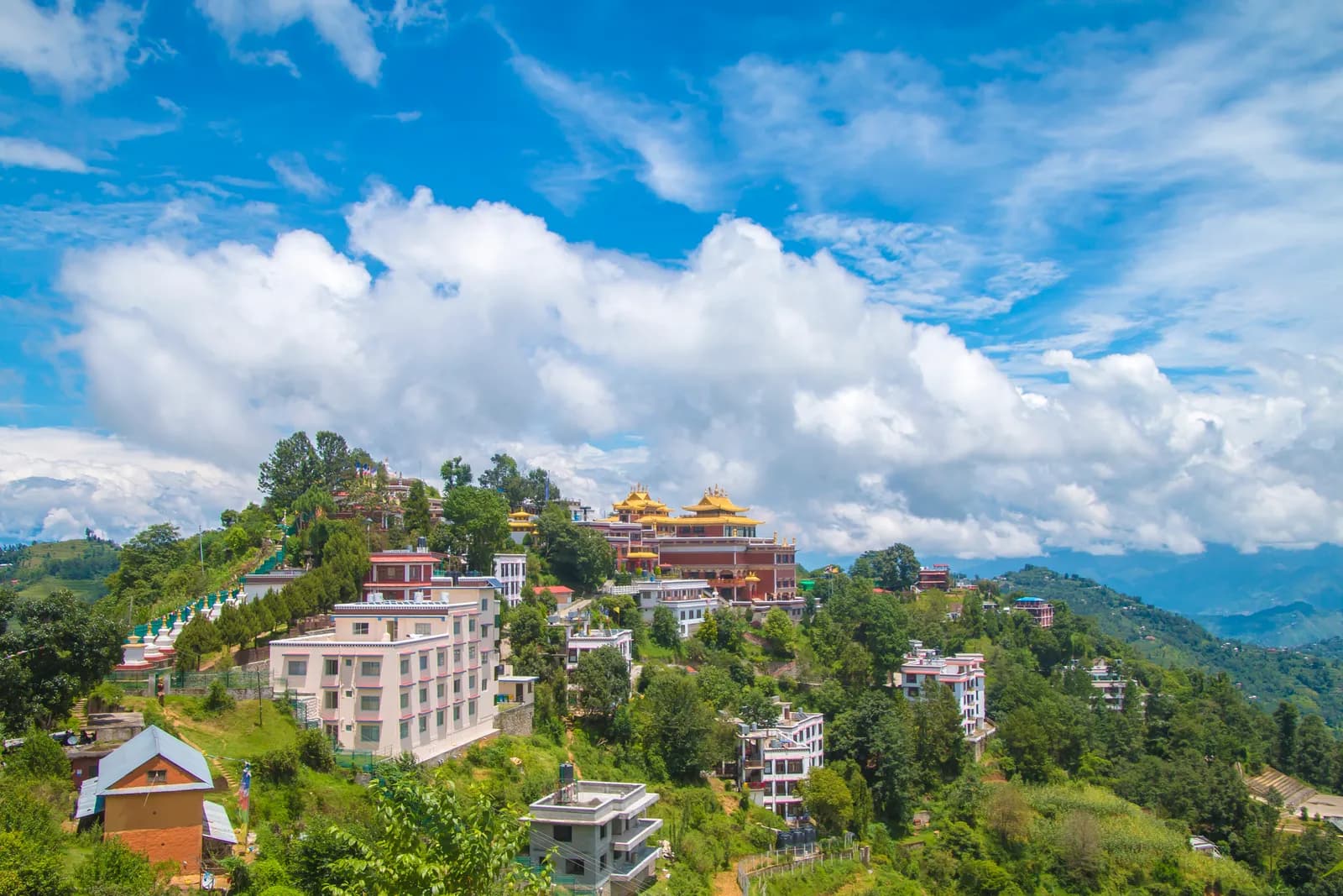
Namo Buddha Day Hike
A one-day walk from Dhulikhel through terraced farmland and forest to the Namo Buddha monastery hill (about 1,750 m) and down to the Newar town of Panauti, 19.4 km on our map.
- 일수1
- 최고 고도1,750 m
- 거리18.8 km
- 상승 고도547 m
- 난이도쉬움
- 최적 시기Mar–May, Sep–Nov
사진: Rukeshmdr12 · CC BY-SA 4.0
영어로 표시됨 — 아직 번역되지 않았습니다.
이 일정은 초안이며 아직 확인되지 않았습니다. 구간은 항상 가이드와 확인하세요.
Written by FindTrekkingPartner team검토: FindTrekkingPartner team검토 방식FindTrekkingPartner
Namo Buddha Day Hike은(는) 네팔 Kathmandu Valley 지역의 1일 일정 트레킹으로, 최고 1,750 m까지 오릅니다. 외국인 트레커는 FindTrekkingPartner에 날짜, 예산, 페이스를 적어 트립을 올리면 이 트레킹의 파트너를 찾을 수 있습니다. 매칭은 두 트레커가 모두 동의하기 전까지 비공개로 유지되며, 서비스는 무료입니다. 중간 요금 기준으로 공인 가이드 비용은 트레커 4명이 함께할 때 1일 동안 1인당 약 USD 9, 혼자일 때는 USD 37입니다. 최적의 시즌은 Oct–Nov, Mar–Apr입니다. 이와 같은 개방 루트에서는 공인 가이드가 의무가 아닙니다(2026년 10월 19일 확인). 쿰부 지자체는 2023년 4월 네팔관광청 규정에서 빠졌고 당일 하이킹에는 가이드가 필요 없지만, 그래도 가이드 동행을 강력히 권장하므로 여행사에 확인하세요. 이 루트의 모집 중인 트립은 출발 월, 그룹 규모, 남은 자리와 함께 아래에 나와 있습니다. 최종 확인일: 2026년 10월 19일. 출처: 네팔관광청, DNPWC, 출입국관리국.
출처:Department of Immigration, NepalNepal Tourism BoardDepartment of National Parks and Wildlife Conservation
Namo Buddha Day Hike 파트너 찾기
- Namo Buddha Day Hike 파트너 찾기아직 모집 중인 트립이 없습니다
- Shivapuri Peak Day Hike 파트너 찾기아직 모집 중인 트립이 없습니다
- Nagarkot to Changu Narayan Day Hike 파트너 찾기아직 모집 중인 트립이 없습니다
- Chisapani Nagarkot Trek 파트너 찾기아직 모집 중인 트립이 없습니다
- Champadevi Day Hike 파트너 찾기아직 모집 중인 트립이 없습니다
- Phulchowki Day Hike 파트너 찾기아직 모집 중인 트립이 없습니다
개요
출발지: Dhulikhel1일 · 최고 1,750 m
최적 시즌: Mar–May, Sep–Nov
The Namo Buddha hike is a one-day walk from Dhulikhel, on the eastern rim of the Kathmandu Valley, through terraced farmland and forest to the Namo Buddha monastery hill, then downhill to the old Newar town of Panauti. On our map the walk is about 19.4 km with 610 m of climbing and 720 m of descent, partly on quiet roads. Operators allow five to six hours including rests, and one guide gives about two and a half hours from Dhulikhel to Namo Buddha and another two and a half to Panauti, a total of 14 to 16 km. We say allow six to seven hours, because our mapped route is longer. The highest point is about 1,750 m. A taxi from Kathmandu to Dhulikhel takes about an hour. None of our sources lists a permit.
The plan follows an operator itinerary and a day-trip guide that agree on the order, Dhulikhel to Namo Buddha to Panauti, and on the lunch stop at the monastery hill. Our map follows roads and tracks because OpenStreetMap has few footpaths here, so it is longer than the guide's 14 to 16 km.
What the hike is like
The trail leaves Dhulikhel through villages and terraced fields, with patches of forest, and climbs gently to Namo Buddha, where Thrangu Tashi Yangtse monastery stands with golden roofs above a stupa. According to Wikipedia, the site recalls a past life of the Buddha who gave his body to save a tigress and her cubs. A stairway through the woods links the stupa to the legend site. After lunch the way drops towards Panauti, an ancient Newari town.
Permits and rules
None of our sources lists a permit or park fee. Monuments and monasteries may charge small entrance fees; operator pages include them in their price without giving amounts. Remove shoes before entering temples and dress modestly.
Best season
Spring (March to May) and autumn (September to November) are the most popular, according to an operator, and winter and monsoon walks are possible.
Getting there and away
Dhulikhel is about an hour by taxi from Kathmandu, or an operator transfer of about 1.5 hours. Local buses run from Ratna Park to Dhulikhel. From Panauti local buses also run from Ratna Park with changes involved, and a taxi is simpler.
Difficulty and fitness
The walk is easy to moderate: 610 m of climbing spread over most of a day. Carry water and a packed lunch, and start by 8 am to reach Panauti before dark.
Budget notes
There is no permit fee. Pay for a taxi or bus to Dhulikhel and a taxi from Panauti, plus lunch. The costs section shows the taxis as lines to check.
하이라이트
- Namo Buddha, a Buddhist pilgrimage site above terraced fields
- Thrangu Tashi Yangtse monastery with its golden roofs
- Terraces, villages and forest between Dhulikhel and Panauti
- Panauti, an old Newar town at the end of the walk
- Mostly gentle going with little altitude gain
루트 지도
OpenStreetMap의 루트 데이터이며 아직 저희 팀이 확인하지 않았습니다. 계획용으로만 사용하고 길 안내용으로는 사용하지 마세요.
일별 일정
비용
1인당 예상 총비용: 고도별 롯지와 식사, 교통, 퍼밋, 가이드와 포터. 가이드와 포터를 나누는 트레커가 많을수록 1인당 부담이 줄어듭니다. 2026년 10월 기준.
| 스타일 | 트레커 1명 분담 | 트레커 2명 분담 | 트레커 4명 분담 |
|---|---|---|---|
| 저예산 | — | — | — |
| 중간 | US$40–US$80* | US$20–US$40* | US$10–US$30* |
| 편안함 | US$40–US$80* | US$30–US$50* | US$20–US$40* |
가이드를 나누고 비용 절약
중간형 기준으로 혼자 트레킹하면 약 US$40–US$80, 트레커 4명이 가이드 1명과 포터 2명을 나누면 1인당 약 US$10–US$30입니다 (범위 상단 기준 66% 절감).
2명 분담 시 내역
| 항목 | 저예산 | 중간 | 편안함 |
|---|---|---|---|
| 가이드 | — | US$10–US$30 | US$10–US$30 |
| 포터 | — | US$0–US$20 | US$10–US$30 |
예산형은 대중교통을 이용하고 포터가 없습니다. 중간형은 트레커 두 명이 포터 한 명을 나누고 전용 차량을 씁니다. 편안형은 트레커마다 포터가 한 명씩 있습니다. 가이드는 필수이거나 스타일이 중간형 또는 편안형인 경우에 포함됩니다.
포함되지 않음
공개된 가격을 찾지 못한 항목: Kathmandu to Dhulikhel by taxi; Panauti to Kathmandu by taxi. *로 표시된 총액에는 이 항목이 빠져 있으니 에이전시에 문의하세요. A day hike: no lodging and no permit. A guide is optional.
비용 출처
- PriceNepal: Nepal Travel Cost Guide 2026 (2026-05-14)
- Third Rock Adventures: Nepal trek budget planner (2026-05-09)
- Himalayan Partner: Guide and porter price in Nepal 2026 (2026-02-10)
- Shikhar Adventure: Annapurna Circuit trek cost (2026-02-03)
- Nepal Tourism Board: Trekking Permit (2026-10-18)
운영사 가이드를 바탕으로 한 추정치이며 견적이 아닙니다. 팁, 보험, 장비, 카트만두 호텔은 포함되지 않으며 USD는 플랫폼 환율을 적용했습니다.
사진
자주 묻는 질문
Operators allow five to six hours including rests. One guide gives about 2.5 hours from Dhulikhel to Namo Buddha and another 2.5 to Panauti, 14 to 16 km. Our mapped route is 19.4 km, so allow six to seven hours.
An operator gives a maximum height of about 1,750 m for the hike.
None of our sources lists a permit or park fee. Operator prices include small monument entrance fees without naming amounts.
Our plan and the operator itinerary go from Dhulikhel to Namo Buddha for lunch and then downhill to Panauti, which keeps the climbing gentle.
Take a taxi from Panauti, about an hour, which a day-trip guide calls simpler than local buses that involve changes.
출처
트레일 주변
루트의 매일마다 있는 숙소, 의료 지원, 식수, 볼거리입니다.
1. Dhulikhel → Panauti
- Dhulikhel Hospital · 의료 · 1,523 m
- Dhulikhel Clinic Center · 의료 · 1,501 m
- Pond · 실용 정보 · 1,549 m
- Water Tank · 실용 정보 · 1,658 m
- Bhimsensthan Viewpoint · 전망대 · 1,546 m
- V-sign Guest House · 숙소 · 1,449 m
- Maneshwori Mo:Mo · 숙소 · 1,447 m
- Namaste Samudai Home Stay · 숙소 · 1,450 m
Show all 53 places
- R.K Pharmacy · 의료 · 1,525 m
- Achutan Pharmacy · 의료 · 1,524 m
- Balaram Pharmacy · 의료 · 1,525 m
- Dhulikhel Hospital · 의료 · 1,523 m
- Dhulikhel Clinic Center · 의료 · 1,501 m
- Ku Helipad · 공항 및 교통 · 1,470 m
- Pediatrics and Gyn/Obs · 의료 · 1,510 m
- Pond · 실용 정보 · 1,549 m
- Love Bird · 숙소 · 1,550 m
- Dada Pari Lama Hotel · 숙소 · 1,555 m
- Sanu Khaja Ghar · 숙소 · 1,556 m
- Star Momo · 숙소 · 1,556 m
- Sanjibani Newari Khaja Ghar · 숙소 · 1,558 m
- Timal Hotel · 숙소 · 1,558 m
- Bishal Hotel · 숙소 · 1,558 m
- Mama ko hotel · 숙소 · 1,558 m
- Roshi bhojanalaye · 숙소 · 1,557 m
- Sanjibani · 숙소 · 1,559 m
- Krishna bhojanayala · 숙소 · 1,559 m
- Water Tank · 실용 정보 · 1,658 m
- Drinking Water · 실용 정보 · 1,536 m
- Bhimsensthan Viewpoint · 전망대 · 1,546 m
- Hotel Green Peace Lodge And Resort · 숙소 · 1,547 m
- Pancha tamang hotel · 숙소 · 1,703 m
- Aahana Pharmacy · 의료 · 1,667 m
- Ram Gopal Baidya Medical Centre · 의료 · 1,640 m
- Sornim Phamacy · 의료 · 1,640 m
- Kulung hotel · 숙소 · 1,704 m
- Namobuddha Hotel And Lodge · 숙소 · 1,707 m
- Thrangu Phende Clinic · 의료 · 1,721 m
- Stupa view point · 전망대 · 1,760 m
- Viewpoint · 전망대 · 1,757 m
- Namobuddha Motel · 숙소 · 1,672 m
- Sankhu Homestay · 숙소 · 1,514 m
- Pariwar Syasthya Clinic · 의료 · 1,454 m
- Prathamik Swasthya Kendra, Sunthan · 의료 · 1,499 m
- Panauti Hospital · 의료 · 1,453 m
- Rebika Pharmacy · 의료 · 1,454 m
- Krishnamohan Pharmacy · 의료 · 1,454 m
- Samudayik ATM · 실용 정보 · 1,450 m
- V-sign Guest House · 숙소 · 1,449 m
- Machhe Pharmacy · 의료 · 1,449 m
- Maneshwori Mo:Mo · 숙소 · 1,447 m
- Bhairab Hospital · 의료 · 1,450 m
- Prakash Drug House · 의료 · 1,447 m
- Karmacharya Pharma · 의료 · 1,450 m
- SomSarobar Medical Hall · 의료 · 1,447 m
- Rehab Center · 의료 · 1,471 m
- Red Cross · 의료 · 1,457 m
- Panauti Public Health Post · 의료 · 1,452 m
- Namaste Samudai Home Stay · 숙소 · 1,450 m
- Tap (Dhunge Dharo) · 실용 정보 · 1,452 m
- Gita devi ozone mart · 의료 · 1,444 m