

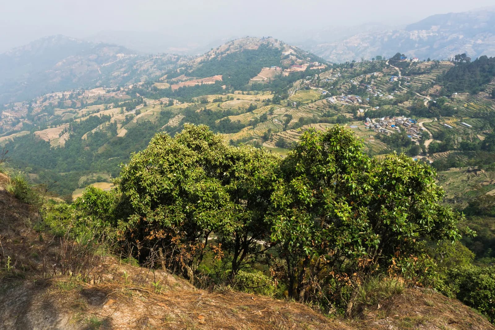
Drive from Kathmandu to Nagarkot, about 1.5 hours, ideally for sunrise, and have tea before you start. The trail leaves the ridge and descends through pine and rhododendron forest and terraced fields, passing Tamang and Newar villages. About two and a half hours on, you reach Telkot, the midway rest stop, where you can visit a small monastery. The way continues downhill with a few gentle ascents to Changu Narayan, a hilltop temple on the UNESCO World Heritage list, where lunch and sightseeing end the day. On our map it is 11.7 km with 150 m of climbing and 535 m of descent, mostly on village roads and tracks. A vehicle back to Kathmandu takes about an hour.
Nagarkot to Changu Narayan Day Hike
A one-day downhill walk from the ridge village of Nagarkot through Telkot and Newar and Tamang villages to Changu Narayan temple, 11.7 km on our map, mostly downhill.
- 일수1
- 최고 고도2,175 m
- 거리11.7 km
- 상승 고도149 m
- 난이도쉬움
- 최적 시기Mar–May, Oct–Nov
사진: Alexey Komarov · CC BY-SA 4.0
영어로 표시됨 — 아직 번역되지 않았습니다.
이 일정은 초안이며 아직 확인되지 않았습니다. 구간은 항상 가이드와 확인하세요.
Written by FindTrekkingPartner team검토: FindTrekkingPartner team검토 방식FindTrekkingPartner
Nagarkot to Changu Narayan Day Hike은(는) 네팔 Kathmandu Valley 지역의 1일 일정 트레킹으로, 최고 2,175 m까지 오릅니다. 외국인 트레커는 FindTrekkingPartner에 날짜, 예산, 페이스를 적어 트립을 올리면 이 트레킹의 파트너를 찾을 수 있습니다. 매칭은 두 트레커가 모두 동의하기 전까지 비공개로 유지되며, 서비스는 무료입니다. 중간 요금 기준으로 공인 가이드 비용은 트레커 4명이 함께할 때 1일 동안 1인당 약 USD 9, 혼자일 때는 USD 37입니다. 최적의 시즌은 Oct–Nov, Mar–Apr입니다. 이와 같은 개방 루트에서는 공인 가이드가 의무가 아닙니다(2026년 10월 19일 확인). 쿰부 지자체는 2023년 4월 네팔관광청 규정에서 빠졌고 당일 하이킹에는 가이드가 필요 없지만, 그래도 가이드 동행을 강력히 권장하므로 여행사에 확인하세요. 이 루트의 모집 중인 트립은 출발 월, 그룹 규모, 남은 자리와 함께 아래에 나와 있습니다. 최종 확인일: 2026년 10월 19일. 출처: 네팔관광청, DNPWC, 출입국관리국.
출처:Department of Immigration, NepalNepal Tourism BoardDepartment of National Parks and Wildlife Conservation
Nagarkot to Changu Narayan Day Hike 파트너 찾기
- Nagarkot to Changu Narayan Day Hike 파트너 찾기아직 모집 중인 트립이 없습니다
- Shivapuri Peak Day Hike 파트너 찾기아직 모집 중인 트립이 없습니다
- Chisapani Nagarkot Trek 파트너 찾기아직 모집 중인 트립이 없습니다
- Champadevi Day Hike 파트너 찾기아직 모집 중인 트립이 없습니다
- Phulchowki Day Hike 파트너 찾기아직 모집 중인 트립이 없습니다
- Namo Buddha Day Hike 파트너 찾기아직 모집 중인 트립이 없습니다
개요
출발지: Nagarkot1일 · 최고 2,175 m
최적 시즌: Mar–May, Oct–Nov
The Nagarkot to Changu Narayan hike is a one-day downhill walk from the ridge village of Nagarkot, about 2,150 m, through Telkot and a string of Tamang and Newar villages to the temple hill of Changu Narayan. On our map the walk is about 11.7 km with 150 m of climbing and 535 m of descent, on village roads, tracks and forest paths. Operators give about 14 km and four to five hours, with a rest stop at Telkot, so our shorter map line looks a little brisk. You drive about 1.5 hours from Kathmandu to Nagarkot, ideally in time for the sunrise view, and take about an hour back from Changu Narayan, or a short bus ride to Bhaktapur. The Nagarkot viewpoint and the Changu Narayan temple charge entrance fees. Carry water and lunch.
The plan follows two operator itineraries that agree on Nagarkot, Telkot and the temple, and on the timing of about four and a half hours with a break. Heights differ: sources give Nagarkot at 2,100 to 2,195 m, and Wikivoyage gives 2,163 m. The same descent is the last day of our Chisapani Nagarkot trek.
What the hike is like
The trail leaves Nagarkot's ridge and descends through pine and rhododendron forest and terraced fields, passing small Tamang and Newar villages. Telkot is the midway rest stop, with an optional monastery visit. The path is wide and easy as long as you wear hiking shoes, with a few gentle ascents. Changu Narayan sits on a hilltop. According to Wikipedia it was listed as a UNESCO World Heritage Site in 1979 and stands about 12 km east of Kathmandu, and a pillar there dates to 464 AD.
Permits and rules
None of our sources lists a park permit for this route. Two entrance fees apply: the Nagarkot viewpoint and the Changu Narayan temple, which operators include in their prices without giving amounts. Dress modestly at the temple and keep to the marked path.
Best season
October to November and March to May, according to operators, who also say it can be walked all year. Autumn and spring have the clearest mountain views; Nagarkot sunrise views are best before cloud builds.
Getting there and away
A taxi from Kathmandu to Nagarkot costs NPR 2,000 to 3,000 one way and takes 1.5 to 2 hours, according to Wikivoyage. Public buses via Bhaktapur cost under NPR 100 and take about two hours. From Changu Narayan a private vehicle takes about one hour to Kathmandu, or a short bus ride reaches Bhaktapur.
Difficulty and fitness
The route is easy: it descends 535 m over 11.7 km, on wide paths and quiet roads. Wear shoes with grip, carry two litres of water, and start by 9 am.
Budget notes
The main cost is the taxi to Nagarkot, NPR 2,000 to 3,000 one way, plus the two entrance fees and lunch. The return from Changu Narayan is shown as a line to check.
하이라이트
- Nagarkot at about 2,150 m, a classic Himalayan viewpoint
- Telkot, the midway rest stop, with an optional monastery visit
- Pine and rhododendron forest, terraced fields and Tamang and Newar villages
- Changu Narayan, a hilltop temple and UNESCO World Heritage Site
- Mostly downhill, so easy on the legs
루트 지도
OpenStreetMap의 루트 데이터이며 아직 저희 팀이 확인하지 않았습니다. 계획용으로만 사용하고 길 안내용으로는 사용하지 마세요.
일별 일정
비용
1인당 예상 총비용: 고도별 롯지와 식사, 교통, 퍼밋, 가이드와 포터. 가이드와 포터를 나누는 트레커가 많을수록 1인당 부담이 줄어듭니다. 2026년 10월 기준.
| 스타일 | 트레커 1명 분담 | 트레커 2명 분담 | 트레커 4명 분담 |
|---|---|---|---|
| 저예산 | US$10–US$30* | US$0–US$20* | US$0–US$10* |
| 중간 | US$60–US$100* | US$30–US$50* | US$10–US$30* |
| 편안함 | US$60–US$100* | US$30–US$60* | US$20–US$50* |
가이드를 나누고 비용 절약
중간형 기준으로 혼자 트레킹하면 약 US$60–US$100, 트레커 4명이 가이드 1명과 포터 2명을 나누면 1인당 약 US$10–US$30입니다 (범위 상단 기준 68% 절감).
2명 분담 시 내역
| 항목 | 저예산 | 중간 | 편안함 |
|---|---|---|---|
| 교통 | US$0–US$20 | US$0–US$20 | US$0–US$20 |
| 가이드 | — | US$10–US$30 | US$10–US$30 |
| 포터 | — | US$0–US$20 | US$10–US$30 |
예산형은 대중교통을 이용하고 포터가 없습니다. 중간형은 트레커 두 명이 포터 한 명을 나누고 전용 차량을 씁니다. 편안형은 트레커마다 포터가 한 명씩 있습니다. 가이드는 필수이거나 스타일이 중간형 또는 편안형인 경우에 포함됩니다.
포함되지 않음
공개된 가격을 찾지 못한 항목: Changu Narayan to Kathmandu by taxi. *로 표시된 총액에는 이 항목이 빠져 있으니 에이전시에 문의하세요. A day hike: no lodging and no permit; viewpoint and temple entrance fees apply but no amounts are published in our sources.
비용 출처
- PriceNepal: Nepal Travel Cost Guide 2026 (2026-05-14)
- Third Rock Adventures: Nepal trek budget planner (2026-05-09)
- Himalayan Partner: Guide and porter price in Nepal 2026 (2026-02-10)
- Shikhar Adventure: Annapurna Circuit trek cost (2026-02-03)
- Nepal Tourism Board: Trekking Permit (2026-10-18)
운영사 가이드를 바탕으로 한 추정치이며 견적이 아닙니다. 팁, 보험, 장비, 카트만두 호텔은 포함되지 않으며 USD는 플랫폼 환율을 적용했습니다.
사진
자주 묻는 질문
Operators give four to five hours and about 14 km. Our map shows 11.7 km with 150 m of climbing and 535 m of descent.
Mostly. Operators describe it as relatively easy downhill with a few gentle ascents, from about 2,150 m at Nagarkot down to the temple hill.
Wikivoyage gives NPR 2,000 to 3,000 one way, taking 1.5 to 2 hours. Public buses via Bhaktapur cost under NPR 100 and take about two hours.
None of our sources lists a park permit. The Nagarkot viewpoint and Changu Narayan temple charge entrance fees; operators include them without giving the amounts.
Yes. Operators drive from Kathmandu about 1.5 hours to Nagarkot for tea and the view before starting the walk.
출처
트레일 주변
루트의 매일마다 있는 숙소, 의료 지원, 식수, 볼거리입니다.
1. Nagarkot → Changu Narayan
- Club Himalaya · 숙소 · 1,924 m
- Viewpoint · 전망대 · 1,662 m
- Narayan Hiti · 실용 정보 · 1,467 m
- Chayanath health care · 의료 · 1,334 m
- Infirmary · 의료 · 1,335 m
- The Nest Guest Gouse · 숙소 · 1,509 m
- Drinking Water · 실용 정보 · 1,538 m
- Gam Dhoka Park · 전망대 · 1,507 m
Show all 25 places
- Club Himalaya · 숙소 · 1,924 m
- Himalayan guest house · 숙소 · 1,910 m
- Hotel Nagarkot Peak · 숙소 · 1,904 m
- Hotel Nagarkot Holiday Inn · 숙소 · 1,907 m
- Hotel Himalayan heart · 숙소 · 1,904 m
- Hotel Himalyan heart · 숙소 · 1,903 m
- Hotel Sakura Durbar · 숙소 · 1,903 m
- Nagarkot Food Home · 숙소 · 1,910 m
- Langtang View Nagarkot Bed & Breakfast · 숙소 · 1,917 m
- Hotel Panaroma Inn Restaurant & Bar · 숙소 · 1,906 m
- Panaroma inn · 숙소 · 1,905 m
- Silver Mountain · 숙소 · 1,903 m
- Gaurisankhar · 숙소 · 1,904 m
- Sister’s homestay · 숙소 · 1,780 m
- Hotel Sunrise · 숙소 · 1,790 m
- Viewpoint · 전망대 · 1,662 m
- Nagarkot Waterfall · 자연 · 1,513 m
- Hotel Rudrakshya · 숙소 · 1,632 m
- Muskan Pharma · 의료 · 1,371 m
- Narayan Hiti · 실용 정보 · 1,467 m
- Drinking Water · 실용 정보 · 1,538 m
- Gam Dhoka Park · 전망대 · 1,507 m
- Chayanath health care · 의료 · 1,334 m
- Infirmary · 의료 · 1,335 m
- The Nest Guest Gouse · 숙소 · 1,509 m