

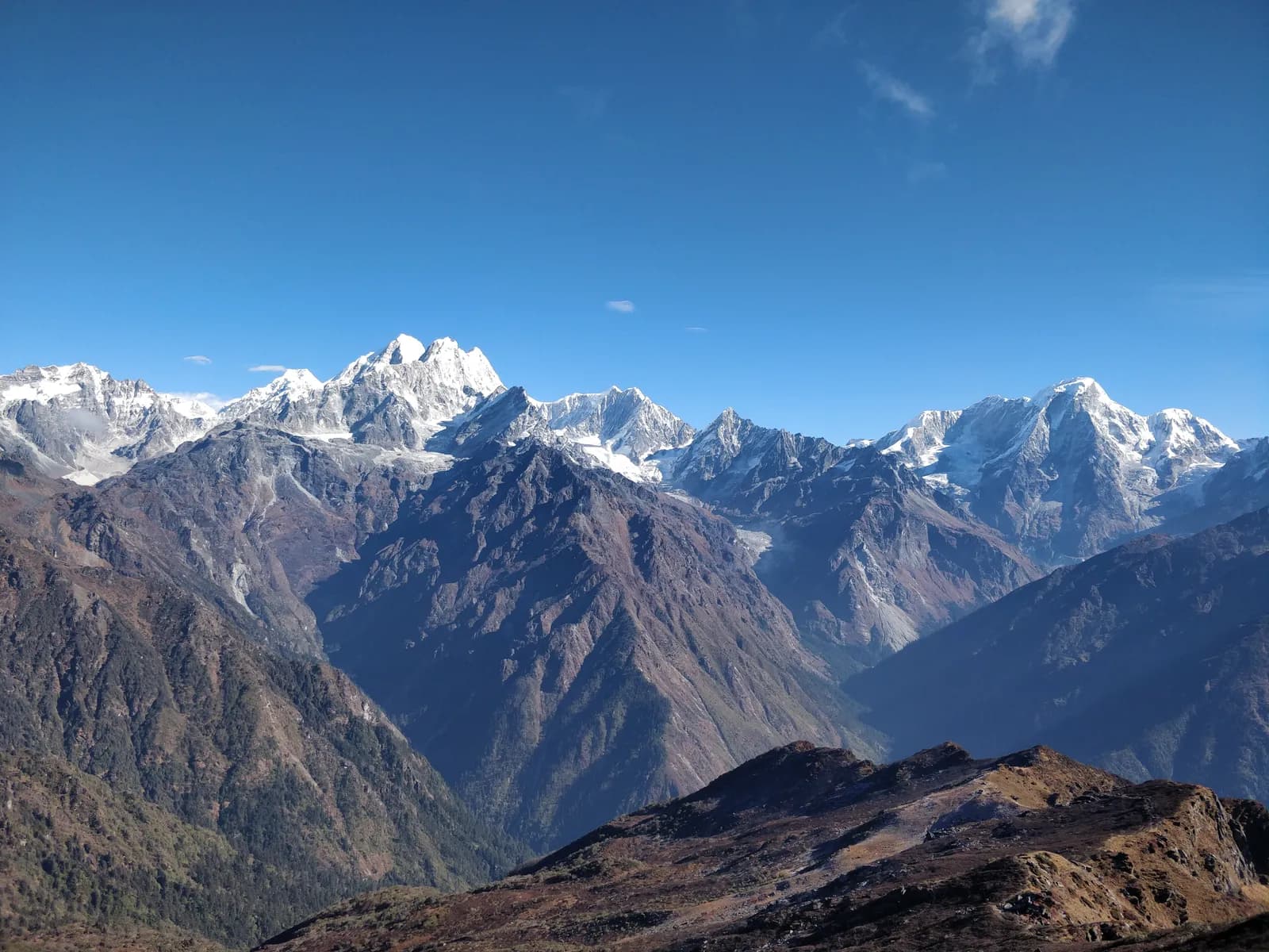
Jugal Himal
Jugal Himal is the snow range north-east of Kathmandu in Sindhupalchok, known for the Panch Pokhari trek to five alpine lakes at about 4,100 m, reached from Chhimti or Chautara with no restricted-area permit.
- 최고 고도Panch Pokhari (about 4,100 m)
- 일수5–16
- 난이도보통–어려움
- 최적 시기Mar–May, Oct–Nov
- 퍼밋퍼밋 1개
사진: Milan Paudyal · CC BY-SA 4.0
Check that your policy covers helicopter evacuation and trekking at this region's altitude. We don't sell insurance.
What to look forWritten by FindTrekkingPartner team검토: FindTrekkingPartner team검토 방식FindTrekkingPartner
Jugal Himal은(는) 네팔의 트레킹 지역으로, 5일 일정의 루트가 있고 최고 4,100 m까지 오릅니다. 외국인 트레커는 FindTrekkingPartner에 날짜, 예산, 페이스를 적어 트립을 올리면 이곳 트레킹의 파트너를 찾을 수 있습니다. 매칭은 두 트레커가 모두 동의하기 전까지 비공개로 유지되며, 서비스는 무료입니다. 중간 요금 기준으로 공인 가이드 비용은 트레커 4명이 함께할 때 5일 동안 1인당 약 USD 47, 혼자일 때는 USD 187입니다. 최적의 시즌은 Mar–May, Oct–Nov입니다. 이곳에서는 사실상 공인 가이드가 필요합니다. 2026년 운영업체들의 보고에 따르면 2023년 4월 네팔관광청 규정이 국립공원과 보전지역 검문소에서 시행되고 있으며, 랑탕이 가장 엄격하고 안나푸르나도 확인합니다(2026년 10월 19일 확인). 등록된 여행사를 통해 가이드를 고용하고 여행사에 확인하세요. 이 루트의 모집 중인 트립은 출발 월, 그룹 규모, 남은 자리와 함께 아래에 나와 있습니다. 최종 확인일: 2026년 10월 19일. 출처: 네팔관광청, DNPWC, 출입국관리국.
출처:Department of Immigration, NepalNepal Tourism BoardDepartment of National Parks and Wildlife Conservation
- Panch Pokhari Trek 파트너 찾기모집 중인 트립 3개
개요
- 공인 가이드
- 외국인 트레커 필수
- 최소 인원
- 트레커 1명
NTB rule (Apr 2023), enforced at checkpoints in national parks and conservation areas (2026 operator reports; checked 19 October 2026). Jugal Himal is not a restricted area and no restricted-area rule applies. The trails above Tuppi Danda are lightly marked and some sections have no villages, so most trekkers go with an agency. Ask your agency whether a park or local fee applies near Panch Pokhari.
인기 트레킹
출발지
Kathmandu, Melamchi, Chhimti, Chautara
가는 방법
Drive Kathmandu to Chhimti through Melamchi (about 5 to 6 hours) for the short Panch Pokhari route, or to Chautara (about 5 hours) for the longer plans. Buses and shared jeeps serve Melamchi and Chautara; the last stretch to Chhimti is by local jeep or on foot. Landslides can close roads in the monsoon.
Jugal Himal is the snow range that rises north-east of Kathmandu on the Tibet border, and its best-known walk is the Panch Pokhari trek to five alpine lakes at about 4,100 m in Sindhupalchok District. The range sits between Langtang Himal and the Rolwaling and Gaurishankar country, and its peaks include Dorje Lakpa, Phurbi Chyachu and Madiya. The lakes are reached on a short four to five day walk from the road at Chhimti, which is five to six hours by road from Kathmandu through Melamchi, or on a longer route that starts at Chautara. There is no restricted-area permit, the trails are quiet, lodging is basic and sometimes absent, and the lakes are crowded only around the Janai Purnima festival in August. The best months are March to May and October to November, and the walk suits fit trekkers who are comfortable at 4,000 m.
Where the Jugal Himal region is
The Jugal Himal lies in Sindhupalchok District of Bagmati Province, a district of 2,542 square kilometres whose headquarters, Chautara, sits at about 1,450 m on a ridge above the Indrawati river. The range runs along the Nepal–Tibet border north-east of the Langtang valley and is a separate massif from the Langtang range itself, although the two are often grouped on trekking maps because they share the same road network out of Kathmandu. From Kathmandu's northern ring road the peaks of the Jugal Himal are visible on a clear morning, and Dorje Lakpa, with its steep pyramid, is one of the shapes that people pick out from Nagarkot.
Wikipedia lists the main summits as Dorje Lakpa, Phurbi Chyachu, Gurkarpo Ri and Loenpo Gang, the last at 6,979 m on the border. Heights vary by a few tens of metres between sources, so treat any single figure as approximate. The area south of the peaks is steep forested hill country cut by the Melamchi, Indrawati and Sun Koshi valleys. Villages sit on the shoulders between them, at 1,500 to 2,500 m, with terraces of maize, millet and potato below the forest line.
Landscape, lakes and wildlife
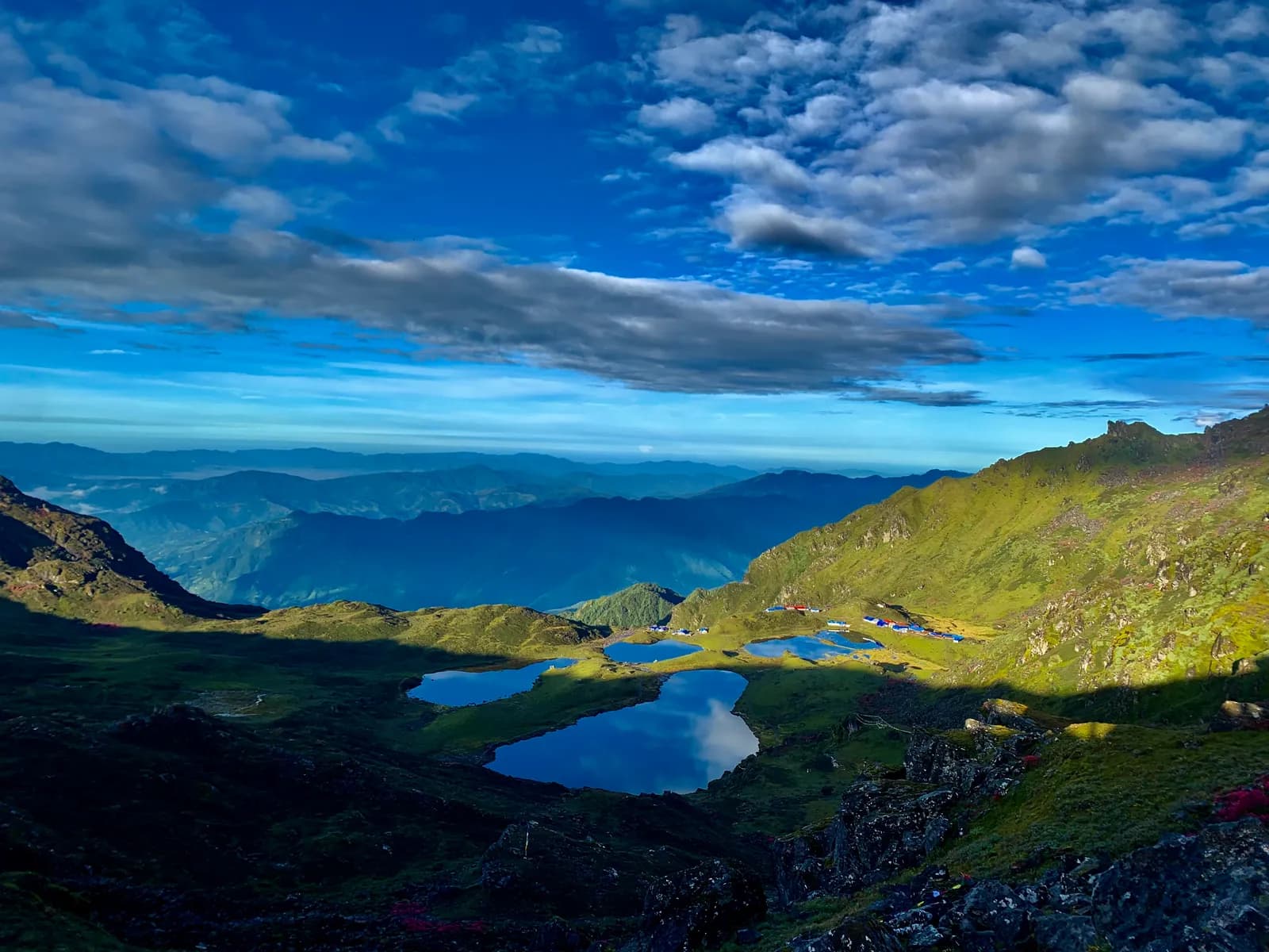
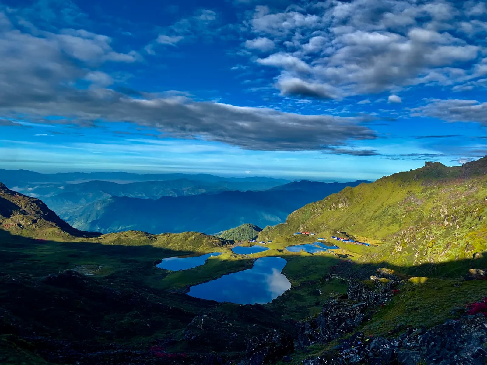
The trek to Panch Pokhari is a climb from river valley to open alpine ground in only a few days. The lower slopes are broad-leaved forest with oak and rhododendron, and above about 3,000 m the trail enters rhododendron and conifer forest, then scrub and grass. The route from Chhimti passes a ridge at Chokkardada, about 3,100 m by the Nepal Traveller account, before reaching the hotel at Nesyampati, which operators place at about 3,700 m. Beyond that the ground opens into rock, tussock grass and, in early summer, patches of snow.
Panch Pokhari itself is a cluster of five lakes, whose name means five ponds. Wikipedia gives their height as about 4,100 m and notes that the lakes are a high-altitude wetland that drains into the Indrawati river. The surrounding ridge gives views of Dorje Lakpa and Phurbi Chyachu. The Wikipedia article on the lakes adds that parts of the area fall within the extent of Langtang National Park, which was gazetted in 1976 as the country's first Himalayan national park and covers 1,710 square kilometres across Nuwakot, Rasuwa and Sindhupalchok. Because operators differ on whether a park fee is collected on this side, ask your agency.
Wikipedia describes Langtang National Park as holding 14 vegetation types in 18 ecosystem types, from subtropical forest to alpine scrub, and the same sequence of zones is packed into the climb from Chhimti to the lakes. Wildlife sightings are not a reason to choose this walk, but the quiet trails make birds and monkeys in the lower forest easier to notice than on the busier trekking routes.
People and culture
Sindhupalchok is mainly a Tamang district. At the 2021 census, Tamangs were 37 per cent of the population, Khas people made up 36 per cent and Newars 10 per cent, with small Sherpa, Thami and Hyolmo communities in the higher valleys. About 36 per cent of residents gave Tamang as their first language. In the villages on the way to the lakes you will see flat-roofed stone and timber houses, prayer-flag poles and mani walls, and in the lower hills the rope bridges and terraces of Tamang farming.
Panch Pokhari is a sacred place for both Hindus and Buddhists. Pilgrims climb to the lakes on Janai Purnima, the full-moon day of the month of Shrawan in August, to bathe and to change the sacred thread. On those days the trail and the lakeside hotels are full, and a quiet walk is not possible. If you want solitude, plan for spring or autumn, and avoid the full moon of August.
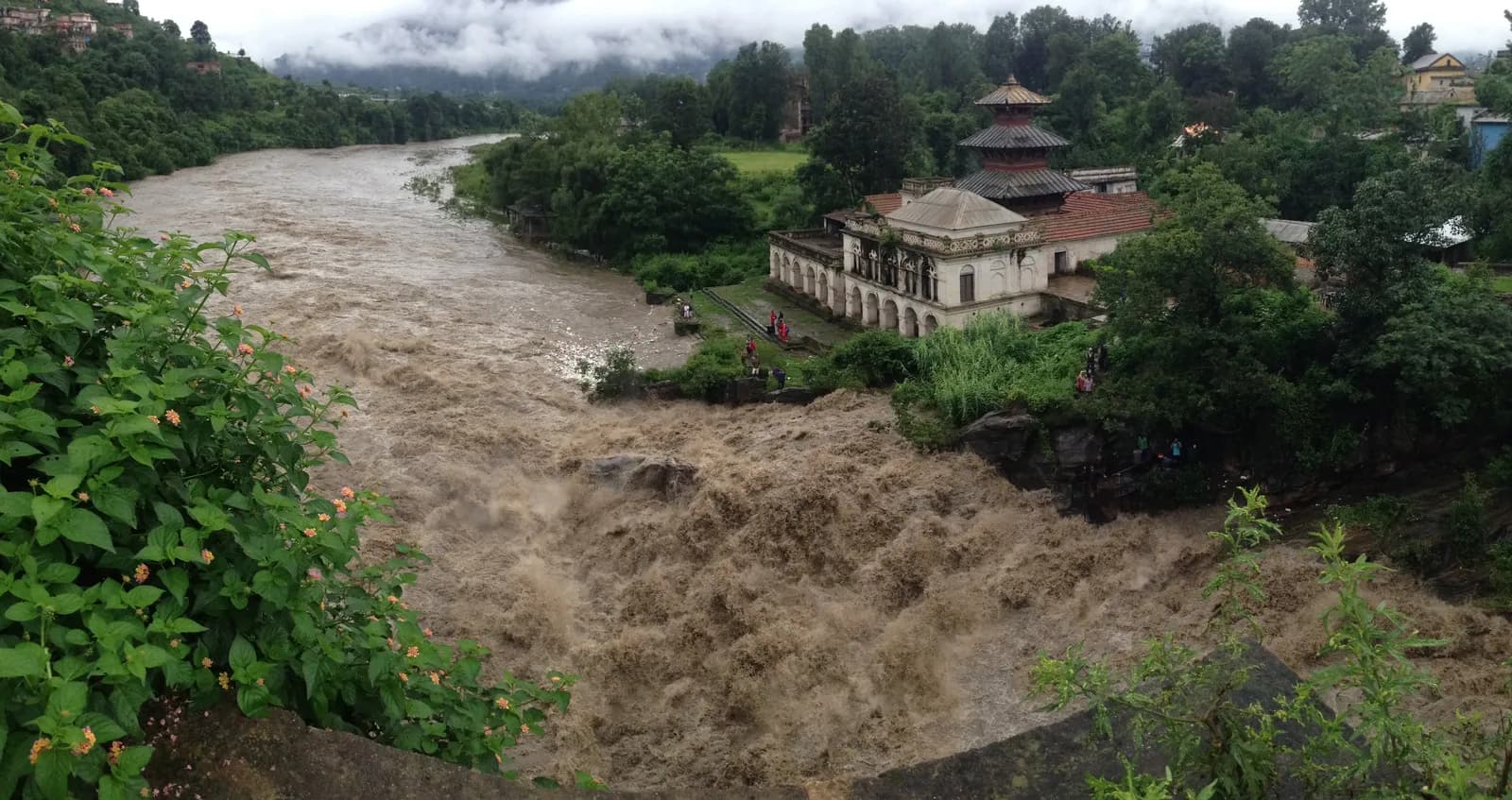
The Melamchi valley also carries recent history. Kathmandu's Melamchi water project diverts water from an intake at the Melamchi river, with a weir crest at about 1,425 m, through a tunnel of about 26 km to Sundarijal. Construction began in 1998 and the project was completed in April 2021. On the road to Chhimti you pass the works and the new roads built for them, which is why access is easier than the old trail descriptions suggest.
Getting there
The two usual road starts are Chhimti and Chautara. Chhimti is reached from Kathmandu through Melamchi in about five to six hours, depending on traffic at Jorpati and the state of the road, and is the start of the short route described by the Nepal Traveller guide. Chautara, the district headquarters, is a drive of about five hours along the Arniko Highway and a side road, and is the start of the longer routes of ten to sixteen days that operators sell, which pass Phusre, Kami Kharka, Pauwa Bas and Hile Bhanjyang before reaching Nesyampati.
Public buses leave Kathmandu for Melamchi and Chautara, and the last stretch to Chhimti is normally done by local jeep or on foot. Private jeep hire from Kathmandu is the easier choice when you travel with a group. Roads in this district are affected by landslides in the monsoon, so build a margin into the first and last day.
When to go
Spring from March to May and autumn from October to November are the stable seasons. In spring the rhododendron is in flower on the lower slopes, and in autumn the air is clear, so the views toward Dorje Lakpa are at their best. Winter, from December to February, is possible with proper equipment, since the upper ridge can hold snow and ice and the lakes can be frozen. Summer from June to August is wet; the trail is slippery and leeches are common in the lower forest, but a few people still walk it for the August festival.
Routes in the region
Panch Pokhari trek is the standard route. It drives from Kathmandu to Chhimti, climbs to the night stop at Tuppi Danda, continues to Nesyampati and the lakes, and returns the same way in five days. The route is out and back, with about 2,500 m of climbing spread over three days. See the Panch Pokhari trek page for the day-by-day plan, the map and the cost estimate.
Longer variants exist for trekkers who want a quieter approach. Operators sell fifteen and sixteen day plans from Chautara via Phusre, Kami Kharka, Pauwa Bas and Hile Bhanjyang to Nesyampati and the lakes, and then a descent through Tupi Danda and Dhap to Melamchi. They mention a ridge that can hold snow late in the season. These plans are camping treks for the most part, because villages are far apart, and you should arrange them through an agency that will carry food and tents.
Permits and rules
The Jugal Himal is not a restricted area. The Nepal Tourism Board's restricted-area list for 2026 names Upper Mustang, Upper Dolpa, Manaslu, Tsum, Nar Phu, Kanchenjunga, Humla, Dolakha, Sankhuwasabha, Rasuwa, Bajhang, Mugu and Darchula areas, but nothing in Sindhupalchok, so no special permit from the Department of Immigration is needed for a normal trek to the lakes.
Because the lakes may lie within the national-park area, some agencies include a park or local fee in their quote. We do not state a fee for Panch Pokhari because no official page we found lists one, and we show the TIMS card as a line to check. Carry your passport, and ask your agency to confirm in writing which permits it has arranged.
Lodging, food and costs
On the short route there are small lodges at Tuppi Danda, at Nesyampati and at the lakes. The Nepal Traveller guide names a homestay and lodge at Nesyampati and a hotel at the lakes. These are basic: a bed with blankets, dal bhat and noodles, and no heating beyond a stove in the dining room. Bring a warm sleeping bag, since nights at 3,700 m and 4,100 m are cold even in the main seasons. On longer routes, expect to camp. Operators note that some sections have no settlement at all.
The Nepal Traveller guide quotes a budget of NPR 7,000 to 10,000 per person including transport, meals and lodging for the short trek, which is far lower than the cost of the better-known regions. Our own cost table uses Nepal-wide price ranges for lodging and meals by altitude and adds a guide, a porter and transport, so budget for a guided trek separately from that independent figure.
Altitude and safety
The route climbs from about 1,900 m at Chhimti to 4,100 m in three days, then descends in two. The first night at Tuppi Danda, where the DEM puts the stop at about 2,900 m, and the second at Nesyampati, at about 3,700 m, are both high enough for mild symptoms in some people, and the gain from Nesyampati to the lakes is modest but steady. Walk slowly, drink plenty of water, and do not go on to the lakes if you have a headache that does not respond to rest. There is no clinic above Melamchi, so descend at the first sign of serious altitude illness.
The trail is steep and rocky near the top, and snow or ice on the ridge can make footing hard in winter and early spring. Weather turns fast above 3,500 m. Carry rain gear, gloves and a hat, and start early. Mobile coverage is patchy, and a guide with a local phone number is worth having.
Practical tips
- Book the first and last days with a margin, because road conditions between Melamchi and Chhimti change after rain.
- Carry water treatment, since streams run beside settlements and animals graze above them.
- Bring cash in small notes, because there are no machines above Melamchi.
- Hire a local guide who knows the ridge between Nesyampati and the lakes, especially in mist.
- Leave no waste at the lakes, which are a shrine as well as a destination.
Sources and how we checked them
The route plan is based on two Nepal Traveller articles on Panch Pokhari, which give the Chhimti start and the day timings, and on two operator itineraries that give the longer Chautara plan and the heights of Nesyampati and the lakes. District and park facts come from Wikipedia's articles on Sindhupalchok, Langtang National Park, Panch Pokhari and the Melamchi Water Supply Project, and the restricted-area list from the Nepal Tourism Board. Where operator heights disagree with the elevation model by more than about 150 m, we leave the height out of the itinerary and say so.
이 지역의 모든 루트
이곳에서 다루는 모든 표준 루트입니다. 루트를 눌러 일별 일정을 여세요.
루트 비교
길이, 고도, 난이도, 예상 비용으로 루트를 정렬해 나에게 맞는 루트를 찾으세요.
일수 ↑ 기준 정렬
| 루트 | |||||
|---|---|---|---|---|---|
| Panch Pokhari Trek | 5 | 4,100 m | 보통–어려움 | 33.2 km | NPR 21,000부터 |
비용은 추정치입니다. 해당 지역의 예산형 일일 요금에 일수를 곱한 값이며 항공권과 퍼밋은 제외입니다.
트레킹 최적 시기
강조 표시된 달이 권장 트레킹 시즌입니다. Mar–May · Oct–Nov
최적 시즌그 외 달
Live conditions
Notes entered by our team from the sources linked on each item. Conditions change quickly, so confirm with your guide or lodge before you set off.
Best seasons: Mar–May · Oct–Nov
Nothing recent on file. Check with your guide or lodge before you go.
퍼밋과 요금
요금은 1인 기준이며 국적 그룹에 따라 다릅니다.
| 퍼밋 | 외국인 | SAARC | 네팔인 |
|---|---|---|---|
TIMS card (trekking agency issued) | NPR 2,000 | NPR 1,000 | — |
- 구매처
Trekking agency / Nepal Tourism Board
일일 비용
티하우스 트레킹 기준 1인 1일 비용. 가이드와 포터는 그룹/포터 1명당 1일 기준입니다. 2026년 10월 기준.
| 스타일 | 1일 | 가이드 / 일 | 포터 / 일 | 예시 합계 |
|---|---|---|---|---|
| 저예산 | NPR 2,900–4,800 | NPR 5,000 | NPR 2,750 | NPR 13,400–21,000 |
| 중간 | NPR 4,100–6,500 | NPR 5,000 | NPR 2,750 | NPR 18,200–27,900 |
| 편안함 | NPR 5,500–8,400 | NPR 5,000 | NPR 2,750 | NPR 23,900–35,600 |
저예산: The Panch Pokhari trek drives from Kathmandu to Chhimti through Melamchi (5 to 6 hours); buses and shared jeeps serve Melamchi and local jeeps the last stretch. Nepal Traveller quotes NPR 7,000 to 10,000 per person for the short trek including transport, meals and lodging. No fare is published in our sources, so the road leg is shown as a line to check.
중간: The Panch Pokhari trek drives from Kathmandu to Chhimti through Melamchi (5 to 6 hours); buses and shared jeeps serve Melamchi and local jeeps the last stretch. Nepal Traveller quotes NPR 7,000 to 10,000 per person for the short trek including transport, meals and lodging. No fare is published in our sources, so the road leg is shown as a line to check.
편안함: The Panch Pokhari trek drives from Kathmandu to Chhimti through Melamchi (5 to 6 hours); buses and shared jeeps serve Melamchi and local jeeps the last stretch. Nepal Traveller quotes NPR 7,000 to 10,000 per person for the short trek including transport, meals and lodging. No fare is published in our sources, so the road leg is shown as a line to check.
규칙과 올바른 실천
가이드
- 모든 지역
Foreign trekkers must trek with a licensed guide in national parks and conservation areas (in force since April 2023). Enforcement varies by region, so verify the current rule before you go.
퍼밋
- 모든 지역
Carry your permits at all times; they are checked at several checkpoints along every route.
안전 & 고도
- 모든 지역
Buy travel insurance that covers helicopter rescue to at least 6,000 m.
- 모든 지역
Climb high, sleep low: above 3,000 m, avoid raising your sleeping altitude by more than about 500 m per day, and add rest days.
환경 보호
- 모든 지역
Carry out all non-burnable waste (batteries, plastic, wrappers) and use a refillable water bottle.
문화
- 모든 지역
Respect monasteries: walk clockwise around stupas and mani walls, and remove shoes where asked.
- 모든 지역
Ask before photographing people, especially at religious sites and ceremonies.
드론
- 모든 지역
No drones without prior permission from the relevant authority.
사진
자주 묻는 질문
In Sindhupalchok District of Bagmati Province, along the Tibet border north-east of the Langtang valley. Its peaks include Dorje Lakpa, Phurbi Chyachu and Loenpo Gang, and the trekking base is the Melamchi and Chautara area, a few hours by road from Kathmandu.
The Panch Pokhari trek, a five-day out-and-back walk from Chhimti to five alpine lakes at about 4,100 m. Longer plans of ten to sixteen days start at Chautara and pass Phusre, Kami Kharka and Hile Bhanjyang.
No. The Nepal Tourism Board's restricted-area list names no part of Sindhupalchok. Because the lakes lie near Langtang National Park, ask your agency whether it has arranged a park or local fee, as we found no official page that sets one.
March to May and October to November. Winter is possible with snow equipment, and August brings the Janai Purnima pilgrimage, when the lakes and their lodges are crowded.
Moderate to hard. You climb about 2,500 m in three days, sleep at about 3,700 m and 4,100 m and descend in two long days. It suits fit walkers who are comfortable at altitude.
On the short route there are basic lodges at Tuppi Danda, a homestay and lodge at Nesyampati and a hotel at the lakes. Longer routes pass sections with no settlement, so operators use tents.
Drive from Kathmandu through Melamchi in about five to six hours, by bus or private vehicle, then take a local jeep or walk the last stretch. Allow a spare day for monsoon landslides.
모집 중인 여행
Jugal Himal 가이드
 커버 사진: Bhuwan Maharjan, CC BY-SA 4.0
 커버 사진: Bijay chaurasia, CC BY-SA 4.0
 커버 사진: RiCEKiLLER, CC BY-SA 4.0
출처
Jugal Himal 트레킹 준비되셨나요?
이 날짜의 트레킹 파트너를 찾거나 나만의 루트 계획을 시작하세요.