

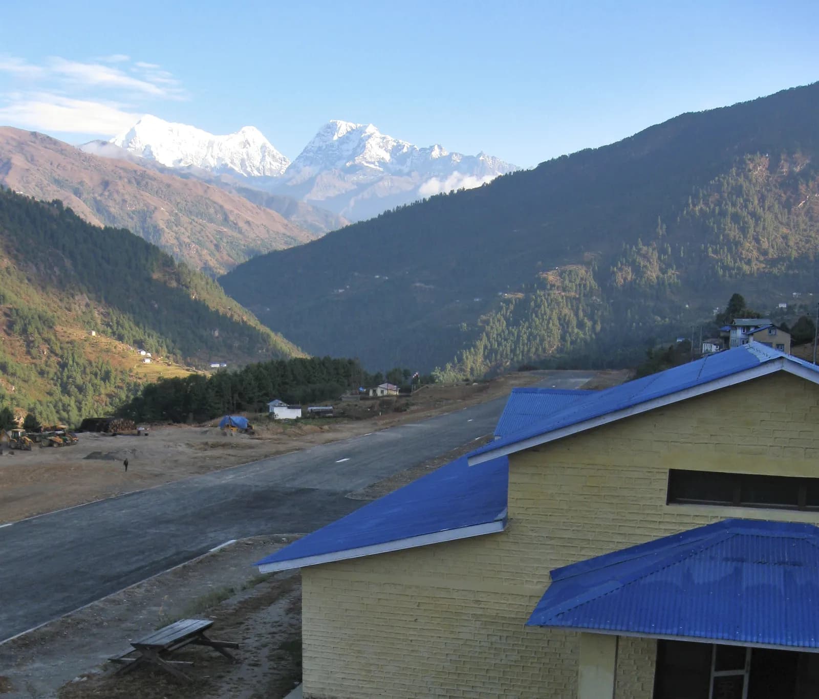
Solu
Solu is the lower, greener half of Solukhumbu: Pikey Peak (4,065 m) for a sunrise over Everest, the sacred lake of Dudh Kunda, Junbesi and Phaplu, by road from Kathmandu with no restricted-area permit.
- 最高標高Dudh Kunda (about 4,560 m)
- 日数6–16
- 難易度普通–難しい
- ベストシーズンMar–May, Sep–Nov
写真:Rucksackschule-dresden · CC BY-SA 4.0
Check that your policy covers helicopter evacuation and trekking at this region's altitude. We don't sell insurance.
What to look forWritten by FindTrekkingPartner team確認者: FindTrekkingPartner team確認方法についてFindTrekkingPartner
Soluはネパールのトレッキング地域で、6–16日間のルートが標高4,561 mまで登ります。外国人トレッカーは、FindTrekkingPartnerに日程、予算、ペースを添えてトリップを投稿すれば、ここでのトレッキングのパートナーを探せます。マッチングは両者が同意するまで非公開で、サービスは無料です。 中級クラスの料金では、ライセンスを持つガイドの費用は、トレッカー4人でシェアすると6日間で1人あたり約USD 56、1人だけの場合はUSD 224です。ベストシーズンはMar–May, Sep–Novです。 ここでは実際にはライセンスガイドが必要です。ネパール観光局の2023年4月の規則は、2026年の旅行会社の報告によると国立公園と保全地域のチェックポイントで実施されており、ランタンが最も厳しく、アンナプルナも確認があります(2026年10月19日確認)。登録済みの旅行会社を通じてガイドを手配し、旅行会社に確認してください。 このルートの募集中のトリップを以下に表示します。出発月、グループ人数、残り枠を確認できます。 最終確認日: 2026年10月19日。出典: ネパール観光局、DNPWC、入国管理局。
出典:Department of Immigration, NepalNepal Tourism BoardDepartment of National Parks and Wildlife Conservation
- Pikey Peak Trekのパートナーを探す募集中のトリップはまだありません
- Dudh Kunda Trekのパートナーを探す募集中のトリップはまだありません
概要
- 公認ガイド
- 外国人トレッカーは必須
- 最少人数
- トレッカー1人
NTB rule (Apr 2023), enforced at checkpoints in national parks and conservation areas (2026 operator reports; checked 19 October 2026). Solu is not a restricted area and no restricted-area rule applies. Trails above Taksindu are lightly marked and lodging at Sano Beni is thin, so most trekkers go with an agency or a local guide.
人気のトレッキング
出発地点
Kathmandu, Phaplu, Salleri, Dhap Bazaar, Ringmu
アクセス
Drive Kathmandu to Salleri (about 8 to 12 hours) or to Dhap Bazaar for Pikey (7 to 9 hours), or fly Kathmandu to Phaplu on a short Twin Otter flight that depends on weather. Buses and shared jeeps serve Salleri. Landslides can close the road in the monsoon.
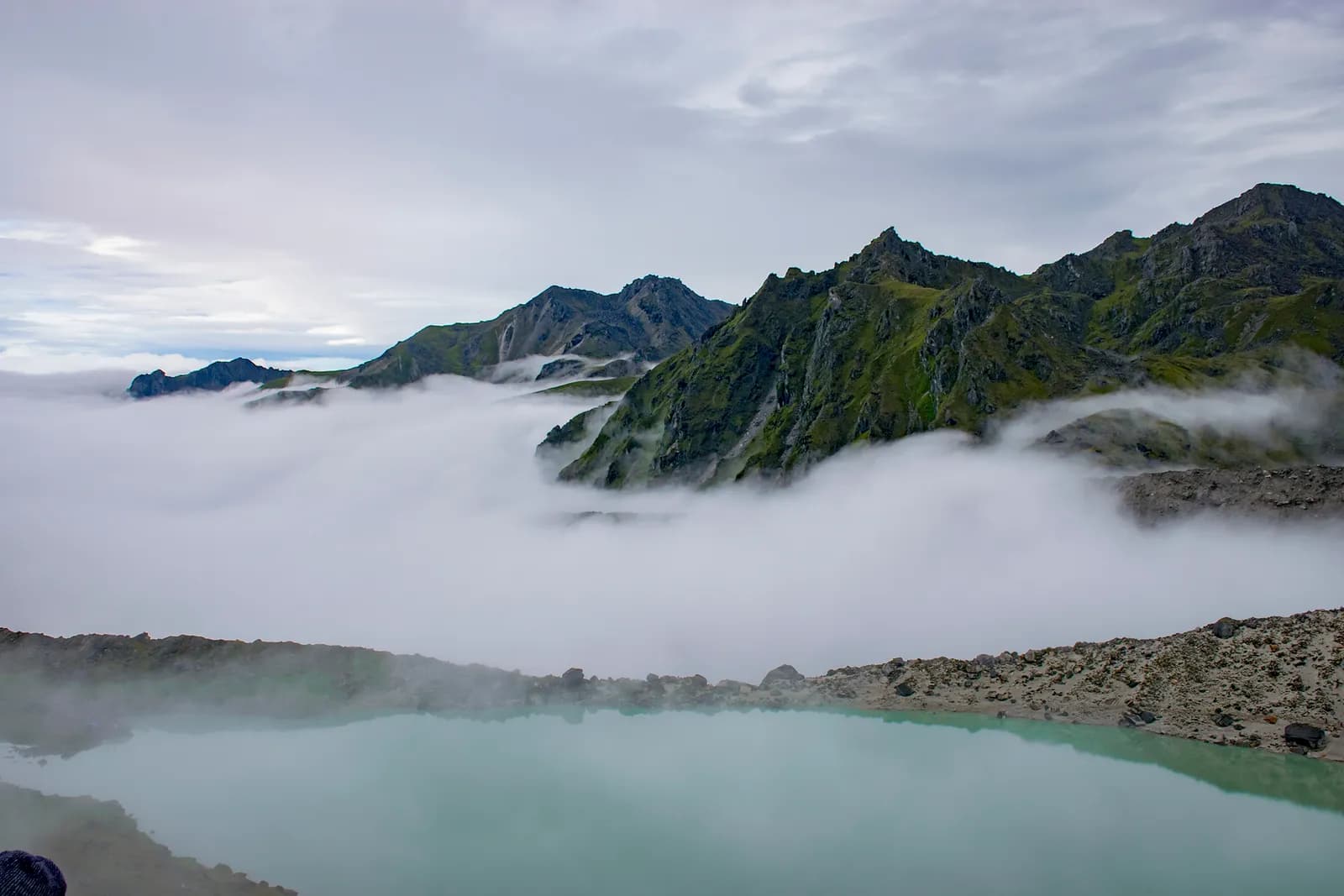
Solu is the lower, greener half of Solukhumbu District in eastern Nepal, the mid-hills below the Khumbu where Rai and Sherpa villages, monasteries and rhododendron ridges sit at 2,000 to 3,500 m. Its two best-known walks are Pikey Peak, a 4,065 m summit that gives a famous sunrise over Everest and the Khumbu range, and Dudh Kunda, a sacred lake at about 4,560 m below Numbur Himal. Both can be reached by road from Kathmandu in a long day, or by a short flight to Phaplu, and neither needs a restricted-area permit. The towns of Salleri and Junbesi supply lodges, and the walking is quieter than on the Everest trail. The best months are March to May and September to November, and a typical Solu trek takes six to ten days from Kathmandu, with no special permit.
Where Solu is
Solukhumbu is a district of 3,312 square kilometres with a population of 104,851 at the 2021 census and its headquarters at Salleri, about 267 km north-east of Kathmandu by road. Wikipedia divides it into two sub-regions. Khumbu is the high valley of Sherpa and Kulung people that holds Namche Bazaar, Tengboche and the Everest base camp trail. Solu is the lower hill country to the south, where Rai people are the largest community, trekking is less developed, and a new Mundhum trail is being built. The lowest point of the whole district is at Tuintar, at about 600 m, and the highest is Everest at 8,848 m, so Solu forms the long staircase between the two.
This guide uses Solu for the part of the district between the Dudh Koshi valley and the ridge that runs from Jiri towards Salleri: Junbesi, Phaplu, Salleri, Ringmu, Taksindu, Nunthala, and the peaks and lakes above them. It overlaps in part with the Everest region's southern approaches, and it connects to the Jiri to Lukla route known as the classic Everest approach.
Landscape and peaks
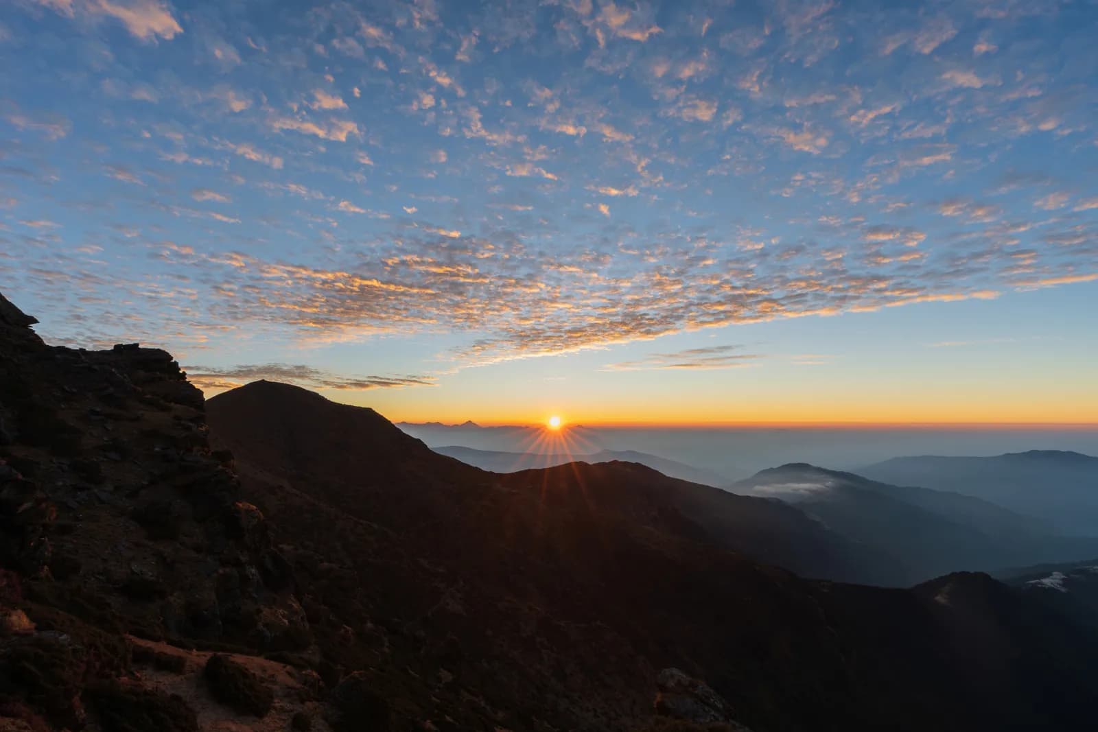
The ridgelines of Solu run from west to east and top out around 3,000 to 3,500 m, with passes named on the maps as Lamjura La, at about 3,530 m, and Taksindu La, at about 3,070 m. Between them lie deep valleys with fast rivers: the Junbesi Khola, the Likhu Khola and the Dudh Koshi. Forests are oak and rhododendron at the lower levels, with conifers higher up and open yak pasture above about 3,500 m. The views are long rather than close. From Pikey Peak the Himalayan wall is seen across ranks of foothill ridges, and the first light on Everest is the reason most people come.
Numbur Himal, at 6,958 m by the Kathmandu Post's figure, stands above Dudh Kunda, with Khatang Himal at 6,781 m and Karyolung at 6,681 m nearby. Mount Everest and Kanchenjunga can be seen from Kamidanda, the viewpoint above Ringmu, on a clear day. The elevation model puts Dudh Kunda at about 4,630 m and the Post gives 4,561 m, so we quote about 4,560 m.
People and culture
Solu is a meeting place of Rai, Sherpa, Tamang and Magar communities, and Wikipedia puts the Rai at 32.8 per cent and the Sherpa at 17.1 per cent of the district's 2021 population. Sherpa villages here keep Buddhist monasteries, and Salleri's Nepal Traveller profile mentions Sherpa, Rai, Tamang and Magar festivals, millet harvests and yak herding. Junbesi has its own monastery, and the Thubten Choling monastery a few kilometres north is a regular half-day side trip from the village on the itineraries we read. Taksindu, about 2,925 m, has a Sherpa monastery below the pass of the same name, and Ringmu is known for its blue and white painted houses.
Chiwong monastery, a few hours' walk from Salleri, holds the Mani Rimdu masked dance festival in October or November, and Dudh Kunda is a pilgrimage lake that locals and pilgrims visit in the full-moon week of August. Many Hindus and Buddhists revere the lake, and some regard it as the abode of Shiva. At other times of year you are unlikely to meet anyone there.
Getting there
Solu is reachable by road and by air. Salleri is about eight to twelve hours from Kathmandu by road, according to Nepal Traveller, depending on the state of the road and the season. Operators describe the drive from Kathmandu to Dhap Bazaar, the start of the southern approach to Pikey, as seven to nine hours, and the Kathmandu Post describes a jeep ride of about ten hours to Salleri plus an hour to Ringmu. Public buses and shared jeeps run to Salleri. In the rainy season, landslides can close the road for hours, and a spare day at the end of the trip is wise.
Phaplu Airport, at 2,413 m next to Salleri, opened in October 1976 and was widened by Sir Edmund Hillary to take Twin Otter aircraft. It was closed in 2013 to pave the runway and reopened a year later with a blacktop surface. The runway is 671 m long. Flights to Lukla that cannot land because of weather are sometimes diverted to Phaplu, and weather causes regular disruption, so any flight plan needs spare days.
When to go
The two clear seasons are March to May and September to November. In spring the rhododendron forests flower between Junbesi and the high passes, and in autumn the air is clearest. Winter brings snow above about 3,000 m and short days, and summer monsoon brings leeches, cloud and slippery trails. Sunrise at Pikey Peak is cold in every season; carry a warm layer and a headlamp for the early climb. August has a short window around the full moon for Dudh Kunda pilgrims.
Routes in the region
Pikey Peak trek. A six-day plan drives from Kathmandu to Dhap Bazaar, walks via Jhapre and Pikey Base Camp to the summit at sunrise, descends to Junbesi, and finishes at Phaplu, with a drive back to Kathmandu. It covers about 48 km of walking and is the more popular choice. The Wikipedia article on Pikey notes that trekkers can also approach from the west by way of Jiri or Shivalaya.
Dudh Kunda trek. A six-day plan drives to Ringmu, walks to Taksindu, climbs to Sano Beni at about 4,000 m, makes a day trip to the lake, and returns through Ringmu. It is shorter and higher than Pikey, with a stay at 4,000 m on two nights, and suits fit trekkers who have a day to spare for acclimatisation. Longer plans of fourteen and sixteen days connect Pikey, Junbesi, Taksindu La and Dudh Kunda in one circuit.
Permits and rules
Solu is not a restricted area. The Nepal Tourism Board's restricted-area list names only one ward of the Khumbu Pasang Lhamu municipality in Solukhumbu, in the far north near Everest, so neither Pikey nor Dudh Kunda needs a special permit. Pikey Peak and Dudh Kunda are outside Sagarmatha National Park, so its entry permit does not apply to these routes. Check with your agency whether the local municipality has introduced a trek card for your route, since fees in the Khumbu are collected by the rural municipality and rules change.
Lodging, food and costs
Lodges in Salleri, Junbesi, Phaplu and Taksindu are basic to mid-range guesthouses and homestays, less developed than in Lukla or Namche. On the Pikey ridge, lodges at Jhapre and at Pikey Base Camp give a bed and dal bhat. At Sano Beni, the Kathmandu Post's writer found a roughly built house as the only shelter, and the writer ruled out camping because of wind and cold, so confirm lodging before you set out. Our cost estimates for Solu use Nepal-wide price ranges per night by altitude band, plus a guide, a porter and road transport, because we found no price list for Solu lodges themselves. The Post gives a figure of NPR 13,000 per person for its own five-day trip, which shows how cheap independent travel can be.
Altitude and safety
Pikey Peak is 4,065 m, and the walking itinerary sleeps at 2,900 to 3,640 m before the summit, so acclimatisation is good for fit trekkers and a slow pace is still needed. Dudh Kunda is different: the night at Sano Beni, at about 4,000 m, comes on the third day, and the lake is about 560 m higher, so take the lake day as a rest-and-hike day and turn back if symptoms appear. Weather can close in on both ridges. Insure for helicopter evacuation, because serious illness means a long road or a flight to Kathmandu.
Food, villages and the pace of a Solu walk
Meals are simple and local. The Kathmandu Post writer describes a typical Solukhumbu breakfast of satu, roasted flour, with shechya, tea made with salt and butter, and dal bhat is the standard lunch and dinner. In Ringmu the old houses are painted blue and white, and in Kamidanda, the viewpoint above, new homestays were being built when the Post visited. Walking days are shorter and gentler than in the Khumbu, but the climbs are real: the section between Taksindu and Sano Beni gains about 1,300 m in 12 km on our map, and the descent from Pikey Peak to Junbesi loses about 1,670 m.
Combining the walks
The two routes can be linked into a longer trek, and operators sell fourteen and sixteen day versions that start at Shivalaya or fly to Phaplu, walk through Junbesi to Taksindu La, and then climb to Dudh Kunda before returning through Ringmu. If you have ten days, a sensible plan is Pikey first, which sleeps lower, then a rest in Phaplu or Salleri, then Dudh Kunda. Do not reverse that order: the lake needs more acclimatisation than the ridge. Both are quiet enough that you will rarely share a lodge with more than a few other groups outside the autumn peak.
Responsible travel
Solu receives far fewer visitors than the Everest trail, so lodges depend on a small number of groups. Buy local products, such as cheese from the cheese circuit lodges near Ringmu, eat where you sleep, and pay porters the agreed rate. Respect monasteries by dressing modestly and walking clockwise around stupas and mani walls. At Dudh Kunda, leave offerings as you find them, and take all of your rubbish back down.
Practical tips
- Allow a spare day at each end, because road and flight delays are common.
- Carry a headlamp, a down jacket and a warm hat for sunrise at 4,065 m.
- Buy cash in Kathmandu or Salleri, since there are no machines above them.
- On the Dudh Kunda trek, book a guide who knows the Taksindu to Sano Beni ridge.
- Remove no stones or offerings at the lake, and avoid the August full-moon weekend if you want quiet.
Sources and how we checked them
The Pikey plan is based on a KimKim itinerary and a Nepal Traveller article that agree on the stops, the height of Jhapre, Pikey Base Camp and Junbesi and the timings, and the Dudh Kunda plan on the Kathmandu Post's account and an operator's day-by-day plan that both use Taksindu and Sano Beni. District, airport and people facts come from Wikipedia, and the restricted-area table from the Nepal Tourism Board. OpenStreetMap and elevation-model heights are used only where at least two operator figures agree with them.
この地域のすべてのルート
この地域で扱っている標準ルートをすべて表示しています。ルートをタップすると、日ごとの行程が開きます。
ルートを比較
長さ、標高、難易度、想定費用でルートを並べ替えて、自分に合うものを見つけましょう。
日数 ↑順
| ルート | |||||
|---|---|---|---|---|---|
| Pikey Peak Trek | 6 | 4,065 m | 普通 | 48.6 km | NPR 25,000から |
| Dudh Kunda Trek | 6 | 4,561 m | 難しい | 37.7 km | NPR 25,000から |
費用は目安です。この地域の予算重視スタイルの1日あたりの料金に日数を掛けたもので、フライトと許可証は含まれません。
トレッキングのベストシーズン
ハイライトされた月が、おすすめのトレッキングシーズンです。 Mar–May · Sep–Nov
ベストシーズンその他の月
Live conditions
Notes entered by our team from the sources linked on each item. Conditions change quickly, so confirm with your guide or lodge before you set off.
Best seasons: Mar–May · Sep–Nov
Nothing recent on file. Check with your guide or lodge before you go.
許可証と料金
料金は1人あたりで、国籍グループによって異なります。
1日の費用
ティーハウス泊のトレッキングでの1人1日あたりの費用です。ガイドとポーターはグループ/ポーター1人の1日あたりの料金です。 2026年10月時点
| スタイル | 1日あたり | ガイド/日 | ポーター/日 | 合計の例 |
|---|---|---|---|---|
| 節約 | NPR 2,900–4,800 | NPR 5,000 | NPR 2,750 | NPR 13,700–22,600 |
| 標準 | NPR 4,100–6,500 | NPR 5,000 | NPR 2,750 | NPR 19,300–30,700 |
| 快適 | NPR 5,500–8,400 | NPR 5,000 | NPR 2,750 | NPR 26,000–39,800 |
節約: Kathmandu to Salleri is 8 to 12 hours by road and Dhap Bazaar 7 to 9 hours; a short flight to Phaplu is an alternative. The Kathmandu Post gives NPR 13,000 per person for its own Dudh Kunda trip. No fares are published in our sources, so the road legs are shown as lines to check.
標準: Kathmandu to Salleri is 8 to 12 hours by road and Dhap Bazaar 7 to 9 hours; a short flight to Phaplu is an alternative. The Kathmandu Post gives NPR 13,000 per person for its own Dudh Kunda trip. No fares are published in our sources, so the road legs are shown as lines to check.
快適: Kathmandu to Salleri is 8 to 12 hours by road and Dhap Bazaar 7 to 9 hours; a short flight to Phaplu is an alternative. The Kathmandu Post gives NPR 13,000 per person for its own Dudh Kunda trip. No fares are published in our sources, so the road legs are shown as lines to check.
ルールとマナー
ガイド
- すべての地域
Foreign trekkers must trek with a licensed guide in national parks and conservation areas (in force since April 2023). Enforcement varies by region, so verify the current rule before you go.
許可証
- すべての地域
Carry your permits at all times; they are checked at several checkpoints along every route.
安全と高度
- すべての地域
Buy travel insurance that covers helicopter rescue to at least 6,000 m.
- すべての地域
Climb high, sleep low: above 3,000 m, avoid raising your sleeping altitude by more than about 500 m per day, and add rest days.
自然保護
- すべての地域
Carry out all non-burnable waste (batteries, plastic, wrappers) and use a refillable water bottle.
文化
- すべての地域
Respect monasteries: walk clockwise around stupas and mani walls, and remove shoes where asked.
- すべての地域
Ask before photographing people, especially at religious sites and ceremonies.
ドローン
- すべての地域
No drones without prior permission from the relevant authority.
写真
よくある質問
The lower mid-hills of Solukhumbu District, south of the Khumbu. Rai people are the largest community here, with Sherpa, Tamang and Magar villages, and trekking is less developed than in the Everest region.
By road to Salleri in about 8 to 12 hours, or to Dhap Bazaar in 7 to 9 hours for Pikey, or by a short flight to Phaplu Airport, which sits at 2,413 m. Flights depend on weather.
4,065 m. It gives a sunrise view of Everest and the Khumbu range, and Wikipedia says that the view is said to have been Edmund Hillary's favourite of Everest.
No restricted-area permit is needed. The Nepal Tourism Board's list names only one ward of the Khumbu Pasang Lhamu municipality in Solukhumbu. Pikey and Dudh Kunda are outside Sagarmatha National Park, so its fee does not apply; ask your agency about any local trek card.
March to May and September to November. Winter brings snow above about 3,000 m, and the monsoon brings leeches and cloud. Pilgrims visit Dudh Kunda in the full-moon week of August.
No. There is another Dudhkunda in the Gaurishankar area of Dolakha. The one in this region lies below Numbur Himal, above Ringmu and Taksindu.
No. It is far quieter than the Everest base camp trail, and outside autumn you may share a lodge with only a few other groups. Lodges are basic to mid-range.
募集中のトリップ
Soluに関するガイド
 カバー写真: Saddam19, CC BY-SA 4.0
 カバー写真: Nabin K. Sapkota, CC BY-SA 4.0
 カバー写真: McKay Savage from London, UK, CC BY 2.0
 カバー写真: Nepal Trek Adventures, CC BY-SA 4.0
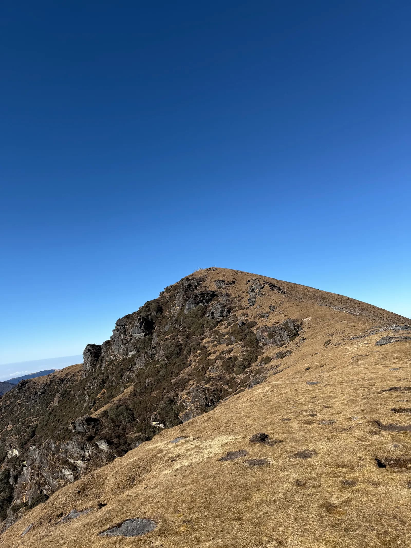 カバー写真: MateoTimateo, CC BY-SA 4.0
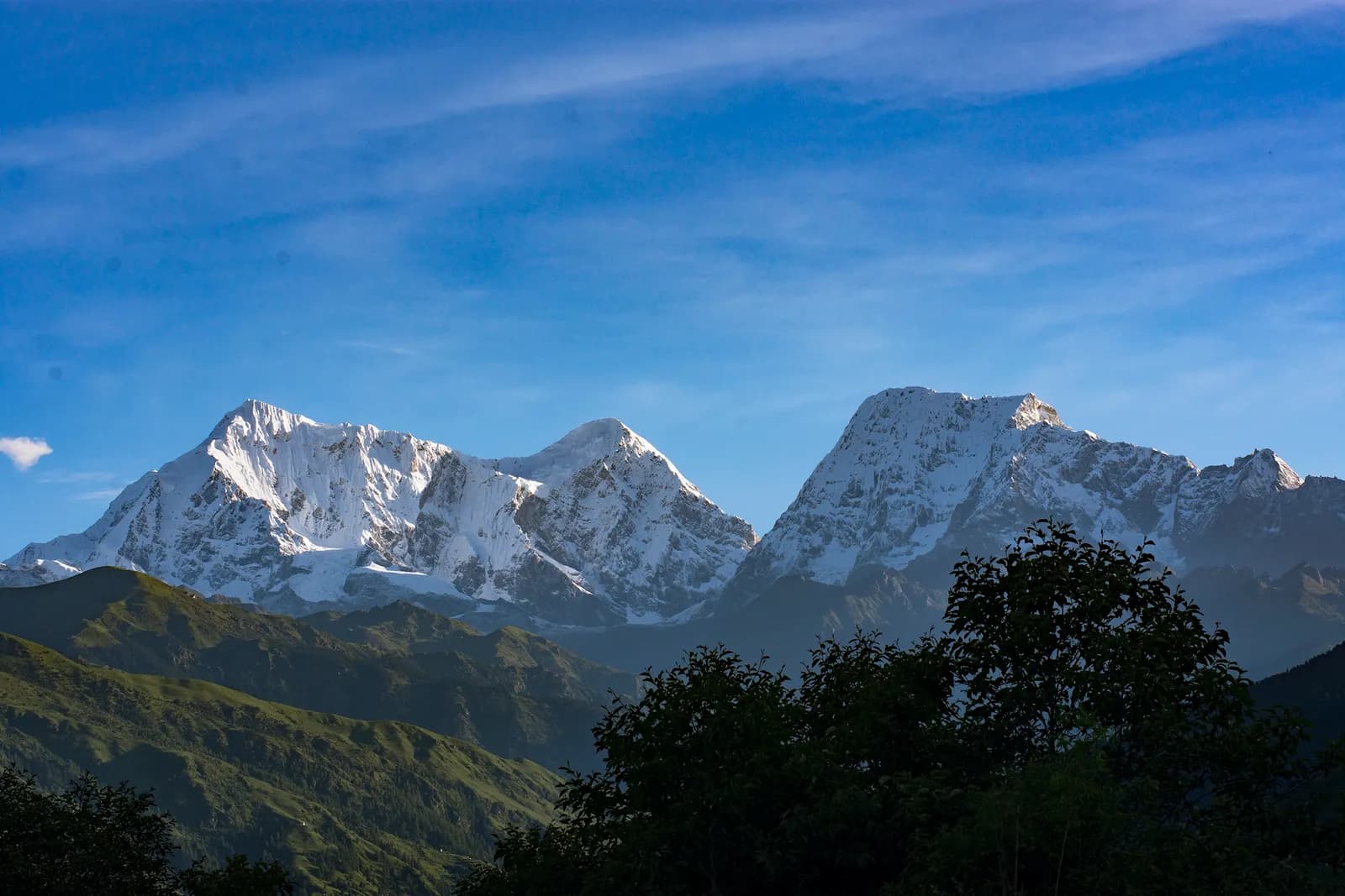 カバー写真: Chandra Chakradhar, CC BY-SA 4.0
情報源
Soluを歩く準備はできましたか?
この日程のトレッキング仲間を探すか、自分のルートの計画を始めましょう。