

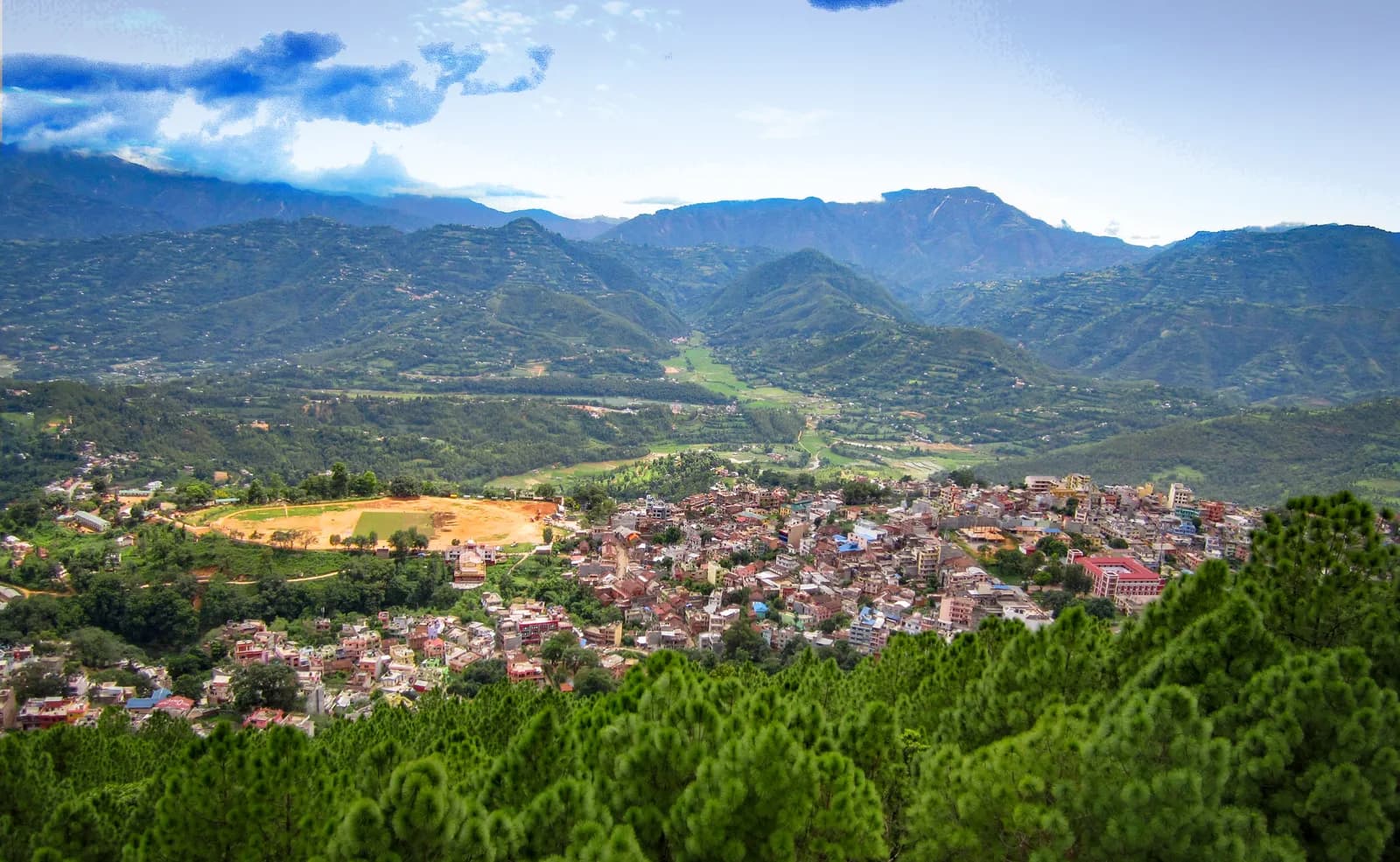
Palpa (Tansen)
Palpa, with its hill town of Tansen, is the old Magar capital on the Mahabharat ridge: an easy walk up Srinagar Hill for the Himalayan view and a long descent to the Rani Mahal palace at Ranighat, with no permit and no flight.
- 最高標高Srinagar Hill (about 1,490 m)
- 日数1–2
- 難易度易しい
- ベストシーズンOct–Nov, Mar–Apr
写真:DrooNa.Bhusal · CC BY-SA 4.0
Check that your policy covers helicopter evacuation and trekking at this region's altitude. We don't sell insurance.
What to look forWritten by FindTrekkingPartner team確認者: FindTrekkingPartner team確認方法についてFindTrekkingPartner
Palpa (Tansen)はネパールのトレッキング地域で、2日間のルートが標高1,490 mまで登ります。外国人トレッカーは、FindTrekkingPartnerに日程、予算、ペースを添えてトリップを投稿すれば、ここでのトレッキングのパートナーを探せます。マッチングは両者が同意するまで非公開で、サービスは無料です。 中級クラスの料金では、ライセンスを持つガイドの費用は、トレッカー4人でシェアすると2日間で1人あたり約USD 19、1人だけの場合はUSD 75です。ベストシーズンはOct–Nov, Mar–Aprです。 このような一般ルートでは、ライセンスガイドの同行は義務付けられていません(2026年10月19日確認)。クンブ自治体はネパール観光局の2023年4月の規則から外れる決定をしており、日帰りハイキングにはガイドは不要ですが、それでもガイドの同行を強くおすすめします。旅行会社に確認してください。 このルートの募集中のトリップを以下に表示します。出発月、グループ人数、残り枠を確認できます。 最終確認日: 2026年10月19日。出典: ネパール観光局、DNPWC、入国管理局。
出典:Department of Immigration, NepalNepal Tourism BoardDepartment of National Parks and Wildlife Conservation
- Tansen, Srinagar Hill and Ranighatのパートナーを探す募集中のトリップはまだありません
概要
- 公認ガイド
- 現地の最新ルールを確認してください
- 最少人数
- トレッカー1人
No restricted area, and the walks here do not lie inside a national park or conservation area, so the Nepal Tourism Board guide rule of April 2023 (written for parks and conservation areas) does not apply; a local guide is optional (checked 19 October 2026).
人気のトレッキング
出発地点
Tansen, Ranighat
アクセス
Tansen is about 122 km from Pokhara and 85 km from Lumbini by road, on the highway between Butwal and Pokhara. Direct buses run from Kathmandu, Pokhara and Bhairahawa, and Bhairahawa is about two hours away.
Palpa, with its hill town of Tansen, is the old Magar capital on the Mahabharat ridge between Pokhara and the Terai, and it offers two easy walks that need no permit and no flight: the 30 to 60 minute climb to Srinagar Hill for a Himalayan view from Dhaulagiri to Langtang, and the long descent to Ranighat, the neoclassical Rani Mahal palace on the Kali Gandaki. Tansen sits on the crest of the range, 122 km from Pokhara by one source, and the town centre is a maze of steep Newari lanes with a white octagonal pavilion, Sitalpati, at its heart. Tansen is also known for dhaka cloth and brass work, and its lanes deserve a morning of their own. The best months are October to November and March to April, and buses run to Tansen from Kathmandu, Pokhara and Bhairahawa.
Tansen and its ridge
Tansen is the administrative centre of Palpa District in Lumbini Province and sits on the crest of the Mahabharat range above the valley of the Kali Gandaki. Wikipedia places it on the highway between Butwal and Pokhara, and notes that the highway bypasses the town centre on the west, which protects a central maze of steep, narrow, winding alleys lined with Newari shophouses and temples. The district covers 1,373 square kilometres and had 245,027 residents at the 2021 census, and Palpa is the only district where the Magars form a majority, 53% of the population. Wikipedia describes the climate as moderate, with temperatures rarely above 30 degrees Celsius or below freezing, which is one reason Tansen is pleasant for walking outside the monsoon.
The town is also a living craft centre. Wikipedia says local Newars are known for traditional metalwork and for dhaka cloth, and an operator guide calls Tansen the best place in Nepal to buy dhaka fabric, a hand-woven cotton. You can hear wooden looms as you walk through the old lanes, and the town is known for its brass pots, which carry the name karuwa.
History
Tansen was the capital of the Magar kingdom of Barha Magarat, one of the most powerful principalities in the west before the Shah dynasty. Wikipedia says that in the 16th century, under Mukunda Sen, it came close to conquering Kathmandu, and that the name Tansen comes from the Magar for northern settlement. The Magar kings lost influence in the 18th century and Tansen became a Newari bazaar on the trade route between India and Tibet that ran along the Kali Gandaki towards Mustang.
The Rana period left the monuments that visitors walk to now. General Khadga Shamsher, who was Governor of Palpa, built the Rani Mahal at Ranighat in 1893 for his wife Tej Kumari, who had died in 1892, and the Mul Dhoka gateway to the Durbar compound, built in 1892 according to the Himalayan Times, dates from the same governor. The Durbar, a four-storey palace of 63 or 64 rooms depending on the source, was badly damaged in the civil war and has been restored, and it houses the Palpa museum. Tansen was added to the UNESCO World Heritage Tentative List in the cultural category on 30 January 2008.
Srinagar Hill
Srinagar Hill (also written Shreenagar or Srinagar Danda) rises just north of the town. Nepal Traveller gives its height as about 1,490 m and the walk as 30 to 60 minutes from the town centre, depending on the route, and says there is a modest view tower at the summit and a Buddha statue along the ridge. Wikipedia lists the peaks that show from the hill, west to east: Kanjiroba, Dhaulagiri, Annapurna, Manaslu, Ganesh and Langtang. The Himalayan Times adds Machhapuchhre and, if the weather allows, cloud filling the Madi valley below. Dawn or dusk is the best time, and OpenStreetMap shows a viewpoint tower, a picnic site and a Ganesh temple on the hill. On our map the walk from the Sitalpati square to the tower and back is 4.4 km with about 160 m of climbing.
Ranighat and Rani Mahal
Ranighat is the long walk. Rani Mahal, called the Taj Mahal of Nepal because it was built for a dead wife, stands on a wooded bluff above the Kali Gandaki, with a restored white and blue facade and a museum inside. Wikipedia records that it took four years to build under a British architect with Indian craftsmen and forced village labour, that the general fled to India in 1902, that the palace fell into near ruin by the end of the 20th century, and that the Government of Nepal restored it in 2017 and added a road along the Brangdi River.
The walk from Tansen is one-way downhill. Sources give about 2 hours (Community Homestay), about 3 hours (Ace the Himalaya and a 2008 trip report) and a route of 15 km or more for the round trip. They agree that the return climb is harder, about 4 hours, or you can arrange a car. A 2008 report starts at Batase Danda on the Tansen ridge, passes Awal and Hatti Dhunga and reaches Ranighat in about 3 hours, with a narrow pebble trail that is slippery in fog and a suspension bridge across the Kali Gandaki towards Syangja. On our map the way to Ranighat is 13.0 km with about 1,000 m of descent, mostly by the Rani Mahal road, so we allow 3 to 4 hours down.
Beyond the two walks
Other sights in sources include Bhairab temple, about 9 km west of Tansen (a 2 hour trek or 30 minutes by road), Ridi, about 20 km north-west, a pilgrimage confluence of the Kali Gandaki and the Ridi Khola with a mela at Maghe Sankranti around 14 January, and Satyawati Lake at 990 m. The United Mission Hospital, opened in 1954, stands a mile east of the centre and is the oldest project of United Mission to Nepal. In the town, look for Sitalpati and its octagonal pavilion, Bhimsen temple, said to be the oldest in Palpa, the three-tier Amar Narayan temple with its wood carving, and the Mul Dhoka gateway to the palace compound, 30 by 12 feet, which is the site of the annual chariot procession.
Culture and festivals
Palpa is Magar country, and its calendar follows the hills. The Mul Dhoka gateway is the site of the town's yearly chariot processions and festivals, and the Rishikesh temple complex at Ruru Kshetra, a Hindu pilgrimage and cremation site on the Kali Gandaki, hosts a festival on the first of Magh when people come to bathe in the river. Ridi has its own mela on Maghe Sankranti, around 14 January. If you can plan around one of these dates the town is at its liveliest, though the lanes are also quiet and pleasant on an ordinary weekday, with little traffic inside the old centre.
Getting there
Tansen is 122 km from Pokhara and 85 km from Lumbini by one operator's guide. The Himalayan Times says there are direct buses from Kathmandu, Pokhara and Bhairahawa, and that Bhairahawa is about two hours from Tansen by road; we found no bus timetable we could confirm, so transport is shown as items to check. Tansen lies on the Kathmandu, Pokhara, Lumbini, Chitwan circuit, which makes it an easy overnight on the way between Pokhara and the Terai. The nearest airports are at Pokhara and Bhairahawa.
Best season
October and November give clear skies and sharp views, and March and April add warm days and rhododendron on the hills, according to Nepal Traveller. The monsoon brings cloud and mud to the ridge and the Barandi Khola valley, and the valley can be hot and humid in spring. The walk to Ranighat is best done early.
Where to stay
Community Homestay Network lists six homestays in Tansen, with private rooms, hot water and meals, and OpenStreetMap shows hotels on the Srinagar road and a guesthouse at the United Mission hospital. We have no sourced room prices for Palpa, so our cost lines use Nepal-wide low-altitude ranges for lodging and meals and say so.
Permits, guides and rules
No trekking permit and no TIMS card is needed. Palpa is not a restricted area, and these walks do not enter a national park or conservation area, so the Nepal Tourism Board rule of April 2023 for those areas does not apply; a local guide is optional. If you visit Rani Mahal as a museum, ask about any ticket on the day. See our guide rule page for the rule in full.
Altitude and safety
The highest point on these walks is Srinagar Hill at about 1,490 m, so altitude is no concern. The risks are the steep, slippery stone steps and the pebble trail in rain or fog, the heat in the Kali Gandaki valley in spring, and the long climb back from Ranighat. Carry water, take a rain layer and leave time to return before dark.
Practical tips
- Start the Ranighat walk early and agree a car pick-up for the climb back.
- Take the Srinagar Hill walk at dawn or dusk, when the air is clearest.
- Carry small notes; we could not confirm machines outside the town centre.
- Buy dhaka cloth from the shops in the old lanes.
- Ask your host which road is open to Ranighat, since the Rani Mahal road is used by vehicles.
Sources and how we checked them
The town's history, geography and population come from Wikipedia, the Srinagar Hill details from Nepal Traveller and Wikipedia, the walking times to Ranighat from Community Homestay (2024), Ace the Himalaya (2017) and a 2008 trip report, and the Durbar and Mul Dhoka details from the Himalayan Times (2016). Where sources give different times or room counts we give both. Distances and climbing are from our own map of OpenStreetMap trails and terrain data, checked on 19 October 2026.
この地域のすべてのルート
この地域で扱っている標準ルートをすべて表示しています。ルートをタップすると、日ごとの行程が開きます。
ルートを比較
長さ、標高、難易度、想定費用でルートを並べ替えて、自分に合うものを見つけましょう。
日数 ↑順
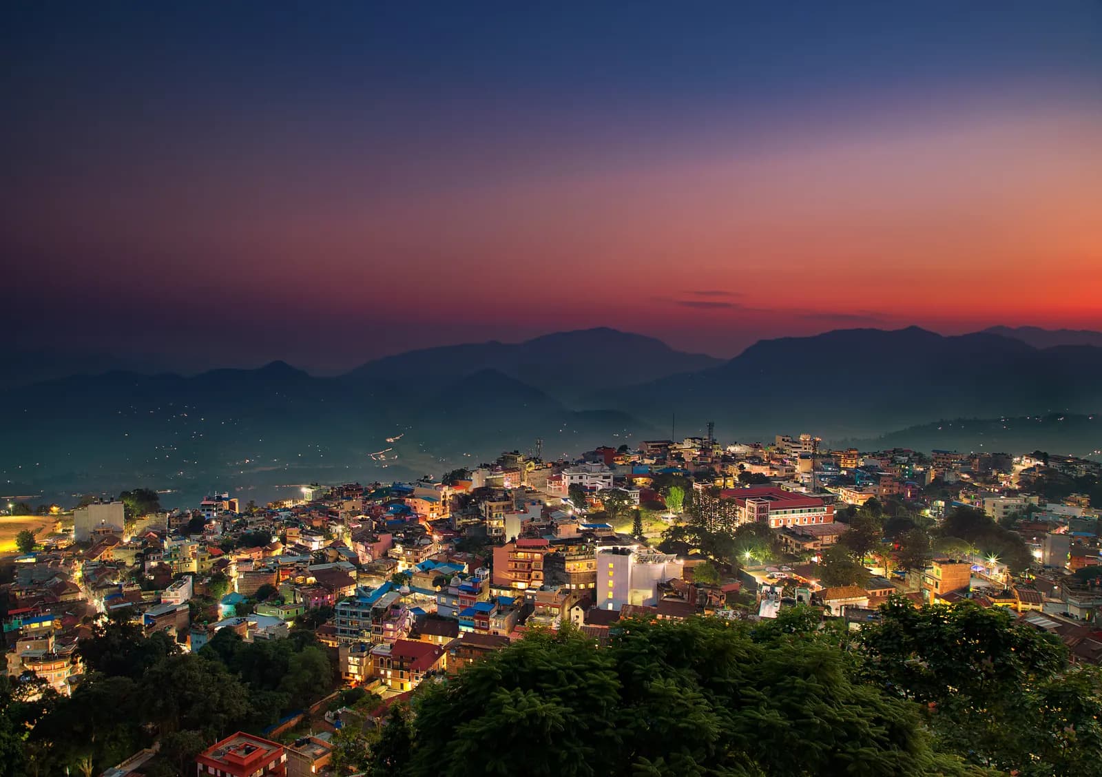
| ルート | |||||
|---|---|---|---|---|---|
| Tansen, Srinagar Hill and Ranighat | 2 | 1,490 m | 易しい | 17.4 km | NPR 8,000から |
費用は目安です。この地域の予算重視スタイルの1日あたりの料金に日数を掛けたもので、フライトと許可証は含まれません。
トレッキングのベストシーズン
ハイライトされた月が、おすすめのトレッキングシーズンです。 Oct–Nov · Mar–Apr
ベストシーズンその他の月
Live conditions
Notes entered by our team from the sources linked on each item. Conditions change quickly, so confirm with your guide or lodge before you set off.
Best seasons: Oct–Nov · Mar–Apr
Nothing recent on file. Check with your guide or lodge before you go.
許可証と料金
料金は1人あたりで、国籍グループによって異なります。
1日の費用
ティーハウス泊のトレッキングでの1人1日あたりの費用です。ガイドとポーターはグループ/ポーター1人の1日あたりの料金です。 2026年10月時点
| スタイル | 1日あたり | ガイド/日 | ポーター/日 | 合計の例 |
|---|---|---|---|---|
| 節約 | NPR 2,900–4,800 | NPR 5,000 | NPR 2,750 | NPR 4,200–6,800 |
| 標準 | NPR 4,100–6,500 | NPR 5,000 | NPR 2,750 | NPR 5,800–9,400 |
| 快適 | NPR 5,500–8,400 | NPR 5,000 | NPR 2,750 | NPR 8,000–12,400 |
節約: Tansen is about 122 km from Pokhara and 85 km from Lumbini by road; the Himalayan Times (2016) lists direct buses from Kathmandu, Pokhara and Bhairahawa, and Bhairahawa is about two hours from Tansen. No bus or taxi fares were found in our sources, so transfers are shown as lines to check.
標準: Tansen is about 122 km from Pokhara and 85 km from Lumbini by road; the Himalayan Times (2016) lists direct buses from Kathmandu, Pokhara and Bhairahawa, and Bhairahawa is about two hours from Tansen. No bus or taxi fares were found in our sources, so transfers are shown as lines to check.
快適: Tansen is about 122 km from Pokhara and 85 km from Lumbini by road; the Himalayan Times (2016) lists direct buses from Kathmandu, Pokhara and Bhairahawa, and Bhairahawa is about two hours from Tansen. No bus or taxi fares were found in our sources, so transfers are shown as lines to check.
ルールとマナー
ガイド
- すべての地域
Foreign trekkers must trek with a licensed guide in national parks and conservation areas (in force since April 2023). Enforcement varies by region, so verify the current rule before you go.
許可証
- すべての地域
Carry your permits at all times; they are checked at several checkpoints along every route.
安全と高度
- すべての地域
Buy travel insurance that covers helicopter rescue to at least 6,000 m.
- すべての地域
Climb high, sleep low: above 3,000 m, avoid raising your sleeping altitude by more than about 500 m per day, and add rest days.
自然保護
- すべての地域
Carry out all non-burnable waste (batteries, plastic, wrappers) and use a refillable water bottle.
文化
- すべての地域
Respect monasteries: walk clockwise around stupas and mani walls, and remove shoes where asked.
- すべての地域
Ask before photographing people, especially at religious sites and ceremonies.
ドローン
- すべての地域
No drones without prior permission from the relevant authority.
写真
よくある質問
Sources give 2 to 3 hours downhill, and our map shows 13.0 km with about 1,000 m of descent, so we allow 3 to 4 hours. The climb back takes about 4 hours, or you can arrange a car.
Yes. Nepal Traveller gives 30 to 60 minutes from the town centre depending on the route, and our map shows 4.4 km round trip with 160 m of climbing from Sitalpati.
Wikipedia lists Kanjiroba, Dhaulagiri, Annapurna, Manaslu, Ganesh and Langtang from west to east on a clear day, and the Himalayan Times adds Machhapuchhre.
A neoclassical palace on the Kali Gandaki built in 1893 by General Khadga Shamsher for his wife Tej Kumari. It is known as the Taj Mahal of Nepal, was restored in 2017 and has a museum.
No trekking permit is needed, Palpa is not a restricted area, and the walks avoid national parks and conservation areas, so the guide rule does not apply. A local guide is optional.
Tansen is 122 km from Pokhara and 85 km from Lumbini by an operator guide, with direct buses from Kathmandu, Pokhara and Bhairahawa; Bhairahawa is about 2 hours away.
October to November for clear views and March to April for warm days and rhododendron. The monsoon is cloudy and muddy.
募集中のトリップ
Palpa (Tansen)に関するガイド
情報源
- Tansen, Nepal (Wikipedia)
- Palpa District (Wikipedia)
- Ranighat Palace (Wikipedia)
- Shreenagar Hill, Tansen (Nepal Traveller)
- Traverse through Tansen (The Himalayan Times, 2016)
- Discover Tansen, Palpa (Community Homestay Network, 2024)
- Tansen heritage town (Ace the Himalaya, 2017)
- Revisiting the monument of love, Rani Mahal (Everest Uncensored, 2008 trip report)
Palpa (Tansen)を歩く準備はできましたか?
この日程のトレッキング仲間を探すか、自分のルートの計画を始めましょう。