

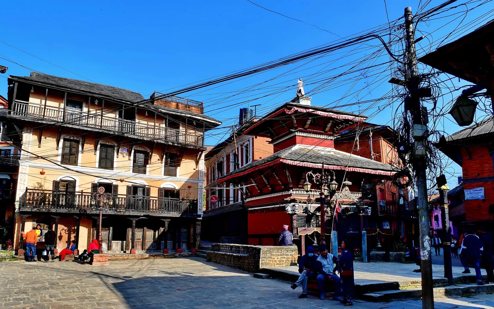
Bandipur
Bandipur is a preserved Newar hill town at 1,030 m on the Prithvi Highway side road, with Himalayan views and short walks to Thani Mai temple, the Tundikhel viewpoint and Siddha Cave, no permit and no flight needed.
- 最高標高Thani Mai hilltop (about 1,100 m)
- 日数1–2
- 難易度易しい
- ベストシーズンOct–Nov, Dec–Feb
写真:Rajesh Dhungana · CC BY-SA 4.0
Check that your policy covers helicopter evacuation and trekking at this region's altitude. We don't sell insurance.
What to look forWritten by FindTrekkingPartner team確認者: FindTrekkingPartner team確認方法についてFindTrekkingPartner
Bandipurはネパールのトレッキング地域で、2日間のルートが標高1,100 mまで登ります。外国人トレッカーは、FindTrekkingPartnerに日程、予算、ペースを添えてトリップを投稿すれば、ここでのトレッキングのパートナーを探せます。マッチングは両者が同意するまで非公開で、サービスは無料です。 中級クラスの料金では、ライセンスを持つガイドの費用は、トレッカー4人でシェアすると2日間で1人あたり約USD 19、1人だけの場合はUSD 75です。ベストシーズンはOct–Nov, Dec–Febです。 このような一般ルートでは、ライセンスガイドの同行は義務付けられていません(2026年10月19日確認)。クンブ自治体はネパール観光局の2023年4月の規則から外れる決定をしており、日帰りハイキングにはガイドは不要ですが、それでもガイドの同行を強くおすすめします。旅行会社に確認してください。 このルートの募集中のトリップを以下に表示します。出発月、グループ人数、残り枠を確認できます。 最終確認日: 2026年10月19日。出典: ネパール観光局、DNPWC、入国管理局。
出典:Department of Immigration, NepalNepal Tourism BoardDepartment of National Parks and Wildlife Conservation
- Bandipur Hill Walksのパートナーを探す募集中のトリップはまだありません
概要
- 公認ガイド
- 現地の最新ルールを確認してください
- 最少人数
- トレッカー1人
No restricted area, and the walks here do not lie inside a national park or conservation area, so the Nepal Tourism Board guide rule of April 2023 (written for parks and conservation areas) does not apply; a local guide is optional (checked 19 October 2026).
人気のトレッキング
出発地点
Bandipur, Dumre, Bimalnagar
アクセス
Bandipur is about 143 km west of Kathmandu and 80 km east of Pokhara. Buses reach Dumre on the Prithvi Highway in 5 to 6 hours from Kathmandu and 3 to 4 hours from Pokhara, and local buses or jeeps climb the 8 km road to the town.
Bandipur is a hilltop trading town in Tanahun District, Gandaki Province, about 143 km west of Kathmandu and 80 km east of Pokhara, and it is the easiest place in central Nepal to combine a Himalayan view with a short walk. The old Newar bazaar sits at about 1,030 m on a 200 m long saddle of the Mahabharat range, roughly 700 m above the Marsyangdi valley, and an 8 km road climbs to it from Dumre on the Prithvi Highway. The walks are short: Thani Mai temple on Gurungche Hill is 15 to 30 minutes from the bazaar, the Tundikhel viewpoint is a stroll, and Siddha Cave, one of the largest caves in Nepal, is a 1.5 to 2 hour walk down the hillside. No permit and no flight are needed, and October to February gives the clearest views.
Bandipur and its hills
Bandipur is not a trekking region in the usual sense. There is no pass, no park gate and no multi-day trail, and nobody walks here for altitude. What it offers is a preserved hill town with views of Dhaulagiri, Annapurna, Manaslu, Ganesh Himal and Langtang, and a handful of walks that fit around a night in a Newar guesthouse. That makes it a good first stop for a traveller who wants to stretch the legs before or after a bigger trek, or a gentle two days for people who cannot manage a long ascent.
The town sits on a mountain saddle at about 1,030 m, some 700 m above the Marsyangdi river, with the Mahabharat range behind and the Himalayan arc in front. Wikipedia describes the saddle as only about 200 m long and barely wide enough for the main street, which is lined with two and three storey buildings, while behind the houses the slopes drop steeply and the gardens are reached by stairs. Bandipur became a municipality in 2014 when the neighbouring Dharampani committee was merged into it. At the 2011 census Bandipur and Dharampani together had 15,591 residents, and the wider rural municipality about 20,000, with Gurung, Magar, Chhetri, Brahmin and Newar families among them.
A town built by traders
Bandipur's look comes from its history. Wikipedia records that it began as a Magar village and that Newar traders from Bhaktapur settled here after Prithvi Narayan Shah conquered the Kathmandu Valley in 1768. The saddle was free of malaria, which made it a useful stop on the India to Tibet trade route, and the Newar merchants brought their architecture with them: neoclassical facades, shuttered windows and streets paved with slate slabs. The town did best under the Rana rulers (1846 to 1951), when it was allowed to have its own library, and the ground floors of many houses still hold small shops.
The decline came in the 1970s. The Prithvi Highway was routed down the Marsyangdi valley instead of through the town, the district headquarters moved to Damauli, and traders moved down to Dumre or to the Terai. Bandipur became close to a ghost town until an 8 km access road opened in 1998 and a European-funded eco-cultural tourism project helped restore buildings and promote the town. The covered veranda that runs along most of the north side of the main street, the renovated library and the Bindabasini temple on the north side of the bazaar are what visitors come to see now. The slate paving has been worn by vehicles in places but is still visible along the edges and in the side lanes.
What to walk
Tundikhel. A field about the size of a football pitch north-east of the bazaar, reached by an easy stroll. Operator and blog accounts list Dhaulagiri (8,167 m), Manaslu (8,162 m), Ganesh Himal (7,406 m), Langtang (7,264 m) and Machhapuchhre (6,997 m) from here on a clear day, and sunrise or sunset is the usual time. It is also the picnic spot, so it is busy at holiday times.
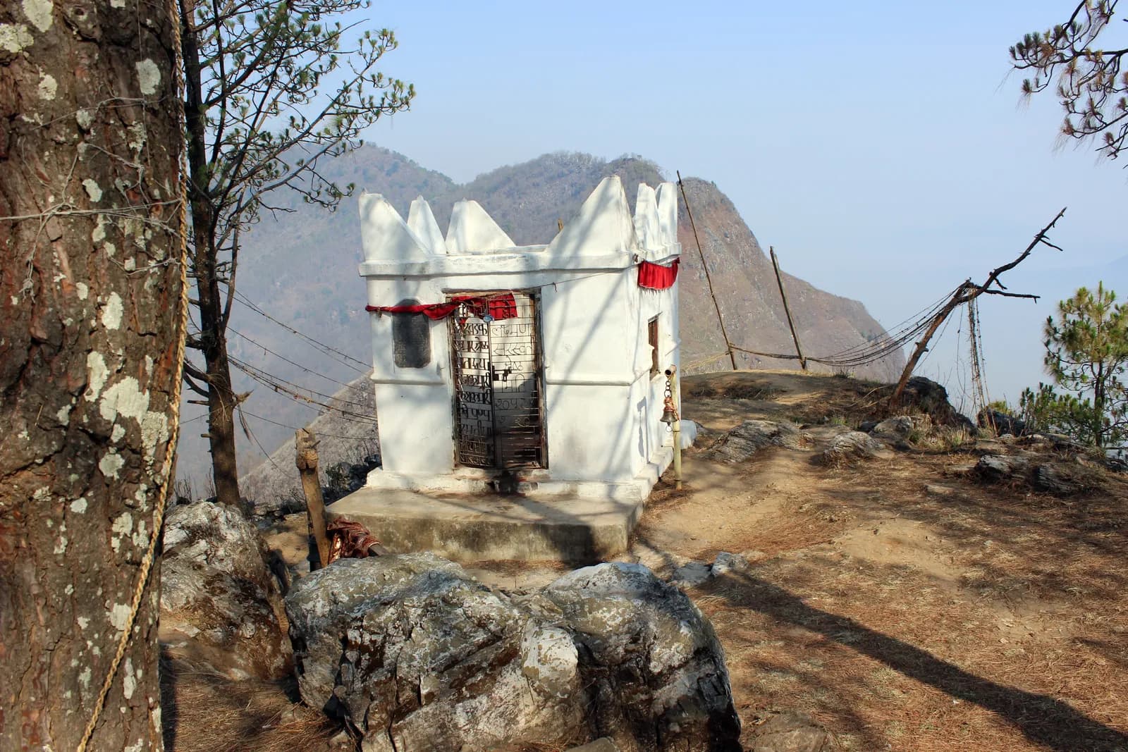
Thani Mai and Gurungche Hill. The temple stands on top of Gurungche Hill, a short climb from the bazaar. A 2016 walking guide gives about 15 minutes, a 2025 guide a steep 30 minute climb from the centre, and a local operator says less than an hour from town; the difference is where you start and how often you stop. The shrine is open to the sky, the view is wide, and sunset is the popular hour. On our map the walk through Tundikhel and Thani Mai and back is 4.3 km with about 260 m of climbing.
Siddha Cave. The cave is in Bimalnagar, below the town, and Wikipedia gives it as 437 m deep and 50 m high; Nepal Traveller says it holds about 2,500 people. It is unlit, the entrance is small, the inside is large, cold and home to bats, and you need your own torch or headlamp because the lights offered at the entrance are weak. From Bandipur it is a walk down: sources give 1 to 2 hours, about 1.5 hours or about 2 hours each way, and our map shows 3.2 km with 430 m of descent, so the climb back is the hard part. A shorter route starts at Bimalnagar on the highway, where one source gives 1.5 hours uphill on stone steps. The trail can be slippery in the monsoon, and one source says the cave is easiest in the dry season.
In and around the bazaar. Bindabasini temple, dedicated to Durga, stands on the north side of the main bazaar, and Mahalaxmi temple, a medieval pagoda-style shrine, on the south-east side. Parpani Mahadev, with its water spout, is about a 15 minute walk north, and Tindhara, a picnic spot with several water spouts, lies east of the bazaar. Khadga Devi temple houses a sword rather than a statue and opens to devotees only at festival time, so most visitors see it from outside. The silkworm farm is open all year, though the worms are reared mainly from August to December and in March to May.
Getting there
Bandipur is reached by road. Kathmandu to Dumre on the Prithvi Highway is 5 to 6 hours by bus, and Pokhara to Dumre 3 to 4 hours. From Dumre, local buses and jeeps climb the 8 km to Bandipur; a 2016 guide gave about NPR 20 for the crowded local bus and about NPR 500 for a 4x4 jeep, which we show as items to check because prices change. Some visitors walk up from Dumre, which a 2016 guide put at about 3 hours. A direct shuttle or taxi from Pokhara or Kathmandu is the easy alternative, and there are no flights. The nearest airport is Pokhara, with Kathmandu the usual entry point.
Best season
The clearest skies come right after the monsoon. A 2016 guide names October to February, and an operator trip report from a July visit found only cloud and rain and called it the off-season for the hike. Spring is warm and hazy, but the town is pleasant at any time and the walks are short enough to wait for a clear morning. Slippery stones and leeches make the cave trail the one to skip in heavy rain.
Where to stay and eat
Bandipur has more guesthouses than most hill towns of its size, because tourism is now its main income. A 2025 guide names Himchuli guesthouse for a budget stay, Hotel Aagaman or Shristi hotel in the middle range and Bandipur Chen at the top end, and OpenStreetMap lists dozens of homestays and hotels along the main street and at Tendhara. Rooms with a view of the Annapurna range are the ones to ask for. Dal bhat and Newari snacks are standard. We have no sourced room prices for Bandipur itself, so our cost lines use Nepal-wide low-altitude ranges for lodging and meals and say so.
Permits, guides and rules
No trekking permit and no TIMS card is needed. Bandipur is not in a national park or conservation area, and it is not a restricted area. The Nepal Tourism Board rule of April 2023, which asks for a licensed guide in national parks and conservation areas, does not apply, and nothing in our sources asks for a guide here. A local guide is still useful if you are unsure about the Siddha Cave trail, where direction signs are scarce and local foraging paths branch off the main one. See our guide rule page for the rule in full.
Altitude and safety
The town is at about 1,030 m and the highest point on any of these walks is about 1,100 m, so altitude is no concern. The real risks are the slippery stone steps and the wet cave trail, the heat on the climb back from Siddha Cave, and the lack of light inside the cave. Carry a good headlamp, water and a layer for the cold cave, wear shoes with grip and tell your guesthouse where you are going. Mist can hide the paths and the views.
Practical tips
- Bring your own headlamp for Siddha Cave; the torches offered at the entrance are dim.
- Start the cave walk early and arrange a jeep from Bimalnagar for the return if you do not want the climb.
- Do the Thani Mai walk at sunset and Tundikhel at sunrise, when the haze is lowest.
- Carry enough cash from Dumre or Pokhara; we could not confirm a cash machine on the saddle.
- Ask your guesthouse for the current state of the cave trail after rain.
How Bandipur fits a longer trip
Bandipur is a natural pairing with Pokhara or with the Gorkha and Manakamana area to the east, since both lie on or near the Prithvi Highway. It also fills a gap before or after a bigger trek, and a night here makes a gentle break after the drive from Kathmandu. Our Bandipur Hill Walks route puts the hill, the viewpoint and the cave into two days that you can shorten to one.
Sources and how we checked them
The town's location, history and population come from Wikipedia and Dolma Ecotourism, the cave's size from Wikipedia and Nepal Traveller, and the walk times from a 2016 HoneyGuide post, a 2025 Backpack Adventures guide and a 2010 trip report, which differ by up to a factor of two, so we give the range. Distances and climbing come from our own map of OpenStreetMap trails and terrain data, checked on 19 October 2026. Bus times are from the 2025 guide; fares are from 2016 and shown only as items to check.
この地域のすべてのルート
この地域で扱っている標準ルートをすべて表示しています。ルートをタップすると、日ごとの行程が開きます。
ルートを比較
長さ、標高、難易度、想定費用でルートを並べ替えて、自分に合うものを見つけましょう。
日数 ↑順
| ルート | |||||
|---|---|---|---|---|---|
| Bandipur Hill Walks | 2 | 1,100 m | 易しい | 7.5 km | NPR 8,000から |
費用は目安です。この地域の予算重視スタイルの1日あたりの料金に日数を掛けたもので、フライトと許可証は含まれません。
トレッキングのベストシーズン
ハイライトされた月が、おすすめのトレッキングシーズンです。 Oct–Nov · Dec–Feb
ベストシーズンその他の月
Live conditions
Notes entered by our team from the sources linked on each item. Conditions change quickly, so confirm with your guide or lodge before you set off.
Best seasons: Oct–Nov · Dec–Feb
Nothing recent on file. Check with your guide or lodge before you go.
許可証と料金
料金は1人あたりで、国籍グループによって異なります。
1日の費用
ティーハウス泊のトレッキングでの1人1日あたりの費用です。ガイドとポーターはグループ/ポーター1人の1日あたりの料金です。 2026年10月時点
| スタイル | 1日あたり | ガイド/日 | ポーター/日 | 合計の例 |
|---|---|---|---|---|
| 節約 | NPR 2,900–4,800 | NPR 5,000 | NPR 2,750 | NPR 4,200–6,800 |
| 標準 | NPR 4,100–6,500 | NPR 5,000 | NPR 2,750 | NPR 5,800–9,400 |
| 快適 | NPR 5,500–8,400 | NPR 5,000 | NPR 2,750 | NPR 8,000–12,400 |
節約: Bandipur is reached by road: Kathmandu to Dumre is 5 to 6 hours by bus and Pokhara to Dumre 3 to 4 hours (Backpack Adventures, 2025), then an 8 km road climbs to the town. A 2016 guide gave about NPR 20 for the local bus and NPR 500 for a 4x4 jeep; no current fares were found, so transfers are shown as lines to check.
標準: Bandipur is reached by road: Kathmandu to Dumre is 5 to 6 hours by bus and Pokhara to Dumre 3 to 4 hours (Backpack Adventures, 2025), then an 8 km road climbs to the town. A 2016 guide gave about NPR 20 for the local bus and NPR 500 for a 4x4 jeep; no current fares were found, so transfers are shown as lines to check.
快適: Bandipur is reached by road: Kathmandu to Dumre is 5 to 6 hours by bus and Pokhara to Dumre 3 to 4 hours (Backpack Adventures, 2025), then an 8 km road climbs to the town. A 2016 guide gave about NPR 20 for the local bus and NPR 500 for a 4x4 jeep; no current fares were found, so transfers are shown as lines to check.
ルールとマナー
ガイド
- すべての地域
Foreign trekkers must trek with a licensed guide in national parks and conservation areas (in force since April 2023). Enforcement varies by region, so verify the current rule before you go.
許可証
- すべての地域
Carry your permits at all times; they are checked at several checkpoints along every route.
安全と高度
- すべての地域
Buy travel insurance that covers helicopter rescue to at least 6,000 m.
- すべての地域
Climb high, sleep low: above 3,000 m, avoid raising your sleeping altitude by more than about 500 m per day, and add rest days.
自然保護
- すべての地域
Carry out all non-burnable waste (batteries, plastic, wrappers) and use a refillable water bottle.
文化
- すべての地域
Respect monasteries: walk clockwise around stupas and mani walls, and remove shoes where asked.
- すべての地域
Ask before photographing people, especially at religious sites and ceremonies.
ドローン
- すべての地域
No drones without prior permission from the relevant authority.
写真
よくある質問
Yes. The town is a preserved Newar trading bazaar with Himalayan views and short walks, and most visitors stay one or two nights. Its charm comes from the old buildings and the quiet main street, not from a big hike.
About 143 km west of Kathmandu and 80 km east of Pokhara. Buses reach Dumre on the Prithvi Highway in 5 to 6 hours from Kathmandu and 3 to 4 hours from Pokhara, then an 8 km road climbs to the town.
From Bandipur it is a downhill walk of about 1.5 to 2 hours each way, and our map shows 3.2 km with 430 m of descent. From Bimalnagar on the highway a source gives 1.5 hours uphill on stone steps. Bring your own light.
Wikipedia gives it as 437 m deep and 50 m high. A tourism listing says it holds about 2,500 people. Sources call it one of the largest caves in Nepal.
October to February, right after the monsoon, gives the clearest views. In heavy rain the stone paths and the cave trail are slippery and the mountains are usually hidden.
No trekking permit is needed, and Bandipur is not in a national park, conservation area or restricted area, so the guide rule does not apply. A local guide is optional, mainly for the cave trail.
Yes. A 2016 guide puts the walk up from Dumre at about 3 hours, and the road is 8 km. Most visitors take a local bus or a jeep instead.
From Tundikhel, sources list Dhaulagiri, Manaslu, Ganesh Himal, Langtang and Machhapuchhre, and the Annapurna range from the main street, all on clear mornings.
募集中のトリップ
Bandipurに関するガイド
情報源
- Bandipur (Wikipedia)
- Siddha Cave (Wikipedia)
- Bandipur, Nepal - A Mountain Village (Dolma Ecotourism)
- Bandipur: A Traveller's Paradise (Nepal Traveller)
- The Best Things to do in Bandipur, Nepal (Backpack Adventures, Oct 2025)
- Bandipur walks and access (HoneyGuide, 2016)
- Trip to Bandipur (Everest Uncensored, 2010 trip report)
Bandipurを歩く準備はできましたか?
この日程のトレッキング仲間を探すか、自分のルートの計画を始めましょう。