Tilicho Lake trek itinerary: the Manang side trip, day by day
How the Tilicho Lake side trip from Manang works: a 3-night loop to a lake at about 4,919 m, where the figures disagree between sources, the landslide section, acclimatisation and when to do it.
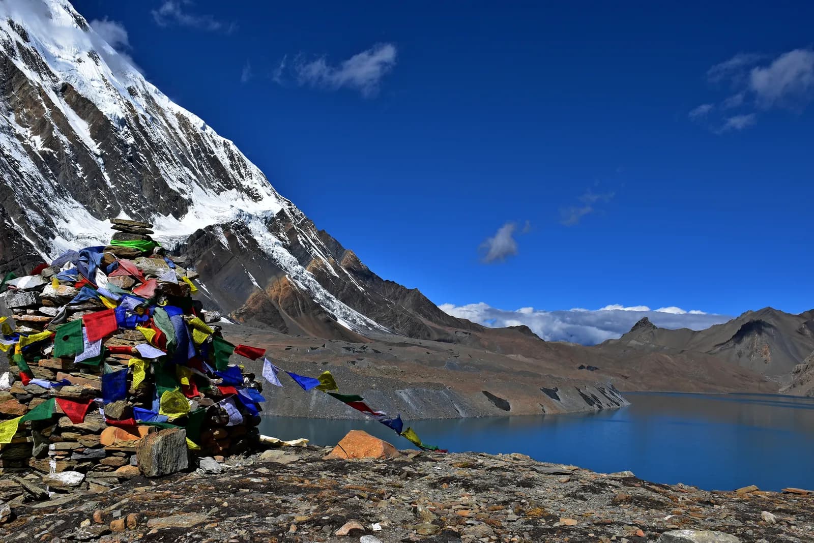
Tilicho Lake is a glacial lake in Manang District at about 4,919 m, and the usual way to see it is a side trip of two or three extra days from Manang on the Annapurna Circuit. You leave Manang for Khangsar or Shree Kharka, sleep at Tilicho Base Camp (about 4,140 m), climb to the lake in the early morning and return. Because Tilicho has no stand-alone route in our data, this itinerary is built on the Circuit plan and on operator itineraries, and where sources disagree the figures below say so.
The full circuit is in the Annapurna Circuit itinerary, and the valley itself is covered in the Manang valley guide. The route data is on the Annapurna Circuit page.
Annapurna Circuit Trek के ओपन ट्रिप
पार्टनर खोज रहे ट्रेकर्स के असली ट्रिप।
Where Tilicho fits
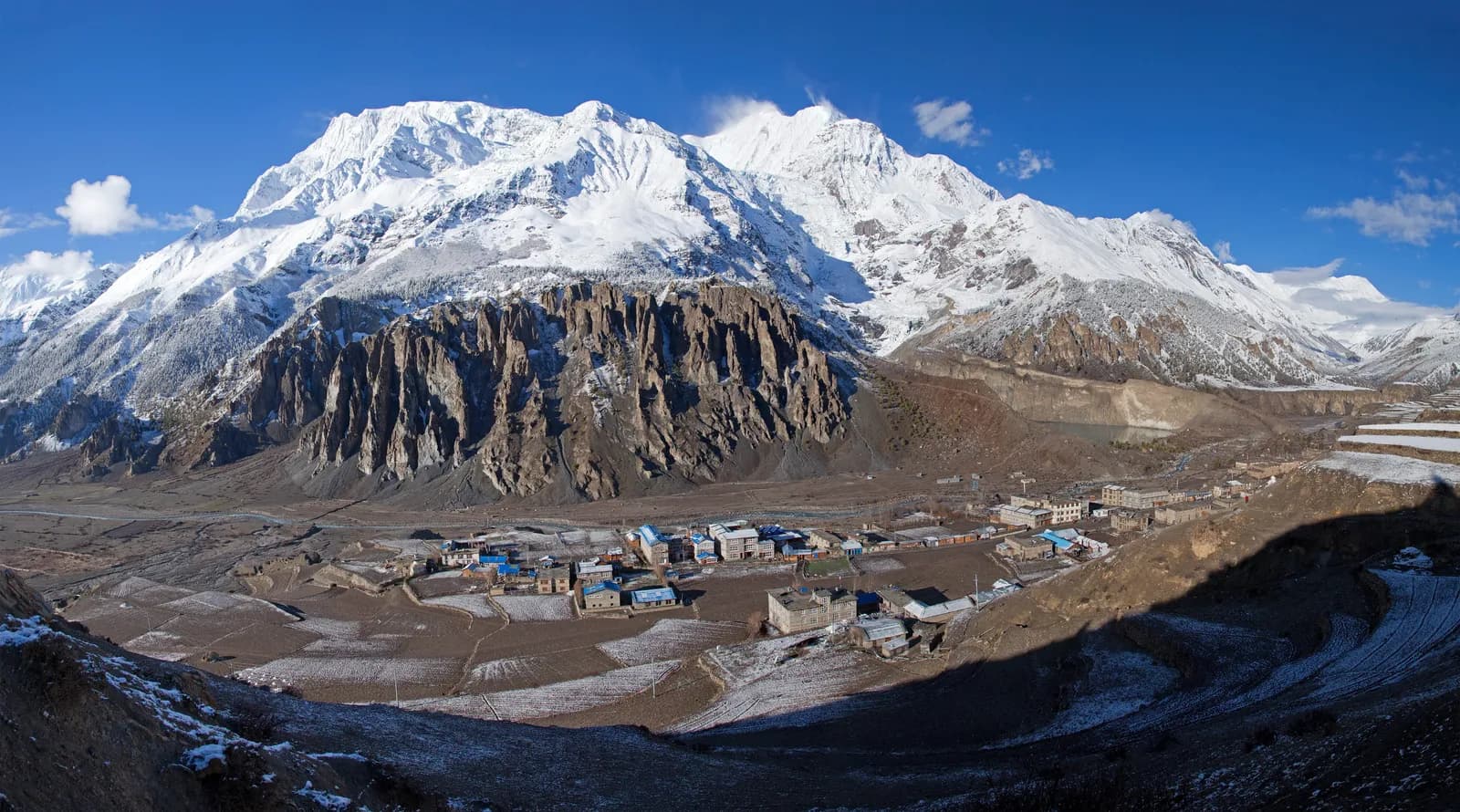
Our Circuit plan reaches Manang (3,540 m) on day 5, spends day 6 acclimatising, and then climbs to Yak Kharka (4,050 m) and Thorong Phedi (4,540 m) before the pass. The data notes that a popular variation adds Tilicho, a glacial lake at about 4,920 m, which needs two or three more days. The side trip leaves from Manang and rejoins the Circuit at Yak Kharka or Manang, depending on the route.
Think of it as a second acclimatisation loop, not a detour. You will sleep at about 3,700 to 4,100 m on the way, reach the lake high above 4,900 m, and come back down, so it is effectively a bigger version of the Manang rest-day hike.
A typical plan
| Stage | Where | Notes |
|---|---|---|
| Day A | Manang to Khangsar or Shree Kharka | About 4 to 6 hours; sources give Khangsar at 3,734 to 3,756 m and Shree Kharka at 3,850 to 4,060 m |
| Day B | to Tilicho Base Camp | About 4,140 m, a short day with a landslide section |
| Day C | Base Camp to the lake and back | An early start, with about 800 m of climbing on loose scree, then back down |
| Day D | Return toward Manang or onward to Yak Kharka | Depends on the route chosen |
Treat those as ranges, not promises. Altitudes for Khangsar and Shree Kharka differ between itineraries by more than 100 m, and one operator describes a different split of the days. Agree the plan with your guide in Manang, where lodge owners know the current state of the trail.
The lake itself
Tilicho Lake is at about 4,919 m according to Wikipedia, which also records another source giving 4,949 m; our route data uses about 4,920 m. It is a glacial lake in the Annapurna range with no recorded aquatic life as of 2003, according to the Department of Hydrology and Meteorology, and the surrounding alpine zone is home to species such as Himalayan snowcock, ibex and extreme-altitude mosses. Hindus believe it is the ancient Kak Bhusundi lake mentioned in the Ramayana. In 2000 a Russian team made what is recorded as the highest scuba dive at the lake.
For a trekker, the point is the setting: a large, cold, blue lake in a bare cirque, reached after a steep climb. Weather decides the day. Wind builds in the late morning, so a pre-dawn or early start is the norm.
The landslide section and other risks
Operator itineraries agree on one hazard: the stretch between Shree Kharka and Tilicho Base Camp crosses a landslide zone. One operator describes it as open but risky, advising that you cross before 10 am because of wind and rockfall, and says a guide is mandatory. Another blog notes that phone signal is lost on this stretch. We cannot confirm the current state of the trail, so ask in Manang and be ready to turn back.
The other risk is altitude. The lake at about 4,919 m is higher than anywhere else on the Circuit except the pass, and Base Camp is above 4,100 m. The general guidance from the Wilderness Medical Society and the CDC Yellow Book applies: modest sleeping gains above 3,000 m, a rest day, never ascend with symptoms and descend if they worsen. Make sure you have done the Manang acclimatisation day first, and use the Himalayan Rescue Association talk in Manang. Our altitude sickness basics and HAPE and HACE warning signs explain what to watch for.
Permits and the guide rule
Our route data lists the same permits as the Circuit: an Annapurna Conservation Area entry permit and a TIMS card where required. As of October 2026 ACAP costs NPR 3,000 for foreigners, NPR 1,000 for SAARC nationals, with children under 10 free; online payment adds 2.9 percent and a permit issued at a check post costs double. The Nepal Tourism Board lists the TIMS card at NPR 2,000 for foreigners (SAARC nationals NPR 1,000), and the agency that issues it may add a service charge. See the ACAP permit explainer.
On guides, a licensed guide through a registered agency is required in restricted areas, and under the Nepal Tourism Board rule of April 2023 in national parks and conservation areas, where 2026 operator reports say checkpoints enforce it in Annapurna and Langtang but not in Khumbu (checked 19 October 2026). Tilicho is inside the conservation area, so plan on a guide, which the landslide section makes sensible anyway. See the guide rule by region.
Season
The windows are the Circuit's: October and November, then March to May. Snow can block the high sections in early spring and late autumn, and winter closes the route for most trekkers. Manang sits in the rain shadow, so the monsoon matters less than on the south side, but landslides on the access roads still do. See best time for the Annapurna Circuit and snow and high-pass conditions.
Lodges, food and costs
Lodges at Khangsar and Shree Kharka are simple, and Base Camp lodging is basic with cold nights, so carry a warm sleeping bag. Menus are short, and charging is limited. As of October 2026 the Annapurna cost data gives a dal bhat of NPR 700 to 1,200 between 2,500 and 3,800 m and NPR 1,300 to 1,600 above 3,800 m, a guide day of NPR 2,700 to 4,000 and a porter day of NPR 2,100 to 3,400, as operator market ranges, not official rates. Carry rupees, as machines in Manang are unreliable.
Should you add it
Add Tilicho if you are well acclimatised after the Manang rest day, have a spare two or three days and a guide who knows the current trail. Skip it if you are short of time, if the weather is poor or if you already struggled at Manang. The pass at 5,416 m is the real goal of the Circuit, and tiring yourself on the side trip can make it harder.
Sharing and more
A guide and porter for the extra days are shared costs; post your dates on the Annapurna Circuit partner page and read rest days: where to acclimatise on EBC and the Annapurna Circuit. The route guides category and the day-by-day itineraries hub list the other plans.
How the day's timing works
The sensible timetable for the lake day is early, and then early again. Leave Base Camp by headlamp, take the climb slowly with regular drinks, and aim to be back down at Base Camp by early afternoon, because wind builds through the morning and the scree is unpleasant in a gale. Operators describe about 800 m of climbing from Base Camp to the lake on loose ground, which at these altitudes is a slow walk even for fit trekkers. Do not set a summit time you cannot beat; set a turnaround time and keep to it, whatever the view looks like from below.
What to carry
A small daypack with a windproof shell, an insulating layer, gloves and hat, a headlamp with spare batteries, two litres of water, snacks you can eat with cold hands and sunglasses with side protection. Poles help on scree and on the descent. Leave anything heavy at Base Camp. Carry a printed copy of your insurance details, because signal is lost on parts of this stretch, and agree a turnaround time with your guide before you start.
Who should skip it
Skip the side trip if you had symptoms at Manang, if you are on a tight return schedule, if the weather is poor or if the landslide section looks worse than usual when you ask in Manang. The pass at 5,416 m is the goal of the Circuit, and Tilicho is a bonus. Many trekkers who enjoy the lake describe it as the best day of the trip, and many who skip it enjoy the pass more for having kept their energy. Both are good decisions, and a short conversation with your guide is the way to make the choice.
The wider data is on the Annapurna region page, and the Nar Phu alternative from the same valley is on the Nar Phu Valley route page.