

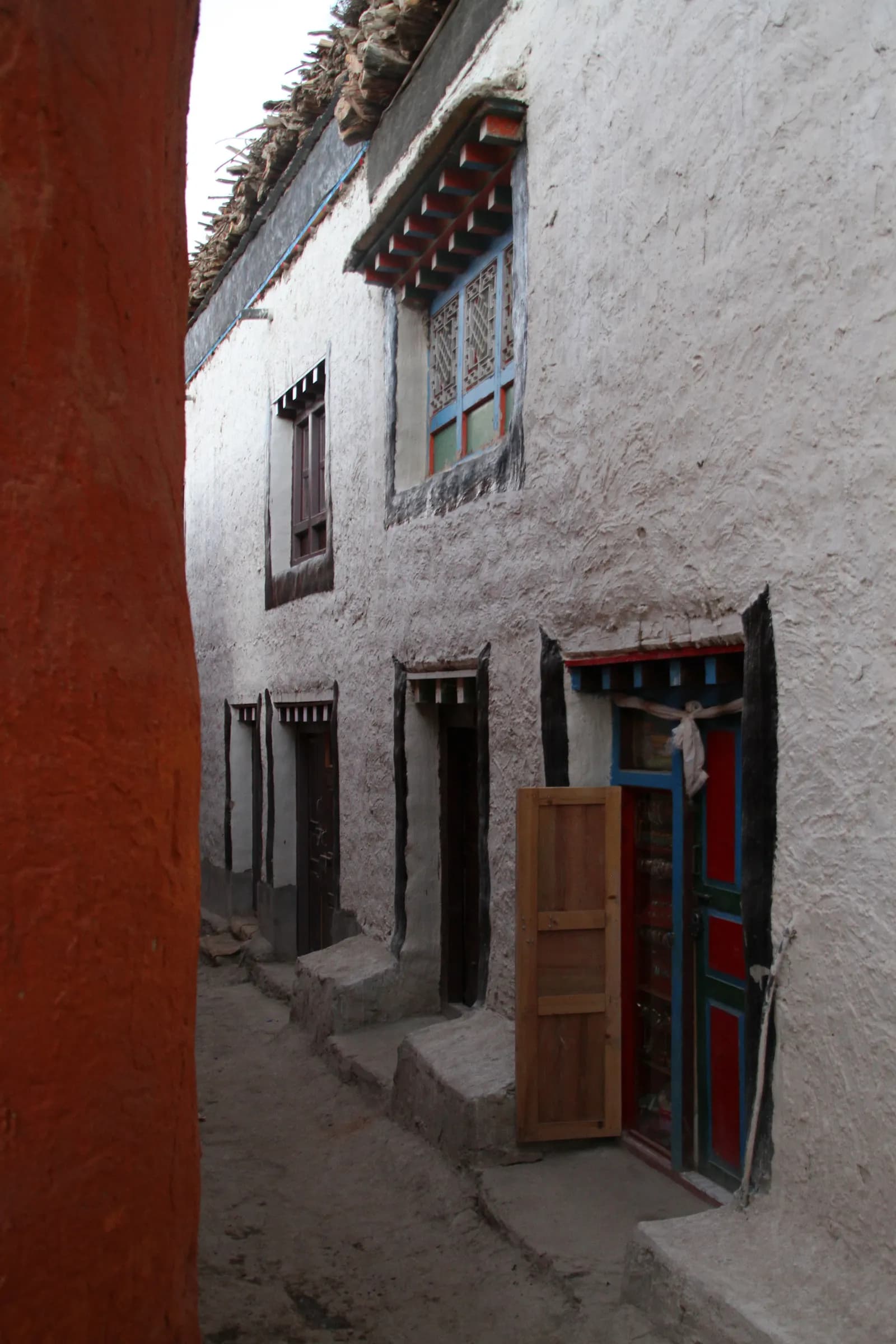
Fly from Pokhara to Jomsom, a 20-minute flight in the morning before the wind rises, past Dhaulagiri and the Annapurnas. From Jomsom walk north along the Kali Gandaki riverbed, or drive part of the way, to Kagbeni, at 2,810 m, a medieval village of mud houses and a red monastery at the gateway to the old kingdom. The wind is strong in the afternoon, so start early. Your restricted area permit is checked at Kagbeni, and permit days are counted from here. Wander the narrow lanes and enjoy the contrast with the green valley.
Upper Mustang Trek (Lo Manthang)
A 12-day loop from Jomsom through rain-shadow canyons to the walled city of Lo Manthang, returning via Dhakmar and Ghar Gompa.
- روز12
- بیشینه ارتفاع۴٬۲۸۰ متر
- مسافت۱۴۱ کیلومتر
- صعود۶٬۷۷۴ متر
- دشواریمتوسط
- بهترین ماههاMar–Nov
- مجوزها2
با این برنامه سفر بسازیدبرای Upper Mustang Trek (Lo Manthang) همراه پیدا کنیدمشاهده حرکتها بر اساس هفته
عکس: Gerd Eichmann · CC BY-SA 4.0
به انگلیسی نمایش داده میشود — هنوز ترجمه نشده است.
این برنامهٔ سفر پیشنویس است و هنوز بررسی نشده. همیشه مراحل را با راهنمای خود تأیید کنید.
Written by FindTrekkingPartner teamبررسیشده توسط FindTrekkingPartner teamروش بررسی ماFindTrekkingPartner
Upper Mustang یک منطقه پیادهروی در نپال است با مسیرهای 12 روزه که تا ۴٬۲۸۰ متر بالا میروند. پیادهروهای خارجی میتوانند در FindTrekkingPartner با ثبت یک سفر همراه با تاریخ، بودجه و سرعت خود، برای پیادهروی در اینجا همسفر پیدا کنند. تا زمانی که هر دو پیادهرو موافقت نکنند، تطابقها خصوصی میمانند و این سرویس رایگان است. با نرخهای متوسط، یک راهنمای دارای مجوز وقتی چهار پیادهرو سهم میدهند حدود ۱۰۵ دلار آمریکا (USD) برای هر نفر در 12 روز هزینه دارد، در مقابل ۴۲۱ دلار آمریکا (USD) برای یک پیادهرو بهتنهایی. بهترین فصلها Mar–Nov هستند. این یک منطقه محدودشده است، بنابراین داشتن راهنمای دارای مجوز از طریق یک آژانس ثبتشده بخشی از مجوز است و کل گروه با یک مجوز آژانس سفر میکند. آخرین بررسی: ۲۷ مهر ۱۴۰۵. منابع: هیئت گردشگری نپال، DNPWC، اداره مهاجرت.
منابع:Department of Immigration, NepalNepal Tourism BoardDepartment of National Parks and Wildlife Conservation
یافتن همسفر برای Upper Mustang Trek (Lo Manthang)
نمای کلی
شروع از Pokhara۱۲ روز · حداکثر ۴٬۲۸۰ متر
بهترین فصلها: Mar–Nov · مجوزها: Restricted Area Permit (Department of Immigration, via a registered agency), Annapurna Conservation Area entry permit
The Upper Mustang trek is a 12-day loop from Jomsom to Lo Manthang, the walled capital of the old Kingdom of Lo, and back by a different route. You fly from Pokhara to Jomsom, walk to Kagbeni where the restricted area begins, and follow the Kali Gandaki north through Chele, Syangboche, Ghami and Tsarang to Lo Manthang at 3,840 m. After a rest day you return via the red cliffs of Dhakmar, the monastery of Ghar Gompa and Ghiling to Chhusang, and finish in Jomsom. The landscape is a high desert of ochre cliffs, cave dwellings and windswept passes, with Tibetan Buddhist villages every few hours. It is a moderate trek at altitude, with winds that are the main discomfort. It suits cultural travellers and photographers, but the permit rules, the afternoon wind and the Jomsom flights all need planning well in advance.
What the trek is like
Days are five to seven hours of walking, mostly over open ground with long, gentle ascents and descents. The trail crosses several passes, among them the Bhena La, the Yamda La and the Nyi La (about 4,010 m), and the Marang La, at about 4,280 m, on the way to or from Lo Manthang. Villages are built of mud and stone, with whitewashed chortens and mani walls, and the colours of the cliffs change through the day. Afternoon winds are strong, so start early. Lodges are simple, and the mornings are cold.
Highlights
- Kagbeni, the medieval gateway to the old kingdom
- The cliff villages of Chele and Syangboche and the long mani wall at Ghami
- Tsarang's fortress and monastery
- Lo Manthang's walls, palace and three great monasteries, plus the Chhoser caves nearby
- Ghar Gompa, an ancient monastery, and the red cliffs of Dhakmar
Permits and rules
You need a Restricted Area Permit from the Department of Immigration through a registered agency, an Annapurna Conservation Area permit, and a licensed guide. Since 22 March 2026 one trekker can apply, so a group of two is no longer needed; the agency and guide requirements remain, and a partner halves the guide cost. Permit days are counted from your entry at Kagbeni, and several sources quote USD 500 for the first 10 days and USD 50 per additional day. Check current fees and rules with the Department of Immigration or your agency.
Best season
September and October are the most popular. April and May are also good, and the Tiji festival is held in Lo Manthang in spring. Because Upper Mustang is in the rain shadow, the monsoon months can be a good option, though flights to Jomsom may be disrupted. Winter is very cold, and most lodges are closed.
Altitude
The route ranges from 2,720 m at Jomsom to about 4,280 m on the Marang La near Lo Manthang. Altitude sickness is less common than on Himalayan treks that go higher, but it can still affect people who arrive by flight and move quickly. Take the rest day at Lo Manthang and drink plenty of water.
Getting there and away
The flight from Pokhara to Jomsom takes about 20 minutes and runs in the morning because of wind. Cancellations are common, so allow a spare day. A road runs from Kagbeni to Lo Manthang, and many people use a jeep for some sections.
Lodges, food and costs
Lodges are simple and have stove-heated dining rooms. Menus are limited, with dal bhat, noodles and Tibetan bread. Carry cash because there are no machines beyond Kagbeni.
Packing list
Windproof jacket, warm layers, down jacket, sun hat, sunglasses, sunscreen, lip balm, buff, waterproof boots, trekking poles, headlamp, water purification, sleeping bag rated to about -10 C and a first-aid kit.
Who this trek suits and how to prepare
The trek suits trekkers who want culture, desert landscapes and a quieter alternative to Annapurna. The walking is moderate, but the wind and altitude make some days tiring. Prepare with hill walks and stair climbing, and practise walking in a windproof jacket. Pack sun and wind protection, and bring a buff for dust.
The plan at a glance
Day 1 flies to Jomsom and walks or drives to Kagbeni (2,810 m). Days 2 to 6 climb through Chele, Syangboche, Ghami and Tsarang to Lo Manthang (3,840 m). Day 7 is a rest day. Days 8 to 10 return via Ghar Gompa and Dhakmar, Ghiling and Chhusang. Day 11 reaches Jomsom, and day 12 flies to Pokhara.
The restricted-area process
Your agency applies for the Restricted Area Permit through the Department of Immigration, and needs your passport copy, photos and visa details. Allow a few days in Pokhara or Kathmandu for the paperwork. Permit checks happen at Kagbeni and several villages. Fees and day limits have changed in recent years, so confirm with your agency.
Practical tips from the trail
- Start early every day and arrive by early afternoon, before the wind rises.
- Carry a windproof jacket, sunglasses with side protection and a buff for dust.
- Bring sunscreen and lip balm, because the sun is strong at altitude.
- Ask permission before photographing inside monasteries, and do not touch paintings.
- Keep a spare day for Jomsom flights.
Responsible trekking
Conserve water, carry out your waste and avoid disturbing caves and monasteries. Spend money in local lodges and shops, and hire local guides and porters.
Food and lodging
Lodges serve dal bhat, noodles, thukpa, Tibetan bread, momos and potatoes, and the apples and dried fruit of the Kali Gandaki valley are a treat. Rooms are simple, and dining rooms have a stove. In Lo Manthang, lodges are more comfortable and some have hot showers. Meals cost more in the north because supplies come from far away. Bring snacks, because lunch stops may be sparse.
Photography tips
The light is best early and late, when the cliffs glow red and gold. A polarising filter helps with the dusty glare in the middle of the day. Ask permission before photographing people or monastery interiors, and never use flash on wall paintings. Protect your camera from dust and wind with a cover or a bag.
نکات برجسته
- Kagbeni gateway
- Ghami's long mani wall
- Tsarang fortress and monastery
- Lo Manthang walled city and monasteries
- Ghar Gompa and Dhakmar red cliffs
نقشه مسیر
دادههای مسیر از OpenStreetMap است و هنوز تیم ما آن را بررسی نکرده است. برای برنامهریزی استفاده کنید، نه مسیریابی.
روزبهروز
Walk north from Kagbeni along the Kali Gandaki, through the dry landscape of Tangbe and Chhusang, with views of cliff villages and cave dwellings. The trail climbs and descends through gullies and across the riverbed, and the wind picks up in the afternoon. Chele, at about 3,050 m, is a small village with a few lodges, perched above the river with a view of the valley. It is a five- to six-hour day. Rest, drink plenty of water and watch the light change on the cliffs. The nights are cold, and the lodges are simple.
شما ۷۵۰ متر بالاتر از شب قبل میخوابید، بیش از حد معمول ۵۰۰ متر. آهسته بروید، زیاد آب بنوشید و مراقب سردرد یا تهوع باشید.
Climb steadily from Chele over a series of passes, among them the Yamda La and the Bhena La, with views of the valley and the Annapurnas, through Samar and Bhena to Syangboche, at about 3,800 m. The trail is a long, exposed series of ascents and descents on dry slopes. Wind is a constant companion, so wear a windproof layer and sunglasses. Syangboche is a small village with a few lodges and a view of a long ridge. It is a long day of six to seven hours. Rest and eat well, and keep an eye on the altitude.
Walk from Syangboche over the Nyi La, a pass of about 4,010 m, and descend into the Ghami valley. The path is mostly open with long views of the plateau. Ghami, at about 3,520 m, has a long mani wall that is reputed to be the longest in Nepal, and a monastery. The village is surrounded by barley fields. It is a five- to six-hour day. Walk along the mani wall in the afternoon, keeping it on your right as local people do. Rest and drink water.
Cross the Tsarang Chu on a bridge and climb to Tsarang, at about 3,560 m, a large village with a fortress, a palace and a red monastery, Tsarang Gompa, which holds a collection of Buddhist texts. The path crosses a wide valley with views of the Annapurnas and the dry mountains of Mustang. It is a short day of four to five hours. In the afternoon, visit the monastery and the fortress, and walk through the village. Ask permission before photographing. The nights are cold, and the lodges are simple.
Climb from Tsarang over a pass of more than 4,000 m and along a high plateau to Lo Manthang, at 3,840 m. The walled city appears suddenly, with its whitewashed walls and red-roofed monasteries. The path crosses open ground with views of the Tibetan border mountains. Lo Manthang, founded in 1380, has a five-storey palace built around 1400, and the monasteries of Jampa Lhakhang, Thubchen and Chode. It is a four- to five-hour day. Walk through the lanes in the late afternoon, when the light is soft. Respect local customs and ask before photographing.
A rest and exploration day at Lo Manthang. Visit the monasteries, the palace and the lanes of the walled city, and, if you have energy, walk or drive to the Chhoser caves, a cluster of cave dwellings north of the city, some of them with ancient paintings. Choose the walk that suits you; the aim is to rest at altitude. In the afternoon, wander the city walls and buy local crafts. Check with your guide about the Tiji festival dates if you are visiting in spring. Drink plenty of water and eat well.
Climb from Lo Manthang over the Marang La, a pass of about 4,280 m and the highest point of the trek, with sweeping views of the Mustang plateau and the Tibetan border, and drop to Ghar Gompa, an ancient monastery that dates back centuries and is said to be one of the oldest in Nepal. Continue through a gorge to Dhakmar, at about 3,820 m, a village beneath towering red cliffs. It is a long day of six to seven hours. The wind is strong at the pass, so wear a windproof layer. Walk through the cliffs in the evening light.
Walk from Dhakmar over a pass and down a long valley to Ghiling, at about 3,570 m, a village with a small monastery and a view of the Annapurna range. The trail follows a dry streambed and crosses high ground, with views of the red cliffs and the river. It is a five- to six-hour day. Ghiling has a few lodges and a long mani wall. Walk around the village in the afternoon and enjoy the quiet. Eat well and rest, because the wind picks up in the afternoon. You are now back on the main route.
Walk from Ghiling along the Kali Gandaki to Chhusang, at about 2,980 m, a village of cliffs and caves, passing Ghami and Samar on the way. The trail drops through gullies and along the riverbed, with views of the Nilgiri peaks. It is a six-hour day, with the wind rising in the afternoon. Chhusang has a red cliff and a cave monastery, and a few lodges. The warmer air is welcome after the high plateau. Rest, wash and eat well, and watch the colours of the cliffs change at sunset.
Walk or drive from Chhusang through Tangbe and Kagbeni, and follow the Kali Gandaki to Jomsom, at 2,720 m, a walk of six to seven hours. The wind is strong in the afternoon, so start early. At Kagbeni, you leave the restricted area. Jomsom is a busy town with an airport, shops and lodges. Have a hot shower, a good meal and a rest. Pay your guide and porters, and have a farewell dinner. Check your flight for tomorrow morning, and keep a spare day in case of delays.
Take the morning flight from Jomsom to Pokhara, a journey of about 20 minutes with fine views of the Annapurnas and Dhaulagiri. Flights leave early because wind builds by midday, and cancellations are common, so keep a spare day. In Pokhara, you can finally enjoy a hot shower, a meal beside the lake and rest. If your flight is cancelled, a jeep to Pokhara takes most of a day. Do not book an international flight for the same day. Keep a spare day in your plan: if the flight is cancelled you can still reach Pokhara by jeep, and you will not miss your onward connection.
سازگاری با ارتفاع
ارتفاع خواب شببهشب. ستونهای قرمز بیش از ۵۰۰ متر از شب قبل بالاتر میروند؛ روزهای استراحت مشخص شدهاند.
- ارتفاع خواب
- افزایش بیش از ۵۰۰ متر
- روز استراحت
هزینهها
برآورد هزینه کل برای هر نفر: اقامتگاه و غذا بر اساس ارتفاع، حملونقل، مجوزها، و راهنما و باربرها. هر چه ترکرهای بیشتری راهنما و باربر را تقسیم کنند، سهم هر نفر کمتر میشود. تا تاریخ ۱۴۰۵ مهر.
| سبک | ۱ ترکر | ۲ ترکر با تقسیم هزینه | ۴ ترکر با تقسیم هزینه |
|---|---|---|---|
| اقتصادی | $۱٬۳۵۰–$۱٬۸۵۰ | $۱٬۲۰۰–$۱٬۶۰۰ | $۱٬۱۰۰–$۱٬۵۰۰ |
| میانرده | $۱٬۶۵۰–$۲٬۲۵۰ | $۱٬۴۰۰–$۱٬۹۰۰ | $۱٬۳۰۰–$۱٬۸۰۰ |
| راحت | $۱٬۷۵۰–$۲٬۴۰۰ | $۱٬۶۰۰–$۲٬۲۰۰ | $۱٬۵۰۰–$۲٬۱۰۰ |
راهنما را تقسیم کنید، پول پسانداز کنید
در سطح میانرده، یک ترکر تنها حدود $۱٬۶۵۰–$۲٬۲۵۰ میپردازد؛ چهار ترکر که یک راهنما و دو باربر را تقسیم میکنند هر کدام حدود $۱٬۳۰۰–$۱٬۸۰۰ میپردازند (21٪ کمتر در بالای بازه).
جزئیات برای ۲ ترکر با تقسیم هزینه
| مورد | اقتصادی | میانرده | راحت |
|---|---|---|---|
| اقامتگاه و غذا | $۲۷۰–$۴۴۰ | $۳۷۰–$۵۸۰ | $۴۹۰–$۷۴۰ |
| حملونقل | $۲۴۰–$۴۰۰ | $۲۴۰–$۴۰۰ | $۲۴۰–$۴۰۰ |
| مجوزها | $۵۳۰–$۵۴۰ | $۵۳۰–$۵۴۰ | $۵۳۰–$۵۴۰ |
| راهنما | $۱۶۰–$۲۳۰ | $۱۶۰–$۲۳۰ | $۱۶۰–$۲۳۰ |
| باربرها | — | $۸۰–$۱۴۰ | $۱۷۰–$۲۸۰ |
سبک اقتصادی از حملونقل عمومی و بدون باربر استفاده میکند؛ میانرده یک باربر را بین دو ترکر و یک وسیله نقلیه اختصاصی تقسیم میکند؛ راحت برای هر ترکر یک باربر در نظر میگیرد. راهنما در جایی که الزامی است یا سبک میانرده یا راحت باشد لحاظ میشود.
اقامتگاه و غذای هر شب (اتاق و یک وعده دال بهات)
۸ شب 2,500 to 3,800 m: اتاق $۴–$۱۱، دال بهات $۵–$۱۱ · ۳ شب Above 3,800 m: اتاق $۷–$۱۹، دال بهات $۸–$۱۳
هزینه مجوزها (منابع رسمی)
منابع هزینه
- PriceNepal: Nepal Travel Cost Guide 2026 (2026-05-14)
- Third Rock Adventures: Nepal trek budget planner (2026-05-09)
- Himalayan Partner: Guide and porter price in Nepal 2026 (2026-02-10)
- Shikhar Adventure: Annapurna Circuit trek cost (2026-02-03)
- Nepal Tourism Board: Trekking Permit (2026-10-18)
برآوردها از راهنماهای اپراتورها هستند، نه قیمت قطعی. انعام، بیمه، تجهیزات و هتلهای کاتماندو شامل نمیشود؛ دلار آمریکا با نرخ تبدیل پلتفرم.
عکسها
پرسشهای متداول
Moderate. Days are five to seven hours at 2,700 to 4,300 m, with strong afternoon wind and cold nights.
Twelve days from Pokhara on this plan, with flights to and from Jomsom.
Yes: a Restricted Area Permit through a registered agency and a licensed guide. Reports say individuals can apply since March 2026; confirm the current rule.
Yes, because Upper Mustang is in the rain shadow, though flights to Jomsom can be disrupted.
About 3,840 m.
An ancient monastery, also called Lo Gekar, near Dhakmar and Ghami, visited on the return route.
منابع
در طول مسیر
اقامتگاه، کمک پزشکی، آب و جاهای دیدنی در هر روز مسیر.
1. Pokhara → Kagbeni
- Viewpoint · چشماندازها · ۲٬۷۷۴ متر
- Hotel New Annapurna Lodge · اقامتگاهها · ۲٬۸۳۴ متر
- Happy Hour · اقامتگاهها · ۲٬۸۷۶ متر
- Nilgiri Hotel · اقامتگاهها · ۲٬۸۴۱ متر
- Dragon Hotel · اقامتگاهها · ۲٬۸۶۹ متر
Show all 18 places
- Hotel Jomsom View · اقامتگاهها · ۲٬۷۳۲ متر
- Shaligram · اقامتگاهها · ۲٬۷۳۷ متر
- Hotel Cold Desert · اقامتگاهها · ۲٬۷۳۷ متر
- Thak Khola Lodge&Restaurant · اقامتگاهها · ۲٬۷۴۹ متر
- Jomsom Paradise · اقامتگاهها · ۲٬۷۵۲ متر
- Hotel Naulo · اقامتگاهها · ۲٬۷۵۱ متر
- Viewpoint · چشماندازها · ۲٬۷۷۴ متر
- Hotel New Annapurna Lodge · اقامتگاهها · ۲٬۸۳۴ متر
- Happy Hour · اقامتگاهها · ۲٬۸۷۶ متر
- Nilgiri Hotel · اقامتگاهها · ۲٬۸۴۱ متر
- Dragon Hotel · اقامتگاهها · ۲٬۸۶۹ متر
- New Tibet · اقامتگاهها · ۲٬۸۳۰ متر
- Shangri La · اقامتگاهها · ۲٬۸۳۶ متر
- Jabyang · اقامتگاهها · ۲٬۸۳۵ متر
- Monalisa · اقامتگاهها · ۲٬۸۳۴ متر
- Lhasa · اقامتگاهها · ۲٬۸۳۸ متر
- Hotel View Point · اقامتگاهها · ۲٬۸۴۲ متر
- Karnali · اقامتگاهها · ۲٬۸۴۵ متر
2. Kagbeni → Chele
- Snow Lion · اقامتگاهها · ۲٬۸۵۵ متر
- Show Boat Hotel - Ama chorten cafe · اقامتگاهها · ۲٬۸۵۹ متر
- Layers · اقامتگاهها · ۲٬۸۵۰ متر
- Viewpoint · چشماندازها · ۲٬۹۱۱ متر
- Sweet Dream · اقامتگاهها · ۳٬۰۷۴ متر
Show all 7 places
- Snow Lion · اقامتگاهها · ۲٬۸۵۵ متر
- Show Boat Hotel - Ama chorten cafe · اقامتگاهها · ۲٬۸۵۹ متر
- Layers · اقامتگاهها · ۲٬۸۵۰ متر
- Viewpoint · چشماندازها · ۲٬۹۱۱ متر
- Hotel Alisha Tangbe · اقامتگاهها · ۳٬۰۴۹ متر
- Braka Guest House · اقامتگاهها · ۲٬۹۶۰ متر
- Sweet Dream · اقامتگاهها · ۳٬۰۷۴ متر
3. Chele → Syangboche
- Viewpoint · چشماندازها · ۳٬۶۰۴ متر
- Hotel Himali · اقامتگاهها · ۳٬۶۰۱ متر
- Hotel Dhaulagiri · اقامتگاهها · ۳٬۷۷۲ متر
- Chungshi Guest House & Restaurant · اقامتگاهها · ۳٬۷۷۷ متر
4. Syangboche → Ghami
- Hotel Anita · اقامتگاهها · ۳٬۷۷۸ متر
- Viewpoint · چشماندازها · ۳٬۵۶۵ متر
- Lo Ghami Guest House · اقامتگاهها · ۳٬۵۷۶ متر
- Hotel Roayal Mustang · اقامتگاهها · ۳٬۵۶۵ متر
5. Ghami → Tsarang
- Viewpoint · چشماندازها · ۳٬۵۴۳ متر
- Kailas Hotel · اقامتگاهها · ۳٬۵۸۰ متر
- Doma Hotel · اقامتگاهها · ۳٬۵۸۲ متر
6. Tsarang → Lo Manthang
- Viewpoint · چشماندازها · ۳٬۵۷۰ متر
- Hotel Peace · اقامتگاهها · ۳٬۸۱۳ متر
- Hotel Mandala · اقامتگاهها · ۳٬۸۱۱ متر
- Hotel Mystique Himalayan · اقامتگاهها · ۳٬۸۲۰ متر
- Everest Guest House & Restaurant · اقامتگاهها · ۳٬۸۱۷ متر
Show all 8 places
- Green Hotel · اقامتگاهها · ۳٬۵۶۴ متر
- Maya's Inn · اقامتگاهها · ۳٬۵۶۵ متر
- Viewpoint · چشماندازها · ۳٬۵۷۰ متر
- Hotel Peace · اقامتگاهها · ۳٬۸۱۳ متر
- Hotel Mandala · اقامتگاهها · ۳٬۸۱۱ متر
- Hotel Mystique Himalayan · اقامتگاهها · ۳٬۸۲۰ متر
- Everest Guest House & Restaurant · اقامتگاهها · ۳٬۸۱۷ متر
- Korala Guest House & Restaurant · اقامتگاهها · ۳٬۸۱۷ متر
7. Lo Manthang
هنوز چیزی برای این روز روی نقشه نیست.هنوز چیزی برای این روز روی نقشه نیست.8. Lo Manthang → Dhakmar
- Lomanthang Ayurvedic Pharmacy · پزشکی · ۳٬۸۱۹ متر
- Lo Manthang Guest House · اقامتگاهها · ۳٬۸۱۹ متر
- Himalayan Guest House · اقامتگاهها · ۳٬۸۱۷ متر
- Viewpoint · چشماندازها · ۳٬۸۸۹ متر
- Morang La · طبیعت · ۴٬۲۸۰ متر
- Mui La · طبیعت · ۴٬۱۷۰ متر
- Pass 4100m · چشماندازها · ۴٬۱۳۷ متر
- Dhakmar Redhill Guest House · اقامتگاهها · ۳٬۷۹۲ متر
Show all 10 places
- Lo Manthang Guest House · اقامتگاهها · ۳٬۸۱۹ متر
- Lomanthang Ayurvedic Pharmacy · پزشکی · ۳٬۸۱۹ متر
- Himalayan Guest House · اقامتگاهها · ۳٬۸۱۷ متر
- Hotel Potala · اقامتگاهها · ۳٬۸۱۹ متر
- Royal Mustang Resort · اقامتگاهها · ۳٬۸۲۹ متر
- Viewpoint · چشماندازها · ۳٬۸۸۹ متر
- Morang La · طبیعت · ۴٬۲۸۰ متر
- Mui La · طبیعت · ۴٬۱۷۰ متر
- Pass 4100m · چشماندازها · ۴٬۱۳۷ متر
- Dhakmar Redhill Guest House · اقامتگاهها · ۳٬۷۹۲ متر
9. Dhakmar → Ghiling
- KC Heaven Hotel · اقامتگاهها · ۳٬۷۸۱ متر
- Tenzin Hotel & Guesthousr · اقامتگاهها · ۳٬۷۶۲ متر
- Viewpoint · چشماندازها · ۳٬۷۰۸ متر
- Ghami La · طبیعت · ۳٬۷۶۵ متر
- Nyi La · طبیعت · ۴٬۰۱۰ متر
10. Ghiling → Chhusang
- Hotel Kunga · اقامتگاهها · ۳٬۵۴۳ متر
- Nilgiri Hotel · اقامتگاهها · ۳٬۷۷۵ متر
- Viewpoint · چشماندازها · ۳٬۷۷۹ متر
- Yamda La · طبیعت · ۳٬۹۷۵ متر
- Bhena La · طبیعت · ۳٬۸۳۶ متر
- Hotel Annapurna · اقامتگاهها · ۳٬۶۰۰ متر
- Hotel Karma · اقامتگاهها · ۳٬۵۹۳ متر
- Dajori La · طبیعت · ۳٬۶۰۳ متر
11. Chhusang → Jomsom
- Safe drinking water station · کاربردی · ۲٬۸۵۶ متر
- Viewpoint · چشماندازها · ۲٬۸۴۴ متر
- Peace And Heaven Guest House And Restaurant · اقامتگاهها · ۲٬۷۵۲ متر
- Cold Desert · اقامتگاهها · ۲٬۷۵۱ متر
- Pride N Spa · اقامتگاهها · ۲٬۷۴۶ متر
- New Galaxy Guest House · اقامتگاهها · ۲٬۷۴۸ متر
- Jomsom Airport · فرودگاهها و حملونقل · ۲٬۷۴۳ متر
Show all 23 places
- Red House · اقامتگاهها · ۲٬۸۵۷ متر
- Safe drinking water station · کاربردی · ۲٬۸۵۶ متر
- Korala · اقامتگاهها · ۲٬۸۴۲ متر
- Mustang Purple Haze · اقامتگاهها · ۲٬۸۴۳ متر
- Johnny Cash Hotel & Restaurant · اقامتگاهها · ۲٬۸۳۸ متر
- Yak Donalds · اقامتگاهها · ۲٬۸۳۵ متر
- Mount Everest · اقامتگاهها · ۲٬۸۳۴ متر
- Singhi Hotel · اقامتگاهها · ۲٬۸۳۴ متر
- Shaligram · اقامتگاهها · ۲٬۸۲۸ متر
- Paradise · اقامتگاهها · ۲٬۸۴۲ متر
- Viewpoint · چشماندازها · ۲٬۸۴۴ متر
- Nilgiri View · اقامتگاهها · ۲٬۸۴۹ متر
- Peace And Heaven Guest House And Restaurant · اقامتگاهها · ۲٬۷۵۲ متر
- Cold Desert · اقامتگاهها · ۲٬۷۵۱ متر
- Pride N Spa · اقامتگاهها · ۲٬۷۴۶ متر
- New Galaxy Guest House · اقامتگاهها · ۲٬۷۴۸ متر
- Dhaulaguri Guest House · اقامتگاهها · ۲٬۷۴۸ متر
- Kaligandaki · اقامتگاهها · ۲٬۷۴۹ متر
- Hotel Amitnarsing · اقامتگاهها · ۲٬۷۴۸ متر
- Ammonite · اقامتگاهها · ۲٬۷۴۸ متر
- Xanadu villa · اقامتگاهها · ۲٬۷۵۴ متر
- Mustang Heritage · اقامتگاهها · ۲٬۷۴۳ متر
- Jomsom Airport · فرودگاهها و حملونقل · ۲٬۷۴۳ متر
12. Jomsom → Pokhara
- CIWEC Hospital Pokhara · پزشکی · ۸۰۹ متر
- Pokhara Airport · فرودگاهها و حملونقل · ۸۲۷ متر
آخرین بررسی در ۲۷ مهر ۱۴۰۵گزارش اطلاعات قدیمی