

Drive by jeep from Kathmandu to Ringmu, about ten hours to Salleri and about an hour more up the hill, according to the Kathmandu Post. The road crosses several ridges and can be slowed by landslides in the monsoon. Ringmu, at about 2,800 m, is known for houses painted blue and white, and the Post's writer slept in a hotel with a wooden interior. Settle in, buy any snacks you need, and check with your guide how many days you will spend above 4,000 m. The next day is short, which helps you acclimatise.
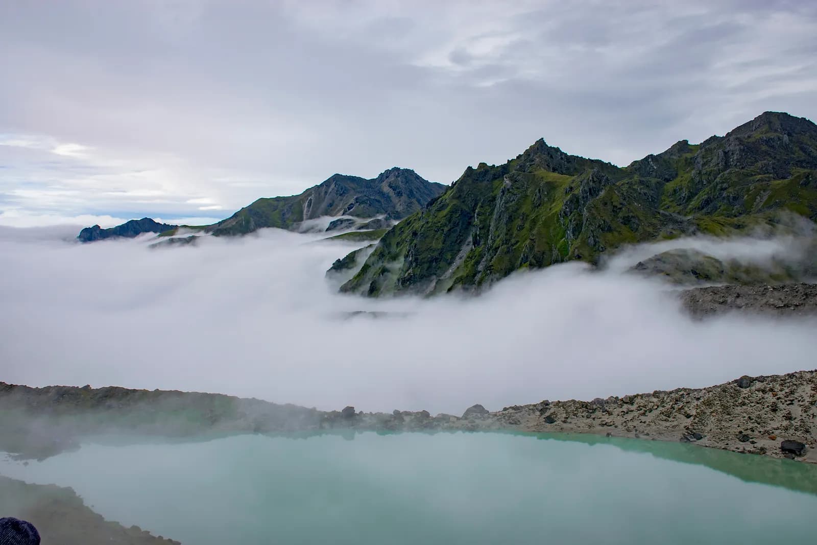
Dudh Kunda Trek
A six-day trek from Ringmu in Solu over Taksindu to Sano Beni and the sacred lake of Dudh Kunda at about 4,560 m below Numbur Himal, with a road start and finish.
- روز6
- بیشینه ارتفاع۴٬۵۶۱ متر
- مسافت۳۷٫۷ کیلومتر
- صعود۲٬۴۳۹ متر
- دشواریسخت
- بهترین ماههاMar–May, Sep–Nov
- مجوزها3
عکس: Chandra Chakradhar · CC BY-SA 4.0
به انگلیسی نمایش داده میشود — هنوز ترجمه نشده است.
این برنامهٔ سفر پیشنویس است و هنوز بررسی نشده. همیشه مراحل را با راهنمای خود تأیید کنید.
Written by FindTrekkingPartner teamبررسیشده توسط FindTrekkingPartner teamروش بررسی ماFindTrekkingPartner
Dudh Kunda Trek یک مسیر پیادهروی 6 روزه در منطقه Solu نپال است که تا ۴٬۵۶۱ متر بالا میرود. پیادهروهای خارجی میتوانند در FindTrekkingPartner با ثبت یک سفر همراه با تاریخ، بودجه و سرعت خود، برای آن همسفر پیدا کنند. تا زمانی که هر دو پیادهرو موافقت نکنند، تطابقها خصوصی میمانند و این سرویس رایگان است. با نرخهای متوسط، یک راهنمای دارای مجوز وقتی چهار پیادهرو سهم میدهند حدود ۵۶ دلار آمریکا (USD) برای هر نفر در 6 روز هزینه دارد، در مقابل ۲۲۴ دلار آمریکا (USD) برای یک پیادهرو بهتنهایی. بهترین فصلها Mar–May, Sep–Nov هستند. در عمل در اینجا راهنمای دارای مجوز لازم است: بر اساس گزارشهای فعالان تور در 2026، قانون آوریل 2023 هیئت گردشگری نپال در ایستهای بازرسی پارکهای ملی و مناطق حفاظتشده اجرا میشود؛ لانگتانگ سختگیرترین است و آناپورنا نیز بازرسی میکند (بررسیشده در 19 اکتبر 2026). راهنما را از طریق یک آژانس ثبتشده بگیرید و با آنها تأیید کنید. آخرین بررسی: ۲۷ مهر ۱۴۰۵. منابع: هیئت گردشگری نپال، DNPWC، اداره مهاجرت.
منابع:Department of Immigration, NepalNepal Tourism BoardDepartment of National Parks and Wildlife Conservation
یافتن همسفر برای Dudh Kunda Trek
- یافتن همسفر برای Dudh Kunda Trekهنوز سفر بازی نیست
- یافتن همسفر برای Pikey Peak Trekهنوز سفر بازی نیست
نمای کلی
شروع از Kathmandu۶ روز · حداکثر ۴٬۵۶۱ متر
بهترین فصلها: Mar–May, Sep–Nov · مجوزها: No restricted-area permit, Outside Sagarmatha National Park, Ask your agency about any local trek card
The Dudh Kunda trek is a six-day walk from the village of Ringmu, above Salleri in Solukhumbu, to a high glacial lake at about 4,560 m under Numbur Himal that is sacred to Hindus and Buddhists. A jeep takes you from Kathmandu to Ringmu in about ten to eleven hours, the trail climbs through Taksindu to the inn at Sano Beni at about 4,000 m, and a day trip reaches the lake and returns. The walk back to Ringmu and a drive to Kathmandu finish the trip. It covers about 38 km with 2,440 m of climbing, and it is harder than the distances suggest, because two nights are at about 4,000 m and the stage from Taksindu to Sano Beni climbs 1,300 m. It needs no flight and no restricted-area permit, and warm clothing and a good sleeping bag matter more than technical gear.
The plan follows the Kathmandu Post's account of its Dudh Kunda walk, which uses the same stops, and an operator's day-by-day notes that route through Taksindu and Sano Beni; Alpine Adventure Club sells a longer cultural trail through Taksindu and Nunthala. Lodging is thin at Sano Beni, and the Post's writer found only a roughly built house, so carry a good sleeping bag, check with your agency, and allow time to acclimatise. The best months are March to May and September to November, and pilgrims come in the August full-moon week.
Difficulty and fitness
The trek is hard for its length. Sano Beni and the lake are at about 4,000 m and 4,560 m, you sleep at 4,000 m on two nights, and the climb from Taksindu is about 1,300 m in one day. It suits fit trekkers who have spent time above 3,500 m before, and the rest day at Sano Beni is part of the acclimatisation, not a spare day.
Budget notes
The Kathmandu Post gives NPR 13,000 per person for its own trip. Our estimate on the costs section uses Nepal-wide lodge and meal ranges with a guide, a porter and road transport, and shows the jeep fare as a line to check. Allow for a good sleeping bag and for a guide who knows the Taksindu to Sano Beni ridge.
What to pack
A warm sleeping bag rated well below freezing, a down jacket, gloves, a hat, waterproofs, a headlamp and snacks. Do not rely on finding food or rooms at Sano Beni without confirming first.
نکات برجسته
- Dudh Kunda, a pilgrimage lake at about 4,560 m below Numbur Himal
- The Kamidanda viewpoint, with Everest and Kanchenjunga on a clear day
- Taksindu monastery and the Taksindu La kani gate
- Quiet trails, with almost no other trekkers outside August
- A pilgrim festival in the full-moon week of August
نقشه مسیر
دادههای مسیر از OpenStreetMap است و هنوز تیم ما آن را بررسی نکرده است. برای برنامهریزی استفاده کنید، نه مسیریابی.
روزبهروز
A short walk of about 2.2 km and 250 m, one to two hours by our estimate, takes you from Ringmu to Taksindu, at about 2,925 m, along a marked path with views back to the valley. Taksindu has a Sherpa monastery below Taksindu La, a pass at about 3,070 m on OpenStreetMap, where a Buddhist gate stands. Visit the monastery and the pass in the afternoon. The easy day is deliberate: tomorrow is long and climbs a long way, so rest, drink water and sleep as well as you can.
A long day of about 12 km and 1,310 m of climbing, seven to eight hours by our estimate, leads from Taksindu to Sano Beni. The path is marked, with rhododendron forest below and open pasture above, and the operator notes mention the Kamu Dada hotel and Aakhey Pokhari lakes as stops. Sano Beni is at about 4,010 m on the elevation model, and the inn there is basic. The Post's writer found lodging a hardship, so confirm your arrangements first. You gain a great deal of altitude today, so go slowly and watch for headache.
A day out and back from Sano Beni to Dudh Kunda: about 10.5 km round trip, with 660 m of climbing and descent, six to seven hours in all. The Post's writer climbed for about three hours to reach the lake at 4,561 m under Numbur Himal, which is held sacred, and returned to Sano Beni the same day. The weather often turns, so start early and turn back if it does. Walk quietly, do not disturb offerings, and avoid swimming. The night at Sano Beni gives you a second night at about 4,000 m before you descend.
A downhill day of about 12.8 km, 1,410 m of descent, five to six hours by our estimate, takes you from Sano Beni back along the ridge to Taksindu and on to Ringmu. The air thickens and the forest returns as you descend, and your knees will feel the drop. Kamidanda, the viewpoint above Ringmu, shows Everest and Kanchenjunga on a clear day, according to the Post, and new homestays were being built there. The hotel at Ringmu feels luxurious after Sano Beni.
Drive from Ringmu to Kathmandu, about an hour to Salleri and ten hours onward, according to the Post and Nepal Traveller, who give eight to twelve hours depending on conditions. Leave early, because daylight matters on the mountain road. Bring snacks, and allow a spare day before an international flight, as landslides can close the road. If you are connecting to a flight, you may prefer to fly from Phaplu, but flights depend on weather.
هزینهها
برآورد هزینه کل برای هر نفر: اقامتگاه و غذا بر اساس ارتفاع، حملونقل، مجوزها، و راهنما و باربرها. هر چه ترکرهای بیشتری راهنما و باربر را تقسیم کنند، سهم هر نفر کمتر میشود. تا تاریخ ۱۴۰۵ مهر.
| سبک | ۱ ترکر | ۲ ترکر با تقسیم هزینه | ۴ ترکر با تقسیم هزینه |
|---|---|---|---|
| اقتصادی | $۱۳۰–$۲۱۰* | $۱۳۰–$۲۱۰* | $۱۳۰–$۲۱۰* |
| میانرده | $۳۹۰–$۶۰۰* | $۲۸۰–$۴۴۰* | $۲۴۰–$۳۸۰* |
| راحت | $۴۴۰–$۶۷۰* | $۳۷۰–$۵۶۰* | $۳۳۰–$۵۱۰* |
راهنما را تقسیم کنید، پول پسانداز کنید
در سطح میانرده، یک ترکر تنها حدود $۳۹۰–$۶۰۰ میپردازد؛ چهار ترکر که یک راهنما و دو باربر را تقسیم میکنند هر کدام حدود $۲۴۰–$۳۸۰ میپردازند (37٪ کمتر در بالای بازه).
جزئیات برای ۲ ترکر با تقسیم هزینه
| مورد | اقتصادی | میانرده | راحت |
|---|---|---|---|
| اقامتگاه و غذا | $۱۳۰–$۲۱۰ | $۱۷۰–$۲۸۰ | $۲۳۰–$۳۵۰ |
| راهنما | — | $۷۰–$۱۲۰ | $۷۰–$۱۲۰ |
| باربرها | — | $۳۰–$۶۰ | $۶۰–$۱۱۰ |
سبک اقتصادی از حملونقل عمومی و بدون باربر استفاده میکند؛ میانرده یک باربر را بین دو ترکر و یک وسیله نقلیه اختصاصی تقسیم میکند؛ راحت برای هر ترکر یک باربر در نظر میگیرد. راهنما در جایی که الزامی است یا سبک میانرده یا راحت باشد لحاظ میشود.
اقامتگاه و غذای هر شب (اتاق و یک وعده دال بهات)
۳ شب 2,500 to 3,800 m: اتاق $۴–$۱۱، دال بهات $۵–$۱۱ · ۲ شب Above 3,800 m: اتاق $۷–$۱۹، دال بهات $۸–$۱۳
شامل نمیشود
قیمت منتشرشدهای پیدا نشد برای: Kathmandu to Ringmu by road (return). مجموعهای ستارهدار * این موارد را در نظر نگرفتهاند؛ از آژانس بپرسید. Lodging at Sano Beni is thin, so confirm rooms or carry tents. The Kathmandu Post gives NPR 13,000 per person for its own five-day trip.
منابع هزینه
- PriceNepal: Nepal Travel Cost Guide 2026 (2026-05-14)
- Third Rock Adventures: Nepal trek budget planner (2026-05-09)
- Himalayan Partner: Guide and porter price in Nepal 2026 (2026-02-10)
- Shikhar Adventure: Annapurna Circuit trek cost (2026-02-03)
- Nepal Tourism Board: Trekking Permit (2026-10-18)
برآوردها از راهنماهای اپراتورها هستند، نه قیمت قطعی. انعام، بیمه، تجهیزات و هتلهای کاتماندو شامل نمیشود؛ دلار آمریکا با نرخ تبدیل پلتفرم.
عکسها
پرسشهای متداول
This plan takes six days from Kathmandu to Kathmandu, with three days of walking up and one day of walking down plus a lake day. The Kathmandu Post describes a five-day trip, and operator plans range from seven to sixteen days with Pikey, Junbesi and Nunthala added.
The Kathmandu Post gives 4,561 m, and our elevation model gives about 4,630 m, so we quote about 4,560 m. The inn at Sano Beni, where you sleep, is at about 4,000 m.
No. There is another Dudhkunda in the Gaurishankar area of Dolakha, which is a different lake. This route goes to the one in Solukhumbu, below Numbur Himal.
In the full-moon week of August, according to the Kathmandu Post, when locals and pilgrims gather at the lake. At other times you are unlikely to meet anyone there, but the weather is wet in August.
No restricted-area permit is needed. The route is outside Sagarmatha National Park, so its entry permit does not apply. Ask your agency whether the local municipality collects a fee.
منابع
در طول مسیر
اقامتگاه، کمک پزشکی، آب و جاهای دیدنی در هر روز مسیر.
1. Kathmandu → Ringmu
- Tribhuvan International Airport · فرودگاهها و حملونقل · ۱٬۳۴۰ متر
2. Ringmu → Taksindu
- Hotel Yak&Nak · اقامتگاهها · ۲٬۷۷۰ متر
- Quite view · اقامتگاهها · ۲٬۸۳۵ متر
- Taksindu Lodge · اقامتگاهها · ۲٬۹۴۵ متر
- Takassindu Resort · اقامتگاهها · ۲٬۹۰۰ متر
Show all 5 places
- Hotel Yak&Nak · اقامتگاهها · ۲٬۷۷۰ متر
- Quite view · اقامتگاهها · ۲٬۸۳۵ متر
- Hiltop Guest House · اقامتگاهها · ۳٬۰۷۰ متر
- Taksindu Lodge · اقامتگاهها · ۲٬۹۴۵ متر
- Takassindu Resort · اقامتگاهها · ۲٬۹۰۰ متر
3. Taksindu → Sano Beni
- Mountain View Lodge · اقامتگاهها · ۲٬۹۰۸ متر
- Panorama Guest House · اقامتگاهها · ۲٬۹۴۶ متر
- Lodges · اقامتگاهها · ۲٬۹۶۲ متر
- Taksindu La · طبیعت · ۳٬۰۷۱ متر
4. Sano Beni
- Numbur Guest House · اقامتگاهها · ۴٬۰۲۲ متر
- Dudhkunda · طبیعت · ۴٬۶۰۶ متر
5. Sano Beni → Ringmu
- Viewpoint · چشماندازها · ۳٬۰۷۳ متر
- Sherpa Fast Food Lodge · اقامتگاهها · ۲٬۸۴۸ متر
6. Ringmu → Kathmandu
هنوز چیزی برای این روز روی نقشه نیست.هنوز چیزی برای این روز روی نقشه نیست.
آخرین بررسی در ۲۷ مهر ۱۴۰۵گزارش اطلاعات قدیمی