

Start in the old town at Sitalpati, the white octagonal pavilion in the main square, and wander the steep Newari lanes past shops selling dhaka cloth and brass pots to the Palpa Durbar and its Mul Dhoka gateway. Then climb to Srinagar Hill, which Nepal Traveller gives as 30 to 60 minutes from the town centre. On our map the town and hill loop is 4.4 km with about 160 m of climbing. From the view tower, Wikipedia lists the peaks from Kanjiroba and Dhaulagiri to Annapurna, Manaslu, Ganesh and Langtang, so go at dawn or dusk. Return to town by the same lanes.
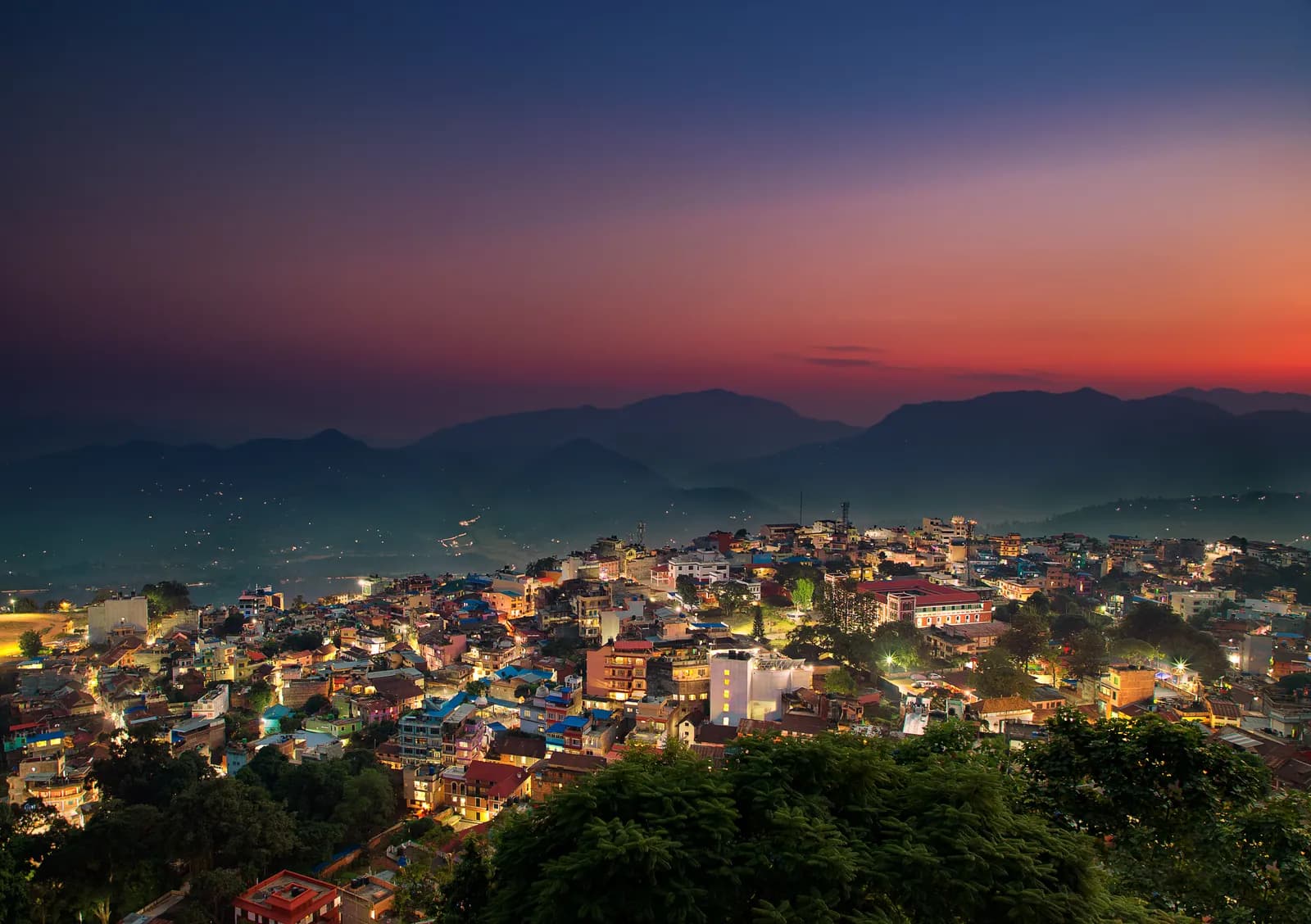
Tansen, Srinagar Hill and Ranighat
A two-day walk from the Magar hill town of Tansen: the lanes and the Srinagar Hill view tower on day one, and a 13 km descent to the Rani Mahal palace at Ranighat on day two, with no permit.
- 天數2
- 最高海拔1,490 公尺
- 距離17.4 公里
- 爬升298 公尺
- 難度簡單
- 最佳月份Oct–Nov, Mar–Apr
照片:Mithunkunwar9 · CC BY-SA 4.0
以英文顯示——尚未翻譯。
此行程為草稿,尚未經過確認。請務必與你的嚮導確認各段行程。
Written by FindTrekkingPartner team審閱者:FindTrekkingPartner team我們如何審閱FindTrekkingPartner
Tansen, Srinagar Hill and Ranighat是位於尼泊爾Palpa (Tansen)地區的 2 天健行路線,最高海拔達 1,490 公尺。外國健行者可以在 FindTrekkingPartner 發布行程,填入日期、預算與步調,為這條路線尋找夥伴。在雙方健行者都同意之前,配對結果會保持私密,且服務完全免費。 以中等價位計算,四位健行者共用時,持照嚮導 2 天的費用約為每人 19 美元(USD),一人獨自健行則為 75 美元(USD)。最佳季節為Oct–Nov, Mar–Apr。 像這樣的開放路線並不強制要求持照嚮導(2026 年 10 月 19 日查證):昆布(Khumbu)自治市已退出尼泊爾旅遊局 2023 年 4 月的規定,當日往返的健行也不需要,但仍強烈建議請嚮導,請向你的代理商確認。 這條路線的開放行程列於下方,附有出發月份、團隊人數與剩餘名額。 最後查證日期:2026年10月19日。資料來源:尼泊爾旅遊局(Nepal Tourism Board)、DNPWC、移民局。
資料來源:Department of Immigration, NepalNepal Tourism BoardDepartment of National Parks and Wildlife Conservation
尋找Tansen, Srinagar Hill and Ranighat的夥伴
概覽
從 Tansen 出發2 天 · 最高 1,490 公尺
最佳季節:Oct–Nov, Mar–Apr
Tansen, Srinagar Hill and Ranighat is a two-day walking plan from the Magar hill town of Tansen in Palpa: a town and hill day to Sitalpati and the Srinagar view tower, and a long descent to Rani Mahal, the Rana palace at Ranighat on the Kali Gandaki. On our map the first day is 4.4 km with about 160 m of climbing and the second is 13.0 km with about 1,000 m of descent, mostly on the Rani Mahal road. Sources give 30 to 60 minutes from town to Srinagar Hill and 2 to 3 hours down to Ranighat, with a return climb of about 4 hours or a car, so the second day is a big one-way day. No permit or flight is needed, and October to November and March to April are best.
What the walk is like
Day one is gentle: the old lanes of Tansen, the white octagonal Sitalpati pavilion, the Palpa Durbar and the climb to Srinagar Hill for a view from Dhaulagiri to Langtang. Day two goes down the valley of the Barandi Khola, through terraces, forest and small farms, to Ranighat, where the restored Rani Mahal stands on a bluff above the river. Most walkers go down on foot and come back by car, since the climb back is steep and takes about 4 hours.
Day by day
Day one is 4.4 km, 2 to 3 hours including time in the town. Day two is 13.0 km down, 3 to 4 hours, and a car or the 4 hour climb back to Tansen. If you prefer a shorter day, drive to Batase Danda on the ridge and walk from there, as a 2008 trip report did, which gives about 3 hours down to Ranighat.
Getting there and away
Tansen lies between Pokhara (122 km) and Lumbini (85 km) on the highway between Butwal and Pokhara, with direct buses from Kathmandu, Pokhara and Bhairahawa; Bhairahawa is about two hours away.
Permits, guides and costs
No trekking permit or TIMS card is needed, and Palpa lies outside any national park, conservation area or restricted area, so no guide is required; one is optional. Costs are the two nights, the transfers and the car back from Ranighat; see the cost section for ranges.
Season and safety
Clear air in October to November makes the best views, and March to April is warm. The pebble trail and stone steps are slippery in fog and rain, and the valley is hot in spring. See our guide rule page for the rule in full.
亮點
- Old Tansen lanes with the octagonal Sitalpati pavilion and the Palpa Durbar
- Srinagar Hill view tower, 30 to 60 minutes from town, over Dhaulagiri, Annapurna and Langtang
- A long descent to Rani Mahal, the restored Rana palace on the Kali Gandaki
- Dhaka cloth and brass pots from the shops of the old town
- No permit and no flight
路線地圖
路線資料來自 OpenStreetMap,尚未經我們團隊查核。請用於規劃,而非導航。
逐日行程
Leave early and head down towards the Kali Gandaki. Sources give 2 to 3 hours for the descent, and our map shows 13.0 km with about 1,000 m of descent, mostly by the Rani Mahal road through terraced fields and forest, so we allow 3 to 4 hours. Rani Mahal, built in 1893 by General Khadga Shamsher for his wife, stands on a wooded bluff above the river and has been a museum since its restoration in 2017. The climb back to Tansen takes about 4 hours and is steep, so most visitors arrange a car for the return, then rest in town.
費用
每人的全包估計費用:依海拔計算的旅舍與餐食、交通、許可,以及嚮導與挑夫。分攤嚮導與挑夫的健行者越多,每個人付的就越少。 截至 2026年10月。
| 風格 | 1 位健行者分攤 | 2 位健行者分攤 | 4 位健行者分攤 |
|---|---|---|---|
| 經濟 | US$30–US$60* | US$30–US$60* | US$30–US$60* |
| 中等 | US$130–US$220* | US$80–US$150* | US$70–US$120* |
| 舒適 | US$150–US$240* | US$120–US$190* | US$100–US$170* |
分攤嚮導,省下開銷
以中等價位計算,單獨健行者約需支付 US$130–US$220;四位健行者分攤一位嚮導和兩位挑夫,每人約 US$70–US$120(以價格區間上限計算,少 44%)。
2 位健行者分攤的費用明細
| 項目 | 經濟 | 中等 | 舒適 |
|---|---|---|---|
| 旅舍與餐食 | US$30–US$60 | US$40–US$80 | US$50–US$100 |
| 嚮導 | — | US$20–US$50 | US$20–US$50 |
| 挑夫 | — | US$10–US$30 | US$30–US$60 |
經濟型使用大眾運輸且不請挑夫;中等價位為兩位健行者共用一位挑夫和一輛包車;舒適型則每位健行者各有一位挑夫。在規定需要嚮導,或風格為中等價位或舒適型時,費用已包含嚮導。
每晚旅舍與餐食(房間與一份 dal bhat 餐)
2 晚Below 2,500 m:房間 US$2–US$9,dal bhat US$4–US$7
不含
找不到以下項目的公開價格:Pokhara to Tansen by bus or car; Ranighat back to Tansen by car。標有 * 的總額未計入這些項目;請向旅行社詢問。 A homestay-based walk with no permit: the costs are the nights, meals and the car back from Ranighat. A guide is optional.
費用來源
- PriceNepal: Nepal Travel Cost Guide 2026 (2026-05-14)
- Third Rock Adventures: Nepal trek budget planner (2026-05-09)
- Himalayan Partner: Guide and porter price in Nepal 2026 (2026-02-10)
- Shikhar Adventure: Annapurna Circuit trek cost (2026-02-03)
- Nepal Tourism Board: Trekking Permit (2026-10-18)
估算依據業者指南,並非報價。小費、保險、裝備與加德滿都的飯店不包含;美元依平台匯率計算。
照片
常見問題
Sources give 2 to 3 hours down, and our map shows 13.0 km, so we allow 3 to 4 hours. The climb back is about 4 hours, or arrange a car.
Possible but long. Srinagar Hill is 30 to 60 minutes from town and the Ranighat descent 3 to 4 hours, so most walkers split the two days.
Yes. The palace was restored in 2017 and has a museum inside. Ask in Tansen about any ticket and the opening time on the day.
October to November for clear views and March to April for warm days; the monsoon brings cloud and mud.
No. Palpa is not a restricted area, and the walks avoid national parks and conservation areas. A guide is optional.
資料來源
沿途地點
路線每一天沿途的住宿、醫療協助、水源與景點。
1. Tansen
- Sangam medical hall · 醫療 · 1,281 公尺
- Ayush pharmacy · 醫療 · 1,273 公尺
- The Bajra · 住宿 · 1,277 公尺
- Laxmi Homestay · 住宿 · 1,331 公尺
- Horizon Homestay · 住宿 · 1,350 公尺
- Annapurna garden · 住宿 · 1,329 公尺
- View Tower · 觀景點 · 1,492 公尺
- Shreenagar View Tower · 觀景點 · 1,439 公尺
Show all 13 places
- The Bajra · 住宿 · 1,277 公尺
- Lumbini Medical College · 機場與交通 · 873 公尺
- Hotel Tansen · 住宿 · 1,262 公尺
- Sangam medical hall · 醫療 · 1,281 公尺
- Ayush pharmacy · 醫療 · 1,273 公尺
- Rock Regency Guest House · 住宿 · 1,269 公尺
- Hotel Crown · 住宿 · 1,305 公尺
- Laxmi Homestay · 住宿 · 1,331 公尺
- Horizon Homestay · 住宿 · 1,350 公尺
- Annapurna garden · 住宿 · 1,329 公尺
- United Mission Tansen Hospital · 醫療 · 1,320 公尺
- View Tower · 觀景點 · 1,492 公尺
- Shreenagar View Tower · 觀景點 · 1,439 公尺
2. Tansen → Ranighat
- LMC Town Clinic · 醫療 · 1,277 公尺
- Indreni Restaurant and Lodge · 住宿 · 1,275 公尺
- Ashoka Guest House $ · 住宿 · 1,276 公尺
- Palpa District Hospital · 醫療 · 1,300 公尺
- The White Lake · 住宿 · 1,312 公尺
- Batasedaada · 觀景點 · 1,393 公尺
- Rice fields Valley · 觀景點 · 1,010 公尺
- Dew Camping Resort · 住宿 · 692 公尺
Show all 16 places
- Indreni Restaurant and Lodge · 住宿 · 1,275 公尺
- Ashoka Guest House $ · 住宿 · 1,276 公尺
- Upakar Medical Hall · 醫療 · 1,278 公尺
- LMC Town Clinic · 醫療 · 1,277 公尺
- The White Lake · 住宿 · 1,312 公尺
- Palpa District Hospital · 醫療 · 1,300 公尺
- Hotel Gauri Shankar · 住宿 · 1,294 公尺
- Bhattarai medical hall · 醫療 · 1,322 公尺
- City View Homestay · 住宿 · 1,330 公尺
- Amatya Homestay · 住宿 · 1,331 公尺
- Sunrise View Homestay · 住宿 · 1,332 公尺
- Hotel Srinagar · 住宿 · 1,420 公尺
- Batasedaada · 觀景點 · 1,393 公尺
- Rice fields Valley · 觀景點 · 1,010 公尺
- Ranimahal Fishing Resort · 住宿 · 877 公尺
- Dew Camping Resort · 住宿 · 692 公尺
最後確認於 2026年10月19日回報過時資訊