

Drive from Kathmandu to Dhunche, at 1,960 m, a journey of six to seven hours along the Trishuli river and up through terraced hills and forest. Dhunche is the headquarters of Rasuwa district and the entrance to Langtang National Park, where permits are checked. The town has lodges, shops and views of Langtang Lirung on a clear day. Check your gear and permits, drink plenty of water and rest. Tomorrow is a steep climb, and the weather in the hills can change quickly. Ask the lodge about trail conditions.
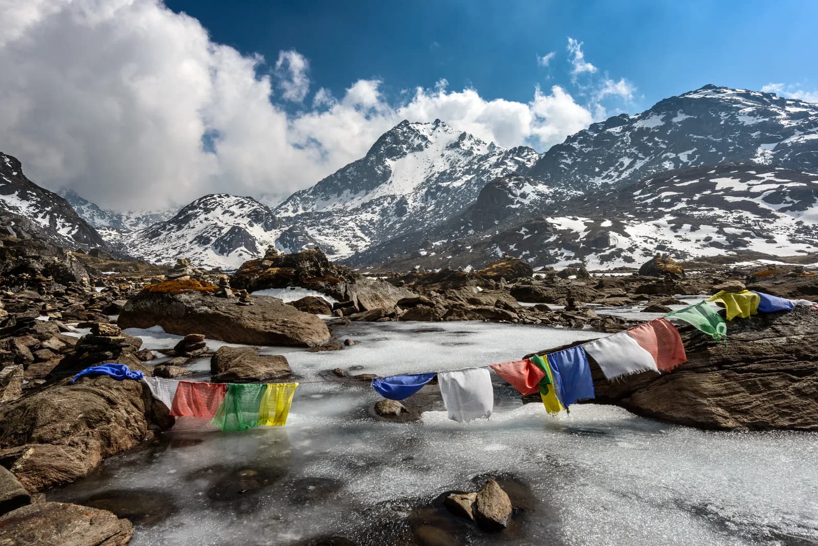
Gosaikunda Lake Trek
A short, steep climb to the sacred alpine lakes of Gosaikunda, returning via Thulo Syabru.
- 天數6
- 最高海拔4,380 公尺
- 距離32.2 公里
- 爬升2,536 公尺
- 難度中等
- 最佳月份Mar–May, Oct–Nov
- 許可2
照片:Sergey Pesterev · CC BY-SA 4.0
警告Gosaikunda: road access to Dhunche is recovering and the Syabrubesi finish is affected
This route starts with a drive to Dhunche and ends by walking from Thulo Syabru to Syabrubesi, then driving to Kathmandu. On 26 August 2026 a large rock-and-ice collapse from the north face of Langtang Lirung sent a debris flow down the Lhende Khola into the Bhote Koshi and Trishuli rivers, hitting Rasuwagadhi, Timure, Syabrubesi and Betrawati (ICIMOD). Many bridges and long stretches of the Pasang Lhamu Highway were damaged, and a large number of people died or are missing; reported figures differ by source.
The Trishuli Bazaar-Betrawati-Dhunche road was reported still closed for repair as of 21 September. A light-vehicle track has reopened, and agencies projected the remaining gaps passable no earlier than mid-October; that is a projection, not an official date. Syabrubesi, the usual Langtang road-head, is reported destroyed or closed as a trekking gateway, with the bridge to it swept away; restoration depends on the Betrawati highway reopening.
Plan the finish with your agency: a reported alternative is to descend from Thulo Syabru towards Dhunche instead of Syabrubesi. ICIMOD warns that loose debris in the valley can be remobilised by monsoon rain.
We found no official reopening notice. Check current road and trail conditions with Langtang National Park and your trekking agency before booking, and do not rely on this summary alone.
狀態查核日期:2026-10-19。
來源: ICIMOD: Kyirong-Rasuwa flood, 26 August 2026 · Nepal Pyramids: Langtang Valley trek update after the 2026 flooding · TravelNepal: Nepal floods 2026 travel safety update · Republica: locals reopen flood-damaged Langtang trekking route (16 Oct)
以英文顯示——尚未翻譯。
此行程為草稿,尚未經過確認。請務必與你的嚮導確認各段行程。
Written by FindTrekkingPartner team審閱者:FindTrekkingPartner team我們如何審閱FindTrekkingPartner
Gosaikunda Lake Trek是位於尼泊爾Langtang地區的 6 天健行路線,最高海拔達 4,380 公尺。外國健行者可以在 FindTrekkingPartner 發布行程,填入日期、預算與步調,為這條路線尋找夥伴。在雙方健行者都同意之前,配對結果會保持私密,且服務完全免費。 以中等價位計算,四位健行者共用時,持照嚮導 6 天的費用約為每人 38 美元(USD),一人獨自健行則為 150 美元(USD)。最佳季節為Mar–May, Oct–Nov。 這裡實務上需要持照嚮導:據 2026 年業者回報,尼泊爾旅遊局 2023 年 4 月的規定在國家公園與保護區的檢查哨會被執行,其中朗塘(Langtang)最嚴格,安納布爾納(Annapurna)也會查驗(2026 年 10 月 19 日查證)。請透過登記代理商聘請嚮導,並向他們確認。 這條路線的開放行程列於下方,附有出發月份、團隊人數與剩餘名額。 最後查證日期:2026年10月21日。資料來源:尼泊爾旅遊局(Nepal Tourism Board)、DNPWC、移民局。
資料來源:Department of Immigration, NepalNepal Tourism BoardDepartment of National Parks and Wildlife Conservation
尋找Gosaikunda Lake Trek的夥伴
- 尋找Gosaikunda Lake Trek的夥伴2 個開放行程
- 尋找Langtang Valley Trek的夥伴目前尚無開放行程
- 尋找Tamang Heritage Trail的夥伴目前尚無開放行程
- 尋找Helambu Trek的夥伴目前尚無開放行程
概覽
從 Kathmandu 出發6 天 · 最高 4,380 公尺
最佳季節:Mar–May, Oct–Nov · 許可:Langtang National Park entry permit, TIMS card where required
The Gosaikunda trek climbs from Dhunche to a group of sacred alpine lakes at about 4,380 m in Langtang National Park, then returns through Thulo Syabru to Syabrubesi. Gosaikunda is a Hindu and Buddhist pilgrimage site, said to have been created when Shiva struck the ground with his trident to quench his thirst after swallowing poison, and the area has 108 lakes in the vicinity, according to local tradition. This six-day plan drives from Kathmandu to Dhunche, climbs to Chandanbari (Sing Gompa), ascends through Laurebina to the lakes, descends to Thulo Syabru in a long day, and ends at Syabrubesi with the drive back. It is short but steep, and the altitude gain is fast, so it needs care. It suits fit walkers who want a short trek to a pilgrimage lake and who will respect the fast altitude gain with a slow pace and plenty of water.
What the trek is like
The route climbs steadily through oak and rhododendron forest to Sing Gompa, then through juniper and rhododendron to Laurebina Yak, where the forest ends. Above this point the trail follows a rocky ridge with exposed sections. The lakes sit in a cirque, and the main lake, Gosaikunda, is surrounded by smaller lakes including Saraswati Kunda, Bhairav Kunda and Surya Kunda. The descent to Thulo Syabru is long and steep, through forest and terraces, and ends with a walk down to Syabrubesi.
Highlights
- Rhododendron forest above Dhunche
- Sing Gompa, a small monastery with a cheese factory
- Laurebina ridge and the view of Himalayan peaks
- Gosaikunda lake and its neighbours, sacred to Hindus and Buddhists
- Thulo Syabru, a Tamang village with views of Langtang Lirung
Permits and rules
You need a Langtang National Park entry permit and a TIMS card where required. The Nepal Tourism Board April 2023 rule requires foreign trekkers to use a licensed guide in national parks and conservation areas, and 2026 operator reports say checkpoints enforce it in Annapurna (ACAP), Langtang (the strictest) and most other parks, but not in Khumbu, where the municipality opted out (checked 19 October 2026). See the guide rule by region. A guide is strongly recommended for this trek because of the exposed ridge and quick altitude gain. Check current fees with the issuing offices.
Best season
October and November are clearest, and April and May are good. The lakes freeze in winter and the trail is under snow; the monsoon brings rain and cloud, but the lakes host a festival at Janai Purnima in August, when thousands of pilgrims walk up.
Altitude
The route climbs from 1,960 m at Dhunche to 4,380 m at Gosaikunda in two days, which is fast. Altitude sickness is common here, so go slowly, drink plenty of water, and consider adding a night at Sing Gompa or Laurebina. If you have a headache or nausea, do not go higher. The descent to Thulo Syabru is long and steep.
Getting there and away
The drive from Kathmandu to Dhunche takes about 6 to 7 hours. From Syabrubesi, the drive back takes 7 to 8 hours. Landslides sometimes close the road in the monsoon.
Lodges, food and costs
Lodges at Chandanbari, Laurebina Yak and Gosaikunda are simple. Nights are very cold, and many lodges have no heating in bedrooms. Carry cash, because there are no machines on the trail.
Packing list
Waterproof boots, warm layers, a down jacket, hat and gloves, a sleeping bag rated to about -10 C, trekking poles, a headlamp, water purification and a first-aid kit.
Who this trek suits and how to prepare
The trek suits fit trekkers who want a short route and are comfortable with steep climbs. Prepare with stair climbing and hill walks. The altitude gain is fast, so previous experience at 3,000 to 4,000 m helps. Pack warm clothes, because the lakes are cold even in autumn.
The plan at a glance
Day 1 drives to Dhunche (1,960 m). Day 2 climbs to Sing Gompa (Chandanbari, 3,330 m). Day 3 climbs through Laurebina to Gosaikunda (4,380 m). Day 4 descends to Thulo Syabru (2,210 m), day 5 walks to Syabrubesi, and day 6 drives back to Kathmandu.
Extensions
From Gosaikunda you can continue over Laurebina La, at about 4,650 m, to Helambu, a trek of three to four more days that ends near Kathmandu. Others combine Gosaikunda with the Langtang Valley, returning to Syabrubesi and walking up the valley. Discuss the options with your guide and agency.
Practical tips from the trail
- Go slowly on the climb to Laurebina: it is the steepest section.
- Check the weather before leaving Sing Gompa, because the ridge is exposed.
- Carry water, because springs are few above the treeline.
- Take warm gloves and a hat for the lakeside.
- If you visit during Janai Purnima in August, expect crowds and book ahead.
Responsible trekking
Gosaikunda is a sacred site, so do not swim, wash or leave rubbish in the lakes, and respect the temple and pilgrims. Carry out your waste and buy from local lodges.
Food and lodging
Lodges at Dhunche, Sing Gompa, Laurebina Yak and Gosaikunda serve dal bhat, noodles, soup, eggs and tea. At Sing Gompa, cheese from the local cheese factory is a treat. Rooms are cold, with blankets and sometimes no heating, so bring a warm sleeping bag. Charging is expensive and slow, and hot showers are not available above Dhunche. Meals cost more at altitude because supplies are carried up by porters.
Photography tips
Early morning gives the best light on the lakes, when the water is still and the surrounding peaks reflect in it. Bring a polarising filter to reduce glare, and a wide-angle lens for the cirque. At Laurebina, the ridge gives a long view of the Himalayan range on clear days. Keep your camera and spare batteries warm, because they drain quickly in the cold.
亮點
- Sing Gompa and Chandanbari
- Laurebina ridge views
- Gosaikunda sacred lake at 4,380 m
- Saraswati Kunda and Bhairav Kunda
- Thulo Syabru
路線地圖
路線資料來自 OpenStreetMap,尚未經我們團隊查核。請用於規劃,而非導航。
逐日行程
你今晚的過夜海拔比前一晚高 1,370 公尺,超過一般 500 公尺的準則。請放慢速度、多喝水,並留意是否頭痛或噁心。
Climb steeply through oak and rhododendron forest from Dhunche to Bharku and on to Sing Gompa, also called Chandanbari, at about 3,330 m. The trail is a series of switchbacks through the trees, with views of Langtang Lirung when the clouds lift. Sing Gompa has a small monastery and a cheese factory, and several lodges. It is a hard five to six hours' walk, and the altitude gain is considerable. Drink water and watch for headaches. The evening is cold, and the lodge dining room is the warmest place.
你今晚的過夜海拔比前一晚高 1,050 公尺,超過一般 500 公尺的準則。請放慢速度、多喝水,並留意是否頭痛或噁心。
Climb through juniper and rhododendron forest to Laurebina Yak, where the trees end and the views open up. Continue along a rocky ridge, taking care in the exposed sections, to Gosaikunda, at about 4,380 m, with a series of lakes in a rocky cirque. The main lake, Gosaikunda, is a sacred site for Hindus and Buddhists, and Bhairav Kunda and Saraswati Kunda lie nearby. It is a big altitude gain, and the day takes five to six hours. Go slowly, drink water and do not continue if you have symptoms of altitude sickness.
Spend the morning at the lakes, enjoying the views of the high peaks, then start the long descent. The path climbs briefly over the Laurebina La side, then drops steeply through rhododendron and bamboo forest to Phedi and Thulo Syabru, at 2,210 m, a Tamang village with terraced fields and a view of Langtang Lirung. It is a long day of seven to eight hours, and the descent is hard on the knees, so use poles. Thulo Syabru has a number of lodges, and you can feel the warmth of the lower altitude.
Walk down from Thulo Syabru through terraced fields and forest to the Bhote Koshi valley, crossing a suspension bridge and following the road to Syabrubesi, at 1,460 m, a walk of about four hours. The path is mostly downhill, with views of the valley and Tibetan peaks. Syabrubesi is a lively village with lodges and shops. Have a hot shower, a good meal and a rest. Pay your guide and porters, and have a farewell dinner. If the road is affected by landslides, ask about conditions for tomorrow.
Drive from Syabrubesi to Kathmandu via Dhunche and Trishuli, a journey of seven to eight hours. Start early to avoid delays caused by landslides or roadworks. The road follows the Trishuli river and drops through terraces and forest. Arrive in the capital in the late afternoon. In Kathmandu, shower, repack and reflect on the trek. If you have time, visit Boudhanath or Pashupatinath. Do not schedule an international flight for the same evening, because the road can be slow or blocked.
高度適應
逐夜的過夜海拔。紅色長條表示比前一晚爬升超過 500 公尺;休息日會另外標示。
- 過夜海拔
- 爬升超過 500 公尺
- 休息日
費用
每人的全包估計費用:依海拔計算的旅舍與餐食、交通、許可,以及嚮導與挑夫。分攤嚮導與挑夫的健行者越多,每個人付的就越少。 截至 2026年10月。
| 風格 | 1 位健行者分攤 | 2 位健行者分攤 | 4 位健行者分攤 |
|---|---|---|---|
| 經濟 | US$270–US$420 | US$210–US$330 | US$180–US$280 |
| 中等 | US$570–US$970 | US$370–US$610 | US$280–US$450 |
| 舒適 | US$620–US$1,050 | US$440–US$720 | US$360–US$560 |
分攤嚮導,省下開銷
以中等價位計算,單獨健行者約需支付 US$570–US$970;四位健行者分攤一位嚮導和兩位挑夫,每人約 US$280–US$450(以價格區間上限計算,少 54%)。
2 位健行者分攤的費用明細
| 項目 | 經濟 | 中等 | 舒適 |
|---|---|---|---|
| 旅舍與餐食 | US$100–US$160 | US$130–US$210 | US$170–US$270 |
| 交通 | US$10–US$50 | US$110–US$230 | US$110–US$230 |
| 許可 | US$30–US$40 | US$30–US$40 | US$30–US$40 |
| 嚮導 | US$60–US$90 | US$60–US$90 | US$60–US$90 |
| 挑夫 | — | US$30–US$60 | US$60–US$110 |
經濟型使用大眾運輸且不請挑夫;中等價位為兩位健行者共用一位挑夫和一輛包車;舒適型則每位健行者各有一位挑夫。在規定需要嚮導,或風格為中等價位或舒適型時,費用已包含嚮導。
每晚旅舍與餐食(房間與一份 dal bhat 餐)
3 晚Below 2,500 m:房間 US$2–US$9,dal bhat US$4–US$7 · 1 晚2,500 to 3,800 m:房間 US$3–US$7,dal bhat US$4–US$7 · 1 晚Above 3,800 m:房間 US$7–US$19,dal bhat US$8–US$13
許可費用(官方來源)
費用來源
- PriceNepal: Nepal Travel Cost Guide 2026 (2026-05-14)
- Third Rock Adventures: Nepal trek budget planner (2026-05-09)
- Himalayan Partner: Guide and porter price in Nepal 2026 (2026-02-10)
- Shikhar Adventure: Annapurna Circuit trek cost (2026-02-03)
- Third Rock Adventures: Kathmandu to Syabrubesi (2026-10-18)
估算依據業者指南,並非報價。小費、保險、裝備與加德滿都的飯店不包含;美元依平台匯率計算。
照片
常見問題
Moderate but steep. The altitude gain is fast, from 1,960 m to 4,380 m in two days, and the descent to Thulo Syabru is long.
Six days on this plan, from Kathmandu to Kathmandu.
About 4,380 m.
Hindu tradition says Shiva created the lake by striking the ground with his trident. Pilgrims visit, especially at the Janai Purnima festival in August.
October to November, and April and May.
A licensed guide is required in practice: the Nepal Tourism Board April 2023 rule is enforced at checkpoints in Annapurna and Langtang and most parks (2026 operator reports, checked 19 October 2026). A guide is strongly recommended for the exposed ridge and quick altitude gain.
資料來源
沿途地點
路線每一天沿途的住宿、醫療協助、水源與景點。
1. Kathmandu → Dhunche
- Tribhuvan International Airport · 機場與交通 · 1,340 公尺
2. Dhunche → Chandanbari
- Dunche Guest House · 住宿 · 2,027 公尺
- Hotel Langtang View · 住宿 · 2,033 公尺
- Hotel Ki-yang · 住宿 · 2,032 公尺
- Rasuwa District Hospital · 醫療 · 2,109 公尺
- Dhunche Pharmacy · 醫療 · 2,029 公尺
- Tap · 實用資訊 · 2,015 公尺
- Drinking Water · 實用資訊 · 2,505 公尺
- Deurali · 住宿 · 2,664 公尺
Show all 14 places
- Dunche Guest House · 住宿 · 2,027 公尺
- Hotel Langtang View · 住宿 · 2,033 公尺
- Hotel Ki-yang · 住宿 · 2,032 公尺
- Sunrise Hotel · 住宿 · 2,032 公尺
- Dhunche national Guest House · 住宿 · 2,031 公尺
- Rasuwa District Hospital · 醫療 · 2,109 公尺
- Dhunche Pharmacy · 醫療 · 2,029 公尺
- Tap · 實用資訊 · 2,015 公尺
- Mama Vanja Hotel & Lodge · 住宿 · 2,004 公尺
- Ghatta Khola · 住宿 · 1,977 公尺
- Mini Gosaikunda hotel and lodge · 住宿 · 1,981 公尺
- New Village Hotel and Lodge · 住宿 · 2,311 公尺
- Drinking Water · 實用資訊 · 2,505 公尺
- Deurali · 住宿 · 2,664 公尺
3. Chandanbari → Gosaikunda
- Hotel Tashi Delek · 住宿 · 3,300 公尺
- Hotel Red Panda · 住宿 · 3,300 公尺
- The Hotel Yak & Nak · 住宿 · 3,309 公尺
- Viewtower · 觀景點 · 3,375 公尺
- Pine forest viewpoint · 觀景點 · 3,618 公尺
- Hotel Mount Rest View · 住宿 · 3,933 公尺
Show all 9 places
- Hotel Tashi Delek · 住宿 · 3,300 公尺
- Hotel Red Panda · 住宿 · 3,300 公尺
- The Hotel Yak & Nak · 住宿 · 3,309 公尺
- Sunset Viewpoint Cottage · 住宿 · 3,321 公尺
- Viewtower · 觀景點 · 3,375 公尺
- Pine forest viewpoint · 觀景點 · 3,618 公尺
- Langtang Lirung View · 住宿 · 3,617 公尺
- Hotel Mount Rest View · 住宿 · 3,933 公尺
- Viewpoint · 觀景點 · 4,241 公尺
4. Gosaikunda → Thulo Syabru
- View of Tibetan peak north of Syabrubensi · 觀景點 · 2,381 公尺
- Nepal view hotel & lodge · 住宿 · 2,241 公尺
- Evening view · 住宿 · 2,240 公尺
- Ganesh Himal · 住宿 · 2,238 公尺
- Ganesh Himal Hotel & Restaurant · 住宿 · 2,239 公尺
Show all 17 places
- Mungkank kharka village · 住宿 · 2,983 公尺
- Himalyan Guest House · 住宿 · 2,986 公尺
- Laligurash · 住宿 · 2,982 公尺
- Sherpa Cottage · 住宿 · 2,736 公尺
- Karmu Guest House · 住宿 · 2,711 公尺
- View of Tibetan peak north of Syabrubensi · 觀景點 · 2,381 公尺
- Nepal view hotel & lodge · 住宿 · 2,241 公尺
- Evening view · 住宿 · 2,240 公尺
- Ganesh Himal · 住宿 · 2,238 公尺
- Ganesh Himal Hotel & Restaurant · 住宿 · 2,239 公尺
- Peace Lodge and Restaurant · 住宿 · 2,238 公尺
- Hotel Yak · 住宿 · 2,235 公尺
- Blue Star lodge · 住宿 · 2,220 公尺
- Hotel Snowfall · 住宿 · 2,229 公尺
- Mona Lisa · 住宿 · 2,229 公尺
- Langtang view hotel & lodge · 住宿 · 2,227 公尺
- Hotel Himalayan 3 Brothers Guest House · 住宿 · 2,215 公尺
5. Thulo Syabru → Syabrubesi
- Namaste · 住宿 · 2,208 公尺
- Stupa Guest House · 住宿 · 2,209 公尺
- Hotel Buddha · 住宿 · 2,197 公尺
- Paradise · 住宿 · 2,157 公尺
Show all 6 places
- Namaste · 住宿 · 2,208 公尺
- Stupa Guest House · 住宿 · 2,209 公尺
- Hotel Buddha · 住宿 · 2,197 公尺
- Paradise · 住宿 · 2,157 公尺
- Tashi Dele · 住宿 · 2,114 公尺
- Tibetan friendly · 住宿 · 2,165 公尺
6. Syabrubesi → Kathmandu
這一天尚未標繪任何地點。這一天尚未標繪任何地點。
最後確認於 2026年10月21日回報過時資訊