

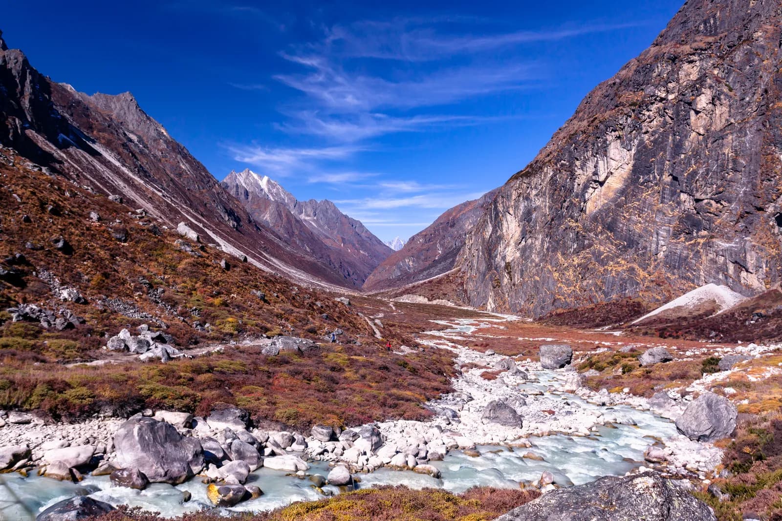
Rolwaling
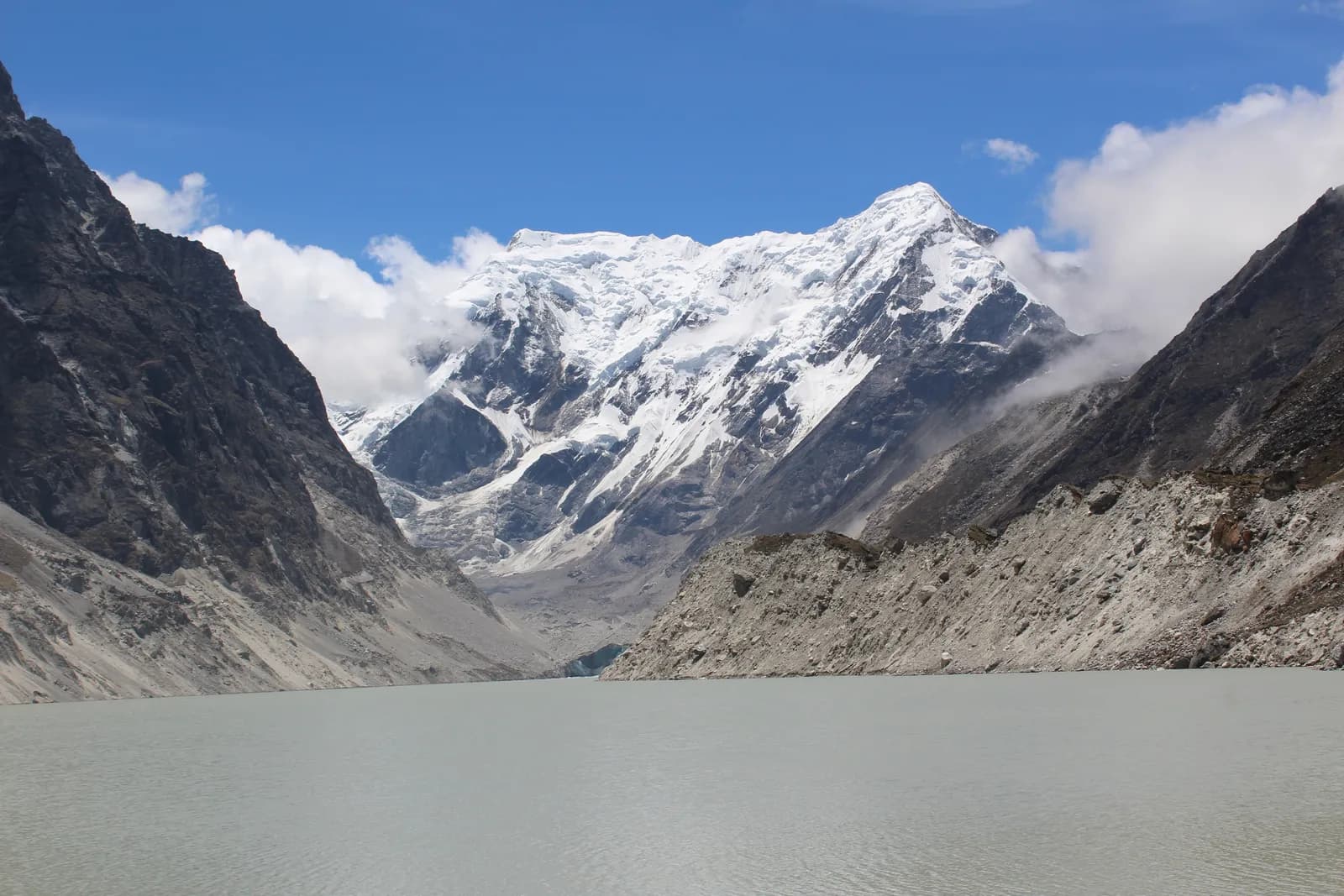
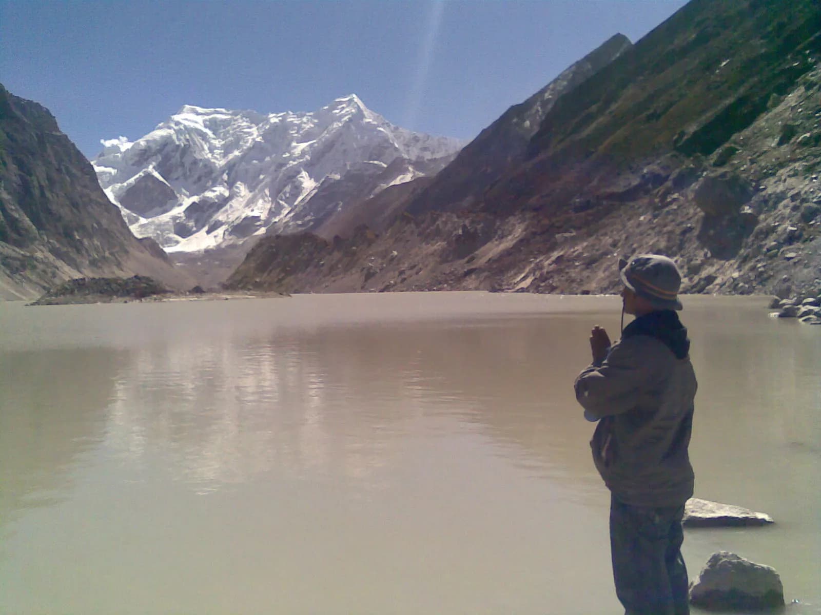
Rolwaling is a hidden Sherpa valley east of Langtang, reached by road in a day from Kathmandu, with a trail to Tsho Rolpa, one of Nepal's biggest glacial lakes, under the pyramid of Gaurishankar.
- 最高海拔Tsho Rolpa glacial lake (about 4,580 m)
- 天数10–16
- 难度困难
- 最佳月份Mar–May, Oct–Nov
- 许可证3 种许可证
照片:Nammy Hang Kirat · CC BY-SA 4.0
Check that your policy covers helicopter evacuation and trekking at this region's altitude. We don't sell insurance.
What to look forWritten by FindTrekkingPartner team审核人:FindTrekkingPartner team我们如何审核FindTrekkingPartner
Rolwaling是尼泊尔的一个徒步地区,路线为 11 天,最高海拔 4,580 米。外国徒步者可以在 FindTrekkingPartner 上发布行程,写明日期、预算和节奏,为这里的徒步寻找搭档。在双方徒步者都同意之前,匹配信息保持私密,且服务免费。 按中档价格计算,持证向导在 11 天内的费用为:四名徒步者分摊时每人约 90 美元,一人独自出行则为 361 美元。最佳季节为Mar–May, Oct–Nov。 这里实际上需要持证向导:据2026年的运营商反映,尼泊尔旅游局2023年4月的规定在国家公园和保护区的检查站得到执行,其中朗唐最严格,安纳布尔纳也会检查(2026年10月19日核查)。请通过注册旅行社聘请向导,并向他们确认。 这条路线的开放行程列在下方,包含出发月份、团队人数和剩余名额。 最后核实:2026年10月19日。资料来源:尼泊尔旅游局、DNPWC、移民局。
资料来源:Department of Immigration, NepalNepal Tourism BoardDepartment of National Parks and Wildlife Conservation
概览
- 持证向导
- 外国徒步者必须聘请
- 最少人数
- 1 名徒步者
NTB rule (Apr 2023), enforced at checkpoints in conservation areas (2026 operator reports). Checked 19 October 2026; see /guide-rule-nepal.
热门路线
出发地
Kathmandu, Charikot, Chetchet
交通方式
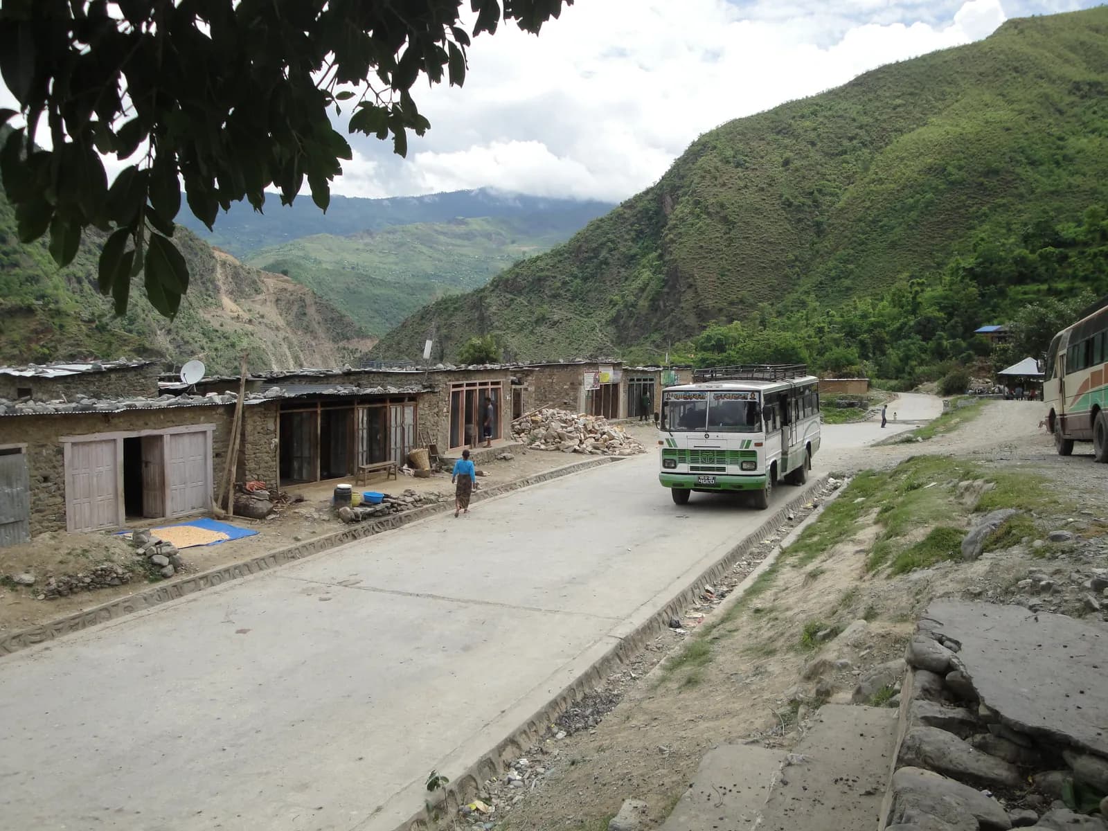
Drive Kathmandu to Chetchet via Charikot and Singati (about 8 to 9 hours, rough in the last stretch), then trek from Chetchet to Simigaon. The road may be blocked in the monsoon. There is no flight.
Rolwaling is a deep Sherpa valley in Dolakha District, east of Langtang and west of the Everest region, and its main trek follows the Rolwaling Khola from Chetchet to Beding, Na and Tsho Rolpa at about 4,580 m, beneath Gaurishankar (7,134 m). The valley lies inside the Gaurishankar Conservation Area, created in 2010, and you reach the trailhead by road in a day from Kathmandu. The trek takes about 11 days from Kathmandu, with about six days of walking, one rest day at Beding and a day trip to the glacial lake. It is quieter than Everest or Langtang, with simple lodges and steep trails, and it suits fit walkers with some altitude experience. The best months are October and November, and March to May. A conservation area permit and a licensed guide are the standard arrangement, and the technical Tashi Lapcha pass to Thame needs separate equipment and permits.
Overview of Rolwaling
The Rolwaling Himal runs along the Tibetan border east of Langtang and includes Gaurishankar at 7,134 m on the border, with Menlungtse (7,181 m) just inside Tibet and dozens of peaks above 6,000 m. The Hindu name Gaurishankar joins Gauri (Parvati) and Shankar (Shiva). The valley itself is long and steep sided, with Sherpa villages at Simigaon, Dongang, Beding and Na.
The Gaurishankar Conservation Area was established in 2010, covers about 2,179 km2 across Dolakha, Ramechhap and Sindhupalchok districts and is managed by the National Trust for Nature Conservation. It adjoins Langtang and Sagarmatha National Parks and the Tibetan border, forming part of the Sacred Himalayan Landscape.
The first western exploration of the valley came in 1951, when Eric Shipton explored it on the reconnaissance for Everest. Many Buddhists regard the valley as a sacred hidden place, with caves said to be blessed.
Best time to trek, month by month
- March: cold at Na and Beding with frozen mornings. The lower forest has rhododendron buds, and the valley is quiet.
- April: rhododendron blooms in the lower forest and the air is clear in the morning. Snow may linger above Beding.
- May: warmer, with afternoon cloud and good light on Gaurishankar at dawn. Leeches begin to appear below Dongang.
- June to August: monsoon. Heavy rain, leeches and landslides on the road to Chetchet, with few views. Not recommended.
- September: the rain eases but the trail is wet and the road is still prone to landslides.
- October: the best month, with stable weather, crisp air and good visibility. Lodges are open.
- November: colder and very clear. Beding and Na have hard frosts, and the lakes may freeze at the edges.
- December to February: very cold, with snow above Dongang. Lodges close and only experienced winter trekkers should go.
Routes compared
| Trek | Typical days | Highest point | Character |
|---|---|---|---|
| Rolwaling and Tsho Rolpa Trek | 11 | Tsho Rolpa, about 4,580 m | Remote Sherpa valley, glacial lake, steep trail, road access |
The Tashi Lapcha pass (about 5,755 m) joins Rolwaling to Thame in the Everest region in roughly 3 to 5 days from Na. It is a technical crossing with glacier travel, fixed ropes and a mandatory mountaineering permit, so only go with a specialist agency. The Daldung La (about 4,500 m) is an alternative high route toward Beding for experienced trekkers.
Permits and rules
Rolwaling lies in the Gaurishankar Conservation Area, so you need a conservation area entry permit, bought at the checkpoint or through the agency. It is not a restricted area, and no Restricted Area Permit is needed for the Tsho Rolpa trek. A TIMS card may be requested. Fees differ for foreigners, SAARC nationals and Nepalis and have changed over time, so ask for current amounts and check them with the National Trust for Nature Conservation or the Department of National Parks and Wildlife Conservation.
Guides. The Nepal Tourism Board April 2023 rule requires foreign trekkers to use a licensed guide in national parks and conservation areas, and 2026 operator reports say checkpoints enforce it in Annapurna (ACAP), Langtang (the strictest) and most other parks, but not in Khumbu, where the municipality opted out (checked 19 October 2026). See the guide rule by region. Reports on enforcement conflict. In Rolwaling, where lodges are few and trails are steep and poorly signed, a guide is strongly advised.
Getting there: the Chetchet road
From Kathmandu, a road runs east to Charikot and Singati, then north along the Tamakoshi to Gongar and Chetchet. The whole drive takes 8 to 9 hours in a jeep, and the last section can be rough and muddy. Chetchet, at about 1,400 m, is the usual start. In the monsoon, landslides often block the road, and some years it ends at Singati, adding days.
On the return, jeeps meet trekkers at Chetchet. Allow a spare day for road delays, particularly in the shoulder seasons.
Altitude and acclimatisation
The trek climbs from Chetchet at about 1,400 m through Simigaon (about 1,970 m) to Dongang (about 2,790 m) and Beding (about 3,710 m), then to Na (about 4,190 m) and the lake at about 4,580 m. The gain from Dongang to Beding is about 1,000 m, so the classic plan has a rest day at Beding and a second night at Na before the lake day trip. Tsho Rolpa itself is about 390 m above Na and a long day trip, so many guides use the early morning.
Watch for headache, nausea and poor sleep; never ascend with symptoms, and descend if they worsen. Discuss altitude medicine with your doctor before you leave, and tell your guide how you feel each evening, because symptoms can appear hours after you arrive.
Lodges, costs and food
Lodges and homestays at Chetchet, Simigaon, Dongang, Beding and Na offer rooms with blankets, dal bhat, noodles, potatoes and tea. Facilities are simple, and during peak weeks at Na some groups camp. The valley has few visitors, so lodges may close early in the season, and menus are short. Prices rise with altitude because porters carry supplies.
Connectivity
Mobile signal exists around Chetchet and Simigaon and is patchy higher up. Some lodges sell Wi-Fi or satellite time. Expect to be offline from Dongang.
Safety
Tsho Rolpa is a glacial lake that grew over decades as the Trakarding glacier retreated, and it poses a glacial lake outburst flood risk to villages along the Rolwaling and Tamakoshi rivers. An early warning system was installed by the authorities in the late 1990s, and agencies continue to monitor the lake. Do not camp on the dam, follow your guide's advice, and keep to the marked trail. In the monsoon, landslides and slippery trails are hazards, and in the upper valley, cold and altitude. Evacuation by helicopter is possible from Beding and Na in good weather, but insurance must cover it.
What to pack
Broken-in boots, waterproof layers, a down jacket, a sleeping bag rated to about minus 10 to minus 15 C, gloves, a warm hat, sun protection, trekking poles, a headlamp, water purification and a first-aid kit. In wet months add leech socks and a rain cover. Gaiters are useful for snow above Beding.
History and culture
The Sherpa people of Rolwaling, sometimes called the Rolwaling Sherpa, have lived here for generations, farming potatoes and herding yaks, and many men have worked as high-altitude guides. The valley is regarded as a sacred hidden valley and has gompas and caves for meditation. Bigu Gompa, a Buddhist nunnery in the lower hills, is a quieter side visit. The region suffered during the 2015 earthquakes, and the lower villages have been rebuilt.
Wildlife and nature
The conservation area includes subtropical forest in the lower valleys, oak and rhododendron forest above 2,000 m, fir and juniper near Beding and alpine meadows above 4,000 m. Wildlife includes red panda, Himalayan black bear, musk deer, tahr and snow leopard, and birdlife includes monal and snowcock. Most trekkers see birds and langur near Simigaon, and tahr near Na.
Responsible trekking
Stay on trails and take rubbish out. Do not swim or camp at Tsho Rolpa, and respect the glacial lake as a sacred and hazardous place. Walk clockwise around mani walls and chortens, ask before photographing people, and buy supplies locally. Use a filter instead of bottled water.
Combining treks
Rolwaling is sometimes combined with the Everest region over the Tashi Lapcha, a major undertaking. Easier combinations are a Langtang or Helambu trek in the same trip, or the Kathmandu valley around Bhaktapur. The Gaurishankar area also has village homestay trails around Bigu.
Money, insurance and logistics
Bring cash from Kathmandu or Charikot, because the valley has no machines. Insurance should cover trekking to 5,000 m and helicopter evacuation. Allow a spare day for road delays.
Arranging your trek
Choose a registered agency with experience in Rolwaling and ask about the road conditions, lodge availability, rest days and a flexible schedule. Agree the route, including whether you will visit Tsho Rolpa and how many nights you will spend at Beding and Na.
The valley village by village
Chetchet is a roadhead hamlet where the jeeps stop and porters wait. Simigaon (about 1,970 m) is the first Sherpa village, with stone houses, potato fields, a gompa and a clear view up the valley. Dongang (about 2,790 m) is a cluster of lodges in the forest above the river. Beding (about 3,710 m) is the main village of the upper valley, with a gompa, mani walls, yak herds and, on a clear morning, a view of the Gaurishankar and Menlungtse ridge from the meadows above the village. Na (about 4,190 m) is a summer settlement of a few lodges and yak huts, and the base for the lake and the Yalung Ri side trip.
Food and drink
Lodges serve dal bhat, noodles, fried potatoes, soup, tsampa porridge and eggs, with local potato and yak cheese in the upper villages. Tea with butter is available at Beding. Boil or filter water and carry electrolyte tablets for the climb to Beding.
Practical tips from the trail
- Go to Tsho Rolpa early: mornings are clear, and clouds build by midday.
- Use poles on the long descent from Beding to Simigaon, which is hard on the knees.
- Keep a warm layer and a waterproof jacket in your day bag at every stage.
- Carry small notes for lodges and donations, as there are no machines beyond Charikot.
- Book the return jeep in advance, because few vehicles wait at Chetchet.
Photography
Gaurishankar glows at sunrise from Beding and Na, and the lake is best photographed in early light when the water is still. A wide-angle lens helps at the lakeshore, and a telephoto picks out the moraine and glacier. Keep batteries warm in a pocket, as they drain quickly in the cold.
Kathmandu before and after
Spend a night in Kathmandu before the drive, and keep a buffer day after the trek. The road to Chetchet starts early, so pack the night before.
此地区的所有路线
我们在此涵盖的每条标准路线。点按路线即可打开其逐日行程。
比较路线
按长度、高度、难度或估算费用对路线排序,找到适合你的那条。
按天数 ↑排序
| 路线 | |||||
|---|---|---|---|---|---|
| Rolwaling and Tsho Rolpa Trek | 11 | 4,580 米 | 困难 | 64.2 公里 | 起价 NPR 45,000 |
费用为估算:该地区经济风格的日均费用乘以天数,不含机票和许可证。
最佳徒步时间
高亮的月份是推荐的徒步季节。 Mar–May · Oct–Nov
最佳季节其他月份
Live conditions
Notes entered by our team from the sources linked on each item. Conditions change quickly, so confirm with your guide or lodge before you set off.
Best seasons: Mar–May · Oct–Nov
Nothing recent on file. Check with your guide or lodge before you go.
许可证与费用
费用按人计算,并取决于你的国籍类别。
| 许可证 | 外国人 | SAARC | 尼泊尔人 |
|---|---|---|---|
Gaurishankar Conservation Area entry permit | NPR 3,000 | NPR 1,000 | — |
Rolwaling (Dolakha) restricted-area permit | 前 7 天 USD 20,之后每天 USD 2.86 | 请咨询旅行社 | — |
TIMS card (trekking agency issued) | NPR 2,000 | NPR 1,000 | — |
- 办理地点
Department of National Parks and Wildlife Conservation
Department of Immigration (restricted-area permit, issued through a registered trekking agency)
Trekking agency / Nepal Tourism Board
每日费用
茶屋徒步的人均每日费用。向导按每队每天计,背夫按每名背夫每天计。 截至 2026年10月。
| 档次 | 每天 | 向导 / 天 | 背夫 / 天 | 参考合计 |
|---|---|---|---|---|
| 经济 | NPR 2,900–4,800 | NPR 4,400 | NPR 2,750 | NPR 29,400–46,000 |
| 中档 | NPR 4,100–6,500 | NPR 4,400 | NPR 2,750 | NPR 39,800–61,600 |
| 舒适 | NPR 5,500–8,400 | NPR 4,400 | NPR 2,750 | NPR 52,800–79,200 |
经济: The jeep from Kathmandu to Chetchet has no published fare in our sources.
中档: The jeep from Kathmandu to Chetchet has no published fare in our sources.
舒适: The jeep from Kathmandu to Chetchet has no published fare in our sources.
规定与良好做法
向导
- 所有地区
Foreign trekkers must trek with a licensed guide in national parks and conservation areas (in force since April 2023). Enforcement varies by region, so verify the current rule before you go.
许可证
- 所有地区
Carry your permits at all times; they are checked at several checkpoints along every route.
安全与高海拔
- 所有地区
Buy travel insurance that covers helicopter rescue to at least 6,000 m.
- 所有地区
Climb high, sleep low: above 3,000 m, avoid raising your sleeping altitude by more than about 500 m per day, and add rest days.
自然保护
- 所有地区
Carry out all non-burnable waste (batteries, plastic, wrappers) and use a refillable water bottle.
文化
- 所有地区
Respect monasteries: walk clockwise around stupas and mani walls, and remove shoes where asked.
- 所有地区
Ask before photographing people, especially at religious sites and ceremonies.
无人机
- 所有地区
No drones without prior permission from the relevant authority.
照片
常见问题
You need the Gaurishankar Conservation Area entry permit. Rolwaling is not a restricted area. Ask the agency for current fees.
The Nepal Tourism Board April 2023 rule requires foreign trekkers to use a licensed guide in national parks and conservation areas, and 2026 operator reports say checkpoints enforce it in Annapurna (ACAP), Langtang (the strictest) and most other parks, but not in Khumbu, where the municipality opted out (checked 19 October 2026). Confirm with a registered agency. Lodges are few and trails steep, so a guide is strongly advised.
Eleven days from Kathmandu on this plan, including two driving days, about six days of walking and rest days at Beding and Na. Allow a spare day for the road.
About 4,580 m. It is one of the biggest glacial lakes in Nepal.
The lake has grown as the glacier retreats and poses an outburst flood risk to downstream villages. An early warning system has been installed. Trekkers visit the shore safely with a guide, but should not camp on the dam.
October and November, and March to May. The monsoon brings leeches and landslides, and winter closes the high valley.
Drive from Kathmandu via Charikot and Singati to Chetchet in 8 to 9 hours, then trek to Simigaon. There is no flight.
Yes, but it is a technical crossing of about 5,755 m with glacier travel and ropes. It requires a specialist agency, equipment and the right permits.
开放行程
关于 Rolwaling 的指南
 封面照片: Krish Dulal, CC BY-SA 3.0
 封面照片: Santosh Mishra, CC BY-SA 4.0
 封面照片: Kapilkhatri19, CC BY-SA 3.0
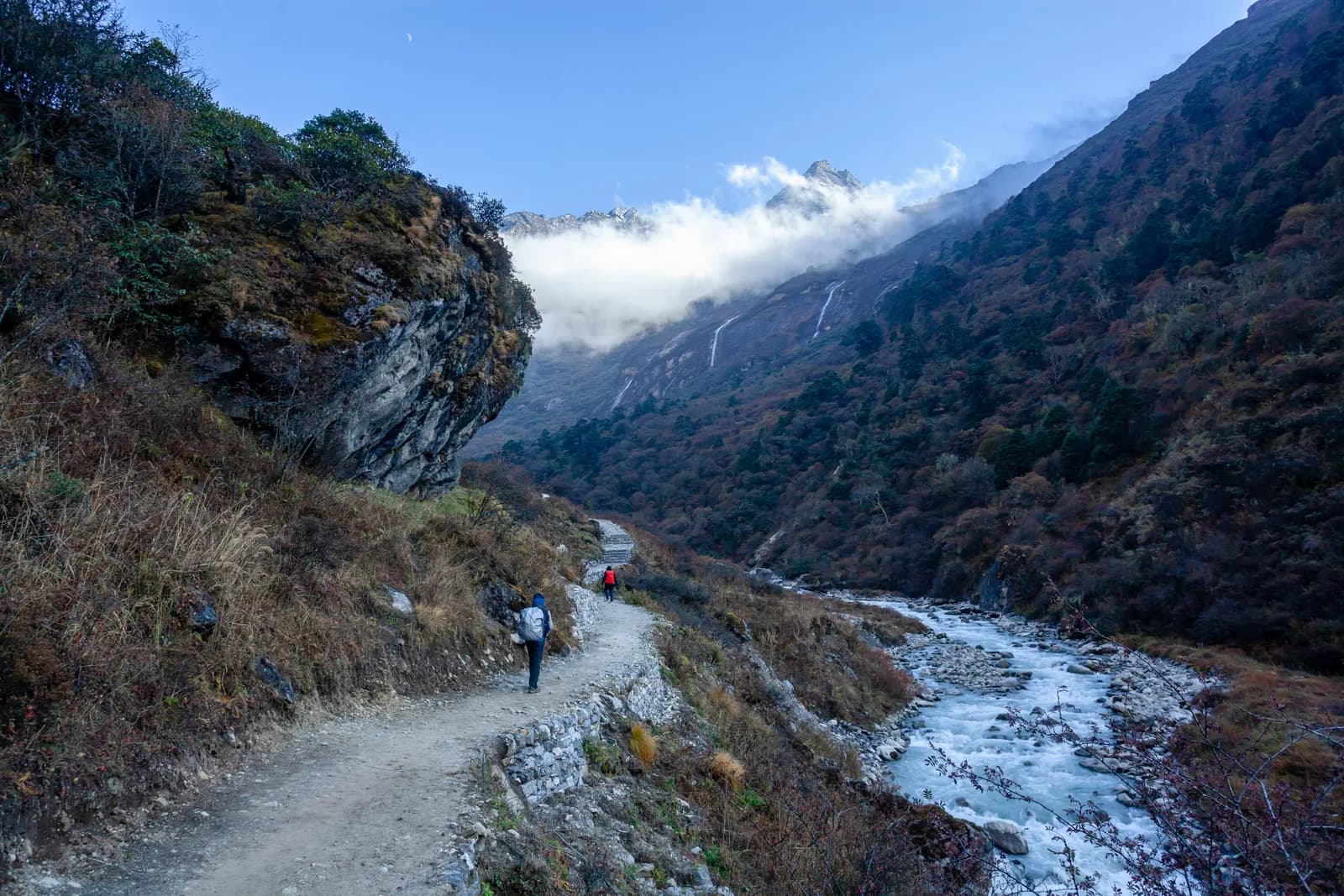 封面照片: Nammy Hang Kirat, CC BY-SA 4.0
来源
- Rolwaling Himal (Wikipedia)
- Gaurishankar Conservation Area (Wikipedia)
- Tsho Rolpa (Wikipedia)
- Dolakha District (Wikipedia)
- National Trust for Nature Conservation
- Department of National Parks and Wildlife Conservation, Nepal
- Nepal Tourism Board
- Himalayan Rescue Association
- OpenStreetMap (elevation tags of villages and lakes)
准备好去Rolwaling徒步了吗?
为这些日期找一位徒步搭档,或开始规划你自己的路线。