

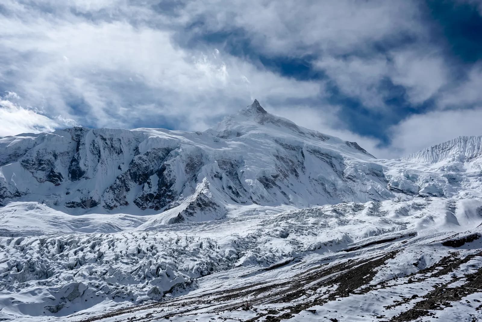
Manaslu
Manaslu is a restricted-area circuit around the world's eighth-highest mountain, crossing Larkya La (5,106 m) through Gurung and Tibetan-influenced villages in the Budhi Gandaki valley.
- Độ cao tối đaLarkya La (5,106 m)
- Ngày12–18
- Độ khóKhó
- Tháng đẹp nhấtMar–May, Oct–Nov
- Giấy phép7 giấy phép
Ảnh: Udhabkc · CC BY-SA 4.0
Check that your policy covers helicopter evacuation and trekking at this region's altitude. We don't sell insurance.
What to look forWritten by FindTrekkingPartner teamĐược FindTrekkingPartner team kiểm duyệtCách chúng tôi kiểm duyệtFindTrekkingPartner
Manaslu là một vùng trekking của Nepal, với các cung đường 12–18 ngày leo lên độ cao 5.106 m. Trekker nước ngoài có thể tìm bạn đồng hành cho các chuyến trek ở đây trên FindTrekkingPartner bằng cách đăng chuyến đi kèm ngày đi, ngân sách và tốc độ. Các kết nối được giữ riêng tư cho đến khi cả hai trekker đồng ý, và dịch vụ này miễn phí. Ở mức giá tầm trung, một hướng dẫn viên có giấy phép tốn khoảng 106 USD mỗi người trong 14 ngày khi bốn trekker chia sẻ, so với 423 USD cho một trekker đi một mình. Các mùa đẹp nhất là Mar–May, Oct–Nov. Đây là khu vực hạn chế, vì vậy hướng dẫn viên có giấy phép được thuê qua công ty lữ hành đã đăng ký là một phần của giấy phép, và cả nhóm đi theo một giấy phép của công ty. Xác minh lần cuối: 19 tháng 10, 2026. Nguồn: Cục Du lịch Nepal (Nepal Tourism Board), DNPWC, Cục Xuất nhập cảnh.
Nguồn:Department of Immigration, NepalNepal Tourism BoardDepartment of National Parks and Wildlife Conservation
- Tìm bạn đồng hành cho Manaslu Circuit Trek4 chuyến đi đang mở
- Tìm bạn đồng hành cho Tsum Valley TrekChưa có chuyến đi đang mở
Tổng quan
- Hướng dẫn viên có giấy phép
- Bắt buộc với trekker nước ngoài
- Nhóm tối thiểu
- 1 trekker
Restricted area (DoI). Restricted area: a Restricted Area Permit from the Department of Immigration through a registered agency, and a licensed guide at all times. Press reports say individual foreigners can apply since a March 2026 notice (previously a two-trekker minimum); confirm the current rule.
Chuyến trek phổ biến
Điểm xuất phát
Kathmandu, Machha Khola, Soti Khola
Cách đến
Drive Kathmandu to Machha Khola (8 to 9 hours, rough road via Arughat and Soti Khola); exit by jeep from Dharapani or Tilije to Besisahar and Kathmandu or Pokhara. There is no air access.
The Manaslu region, in Gorkha District of west-central Nepal, is a remote trekking area around Manaslu (8,163 m), the eighth-highest mountain in the world. Its classic trek, the Manaslu Circuit, follows the Budhi Gandaki valley north from Machha Khola to Samagaun, then crosses the Larkya La (5,106 m) and descends to Bimthang and Dharapani, joining the Annapurna region. Because the route passes close to the Tibetan border, it lies partly in a restricted area: you need a Restricted Area Permit issued by the Department of Immigration, arranged through a registered agency, and a licensed guide. The best months are October and November, and March to May. Plan 14 days including the drive, with two acclimatisation days at Samagaun and Samdo. Treat it as a serious expedition-style trek: book through a registered agency early, carry insurance for evacuation and allow spare days for weather on the pass.
Overview of the region
The Manaslu Conservation Area was established in 1998 and covers about 1,663 km2, rising from subtropical valleys at around 1,400 m to the summit of Manaslu. It is managed under the Department of National Parks and Wildlife Conservation and classified as IUCN category VI. Snow leopard, Himalayan tahr and musk deer live here, with over 110 species of birds and more than 1,500 flowering plants.
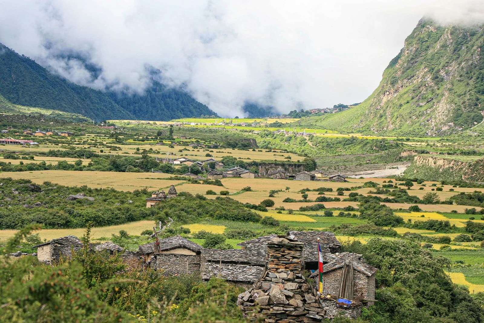
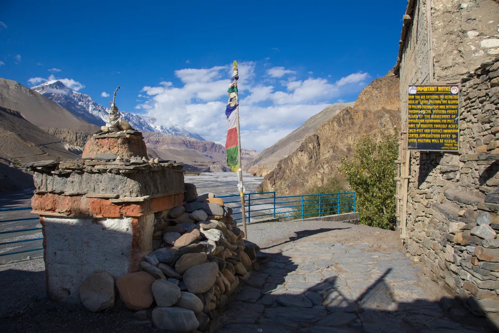
The lower valley is settled by Gurung and other hill communities, and above Namrung the villages are Tibetan-speaking and Buddhist, with monasteries, mani walls and prayer flags. Samagaun, Samdo and Lho are old trading communities. Manaslu was first climbed on 9 May 1956 by Toshio Imanishi and Gyalzen Norbu, members of a Japanese expedition, and the area has a long link with Japan.
Best time to trek, month by month
- March: cold at altitude, with snow on Larkya La. Rhododendron flowers lower down; the pass may not be passable until later in the month.
- April: the spring peak. Flowers and clear weather, though snow lingers on the pass early in the month.
- May: warmer, with some haze and afternoon cloud. Larkya La is usually clear.
- June to August: monsoon. Heavy rain, landslides on the lower trail and cloud; few people trek.
- September: the rains fade through the month, and trails are green. The pass can be wet and icy early.
- October: the most popular month, with stable weather and clear views.
- November: colder but clear and quiet; Larkya La is cold and windy.
- December to February: very cold with deep snow on the pass; the upper villages are often empty. Not recommended without winter experience.
Routes compared
| Trek | Typical days | Highest point | Character |
|---|---|---|---|
| Manaslu Circuit | 14 | Larkya La, 5,106 m | Restricted-area circuit, remote, high pass |
Side trips add variety. The Tsum Valley, a separate restricted area north of Philim, needs its own permit and several extra days. Near Samagaun you can walk to Birendra Lake, Pungyen Gompa and Manaslu Base Camp as acclimatisation hikes.
Permits and rules
The Manaslu Circuit crosses a restricted area, so you need a Restricted Area Permit (RAP) issued by the Department of Immigration of Nepal, plus Manaslu Conservation Area (MCAP) and Annapurna Conservation Area (ACAP) entry permits for the sections they cover, and a TIMS card where required. The permits are applied for through a registered trekking agency, which submits your passport copy and your guide's licence number. Check the current fees with the agency or the Department of Immigration; amounts and the day-count rules for the RAP have changed more than once, and fee quotes on trekking blogs conflict.
Solo trekking and guides. Since 22 March 2026 one trekker can apply for a restricted-area permit, so a group of two is no longer needed, and a partner halves the guide cost. The permit still has to go through a registered agency and a licensed guide must accompany you at all times. I could not confirm the official text, so check with the Department of Immigration or your agency before you book.
Getting there: road
The trek starts from Machha Khola, about 8 to 9 hours by jeep from Kathmandu via Dhading, Arughat and Soti Khola on a rough, dusty road that is often disrupted by landslides in the monsoon. Some trekkers start at Soti Khola or Arughat Bazaar. The exit is by jeep from Dharapani or Tilije to Besisahar and on to Kathmandu or Pokhara, about 6 to 7 hours from Besisahar to Kathmandu. There is no air access to the valley.
Altitude and acclimatisation
Samagaun lies at 3,530 m, Samdo at 3,875 m, and Larkya La at 5,106 m, so acclimatisation matters. The standard plan uses two rest days, one at Samagaun and one at Samdo, with day hikes to Pungyen Gompa, Birendra Lake or toward Manaslu Base Camp. Sleep at Dharamsala (Larkya Phedi, about 4,470 m) before the pass. The crossing is a long day of eight to ten hours, starting before dawn, with a climb of about 700 m from Dharamsala and a descent of about 1,400 m to Bimthang. Turn back if the weather deteriorates, and take any symptoms of altitude sickness seriously.
Lodges, costs and food
Teahouses are simple, though lodges at Samagaun, Samdo and Dharamsala are smaller and more basic than on the Annapurna or Everest routes. Rooms are cheap if you eat at the lodge; menus are limited above Namrung. Carry cash, because there are no machines on the route. Tips for the guide and porters are customary at the end of the trek.
Connectivity
Mobile coverage is patchy: you may find signal in Jagat, Lho and Samagaun, but not along the valley floor. Some lodges sell Wi-Fi by the day, and electricity is limited by solar. Carry a power bank and a paper map, and do not rely on a call for safety.
Safety
- Landslides can cut the lower trail between Machha Khola and Jagat; check conditions.
- The Larkya La crossing involves a glacial moraine and snow, and weather can close the pass. Start before dawn and keep your group together.
- Avalanche paths cross the valley above Samdo in cold seasons.
- Altitude sickness: do not ascend with symptoms, and descend if they worsen.
- Carry travel insurance that covers helicopter evacuation above 5,000 m.
What to pack
Waterproof boots, warm layers, down jacket, shell jacket and trousers, insulated gloves, warm hat, sunglasses or goggles for the pass, microspikes after snow, a sleeping bag rated to about -15 C, trekking poles, a headlamp, water purification and a first-aid kit. Bring several passport photos and copies of your permits.
Culture and communities
The lower Budhi Gandaki valley is home to Gurung and other hill communities, and above Namrung the people of Nubri speak a Tibetan dialect and practise Tibetan Buddhism. The villages of Lho, Sho, Shyala, Samagaun and Samdo have monasteries, long mani walls, chortens and prayer wheels, and many families keep yaks, sheep and horses. The people of Samdo are of Tibetan origin, and small-scale trade with Tibet over the high passes has a long history.
Walk clockwise around religious structures, dress modestly in villages and monasteries, and ask before photographing people. Local people appreciate visitors who buy from village shops and eat in family lodges.
Wildlife and nature
The conservation area is home to snow leopard, musk deer and Himalayan tahr, and Himalayan tahr are often seen on the slopes above Samagaun. Birdlife includes the Himalayan monal, snow pigeons and several species of vulture. The forests between Deng and Namrung are among the richest on the route, with rhododendron, bamboo, oak and pine, and the area has a large variety of flowering plants.
Responsible trekking
Teahouses at Samagaun, Samdo and Dharamsala are small and far from the road, so everything has to be carried in. Carry out your rubbish, take care with water and fuel, and do not expect a hot shower. The Manaslu Conservation Area Project and local lodge committees manage waste and trail upkeep, and your permits help to pay for that. Hire local guides and porters and treat them well, with proper clothing and sensible loads.
Side trips
From Samagaun, the day walks to Birendra Lake and Pungyen Gompa are popular acclimatisation trips. A longer walk to Manaslu Base Camp, at about 4,800 m, needs most of a day, and is best done only if you are acclimatised. From Philim, the Tsum Valley is a separate restricted area that needs its own permit, extra days and a guide familiar with it; it is known for monasteries such as Mu Gompa and Rachen Gompa. Check the rules and timing with your agency.
Combining with other treks
The Manaslu Circuit ends at Dharapani, which is on the Annapurna Circuit. Some people continue over Thorong La, joining the Annapurna Circuit for a trek of 20 days or more, which requires serious fitness and acclimatisation. Others finish at Besisahar and return to Kathmandu or Pokhara. Plan any extension with your agency, because your permits and guide cover only certain sections.
Money, insurance and logistics
Because the permit is arranged through an agency, the agency usually handles transport, guide and accommodation. Carry rupees for drinks and snacks, and enough small notes. Your insurance should cover trekking to 5,500 m, helicopter evacuation and restricted-area activities, so check the wording. If you are travelling on a tight schedule, leave a spare day in case the road from Kathmandu or the pass crossing is delayed by weather.
The permit process step by step
Because the circuit is a restricted area, planning starts in Kathmandu. Your registered agency collects your passport copy, visa details and photos, and submits the application to the Department of Immigration together with your guide's licence number and insurance details. The agency also buys the Manaslu Conservation Area and Annapurna Conservation Area permits and the TIMS card where it is required. Allow at least a few working days for processing, bring several passport photos, and keep paper copies of every permit, because checkposts at Jagat, Philim, Namrung and Samagaun inspect them. Insurance that covers restricted-area trekking and helicopter evacuation is part of the process, so check your policy wording first.
Food and lodging
Food at lower lodges is varied, but above Namrung menus shrink to dal bhat, noodles, tsampa porridge, potatoes, eggs and tea. In Samagaun and Samdo you may find local yak products, and in some lodges tsampa and butter tea are on offer. Rooms are small and often unheated, so bring a warm sleeping bag. Check with your guide before you rely on lodges having space at Dharamsala in the busy season.
Training and preparation
The Manaslu Circuit is long and remote, and it rewards preparation. Aim for three months of regular hill walking with a loaded pack, stair climbing and cardio, and practise on back-to-back long days to simulate the first week. Break in your boots, test your sleeping bag and practise with microspikes and poles. If you have not been above 4,500 m before, consider doing a shorter high trek first. Mental preparation matters as well: cold nights, simple food and long days are part of the journey, and a flexible attitude is the best asset.
Tất cả lộ trình trong vùng này
Mọi lộ trình tiêu chuẩn chúng tôi có ở đây. Chạm vào một lộ trình để mở lịch trình từng ngày.
So sánh lộ trình
Sắp xếp các lộ trình theo độ dài, độ cao, độ khó hoặc chi phí ước tính để tìm lộ trình phù hợp.
Sắp xếp theo Ngày ↑
Tsum Valley Trek Bản nháp
133.700 m131 km
KhóTừng ngày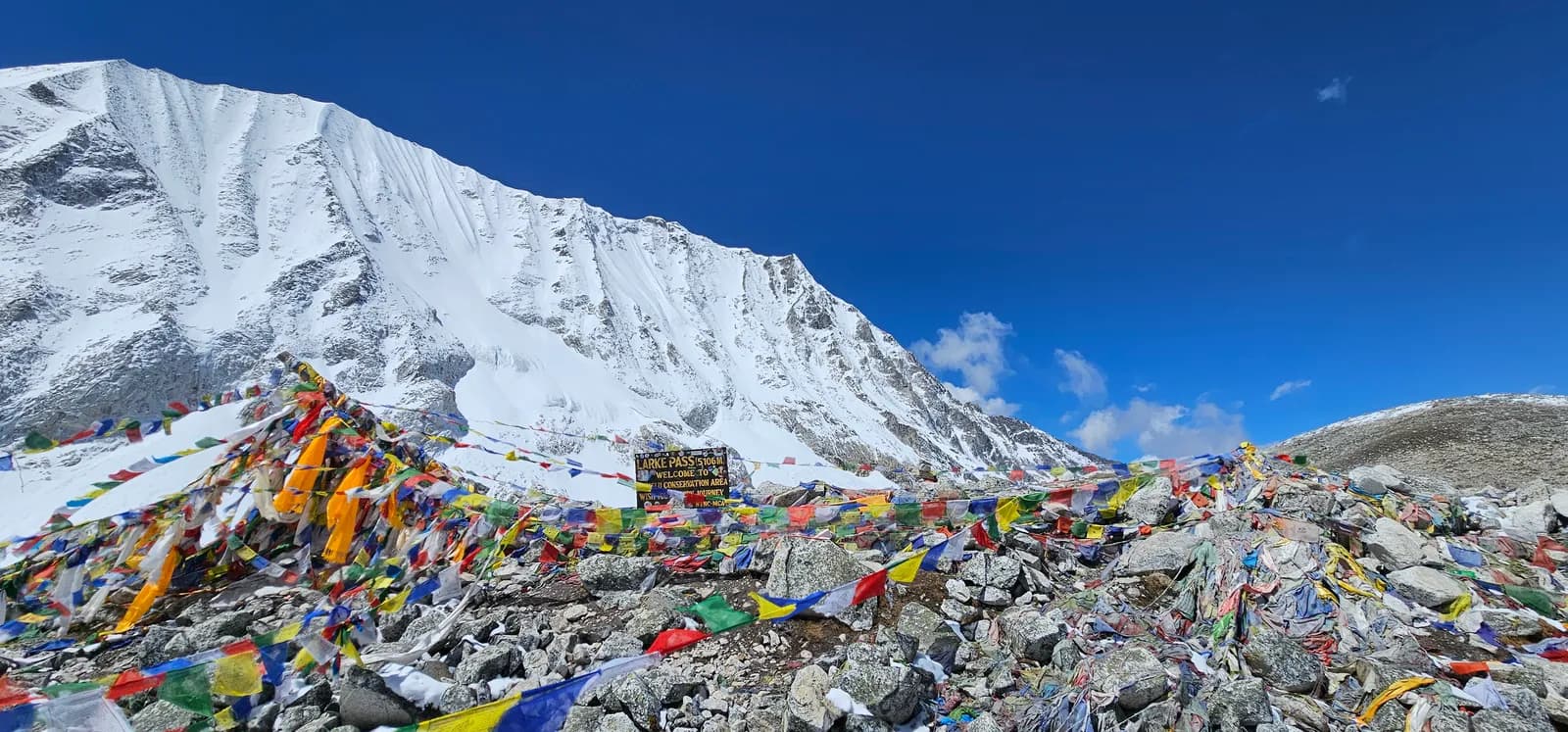
Manaslu Circuit Trek
145.106 m137 km
KhóTừng ngày
| Lộ trình | |||||
|---|---|---|---|---|---|
| Tsum Valley Trek | 13 | 3.700 m | Khó | 131 km | từ NPR 53.000 |
| Manaslu Circuit Trek | 14 | 5.106 m | Khó | 137 km | từ NPR 57.000 |
Chi phí là ước tính: mức giá hằng ngày kiểu tiết kiệm của vùng nhân với số ngày, chưa gồm vé bay hay giấy phép.
Thời điểm trekking tốt nhất
Các tháng được đánh dấu là mùa trekking được khuyến nghị. Mar–May · Oct–Nov
Mùa đẹp nhấtCác tháng khác
Live conditions
Notes entered by our team from the sources linked on each item. Conditions change quickly, so confirm with your guide or lodge before you set off.
Best seasons: Mar–May · Oct–Nov
Nothing recent on file. Check with your guide or lodge before you go.
Giấy phép và phí
Phí tính theo mỗi người và phụ thuộc vào nhóm quốc tịch của bạn.
| Giấy phép | Người nước ngoài | SAARC | Người Nepal |
|---|---|---|---|
Manaslu Restricted Area Permit (Sep–Nov)Tháng 9–Tháng 11 | USD 100 cho 7 ngày đầu, sau đó USD 15/ngày | Hỏi công ty lữ hành | Không bắt buộc |
Manaslu Restricted Area Permit (Dec–Aug)Tháng 12–Tháng 8 | USD 75 cho 7 ngày đầu, sau đó USD 10/ngày | Hỏi công ty lữ hành | Không bắt buộc |
Manaslu Conservation Area Permit (MCAP) | NPR 3.000 | NPR 1.000 | NPR 100 |
Annapurna Conservation Area Permit (ACAP, exit via Dharapani) | NPR 3.000 | NPR 1.000 | NPR 100 |
Tsum Valley restricted-area permit (Sep–Nov)Tháng 9–Tháng 11 | USD 40 cho 7 ngày đầu, sau đó USD 7/ngày | Hỏi công ty lữ hành | — |
Tsum Valley restricted-area permit (Dec–Aug)Tháng 12–Tháng 8 | USD 30 cho 7 ngày đầu, sau đó USD 7/ngày | Hỏi công ty lữ hành | — |
TIMS card (trekking agency issued) | NPR 2.000 | NPR 1.000 | — |
- Nơi mua
Only through a registered trekking agency
Nepal Tourism Board, Kathmandu, usually arranged by your agency with the RAP
Nepal Tourism Board, Kathmandu
Nepal Tourism Board offices in Kathmandu and Pokhara
Department of Immigration (restricted-area permit, issued through a registered trekking agency)
Trekking agency / Nepal Tourism Board
- Giấy tờ cần thiết
Passport copy, 2 passport photos (or digital), travel insurance details, itinerary
Chi phí hằng ngày
Mỗi người mỗi ngày cho chuyến trek ở teahouse. Hướng dẫn viên và porter tính theo nhóm/porter mỗi ngày. Tính đến tháng 10 năm 2026.
Tổng chi phí điển hình cho Manaslu Circuit Trek, 2 người trekking chia chung
- Tiết kiệm
- 670 US$–970 US$
- Tầm trung
- 1.000 US$–1.500 US$
- Thoải mái
- 1.200 US$–1.800 US$
| Mức chi tiêu | Mỗi ngày | Hướng dẫn viên / ngày | Porter / ngày | Tổng tham khảo |
|---|---|---|---|---|
| Tiết kiệm | NPR 2.900–4.800 | NPR 4.050 | NPR 2.750 | NPR 41.400–65.000 |
| Tầm trung | NPR 4.100–6.500 | NPR 4.050 | NPR 2.750 | NPR 96.700–140.200 |
| Thoải mái | NPR 5.500–8.400 | NPR 4.050 | NPR 2.750 | NPR 113.700–163.200 |
Tiết kiệm: Kathmandu to Machha Khola local bus about USD 10, private jeep about USD 180 to 220 per vehicle each way. A licensed guide through a registered agency is required; since 22 March 2026 one trekker can apply, so there is no minimum group of two.
Tầm trung: Kathmandu to Machha Khola local bus about USD 10, private jeep about USD 180 to 220 per vehicle each way. A licensed guide through a registered agency is required; since 22 March 2026 one trekker can apply, so there is no minimum group of two.
Thoải mái: Kathmandu to Machha Khola local bus about USD 10, private jeep about USD 180 to 220 per vehicle each way. A licensed guide through a registered agency is required; since 22 March 2026 one trekker can apply, so there is no minimum group of two.
Quy định và thực hành tốt
Hướng dẫn viên
- Manaslu
Your group must stay together through the restricted zone.
- Tất cả khu vực
Foreign trekkers must trek with a licensed guide in national parks and conservation areas (in force since April 2023). Enforcement varies by region, so verify the current rule before you go.
Giấy phép
- Manaslu
Restricted area: a minimum of 2 trekkers plus a licensed guide, with permits issued only through a registered agency.
- Manaslu
Tsum Valley needs its own Restricted Area Permit.
- Tất cả khu vực
Carry your permits at all times; they are checked at several checkpoints along every route.
An toàn & độ cao
- Tất cả khu vực
Buy travel insurance that covers helicopter rescue to at least 6,000 m.
- Tất cả khu vực
Climb high, sleep low: above 3,000 m, avoid raising your sleeping altitude by more than about 500 m per day, and add rest days.
Bảo tồn
- Tất cả khu vực
Carry out all non-burnable waste (batteries, plastic, wrappers) and use a refillable water bottle.
Văn hóa
- Tất cả khu vực
Respect monasteries: walk clockwise around stupas and mani walls, and remove shoes where asked.
- Tất cả khu vực
Ask before photographing people, especially at religious sites and ceremonies.
Drone
- Tất cả khu vực
No drones without prior permission from the relevant authority.
Ảnh
Câu hỏi thường gặp
Yes: a Restricted Area Permit from the Department of Immigration, issued through a registered agency, plus Manaslu and Annapurna conservation area permits. Check current fees with the agency or the Department of Immigration.
No. Reports say that since March 2026 individuals can apply for restricted-area permits, but a registered agency and licensed guide are still required. Confirm the current rule before booking.
Fourteen days from Kathmandu on this plan, including the drive and two acclimatisation days. Some itineraries take 12 to 18 days.
Larkya La is 5,106 m, the highest point of the circuit. Some sources give slightly different figures.
October and November, and March to May. Winter and the monsoon are poor.
It is a hard trek, with long days, basic lodges and a high pass. Previous multi-day trekking experience is advised.
It is rough and dusty, and landslides can close it in the monsoon. Plan for 8 to 9 hours by jeep.
Yes, but it is a separate restricted area that needs its own permit and several extra days.
Chuyến đi đang mở
Hướng dẫn về Manaslu
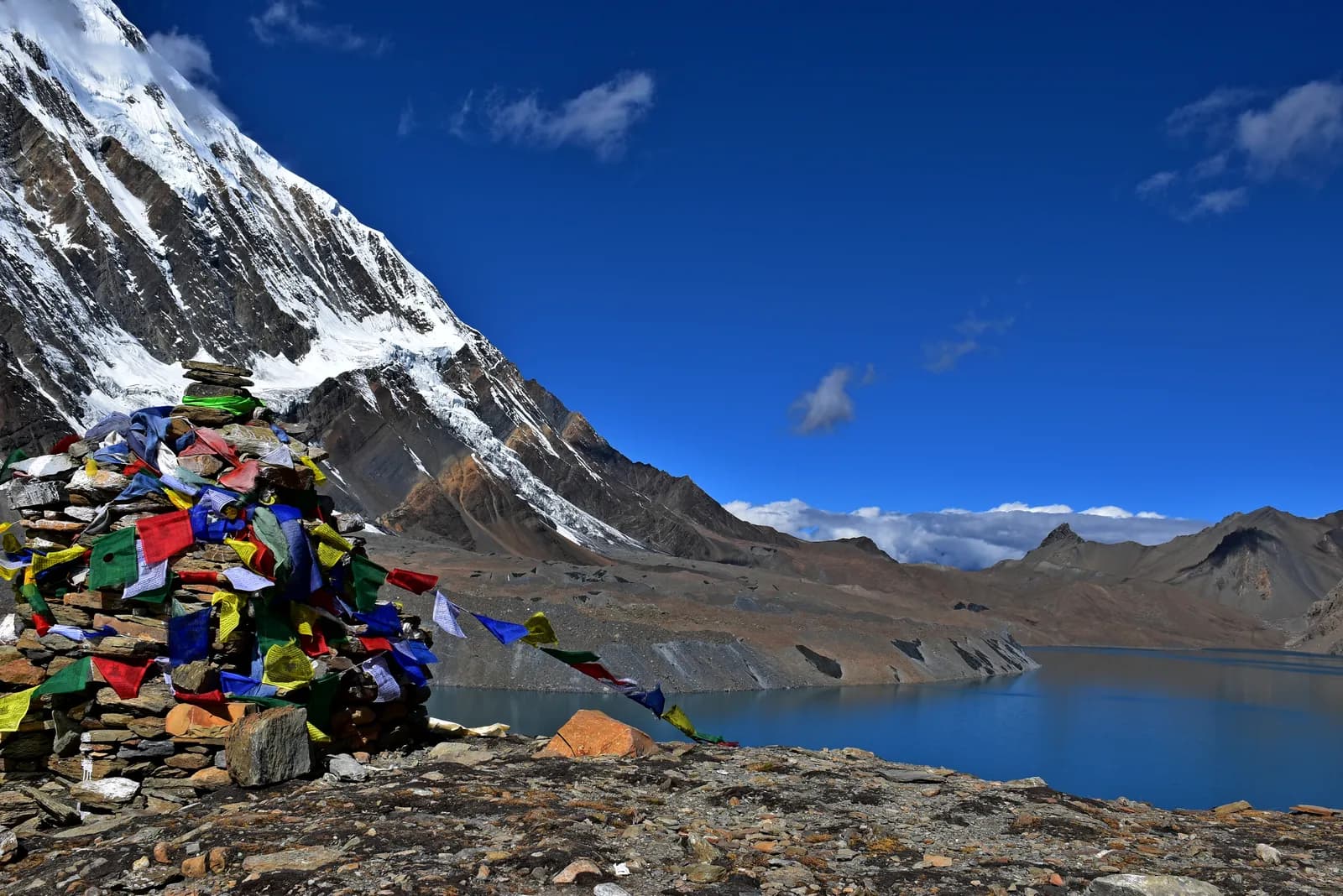 Ảnh bìa: Prabeshsdev, CC BY-SA 4.0
 Ảnh bìa: Jmhullot, CC BY 3.0
 Ảnh bìa: Ali Sabbagh, CC0
 Ảnh bìa: Dmitry A. Mottl, CC BY-SA 3.0
 Ảnh bìa: Boyko Blagoev, CC BY 2.0
 Ảnh bìa: Manuel Velazquez, CC BY 3.0
Nguồn
- Manaslu Conservation Area (Wikipedia)
- Manaslu (Wikipedia)
- Department of Immigration, Nepal
- Restrictions on trekking for foreigners in controlled areas of 13 districts (Kantipur, 6 May 2026)
- Nepal Tourism Board
- Larkya La (Wikipedia)
- Tsum Valley (Wikipedia)
- Himalayan Rescue Association
- OpenStreetMap (elevation tags of passes, peaks and villages)
Sẵn sàng trek Manaslu?
Tìm bạn đồng hành trekking cho những ngày này hoặc bắt đầu tự lên kế hoạch lộ trình.