Rolwaling valley trekking guide
What trekking in Rolwaling involves: the Chetchet road, the Sherpa villages, Tsho Rolpa glacial lake, Gaurishankar Conservation Area rules, seasons and who the trek suits.
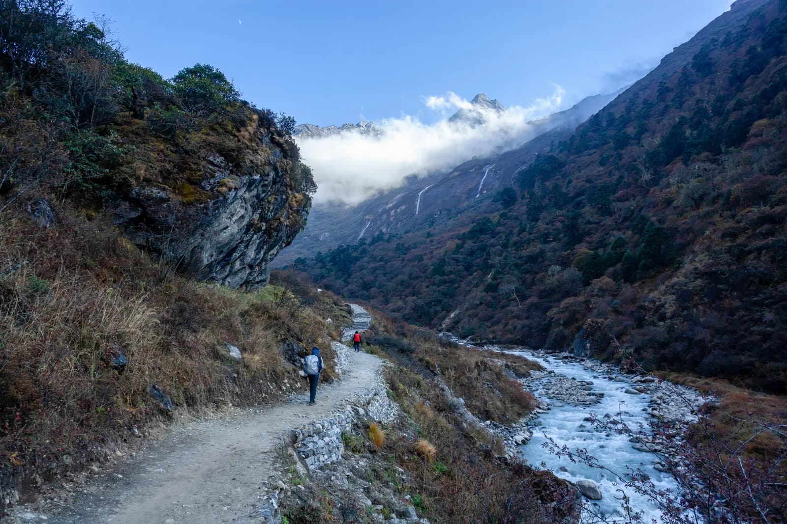
Rolwaling is a deep Sherpa valley in Dolakha District, east of Langtang and west of the Everest region. Its main trek follows the Rolwaling Khola from the roadhead at Chetchet (about 1,410 m) through Simigaon, Dongang, Beding and Na to Tsho Rolpa, a glacial lake at about 4,580 m beneath Gaurishankar (7,134 m). It takes 11 days from Kathmandu with two road days, there is no flight, and you need the Gaurishankar Conservation Area permit plus, in practice, a guide. It is hard, steep and quiet, so it suits fit walkers who have already slept above 4,000 m. The pages to open alongside this guide are the Rolwaling region page and the Rolwaling and Tsho Rolpa route.
Rolwaling and Tsho Rolpa Trek için açık geziler
Partner arayan trekkingcilerin paylaştığı gerçek geziler.
Why people choose Rolwaling
The case for Rolwaling is access plus quiet. A road takes you to the trailhead in a day, so you do not need to book flights or risk cancellations, yet the valley has few visitors, simple lodges and Sherpa villages that have not been rebuilt for large numbers of trekkers. The Rolwaling Himal runs along the Tibetan border and includes Gaurishankar at 7,134 m, with Menlungtse (7,181 m) just inside Tibet and dozens of peaks above 6,000 m. The Hindu name joins Gauri (Parvati) and Shankar (Shiva), and many Buddhists regard the valley as a sacred hidden place with blessed caves. Eric Shipton explored it in 1951 on the Everest reconnaissance.
The case against: it is steep, comfort is basic and a landslide on the road can cost you days.
The conservation area
The Gaurishankar Conservation Area was established in 2010, covers about 2,179 km2 across Dolakha, Ramechhap and Sindhupalchok districts and is managed by the National Trust for Nature Conservation. It adjoins Langtang and Sagarmatha National Parks and the Tibetan border and forms part of the Sacred Himalayan Landscape. The entry permit is bought at the checkpoint or through the agency. Our Gaurishankar permit guide explains what is and is not confirmed.
Village by village
Chetchet is a roadhead hamlet where jeeps stop and porters wait. Simigaon (about 1,970 m) is the first Sherpa village, with a gompa, mani walls and potato fields, and it is reached by a steep walk of nearly 600 m in 2 to 3 hours on day 2. Dongang (about 2,790 m) is a forest clearing with a few lodges. Beding (about 3,710 m) is the main village of the upper valley, with a gompa, yak herds and meadows above the houses with views of Gaurishankar. Na (about 4,190 m) is a seasonal settlement of a few lodges and yak huts, and the base for the lake. The gain from Dongang to Beding is about 1,050 m in 5 to 6 hours, which is why the plan rests at Beding.
Tsho Rolpa and the flood risk
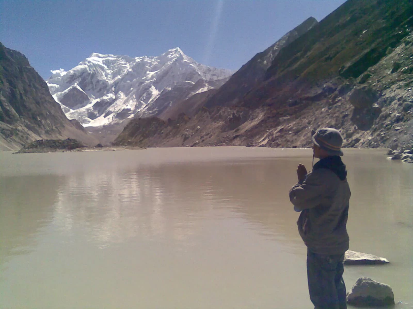
Tsho Rolpa is a glacial lake held by a moraine dam under the Trakarding glacier. The route page describes the day trip from Na as about 9 km with 380 m of climbing in 6 to 8 hours, on moraine. The lake grew over decades as the glacier retreated, and it poses an outburst flood risk to villages along the Rolwaling and Tamakoshi rivers. An early warning system was installed by the authorities in the late 1990s, and agencies continue to monitor it. For trekkers the rules are simple: go with a guide, keep to the marked trail and do not camp on the dam. Start early, because mornings are clear and clouds build by midday.
Seasons
October is the best month, with stable weather, crisp air and open lodges. November is colder and very clear, with hard frosts at Beding and Na and lakes freezing at the edges. April brings rhododendron in the lower forest and clear mornings, with snow possible above Beding. March is cold with frozen mornings, and May is warmer with afternoon cloud and good dawn light on Gaurishankar, though leeches start to appear below Dongang. June to August is monsoon, with heavy rain, leeches and landslides on the road to Chetchet, and the route data does not recommend it. In winter there is snow above Dongang and lodges close.
Road access
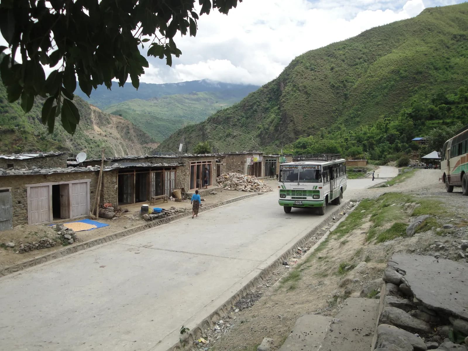
The drive from Kathmandu runs east to Charikot and Singati, then north along the Tamakoshi to Gongar and Chetchet. It takes 8 to 9 hours in a jeep, and the last section can be rough and muddy. In the monsoon landslides often block it, and in some years it ends at Singati, adding days. On the return, jeeps meet trekkers at Chetchet, and a spare day for road delays is wise.
Lodges and cash
Lodges and homestays at Chetchet, Simigaon, Dongang, Beding and Na offer rooms with blankets and dal bhat, noodles, potatoes and tea. The valley has few visitors, so lodges may close early in the season and menus are short. There are no cash machines in the valley, so bring cash from Kathmandu or Charikot.
Culture
The Rolwaling Sherpa have lived here for generations, farming potatoes and herding yaks, and many men have worked as high-altitude guides. The valley has gompas and meditation caves, and Bigu Gompa, a Buddhist nunnery in the lower hills, is a quieter side visit. The lower villages were damaged in the 2015 earthquakes and have been rebuilt. Walk clockwise around mani walls and chortens and ask before photographing people.
Altitude and health
You climb from about 1,410 m at Chetchet to 3,710 m at Beding in three days, then to Na at about 4,190 m after a rest day, and the lake at about 4,580 m is a day trip, so you sleep no higher than Na. Because the pace is fast on days 3 and 4, the route page builds the rest day at Beding before Na. Watch for headache, nausea and poor sleep, tell your guide how you feel each evening and never ascend with symptoms, as covered in our altitude sickness basics. Evacuation by helicopter is possible from Beding and Na in good weather, but insurance must cover it, and the region page says insurance should cover trekking to 5,000 m.
Beyond the standard trek
The Tashi Lapcha pass (about 5,755 m) joins Rolwaling to Thame in the Everest region in roughly 3 to 5 days from Na. It is a technical crossing with glacier travel, fixed ropes and a mandatory mountaineering permit, so only go with a specialist agency. The Daldung La (about 4,500 m) is an alternative high route toward Beding for experienced trekkers. Easier combinations are a Langtang or Helambu trek in the same trip, or village homestay trails around Bigu.
Nature
Forest changes from subtropical in the lower valleys to oak and rhododendron above 2,000 m, then fir and juniper near Beding and alpine meadow above 4,000 m. The conservation area includes red panda, Himalayan black bear, musk deer, tahr and snow leopard, and birdlife includes monal and snowcock, though most trekkers see birds and langur near Simigaon and tahr near Na.
What to pack
A sleeping bag rated to about minus 10 to minus 15 C, a down jacket, waterproofs, gaiters for snow above Beding, poles for the 2,030 m descent on day 9, leech socks in wet months, a headlamp and water purification. Keep a warm layer and rain jacket in your day bag at every stage.
Who should go
Choose Rolwaling if you want a hard, short, road-access trek, are comfortable with simple lodges and have some altitude experience. Choose something else if you want a social trail with many lodges, or if you cannot tolerate a rough road. The Rolwaling itinerary gives the daily plan. For other regions return to the regions guide.