

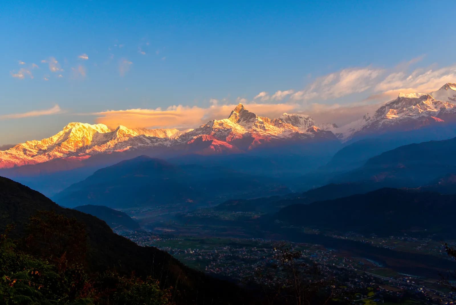
Take a taxi from Lakeside to Sedi Bagar around 4 am and start up the classic footpath with a headlamp. The way climbs through Sedi and Sarangkot villages and sal and pine forest on stone steps and dirt trail. On our map the climb is about 3.7 km with 770 m of ascent, which a guide gives as two to three hours at an easy pace, and you want to reach the viewpoint 20 to 30 minutes before sunrise. At the top, a deck at 1,592 m looks at Machhapuchhre, Annapurna South and Hiunchuli lit by the first light, with Pokhara and Phewa Lake below. Have tea and breakfast, pay the small viewpoint fee, then walk down in an hour and a half or so, or take a taxi.
Sarangkot Sunrise Hike
A one-day pre-dawn hike from Sedi Bagar near Pokhara's Lakeside up stone steps and forest paths to Sarangkot (1,592 m) for the Annapurna sunrise, 7.5 km round trip with 770 m of climbing.
- Hari1
- Ketinggian maks.1.592 m
- Jarak7,5 km
- Pendakian773 m
- KesulitanSedang
- Bulan terbaikOct–Nov, Mar–Apr
Rencanakan trip dengan rencana perjalanan iniCari partner untuk Sarangkot Sunrise HikeLihat keberangkatan per minggu
Foto: Paryataksarathi ( Sneha) · CC BY-SA 4.0
Ditampilkan dalam bahasa Inggris — belum diterjemahkan.
Rencana perjalanan ini masih draf dan belum diverifikasi. Selalu konfirmasikan tahapannya dengan pemandu Anda.
Written by FindTrekkingPartner teamDitinjau oleh FindTrekkingPartner teamCara kami meninjauFindTrekkingPartner
Sarangkot Sunrise Hike adalah trek 1 hari di wilayah Pokhara, Nepal, yang mendaki hingga 1.592 m. Trekker asing dapat mencari teman untuk trek ini di FindTrekkingPartner dengan memposting trip berisi tanggal, anggaran, dan kecepatan mereka. Kecocokan tetap privat sampai kedua trekker setuju, dan layanannya gratis. Pada tarif menengah, pemandu berlisensi memerlukan sekitar USD 9 per orang selama 1 hari jika empat trekker berbagi, dibandingkan USD 37 untuk satu trekker sendirian. Musim terbaik adalah Oct–Nov, Mar–Apr. Pemandu berlisensi tidak diwajibkan di rute terbuka seperti ini (dicek 19 Oktober 2026): kotamadya Khumbu keluar dari aturan Nepal Tourism Board April 2023 dan hiking harian tidak memerlukannya, tetapi pemandu tetap sangat disarankan, jadi konfirmasikan dengan agen Anda. Trip terbuka untuk rute ini tercantum di bawah, lengkap dengan bulan berangkat, ukuran grup, dan sisa tempat. Terakhir diverifikasi: 19 Oktober 2026. Sumber: Nepal Tourism Board, DNPWC, Department of Immigration.
Sumber:Department of Immigration, NepalNepal Tourism BoardDepartment of National Parks and Wildlife Conservation
Cari teman untuk Sarangkot Sunrise Hike
- Cari teman untuk Sarangkot Sunrise HikeBelum ada trip terbuka
- Cari teman untuk World Peace Pagoda and Raniban HikeBelum ada trip terbuka
- Cari teman untuk Australian Camp and Dhampus TrekBelum ada trip terbuka
- Cari teman untuk Panchase TrekBelum ada trip terbuka
- Cari teman untuk Ghandruk Village 2-Day Trek1 trip terbuka
Ikhtisar
Mulai dari Sedi Bagar1 hari · maks. 1.592 m
Musim terbaik: Oct–Nov, Mar–Apr
The Sarangkot sunrise hike is a one-day pre-dawn walk from Sedi Bagar, on the north side of Pokhara's Lakeside, up stone steps and forest paths to the Sarangkot viewpoint at 1,592 m, with a walk or taxi ride back down. On our map the round trip is about 7.5 km with 770 m of climbing. A guide to the classic footpath gives two to three hours up at an easy pace, faster coming down, and another account puts the whole free hike at three to five hours. Start between 4:30 and 5:30 am so that you reach the top 20 to 30 minutes before sunrise, when Machhapuchhre and Annapurna South catch the first light. Reaching Sedi by taxi takes 15 to 25 minutes. The viewpoint charges a small fee. Take a headlamp, warm clothes and water.
The plan follows an Adventure Collective guide to the footpath and a travel blog that walked it, with a Wikipedia entry for the hill. They agree on the height of about 1,600 m, with 1,592 m on the observation deck, and on a climb of 700 to 800 m. The blog counts 11 km from the lakeside; our map starts at Sedi Bagar and is shorter.
What the hike is like
The classic footpath climbs through Sedi and Sarangkot villages and sal and pine forest on stone steps and dirt trail, with periodic stair-lanes. The steps are well laid and well used. At the top a viewing deck sits about 50 m of stairs above the parking area, with tea and breakfast nearby; the blog estimated about 200 people there at sunrise. The view takes in Machhapuchhre, Annapurna South, Hiunchuli and, on clear days, Dhaulagiri, with Pokhara and Phewa Lake below.
Permits and rules
No park permit applies. The viewpoint charges NPR 60 per person according to a travel blog, and a guide says a small local viewpoint fee may apply, so carry small notes. Mind the stone steps and the edges of the ridge in the dark.
Best season
An operator says you can do the hike at any time of year. Clear mornings are best in autumn (October to November) and spring (March to April). Sunrise falls between about 5:10 and 7:00 am depending on the month.
Getting there and away
Take a taxi from Lakeside to Sedi, 15 to 25 minutes. If you prefer to ride up, a taxi quote to the viewpoint was NPR 1,500, and NPR 2,000 to the summit, in a blog updated in 2026; another traveller paid NPR 1,800 for a taxi that waited two hours. The drive takes about 30 minutes.
Difficulty and fitness
The hike is moderate: 770 m of climbing in about 3.7 km, mostly on steps. Start with a headlamp, carry water, and take it slowly in the dark.
Budget notes
There is no permit. Budget for the taxi to Sedi, the viewpoint fee of NPR 60 and breakfast at the top. The costs section shows the taxi as a line to check.
Sorotan
- Sunrise over Machhapuchhre and Annapurna South from the Sarangkot viewpoint at 1,592 m
- A classic footpath through Sedi and Sarangkot villages and sal and pine forest
- Views of Pokhara city, Phewa Lake and, on clear days, Dhaulagiri
- A free walk with a small viewpoint fee at the top
- Tea and breakfast at the viewpoint
Peta rute
Data rute dari OpenStreetMap, belum diperiksa tim kami. Gunakan untuk perencanaan, bukan navigasi.
Hari demi hari
Biayanya
Perkiraan biaya total per orang: lodge dan makanan menurut ketinggian, transportasi, izin, serta pemandu dan porter. Semakin banyak trekker berbagi pemandu dan porter, semakin sedikit yang dibayar tiap orang. Per Oktober 2026.
| Gaya | 1 trekker berbagi | 2 trekker berbagi | 4 trekker berbagi |
|---|---|---|---|
| Hemat | — | — | — |
| Menengah | US$40–US$80* | US$20–US$40* | US$10–US$30* |
| Nyaman | US$40–US$80* | US$30–US$50* | US$20–US$40* |
Bagi pemandu, hemat uang
Pada kisaran menengah, trekker solo membayar sekitar US$40–US$80; empat trekker berbagi satu pemandu dan dua porter membayar sekitar US$10–US$30 per orang (66% lebih murah di ujung atas kisaran).
Rincian untuk 2 trekker berbagi
| Item | Hemat | Menengah | Nyaman |
|---|---|---|---|
| Pemandu | — | US$10–US$30 | US$10–US$30 |
| Porter | — | US$0–US$20 | US$10–US$30 |
Hemat memakai transportasi umum dan tanpa porter; menengah berbagi satu porter untuk dua trekker dan kendaraan pribadi; nyaman memberi setiap trekker seorang porter. Pemandu disertakan jika diwajibkan atau gayanya menengah atau nyaman.
Tidak termasuk
Tidak ditemukan harga yang dipublikasikan untuk: Lakeside to Sedi Bagar and back by taxi. Total bertanda * tidak menyertakannya; tanyakan ke agen Anda. A day hike: no lodging and no permit; a small viewpoint fee (about NPR 60) applies. A guide is optional.
Sumber biaya
- PriceNepal: Nepal Travel Cost Guide 2026 (2026-05-14)
- Third Rock Adventures: Nepal trek budget planner (2026-05-09)
- Himalayan Partner: Guide and porter price in Nepal 2026 (2026-02-10)
- Shikhar Adventure: Annapurna Circuit trek cost (2026-02-03)
- Nepal Tourism Board: Trekking Permit (2026-10-18)
Perkiraan dari panduan operator, bukan penawaran harga. Tip, asuransi, perlengkapan, dan hotel di Kathmandu tidak termasuk; USD dengan kurs platform.
Foto
Pertanyaan yang sering diajukan
A guide to the classic footpath says two to three hours up at an easy pace and faster down; another account gives three to five hours for the whole free hike. Our map shows 7.5 km round trip with 770 m of climbing.
Between 4:30 and 5:30 am, depending on the season, so you reach the viewpoint 20 to 30 minutes before sunrise. Sunrise falls between about 5:10 and 7:00 am through the year.
The observation deck is at 1,592 m; other pages round it to about 1,600 m.
A travel blog gives NPR 60 per person. A guide says a small local fee may apply, so carry small notes.
A 2019 blog, updated in 2026, was quoted NPR 1,500 to the viewpoint and NPR 2,000 to the summit, with quotes of up to 3,500 from other drivers. The drive takes about 30 minutes.
Sumber
Di sepanjang jalur
Penginapan, bantuan medis, air, dan pemandangan di setiap hari rute.
1. Sedi Bagar
- CIWEC Hospital Pokhara · Medis · 809 m
- Global Health Care · Medis · 808 m
- Viewpoint · Titik pandang · 1.154 m
- Drinking Water · Praktis · 1.197 m
- Fewa View Family Guest House and Resturent · Penginapan · 1.464 m
- ViewTop Lodge and Restaurant · Penginapan · 1.498 m
- Panaromic View Guest House · Penginapan · 1.514 m
- Hotel New Galaxy · Penginapan · 1.526 m
Show all 38 places
- Goma Medical Hall · Medis · 807 m
- Pandey Medical Hall · Medis · 813 m
- Ramba Pharmacy · Medis · 808 m
- Smriti Medical · Medis · 807 m
- The Lake Pharmacy · Medis · 807 m
- Panthi Pharmacy · Medis · 816 m
- Trekking Medicine Pharmacy · Medis · 808 m
- Sarathi Medical Hall · Medis · 807 m
- Bishal Medico Pharma · Medis · 814 m
- Ayurvedic Health Home · Medis · 817 m
- CIWEC Hospital Pokhara · Medis · 809 m
- Global Health Care · Medis · 808 m
- OM family ashram · Medis · 838 m
- Phewa Lake · Alam · 798 m
- Gita’s Place · Penginapan · 850 m
- Gorgeous Village Guest House · Penginapan · 919 m
- Viewpoint · Titik pandang · 1.154 m
- Drinking Water · Praktis · 1.197 m
- Hare Danda viewpoint · Titik pandang · 1.296 m
- Fewa View · Penginapan · 1.426 m
- Fewa View Family Guest House and Resturent · Penginapan · 1.464 m
- Healthpost Road · Medis · 1.435 m
- ViewTop Lodge and Restaurant · Penginapan · 1.498 m
- Panaromic View Guest House · Penginapan · 1.514 m
- Hotel New Galaxy · Penginapan · 1.526 m
- Hotel High Ground Inn · Penginapan · 1.523 m
- Lake View Lodge · Penginapan · 1.533 m
- Trekking Lodge · Penginapan · 1.532 m
- Pristine Himalaya Lodge & Restaurant · Penginapan · 1.526 m
- High Ground Inn & Roof Top Restaurant · Penginapan · 1.523 m
- Blue Planet Anex Lodge & Restaurant · Penginapan · 1.539 m
- Superview Lodge · Penginapan · 1.543 m
- River View Guest House · Penginapan · 1.547 m
- Mountain View Lodge & Restaurant · Penginapan · 1.529 m
- Sarangkot View Point Lodge · Penginapan · 1.552 m
- Aati Restaurant & Cafe · Penginapan · 1.528 m
- Crony Cottage Lodge · Penginapan · 1.533 m
- Sarangkot · Titik pandang · 1.578 m