

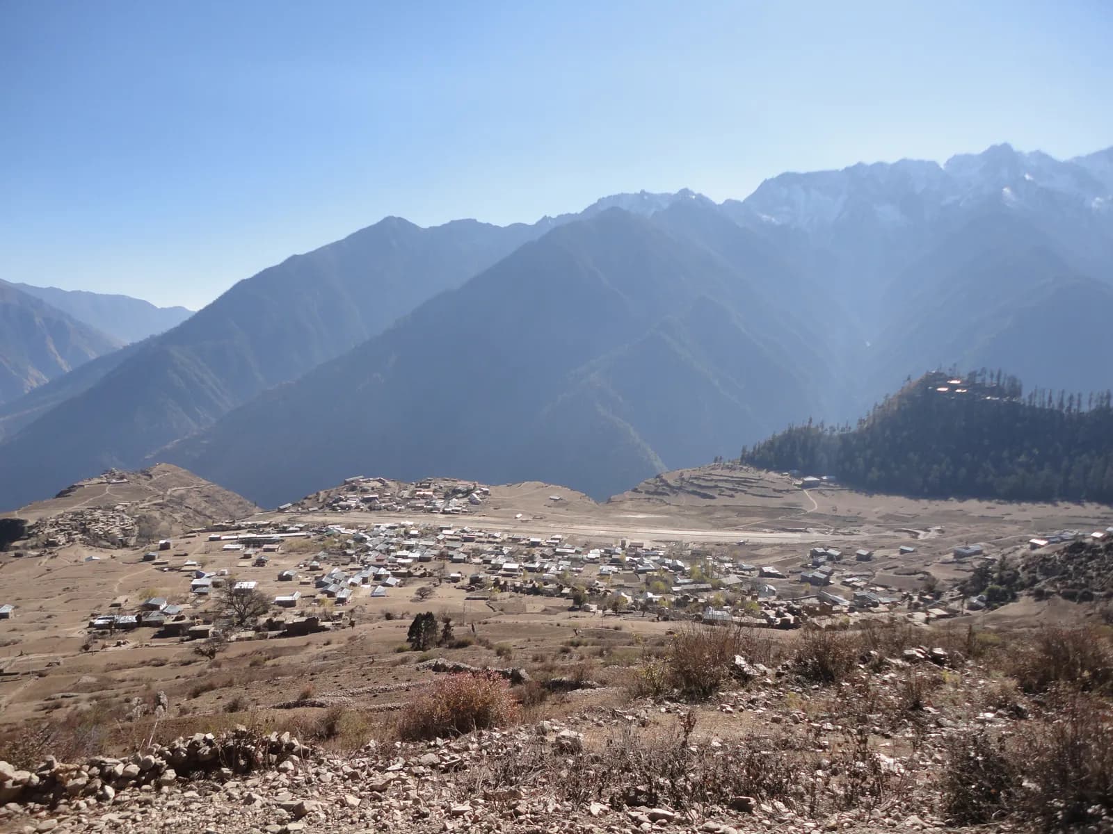
Humla
Humla is Nepal's far north-west: the Humla Karnali gorge from Simikot to the Tibet border at Hilsa, and the Limi Valley, three Tibetan villages beyond the Nara La reached only by air and on foot.
- अधिकतम ऊँचाईNyalu La (about 4,940 m)
- दिन16–21
- कठिनाईकठिन
- सबसे अच्छे महीनेApr–Jun, Sep–Nov
- परमिट2 परमिट
फ़ोटो: Ganesh Paudel · CC BY-SA 3.0
Check that your policy covers helicopter evacuation and trekking at this region's altitude. We don't sell insurance.
What to look forWritten by FindTrekkingPartner teamFindTrekkingPartner team द्वारा समीक्षितहम समीक्षा कैसे करते हैंFindTrekkingPartner
Humla नेपाल का एक ट्रेकिंग क्षेत्र है, जहां 18 दिन के रूट हैं जो 4,940 मीटर तक चढ़ते हैं। विदेशी ट्रेकर FindTrekkingPartner पर अपनी तारीखों, बजट और रफ़्तार के साथ ट्रिप पोस्ट करके यहां के ट्रेक के लिए पार्टनर खोज सकते हैं। मैच तब तक निजी रहते हैं जब तक दोनों ट्रेकर सहमत न हों, और सेवा मुफ़्त है। मध्यम दरों पर लाइसेंस प्राप्त गाइड का खर्च चार ट्रेकर के साझा करने पर 18 दिनों में प्रति व्यक्ति लगभग USD 168 है, जबकि अकेले एक ट्रेकर के लिए USD 672। सबसे अच्छे मौसम Apr–Jun, Sep–Nov हैं। यह प्रतिबंधित क्षेत्र है, इसलिए पंजीकृत एजेंसी के माध्यम से रखा गया लाइसेंस प्राप्त गाइड परमिट का हिस्सा है, और पूरा समूह एक एजेंसी परमिट पर यात्रा करता है। अंतिम सत्यापन: 19 अक्टूबर 2026। स्रोत: नेपाल पर्यटन बोर्ड, DNPWC, आव्रजन विभाग।
स्रोत:Department of Immigration, NepalNepal Tourism BoardDepartment of National Parks and Wildlife Conservation
- Limi Valley Trek के लिए पार्टनर खोजेंअभी कोई खुली ट्रिप नहीं
परिचय
- लाइसेंसधारी गाइड
- विदेशी ट्रेकर्स के लिए ज़रूरी
- न्यूनतम ग्रुप
- 1 ट्रेकर
Restricted area (DoI). Humla is a restricted area. The Nepal Tourism Board lists the permit at USD 50 per person for the first week and USD 10 per day beyond that, issued by the Department of Immigration through a registered trekking agency. Since 22 March 2026 one trekker can apply, but a licensed guide through a registered agency is still required (a partner halves the guide cost); some operators quote older or different fees, so use the official figure and confirm the current rules with your agency.
लोकप्रिय ट्रेक
शुरुआती स्थान
Kathmandu, Nepalgunj, Simikot, Hilsa
कैसे पहुँचें
Fly Kathmandu to Nepalgunj (45 to 60 minutes), then a small plane to Simikot (about 40 to 45 minutes, 2,900 to 2,950 m by operator figures). Flights depend on wind and cloud, so carry spare days. Humla can only be reached by air or on foot; a road is under construction but is not a travel plan.
Humla is the north-western corner of Karnali Province, a district of 5,655 square kilometres, the second-largest in Nepal, that borders Tibet and can only be reached by air or on foot. Its headquarters Simikot, about 2,900 m up, is the gateway to two remote walks: the Humla Karnali valley to Hilsa on the border, a route pilgrims walk to Mount Kailash, and the Limi Valley, three Tibetan-speaking villages (Halji, Jang and Til) at roughly 3,700 to 4,100 m. The standard Limi loop takes 18 days from Kathmandu by air to Simikot, walks up the Karnali to Hilsa, crosses the Nara La (about 4,620 m), visits the three Limi villages, returns over the Nyalu La (about 4,940 m) and walks back to Simikot. Humla is a restricted area: the Nepal Tourism Board lists the permit at USD 50 per person for the first week and USD 10 per day after that, through a registered agency, with a licensed guide.
Overview of the Humla region
Humla has about 55,000 residents, all rural, who live between the subtropical river valleys and the nival peaks. More than half of the district, 58.7 percent, lies in the alpine zone at 4,000 to 5,000 m. Hindus, mostly Chhetri and Thakuri, make up about 87 percent of the population and Buddhists about 12 percent; the Buddhists are Tibetan-speaking people in the north, especially in Limi. The district has seven rural municipalities, and Namkha is the largest rural municipality in Nepal by area. Wild yaks, thought to be regionally extinct, were rediscovered in Humla in 2014.
Simikot and the Karnali gorge
Simikot's airstrip sits on a terrace above the town, at about 2,820 m on OpenStreetMap and 2,900 to 2,950 m in operator itineraries. From there the trail drops to Dharapuri, about 2,300 m, and follows the Humla Karnali upstream through Kermi (hot springs), Yalbang, Tumkot and Yari to Hilsa, the Tibet border post on the river. The traditional Kailash foot route covers Simikot to Hilsa in four to five days over the Nara La. The Great Himalaya Trail's Nepal section ends at Hilsa.
The Limi Valley loop
Past Hilsa the trail follows the upper Karnali to Manepeme, crosses the Lamka La (about 4,300 m) and reaches Til, the first of the three Limi villages. Halji has the Rinchenling monastery, Jang is the highest of the three, and from Jang a long wilderness stage via Talung climbs to the Nyalu La and drops to Shinjungma, with no village until Kermi. The route returns down the Karnali to Simikot. See the Limi Valley day plan for the stage-by-stage plan.
Halji, Rinchenling and Limi culture
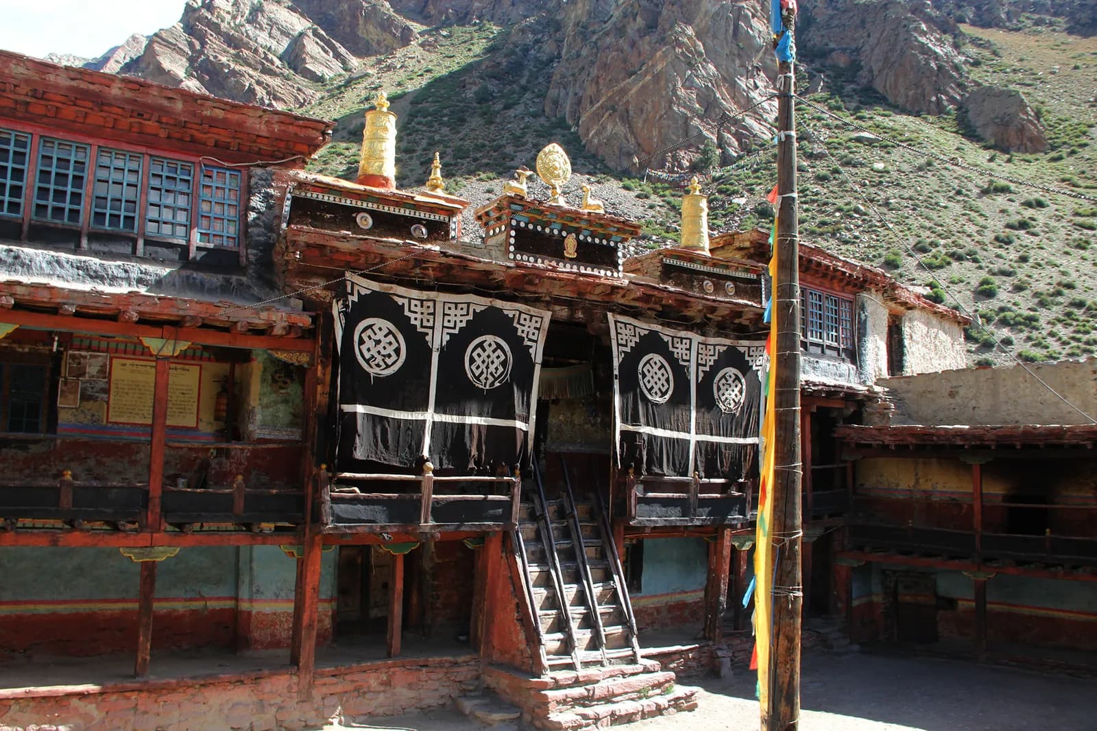
Limi's three villages were settled by Tibetan migrants and have been continuously inhabited for at least a thousand years, by the accounts we found. The Rinchenling monastery in Halji follows the Drikung Kagyu school; popular accounts credit the 11th-century translator Rinchen Zangpo, while a 2008 article attributes the foundation to the 13th or 14th century, so treat the date as traditional. A glacial lake outburst flood damaged Halji in 2011, and conservation work continues. Behave as a guest: ask before photographing monks or interiors, circle chortens and mani walls clockwise, and do not touch ritual objects.
Best time to trek, month by month
April to June and September to November are the best months. Operators avoid December to February, when passes are snowed in and the nights are bitter, and the monsoon (June to September) brings landslides on the lower trail and cancels flights. Limi's villages are high enough for frost in October.
- April and May: dry trails, flowers on the lower slopes, cold nights above Hilsa.
- June: warmer, with the first monsoon cloud at the end of the month.
- September: green and clear after rain, but landslide risk lingers.
- October and November: the clearest views; short days and frost at Til.
- December to February: not advised.
Permits and rules
Humla is on the Department of Immigration's restricted-area list. The Nepal Tourism Board gives the fee as USD 50 per person for the first week and USD 10 per day beyond one week. One operator quotes USD 90 for ten days, and other fee tables list different figures, so use the Board's number and ask the agency to confirm. The permit is arranged through a registered trekking agency; you hand over your passport and visa details in Kathmandu. A licensed guide through a registered agency is required. Since 22 March 2026 one trekker can apply, so there is no longer a minimum group of two, but a partner halves the guide cost. Your agency also arranges the TIMS card (NPR 2,000 for foreigners (SAARC nationals NPR 1,000) per the Nepal Tourism Board).
Getting there and away
The route in is by air: Kathmandu to Nepalgunj (45 to 60 minutes), then a flight to Simikot of about 40 to 45 minutes. The Simikot airstrip is weather dependent, and flights are often delayed or cancelled for days, so build at least two spare days in the middle of the trip and at the end. Some operators route through Surkhet, driving three hours from Nepalgunj before the flight. Your agency books the seats, and baggage allowances on the small aircraft are strict.
Altitude and acclimatisation
The itinerary climbs from Simikot (about 2,950 m) to Yari (about 3,700 m) and the Nara La (about 4,620 m) in four days, which is fast: plan to drink well, keep a steady pace and descend if you feel unwell. The highest night is Talung at about 4,370 m, and the Nyalu La, near 4,940 m, is the highest crossing. Descent from Talung is a long day to Shinjungma, so you cannot easily turn back there. Take a medical kit and read about the signs of altitude sickness.
Lodging, food and costs
Humla has few teahouses. Operators run Limi as a camping or homestay trek with a cook and porters, because facilities are scarce, and the cost is the agency's price rather than lodge bills. The route page lists the sourced permit fees and sample costs, and flags this as a camping trek.
Safety and logistics
Evacuation from Limi takes days: the nearest roads and hospital are far, and a helicopter needs good weather. Carry a satellite messenger or radio through your guide, buy insurance that covers helicopter evacuation above 4,000 m and delays, and keep a reserve of days and cash. Do not rely on phone coverage in Limi.
Wildlife and nature
The valley floors have blue pine and juniper, with birch and barley fields in the villages, and the high slopes are open alpine pasture. Wild yaks were rediscovered in northern Humla in 2014, and Himalayan blue sheep and snow leopards may use the high valleys. The Humla Karnali is a river you hear most of the way.
Responsible trekking
Humla's communities are small, so buy local food and services where you can, ask permission before camping on pasture and carry your litter out. Do not give money or sweets to children. Respect that the Limi villages keep their own customs, and follow your guide's advice on photography.
What to pack
Limi needs the kit of a high-altitude camping trek: broken-in boots, a four-season sleeping bag rated to about minus 10 degrees or lower, a down jacket, a windproof shell, warm hat, gloves, sun hat, sunglasses with side protection, high-factor sun cream, trekking poles, a headlamp and a water filter or purification tablets. Bring a first-aid kit with blister care, rehydration salts and your own prescription medicines. Operators supply tents, kitchen gear and food, but check which items you are expected to bring yourself, including a sleeping mat. Pack in a duffel bag that fits the small-aircraft allowance, and leave surplus luggage in Kathmandu.
Fitness and training
This is a long remote loop with 14 days on foot, several of them 7 to 8 hours, and the two longest stages come after more than a week of walking. Train for stamina with long hikes carrying a loaded daypack, stair or hill repeats for the climbs and a few back-to-back long days. Practise in the boots you will wear. Previous experience at 4,000 m is a real advantage, because the plan has no acclimatisation day, and the route climbs from Simikot to Yari in four days. Get a medical check before you go.
Money, insurance and permits timeline
Book through a registered agency at least a few weeks ahead, because the restricted-area permit is processed in Kathmandu and the agency needs your passport details and photographs. The Nepal Tourism Board publishes the fee; the agency adds its own service charge. Insurance must cover trekking above 4,000 m, helicopter evacuation and flight delays. Carry rupees in small notes for Kermi, Halji and Simikot, and leave tips for the crew until the end of the trek.
Kathmandu before and after
Allow a spare day in Kathmandu before the trip to meet the agency, check your gear and have your permit papers signed, and another after it in case the Simikot flights run late. The flights to Nepalgunj run daily, but the connection to Simikot depends on the weather and is the usual reason for delay. If you have time, add a rest day in Kathmandu or Pokhara to recover before heading home.
How the operators' itineraries differ
Four operator itineraries describe the Limi loop and they match closely from Simikot to Hilsa and from Til to Kermi. Travels with Teri runs 18 days with a rest day at Jang and a Surkhet route to the Simikot flight; Eternal Himalaya and Explore Share run 20 to 21 days with extra days in Kathmandu and a stop at Muchu between Yalbang and Yari; Peregrine Treks runs about 20 days with the same stages. The sources give Nara La as 4,560 or 4,620 m, the Nyalu La as 4,940, 4,949 or 5,001 m, and Til at 4,000 m, so altitudes here are rounded and labelled "about". Wikipedia puts the Nara La at 4,530 m. The plan on this site uses the shared stage structure with the flight days as separate days, and leaves buffer days for you to add.
Who the Limi loop suits
The Limi loop suits experienced walkers who want a remote, cultural trek and can cope with 14 walking days, several of 8 hours, camping and slow evacuation. It is not a trek for beginners, and it is best done with a registered agency that has run Humla before, a guide who knows the route and a plan for flight delays. If you have less time, a shorter walk from Simikot to Hilsa on the Kailash pilgrim route is possible.
Health, food and water
Food in Humla is simple and heavily based on rice, lentils, potatoes and barley, with tsampa, butter tea and dried yak products in Limi. The crew cooks most meals on a camping trek. Boil, filter or treat all water, and avoid raw salads. Carry rehydration salts, diarrhoea tablets, blister care, a pulse oximeter if you wish, and your own prescription medicines, because the pharmacies at Simikot and Hilsa are small and the next hospital is a flight away.
इस क्षेत्र के सभी रूट
यहाँ हमारे कवर किए सभी मानक रूट। किसी रूट पर टैप करके उसका दिन-ब-दिन यात्रा-कार्यक्रम खोलें।
रूट की तुलना करें
अपने लिए सही रूट खोजने के लिए रूट को लंबाई, ऊँचाई, कठिनाई या अनुमानित खर्च से क्रमबद्ध करें।
दिन ↑ के अनुसार क्रमबद्ध
| रूट | |||||
|---|---|---|---|---|---|
| Limi Valley Trek | 18 | 4,940 मी | कठिन | 193 किमी | NPR 74,000 से |
खर्च एक अनुमान है: क्षेत्र की बजट-स्टाइल दैनिक दर गुणा दिन, उड़ानों और परमिट के बिना।
ट्रेक के लिए सबसे अच्छा समय
हाइलाइट किए गए महीने ट्रेकिंग के सुझाए गए मौसम हैं। Apr–Jun · Sep–Nov
सबसे अच्छा मौसमअन्य महीने
Live conditions
Notes entered by our team from the sources linked on each item. Conditions change quickly, so confirm with your guide or lodge before you set off.
Best seasons: Apr–Jun · Sep–Nov
Nothing recent on file. Check with your guide or lodge before you go.
परमिट और शुल्क
शुल्क प्रति व्यक्ति है और आपके राष्ट्रीयता समूह पर निर्भर करता है।
| परमिट | विदेशी | SAARC | नेपाली |
|---|---|---|---|
Humla restricted-area permit (Simikot, Limi) | पहले 7 दिनों के लिए USD 50, फिर USD 10/दिन | एजेंसी से पूछें | — |
TIMS card (trekking agency issued) | NPR 2,000 | NPR 1,000 | — |
- कहाँ से लें
Department of Immigration (restricted-area permit, issued through a registered trekking agency)
Trekking agency / Nepal Tourism Board
दैनिक ख़र्च
टीहाउस ट्रेक पर प्रति व्यक्ति प्रतिदिन। गाइड और पोर्टर का ख़र्च प्रति ग्रुप/पोर्टर प्रतिदिन है। अक्टूबर 2026 तक।
Limi Valley Trek का सामान्य कुल खर्च, 2 ट्रेकर्स साथ में
- किफ़ायती
- $990–$1,450
- मध्यम बजट
- $1,250–$1,850
- आरामदायक
- $1,500–$2,250
| शैली | प्रतिदिन | गाइड / दिन | पोर्टर / दिन | नमूना कुल |
|---|---|---|---|---|
| किफ़ायती | NPR 2,900–4,800 | NPR 5,000 | NPR 2,750 | NPR 80,900–1,22,200 |
| मध्यम बजट | NPR 4,100–6,500 | NPR 5,000 | NPR 2,750 | NPR 1,00,100–1,50,300 |
| आरामदायक | NPR 5,500–8,400 | NPR 5,000 | NPR 2,750 | NPR 1,23,400–1,81,800 |
किफ़ायती: Kathmandu to Nepalgunj flight about USD 100 to 140 each way; the Nepalgunj to Simikot fare was not found in our sources, flights are weather-bound and often delayed.
मध्यम बजट: Kathmandu to Nepalgunj flight about USD 100 to 140 each way; the Nepalgunj to Simikot fare was not found in our sources, flights are weather-bound and often delayed.
आरामदायक: Kathmandu to Nepalgunj flight about USD 100 to 140 each way; the Nepalgunj to Simikot fare was not found in our sources, flights are weather-bound and often delayed.
नियम और अच्छे तरीके
गाइड
- सभी क्षेत्र
Foreign trekkers must trek with a licensed guide in national parks and conservation areas (in force since April 2023). Enforcement varies by region, so verify the current rule before you go.
परमिट
- सभी क्षेत्र
Carry your permits at all times; they are checked at several checkpoints along every route.
सुरक्षा और ऊँचाई
- सभी क्षेत्र
Buy travel insurance that covers helicopter rescue to at least 6,000 m.
- सभी क्षेत्र
Climb high, sleep low: above 3,000 m, avoid raising your sleeping altitude by more than about 500 m per day, and add rest days.
संरक्षण
- सभी क्षेत्र
Carry out all non-burnable waste (batteries, plastic, wrappers) and use a refillable water bottle.
संस्कृति
- सभी क्षेत्र
Respect monasteries: walk clockwise around stupas and mani walls, and remove shoes where asked.
- सभी क्षेत्र
Ask before photographing people, especially at religious sites and ceremonies.
ड्रोन
- सभी क्षेत्र
No drones without prior permission from the relevant authority.
फ़ोटो
अक्सर पूछे जाने वाले सवाल
Yes. The Nepal Tourism Board lists a Humla restricted-area permit at USD 50 per person for the first week and USD 10 per day beyond one week, issued through a registered trekking agency.
A licensed guide through a registered agency is required in the restricted area. Since 22 March 2026 one trekker can apply, so you no longer need a group of two, but a partner halves the guide cost. Confirm with your agency.
Fly Kathmandu to Nepalgunj, then a small plane to Simikot. Humla can only be reached by air or on foot, and flights are often delayed by weather.
This plan takes 18 days from Kathmandu including four flight and transfer days, 14 days on foot and no spare day. Operators run 18 to 21 days; add buffer days for flights.
The Nyalu La, which operators put at about 4,940 m (one at 5,001 m). The Nara La is about 4,620 m and the highest night is Talung at about 4,370 m.
April to June and September to November. Operators avoid December to February; the monsoon brings landslides and flight cancellations.
Few. Operators run Limi as a camping or homestay trek with a crew and porters; ask the agency which villages have basic lodges.
The traditional pilgrim foot route runs from Simikot to Hilsa in four to five days, but crossing into Tibet is a separate matter of Chinese visas and border rules.
ओपन ट्रिप
Humla के बारे में गाइड
 कवर फ़ोटो: Mithunkunwar9, CC BY-SA 4.0
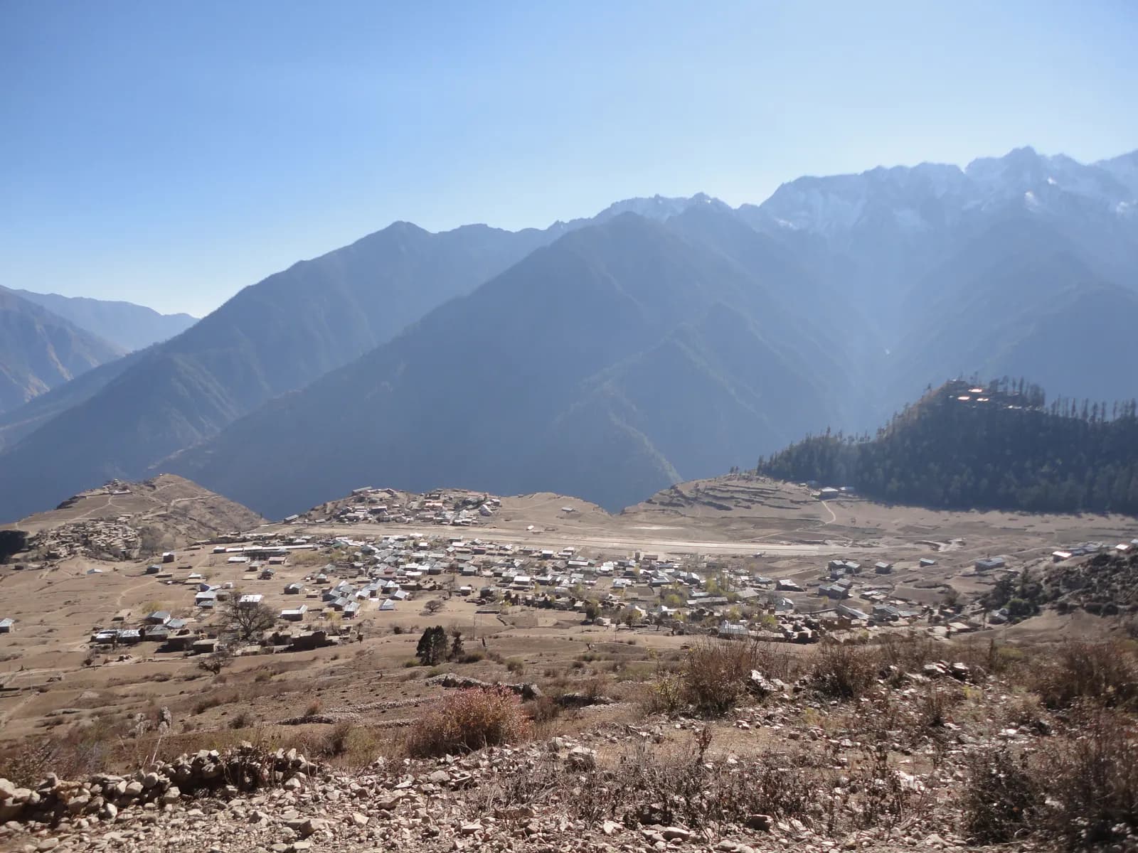 कवर फ़ोटो: Ganesh Paudel, CC BY-SA 3.0
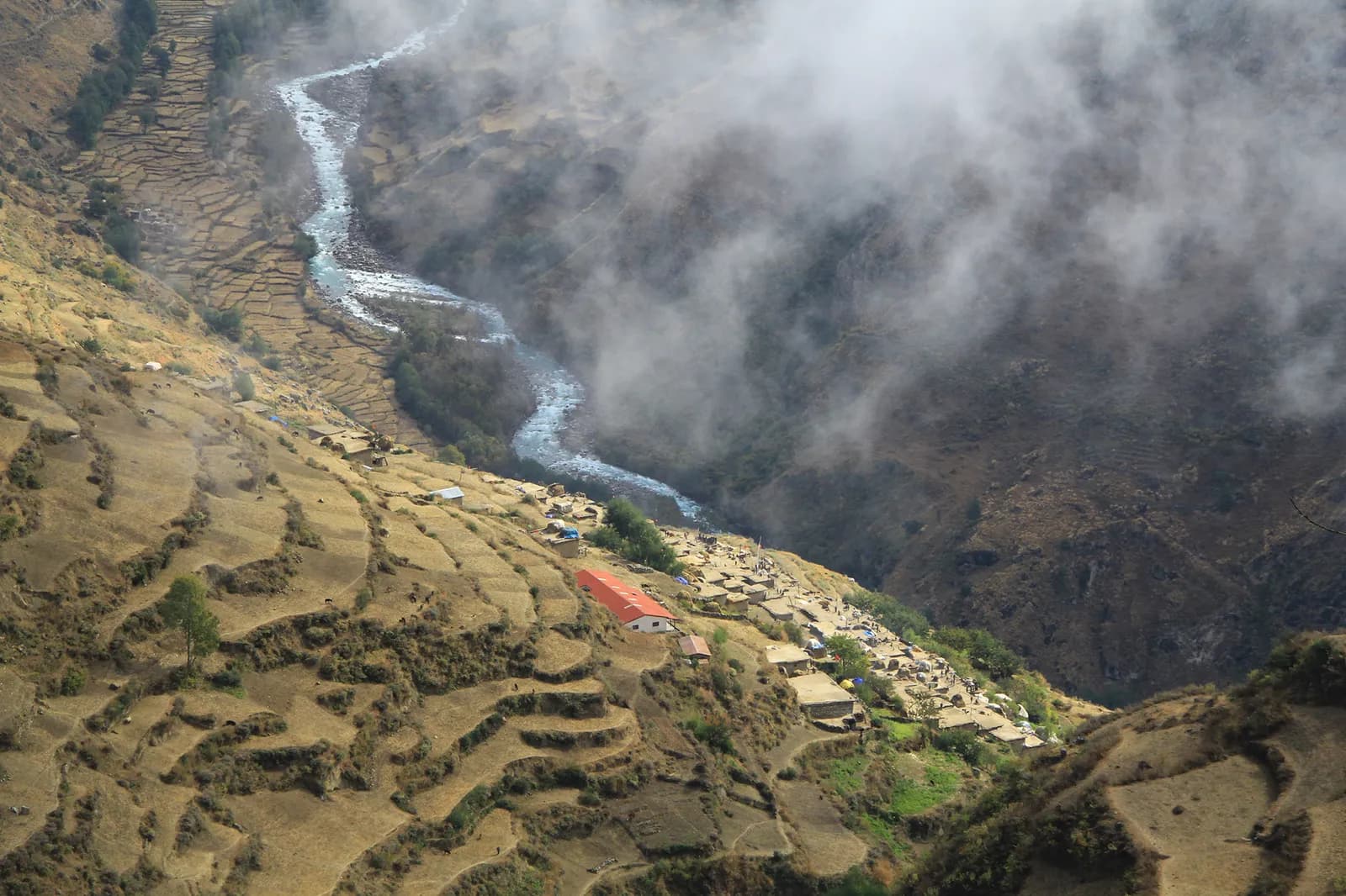 कवर फ़ोटो: Wang Lama Humla, CC BY-SA 4.0
स्रोत
Humla ट्रेक के लिए तैयार?
इन तारीखों के लिए ट्रेकिंग पार्टनर खोजें या अपना रूट प्लान करना शुरू करें।