Makalu Base Camp itinerary day by day
A 16-day Makalu Base Camp itinerary from Tumlingtar and Seduwa over the Shipton La to base camp, with distances, climbs, sleeping altitudes and the steep Khongma Danda day.

The Makalu Base Camp itinerary here takes 16 days: a Kathmandu to Tumlingtar flight, a 4 to 5 hour jeep drive to Seduwa (about 1,610 m), eight days of walking up to Makalu Base Camp (about 4,830 m) with a rest day on arrival, five days walking back, a drive and a flight. The only pass is the Shipton La at about 4,250 m, and the day that decides the trek is day 4, a climb of about 1,530 m to Khongma Danda. The trail sits inside Makalu Barun National Park, so the park permit and a guide are part of the plan. Route data is on the Makalu Base Camp page, and the Makalu region page gives the wider context.
Times are estimates from distance and climb, checked against operator itineraries. The route page's time field and description sometimes differ by a short margin, so the table gives the field and the notes mention the range.
Makalu Base Camp Trek के ओपन ट्रिप
पार्टनर खोज रहे ट्रेकर्स के असली ट्रिप।
The 16 days at a glance
| Day | From - to | Time | Sleep |
|---|---|---|---|
| 1 | Kathmandu - Tumlingtar (flight) | about 45 min flight | about 400 m |
| 2 | Tumlingtar - Seduwa (jeep) | 4-5 h | about 1,610 m |
| 3 | Seduwa - Tashigaon | 3.5-4 h | about 2,120 m |
| 4 | Tashigaon - Khongma Danda | 5-7 h | about 3,600 m |
| 5 | Khongma Danda - Shipton La - Dobate | 3.5-7 h | about 3,860 m |
| 6 | Dobate - Yangle Kharka | 3.5-4 h | about 3,630 m |
| 7 | Yangle Kharka - Langmale Kharka | 4-5 h | about 4,440 m |
| 8 | Langmale Kharka - Makalu Base Camp | 3-4 h | about 4,830 m |
| 9 | Base camp (rest) | 2-3 h walk | about 4,830 m |
| 10 | Base camp - Yangle Kharka | 4-6 h | about 3,630 m |
| 11 | Yangle Kharka - Dobate | 3.5-5 h | about 3,860 m |
| 12 | Dobate - Shipton La - Khongma Danda | 3-4 h | about 3,600 m |
| 13 | Khongma Danda - Tashigaon | 2.5-3.5 h | about 2,120 m |
| 14 | Tashigaon - Seduwa | 2-3 h | about 1,610 m |
| 15 | Seduwa - Tumlingtar (jeep) | 4-5 h | about 400 m |
| 16 | Tumlingtar - Kathmandu (flight) | about 45 min flight | about 1,400 m |
Days 1 and 2: Tumlingtar and the road to Seduwa
The flight crosses the foothills to an airstrip in the Arun valley at about 400 m, and on a clear morning Makalu and Everest are visible from the plane. Tumlingtar is hot and humid compared with Kathmandu, and the route notes warn that its flights are among the first to be cancelled, so keep the afternoon free. Day 2 is a rough 4 to 5 hour jeep ride through Khandbari and Num, crossing the Arun river and climbing through terraces of rice, millet and cardamom. Seduwa is a ridge village and the start of the trail, with lodges and a national park checkpost where your permits are checked.
Day 3: Seduwa to Tashigaon (about 2,120 m)
About 8 km with a climb of 530 m, in 3.5 to 4 hours, through rhododendron, oak and bamboo forest on a ridge with views of Makalu on clear days. Tashigaon is a Rai village with homestays and lodges, a school and a gompa. Carry salt or repellent in wet weather because leeches appear.
Day 4: Tashigaon to Khongma Danda (about 3,600 m)
This is the crux. The route is only about 6 km but gains about 1,530 m, so allow 5 to 6 hours of steady climbing (the table field says up to 7). The path rises through rhododendron and fir with views opening on the Barun valley, and the air turns cold. Khongma Danda is a ridge with a few lodges and views of Makalu, Chamlang and Baruntse. Put on warm layers, eat well and watch for headache and poor sleep after such a big gain. Many agencies add a rest day here for this reason, and you should consider it if you arrive tired.
Day 5: over the Shipton La to Dobate (about 3,860 m)
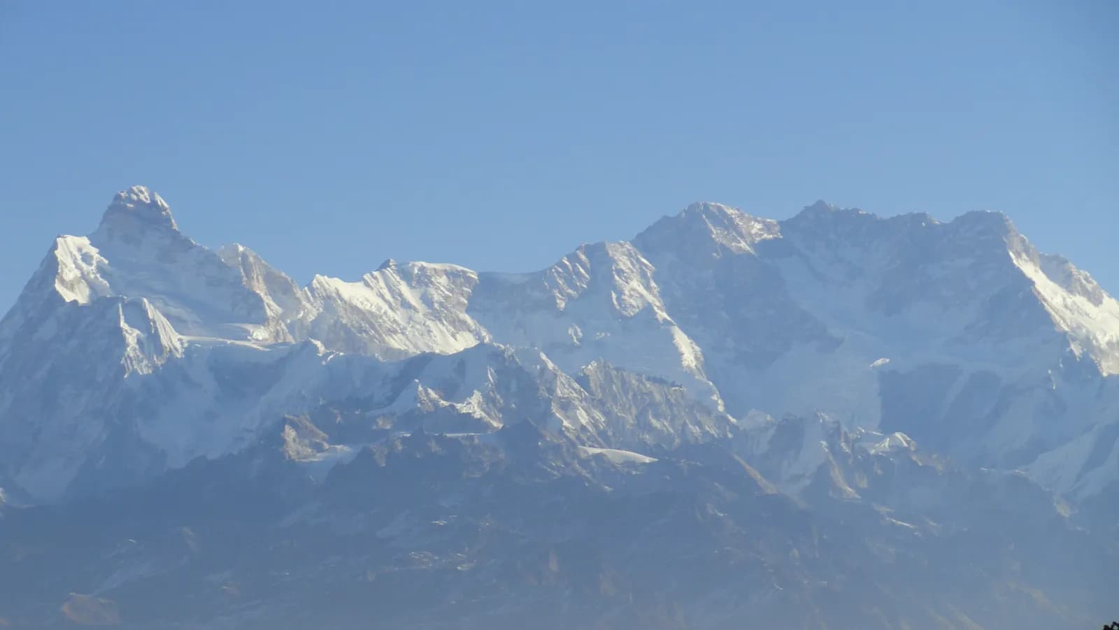
Walk along the ridge and over the Shipton La, at about 4,250 m, before descending to Dobate. The day is about 7 km, with a climb of 770 m and a descent of 530 m, in 3.5 to 5 hours. The pass has views of the Makalu and Kanchenjunga ranges on a clear day and can be icy in spring and late autumn. Dobate is a small seasonal settlement with a teahouse in a forest clearing.
Day 6: Dobate to Yangle Kharka (about 3,630 m)
A descent through fir and rhododendron to the Barun Khola, then along it for about 9 km in 3.5 to 4 hours, passing Mumbuk. Yangle Kharka is a large seasonal meadow with lodges and yak herders' huts, and it is the first place with open views of the upper valley. You have lost altitude, which should help you sleep.
Day 7: Yangle Kharka to Langmale Kharka (about 4,440 m)
About 8 km with 810 m of climbing, in 4 to 5 hours, through juniper and rhododendron scrub and then open moraine slopes with Chamlang in view. Langmale Kharka is a stone teahouse and camping area with a cold, windswept feel. Drink water and rest early.
Day 8: Langmale Kharka to base camp (about 4,830 m)
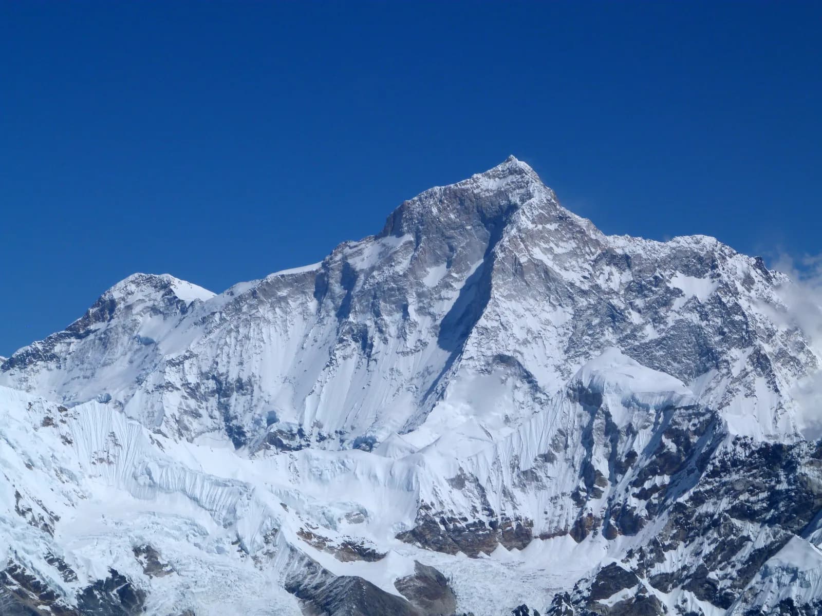
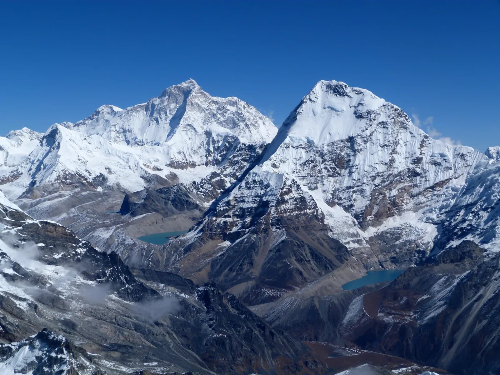
The last climb is about 8.5 km with 470 m of ascent in 3 to 4 hours, following the moraine above the Barun glacier past the Merek area and the lakes near the glacier, with the south face of Makalu ahead. Base camp has a small teahouse and a camping area, and it is cold and windy. The figure of 4,830 m comes from OpenStreetMap, while guides often quote 4,870 m, and there is no fixed marker.
Day 9: rest day at base camp
Walk gently around camp and the nearby lakes. There is no need to climb higher, and many trekkers feel the altitude here. Dry gear, drink water and talk with your guide about the return. Nights are very cold, so keep your sleeping system close.
Days 10 to 14: the way back
Day 10 is a long descent of about 16 km with a loss of 1,320 m to Yangle Kharka, in 4 to 6 hours, with poles to spare your knees. Day 11 climbs about 670 m and drops 450 m back to Dobate in 3.5 to 5 hours. Day 12 crosses the Shipton La again, about 7 km with 540 m up and 770 m down in 3 to 4 hours, and the weather can change quickly, so start early. Day 13 drops about 1,550 m in about 6 km from Khongma Danda to Tashigaon in 2.5 to 3.5 hours, the hardest on the knees. Day 14 is 2 to 3 hours and about 500 m of descent to Seduwa, where the route notes suggest thanking your porters and crew.
Days 15 and 16: road and flight
The jeep takes 4 to 5 hours from Seduwa to Tumlingtar, and you fly the next morning. The route page recommends a spare day, because flights from Tumlingtar are often delayed. Keep passport and permit copies in your hand luggage.
Permits, checkpoints and cash
The national park checkpost at Seduwa checks your permits on day 2, so carry the park entry permit, a TIMS card where the local office asks for one, your passport and several copies. We cover the permit position in the Makalu Barun permit guide. There are no cash machines beyond Khandbari, so bring enough rupees in small notes for the whole trek, including hot water, charging and snacks at the upper lodges.
What to carry for this route
A sleeping bag rated to about minus 15 C for the upper valley, a down jacket within reach from Dobate onward, gaiters and leech socks in wet months, microspikes in early spring, and poles for the 1,550 m descent on day 13. Pack soft bags for the Tumlingtar flight, because small aircraft have tight baggage limits.
Adjusting the plan
- Add a day at Khongma Danda if the day-4 climb leaves you with a headache, or an extra night at Langmale Kharka before base camp.
- Keep one spare day at the end for a cancelled Tumlingtar flight. The overland alternative to Khandbari takes around 20 hours.
- Do not add the Sherpani Col or the Tutu La unless you have technical skills, a full camping crew and the right permits. The route page treats these as separate expedition-style options.
How this itinerary compares
The Makalu plan covers about 94 km with about 6,000 m of climbing, which is less than the Kanchenjunga plan but with a much steeper early day. For a decision between them read Kanchenjunga versus Makalu, and for all itinerary articles use the day-by-day hub. The Makalu Barun region guide covers the park, seasons and culture.