

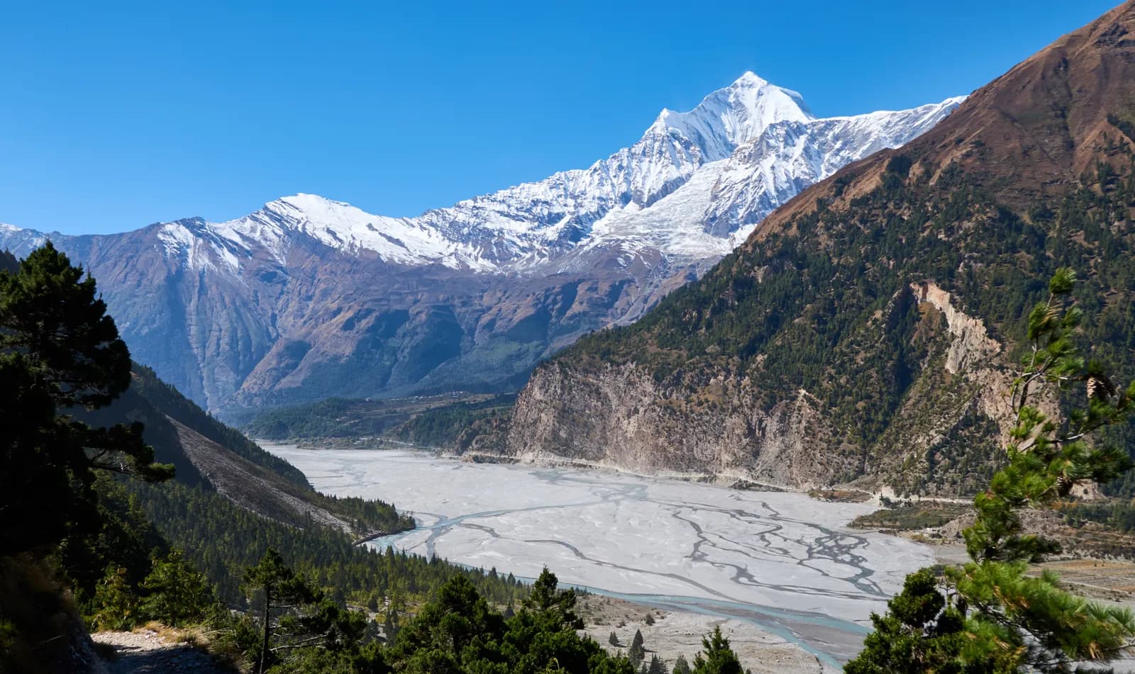
Dhaulagiri
Dhaulagiri is the wild western neighbour of Annapurna: the 8,167 m massif above the Myagdi valley, the Dhaulagiri Circuit over French Pass and Dhampus Pass, and the high pastures of Dhorpatan.
- גובה מרביFrench Pass (about 5,360 m)
- ימים14–21
- קושיקשה
- החודשים הטובים ביותרMar–May, Oct–Nov
- היתרים2 היתרים
תמונה: Solundir · CC BY-SA 4.0
Check that your policy covers helicopter evacuation and trekking at this region's altitude. We don't sell insurance.
What to look forWritten by FindTrekkingPartner teamנבדק על ידי FindTrekkingPartner teamאיך אנחנו בודקיםFindTrekkingPartner
Dhaulagiri הוא אזור טרקים בנפאל, עם מסלולים של 17 ימים שמטפסים עד 5,360 מ'. מטיילים זרים יכולים למצוא כאן שותף לטרקים ב-FindTrekkingPartner בפרסום טיול עם התאריכים, התקציב והקצב שלהם. ההתאמות נשארות פרטיות עד ששני המטיילים מסכימים, והשירות חינמי. במחירי טווח הביניים מדריך מורשה עולה כ-159 דולר ארה״ב לאדם על פני 17 ימים כשארבעה מטיילים חולקים, לעומת 634 דולר ארה״ב למטייל יחיד. העונות הטובות ביותר הן Mar–May, Oct–Nov. בפועל נדרש כאן מדריך מורשה: לפי דיווחי מפעילים מ-2026, כלל מועצת התיירות של נפאל מאפריל 2023 נאכף במחסומים בפארקים לאומיים ובאזורי שימור, כשלנגטנג היא המחמירה ביותר ואנאפורנה בודקת גם היא (נבדק ב-19 באוקטובר 2026). שכרו מדריך דרך סוכנות רשומה ואשרו מולה. טיולים פתוחים למסלול זה מופיעים למטה, עם חודש יציאה, גודל קבוצה ומקומות פנויים. אומת לאחרונה: 19 באוקטובר 2026. מקורות: מועצת התיירות של נפאל, DNPWC, מחלקת ההגירה.
מקורות:Department of Immigration, NepalNepal Tourism BoardDepartment of National Parks and Wildlife Conservation
- מצאו שותף לDhaulagiri Circuitעדיין אין טיולים פתוחים
סקירה
- מדריך מורשה
- חובה למטיילים זרים
- קבוצה מינימלית
- מטייל/ת אחד/ת
NTB rule (Apr 2023), enforced at checkpoints in national parks and conservation areas (2026 operator reports; checked 19 October 2026). The Dhaulagiri Circuit is not a restricted area. It crosses the Annapurna Conservation Area on its last days, so it needs the ACAP entry permit (NPR 3,000 for foreigners per the NTNC e-permit page) and a TIMS card issued by an agency. The route has glaciers, two passes above 5,200 m and no villages for most of its length, so every operator supplies a licensed guide and a camping crew, and you should treat that as the rule even though no restricted-area permit applies. Confirm current permit rules with your agency.
טרקים פופולריים
נקודות יציאה
Pokhara, Beni, Marpha, Jomsom
איך מגיעים
Most trips start in Pokhara. A road runs west to Beni (about 4 to 5 hours), the district town of Myagdi at roughly 830 m, and the Dhaulagiri Circuit starts from the road end beyond it. The circuit finishes at Marpha or Jomsom in the Kali Gandaki valley, from where a short flight (weather dependent, mornings only) or a long jeep ride returns to Pokhara.
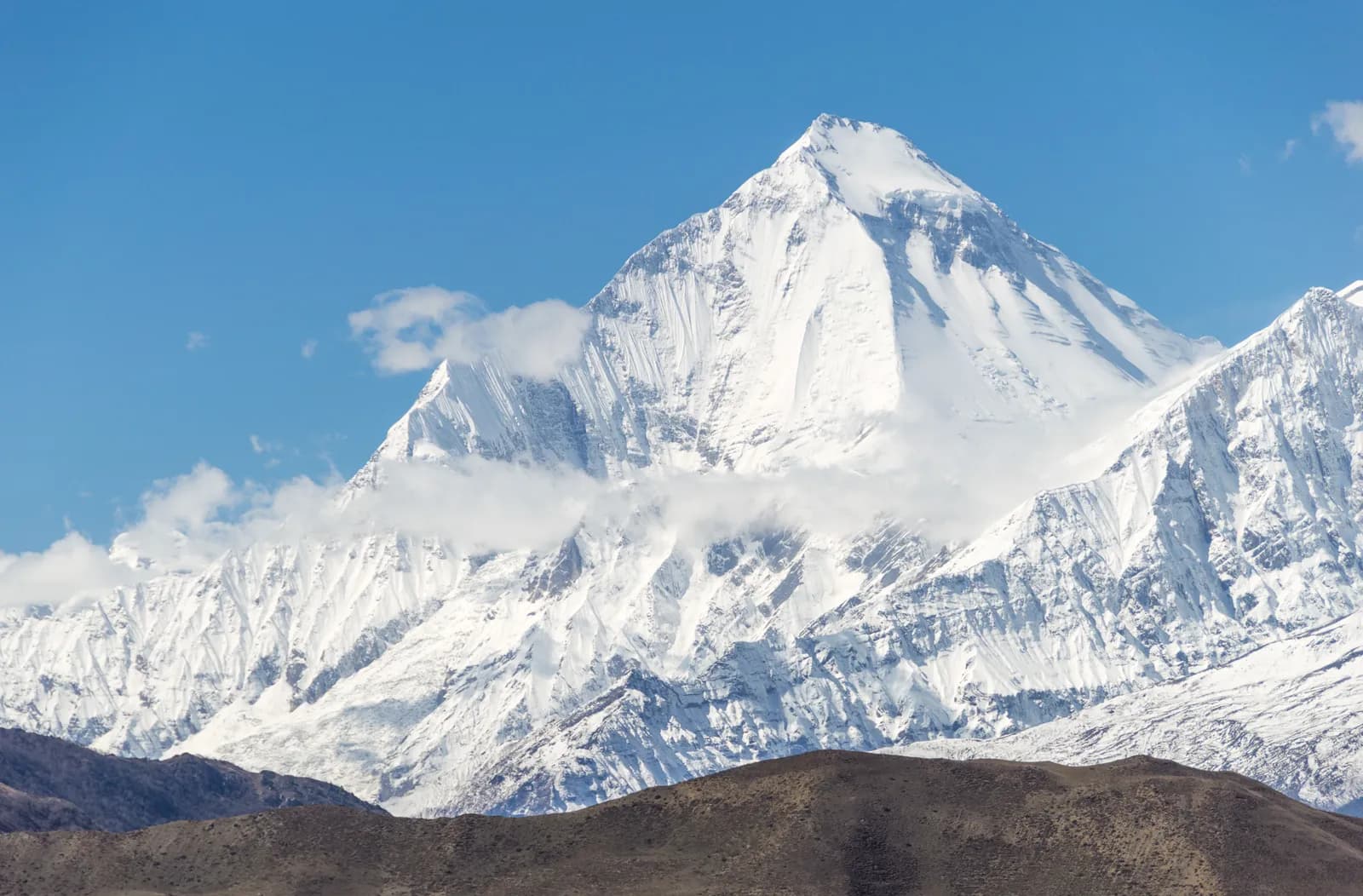
Dhaulagiri is the Himalayan block west of the Kali Gandaki gorge, where Dhaulagiri I rises to 8,167 m, the seventh-highest mountain on Earth and the highest one that lies wholly inside Nepal. Most of the region is the Myagdi district, whose headquarters Beni is a four-to-five-hour drive from Pokhara, and its one great trek is the Dhaulagiri Circuit: about 17 days from Pokhara to Pokhara, camping all the way, up the Myagdi Khola to Italian Base Camp and Dhaulagiri Base Camp, over French Pass at about 5,360 m into the Hidden Valley, and over Dhampus Pass to Yak Kharka and Marpha. There are no teahouses between the road and Marpha, the passes are glaciated and the nights are cold, so this is a trek for fit, experienced walkers with an agency and a licensed guide. The best months are late March to early May and October to mid-November, and the Circuit needs the ACAP permit but no restricted-area permit.
Overview of the Dhaulagiri region
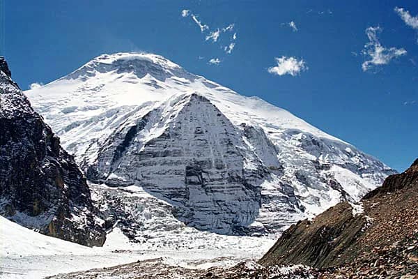
The Dhaulagiri Himal is a chain of summits above 7,000 m that runs roughly east to west between the Kali Gandaki river and the Bheri valleys. Dhaulagiri I is the tallest, first climbed on 13 May 1960 by a Swiss, Austrian and Nepali expedition; Dhaulagiri II to VI follow, with Tukuche Peak and the sharp ridge of Dhampus Peak (about 6,000 m) on the Kali Gandaki side. The Kali Gandaki runs between Dhaulagiri and Annapurna I, and the mountain stands about 7,000 m above the river, one reason the gorge is often called the deepest in the world.
The southern foothills belong to Myagdi district (about 2,300 square kilometres), where Pun Magar farming villages stand on terraces from roughly 300 m up to the forest line. Beni, at the meeting of the Myagdi Khola and the Kali Gandaki, is the market town and the last place to buy supplies. Further west, the open pastures of Dhorpatan sit between Myagdi, Baglung and Rukum districts.
The Dhaulagiri Circuit
The classic trek here is the Dhaulagiri Circuit. It leaves the road beyond Beni, follows the marked trail up the Myagdi Khola through villages at Babiachaur, Dharapani and Muri, then climbs into forest at Boghara and Dobang. Above Choriban Khola the valley opens into moraine and the north face of Dhaulagiri appears. Italian Base Camp (about 3,660 m) and Dhaulagiri Base Camp (about 4,740 m) are the two high camps, with an acclimatisation day at each, and a stop at Glacier Camp between them on the way over the moraine.
The crux is the crossing from Dhaulagiri Base Camp over French Pass, which operators put between 5,240 m and 5,360 m (OpenStreetMap lists the saddle at 5,370 m), into the Hidden Valley, a high basin at about 5,100 m where nights fall far below freezing. The next day crosses Dhampus Pass (about 5,240 to 5,290 m) and drops more than 1,600 m to Yak Kharka and then Marpha. See the Dhaulagiri Circuit day plan for the stage-by-stage plan.
Dhorpatan and the western pastures
Dhorpatan Hunting Reserve covers 1,325 square kilometres between about 2,850 m and 5,500 m across the districts of Rukum, Myagdi and Baglung. It was set up in 1983 and gazetted in 1987, and it is the only reserve in Nepal where regulated sport hunting is allowed, limited to blue sheep and Himalayan tahr under a seasonal quota. The same open grassland that draws herders in summer shelters blue sheep and snow leopards. Treks across Dhorpatan exist, but they are rarely marketed to foreigners and have far less infrastructure than the Circuit, so this guide treats the reserve as a region to understand rather than a route to plan from a desk.
Best time to trek, month by month
Spring (late March to early May) brings rhododendron below the tree line, clear mornings and rising snow on the high pass. October to mid-November is the other window, with stable weather and the coldest nights. Operators discourage the off-season for the passes: snow, wind and whiteout can arrive at any time, and one operator quotes Hidden Valley night lows of minus 15 to minus 25 degrees Celsius. The monsoon (June to September) brings leeches and landslides on the approach, and winter locks the passes.
- March and April: snow still deep on the passes, long days, flowers in the lower forest.
- May: warmer, but cloud builds in the afternoon.
- October and early November: the most settled month for the crossing.
- December to February and June to September: not advised for the Circuit.
Permits and rules
The Dhaulagiri Circuit is not a restricted area. You need the Annapurna Conservation Area Project entry permit, which the NTNC e-permit page lists at NPR 3,000 for foreigners (NPR 1,000 for SAARC nationals; double at a check post), and the TIMS card issued by an agency, for which the Nepal Tourism Board lists NPR 2,000 for foreigners (SAARC nationals NPR 1,000). Operators fold both into the price. Checkposts are sparse on this route and appear when it joins the Annapurna Circuit near Marpha.
A guide is not a legal condition here, but the route crosses crevassed moraine and two high passes where trails are not marked and snow can erase tracks, and every operator we checked supplies a licensed guide, cook and porters. Camping gear and food are carried from the road, so the cost is in the agency price, not in lodge bills.
Getting there and away
Pokhara to Beni is a road drive of four to five hours; operators also list a Kathmandu to Beni bus of eight to nine hours. From Beni the route starts on a jeep road along the Myagdi Khola, and some groups drive part of it. At the end, Jomsom has an airport with flights to Pokhara of about 20 to 25 minutes, but only in the morning, before the wind rises, and cancellations are common, so keep a spare day. The alternative is a jeep down the Kali Gandaki road, a long day to Pokhara.
Altitude and acclimatisation
The Circuit gains height quickly after Boghara: Dobang is at 2,520 m, Choriban Khola at 3,110 m and Italian Base Camp at 3,660 m, which is why the two scheduled rest days (at Italian Base Camp and at Dhaulagiri Base Camp) matter. Hidden Valley, at about 5,100 m, is the highest camp, and it comes right after the hardest day. Acute mountain sickness is a real risk; read about the signs of altitude sickness and descent rules before you go, and never take Diamox as a substitute for slow ascent. If the weather closes the pass, the retreat is back down to Dhaulagiri Base Camp, not forward.
Camping, food and costs
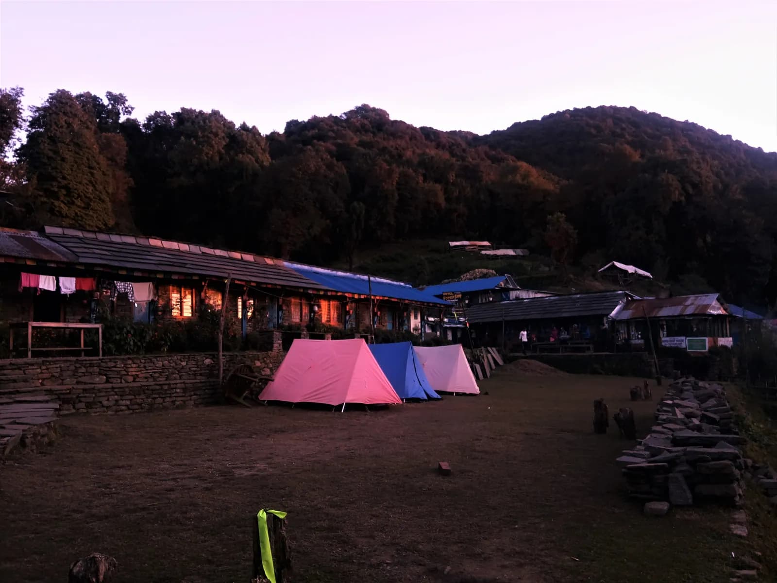
The Circuit is a camping trek, so the cost is not a lodge bill. The agency provides tents, a cook and kitchen crew, meals, porters and a guide, and prices vary with group size. Lodges only return at Marpha, where guesthouses and apple orchards return. See the pricing section on each route page for sourced permit fees and sample totals; no figures are quoted here without a source. In Beni and Pokhara, buy what you need for the first days (batteries, snacks, sun cream); on the trail, there is nothing to buy.
Safety and what to bring
Stone fall in the narrow gorge between the base camps, loose moraine and glacier crevasses are the main hazards. Bring micro-spikes or light crampons (operators advise them for the glacier crossing and the Dhampus descent) and trekking poles, a sleeping bag rated well below zero, and layers for minus 15 degrees at night. Insurance must cover helicopter evacuation above 4,000 m and, on some policies, trekking above a certain height.
Culture and nature
The lower valleys are Magar country, with stone and slate houses, terraced millet and maize, and a seasonal rhythm of livestock moving to high pastures. The forest above 2,000 m is rhododendron, oak and bamboo, with blue sheep, Himalayan tahr and, rarely, snow leopard higher. At Marpha the architecture changes to flat-roofed Thakali houses, and the apple orchards are the main local industry.
Combining Dhaulagiri with other treks
Marpha and Jomsom put you on the Annapurna Circuit, so some trekkers continue north to Muktinath and the Thorong La, or south by the Tatopani and Ghorepani trail; read the notes for the Annapurna region before stacking treks, since doing both without extra rest days is demanding.
History and mountaineering
Dhaulagiri was long believed to be the highest mountain on Earth, until Kangchenjunga and then Everest were measured. A Swiss, Austrian and Nepali expedition made the first ascent on 13 May 1960, by the northeast ridge that is still the standard climbing route, and Jerzy Kukuczka and Andrzej Czok made the first winter ascent on 21 January 1985. Expeditions in spring and autumn set up their tents at the same base camps that trekkers use, which is why the Circuit has real camping infrastructure on its upper section even though it has no lodges.
Wildlife and nature
The lower valley is subtropical, with bamboo, oak and rhododendron that flower in spring. Higher up, the forest gives way to juniper and then to bare moraine and snow. Blue sheep and Himalayan tahr graze the high slopes, and the rarely seen snow leopard hunts them, a food chain that also runs through Dhorpatan to the west. In autumn you may meet livestock herders at the yak pastures near Yak Kharka. Respect the animals and keep a distance, leave no litter and carry out what you carry in.
Responsible trekking
A camping trek leaves a larger footprint than a teahouse trek, so choose an agency that carries fuel instead of burning wood, packs out rubbish, pays and equips its porters properly and does not overload them. Keep to existing paths on the moraine, do not wash in streams, and use the toilet tents. Porters wear the same cold as you do: check that the crew has sleeping bags, boots and sunglasses for the passes.
Practical tips
- Allow at least one spare day at each end for the Jomsom flight and the road to Beni.
- Carry cash in small notes for Beni, Marpha and Jomsom, and settle crew tips before the flight.
- Pack a power bank: camp charging is limited.
- Tell your insurer you are trekking above 5,000 m and ask whether the policy has a height cap.
- Train for long days with a loaded pack and practise walking in boots with micro-spikes before you travel.
Money, connectivity and emergencies
Pay the agency before you leave Pokhara, and carry a modest amount of cash in rupees for drinks, tips and the last nights in Marpha and Jomsom. Do not count on a phone signal at the high camps: ask your agency which satellite messenger or radio the guide carries, and leave your itinerary with someone at home. A rescue from Dhaulagiri Base Camp or the Hidden Valley means a helicopter, which must be paid for or guaranteed by your insurer, so check that your policy names the altitude and the activity, and keep the policy number and the agency's emergency number in your daypack.
Fitness and training
The Circuit has two scheduled rest days but few easy ones: stages of 5 to 7 hours carry on day after day, with a long, hard crossing in the middle. Prepare with months of hill walking, long days with a loaded pack, stair or incline training and, ideally, a previous trek above 4,500 m. Practise in the boots and spikes you will use, and learn to walk on loose scree and snow. A medical check before the trip is sensible, and tell your guide about any conditions.
Arranging your trek
Choose a registered agency that runs the Circuit regularly and ask who the guide is, how many camps it has and what the retreat plan is if the pass is closed. Ask what is included (ACAP, TIMS, camping gear, meals, porters, the Jomsom flight), what the group size is, and how the crew is dressed and insured. Compare itineraries: the plan on this site follows the three published by Peregrine Treks, Hayden Rue and Himex Nepal, which differ by a day or two.
כל המסלולים באזור הזה
כל מסלול סטנדרטי שאנחנו מכסים כאן. הקישו על מסלול כדי לפתוח את המסלול יום אחר יום.
השוואת מסלולים
מיינו את המסלולים לפי אורך, גובה, קושי או עלות משוערת כדי למצוא את המתאים לכם.
ממוין לפי ימים ↑
| מסלול | |||||
|---|---|---|---|---|---|
| Dhaulagiri Circuit | 17 | 5,360 מ' | קשה | 117 ק"מ | החל מ-NPR 70,000 |
העלות היא הערכה: התעריף היומי בסגנון תקציבי של האזור כפול מספר הימים, בלי טיסות והיתרים.
הזמן הטוב ביותר לטרק
החודשים המודגשים הם עונות הטרקים המומלצות. Mar–May · Oct–Nov
העונה הטובה ביותרחודשים אחרים
Live conditions
Notes entered by our team from the sources linked on each item. Conditions change quickly, so confirm with your guide or lodge before you set off.
Best seasons: Mar–May · Oct–Nov
Nothing recent on file. Check with your guide or lodge before you go.
היתרים ותעריפים
התעריפים הם לאדם ותלויים בקבוצת הלאום שלכם.
| היתר | זר | SAARC | נפאלי |
|---|---|---|---|
Annapurna Conservation Area entry permit (ACAP) | NPR 3,000 | NPR 1,000 | NPR 100 |
TIMS card (trekking agency issued) | NPR 2,000 | NPR 1,000 | — |
- איפה קונים
National Trust for Nature Conservation (NTNC)
Trekking agency / Nepal Tourism Board
עלויות יומיות
לאדם ליום בטרק בבתי תה. מדריך וסבל — לקבוצה/לסבל ליום. נכון ל-אוקטובר 2026.
סך טיפוסי לDhaulagiri Circuit, 2 מטיילים שחולקים עלויות
- חסכוני
- 520 $–820 $
- בינוני
- 1,000 $–1,600 $
- נוחות
- 1,250 $–2,000 $
| סגנון | ליום | מדריך / יום | סבל / יום | סה"כ לדוגמה |
|---|---|---|---|---|
| חסכוני | NPR 2,900–4,800 | NPR 5,000 | NPR 2,750 | NPR 65,680–103,800 |
| בינוני | NPR 4,100–6,500 | NPR 5,000 | NPR 2,750 | NPR 82,880–129,400 |
| נוחות | NPR 5,500–8,400 | NPR 5,000 | NPR 2,750 | NPR 104,180–158,200 |
חסכוני: Pokhara to Beni by road takes 4 to 5 hours and no fare was found in our sources. Jomsom to Pokhara flight about USD 120 to 200 (Annapurna region cost notes); flights depend on the morning wind.
בינוני: Pokhara to Beni by road takes 4 to 5 hours and no fare was found in our sources. Jomsom to Pokhara flight about USD 120 to 200 (Annapurna region cost notes); flights depend on the morning wind.
נוחות: Pokhara to Beni by road takes 4 to 5 hours and no fare was found in our sources. Jomsom to Pokhara flight about USD 120 to 200 (Annapurna region cost notes); flights depend on the morning wind.
כללים ונהלים טובים
מדריכים
- כל האזורים
Foreign trekkers must trek with a licensed guide in national parks and conservation areas (in force since April 2023). Enforcement varies by region, so verify the current rule before you go.
היתרים
- כל האזורים
Carry your permits at all times; they are checked at several checkpoints along every route.
בטיחות וגובה
- כל האזורים
Buy travel insurance that covers helicopter rescue to at least 6,000 m.
- כל האזורים
Climb high, sleep low: above 3,000 m, avoid raising your sleeping altitude by more than about 500 m per day, and add rest days.
שימור
- כל האזורים
Carry out all non-burnable waste (batteries, plastic, wrappers) and use a refillable water bottle.
תרבות
- כל האזורים
Respect monasteries: walk clockwise around stupas and mani walls, and remove shoes where asked.
- כל האזורים
Ask before photographing people, especially at religious sites and ceremonies.
רחפנים
- כל האזורים
No drones without prior permission from the relevant authority.
תמונות
שאלות נפוצות
The plan on this site takes 17 days from Pokhara to Pokhara, including two rest days and a final flight from Jomsom. Operators run 16 to 20 days with their own transfers and weather buffers.
No. The Circuit is not on the Department of Immigration's restricted-area list. You need the ACAP entry permit and a TIMS card, both arranged by your agency. Ask the agency to confirm current rules before you pay.
Operators quote it between about 5,240 m and 5,360 m; OpenStreetMap lists the saddle at 5,370 m. Plan for a pass above 5,300 m and ask your guide for the current reading.
Yes. It is a camping trek with no lodges for most of its length, two glaciated passes above 5,200 m and several days at 4,000 m or higher, while the Annapurna Circuit has teahouses nightly.
Late March to early May and October to mid-November. The passes are snow-prone at any time, and the monsoon and winter are not advised.
Ask your agency which rule applies: the Nepal Tourism Board rule of April 2023 asks for a licensed guide through a registered agency in conservation areas such as ACAP, and 2026 operator reports say enforcement varies by checkpoint. Separately, the route is unmarked in places, glaciated and unsupplied, and every operator we found provides a licensed guide and a crew. We recommend you do the same.
Drive from Pokhara in about 4 to 5 hours, or take a bus from Kathmandu in 8 to 9 hours. The trek starts on a jeep road beyond Beni.
Dhorpatan Hunting Reserve is a 1,325 square kilometre area of high pastures and forest where blue sheep and Himalayan tahr are hunted under a seasonal quota. Routes exist but few foreigners walk them.
טיולים פתוחים
מדריכים על Dhaulagiri
 תמונת שער: Solundir, CC BY-SA 3.0
 תמונת שער: Binayaksha Sharma, CC BY-SA 4.0
 תמונת שער: Iamthanes, CC BY-SA 4.0
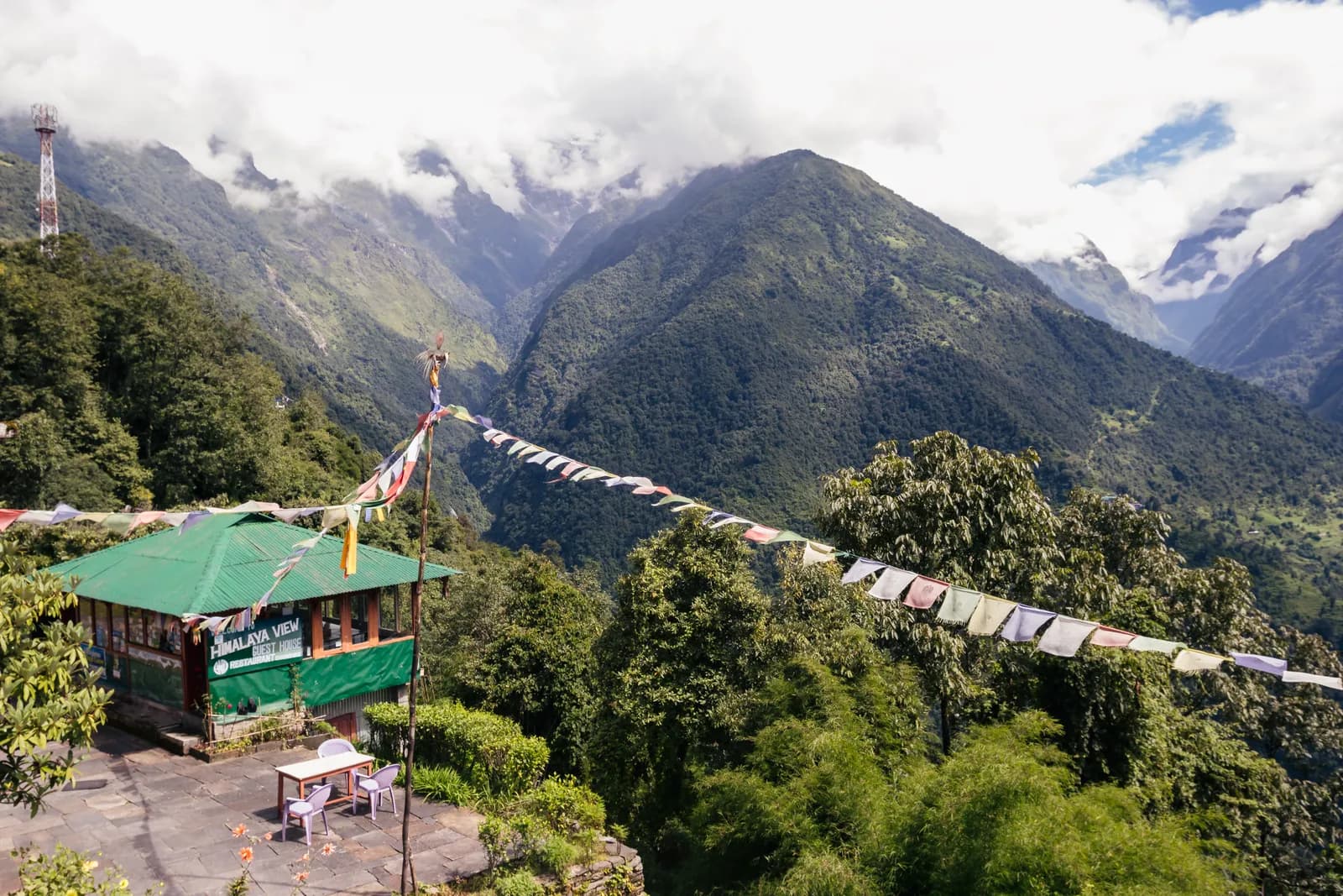 תמונת שער: Bijay Chaurasia, CC BY-SA 4.0
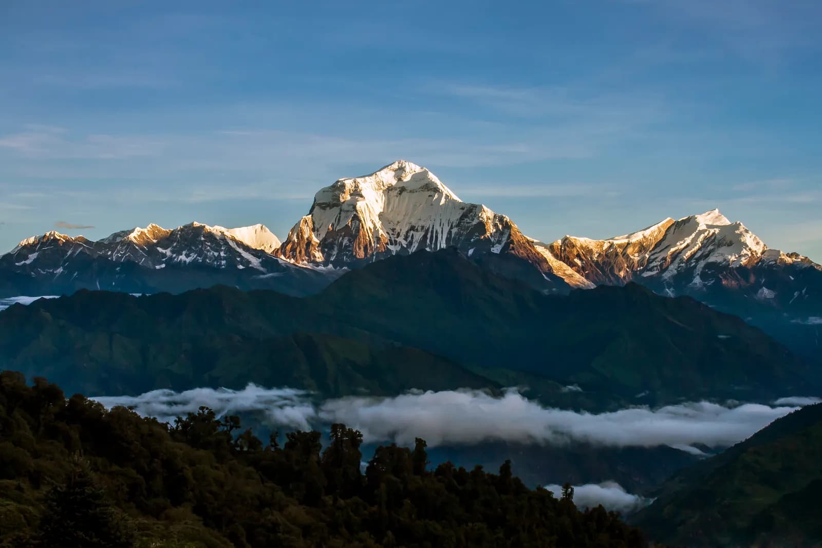 תמונת שער: Madhabdhk, CC BY-SA 4.0
מקורות
מוכנים לטרק בDhaulagiri?
מצאו שותף לטרק לתאריכים האלה או התחילו לתכנן מסלול משלכם.