

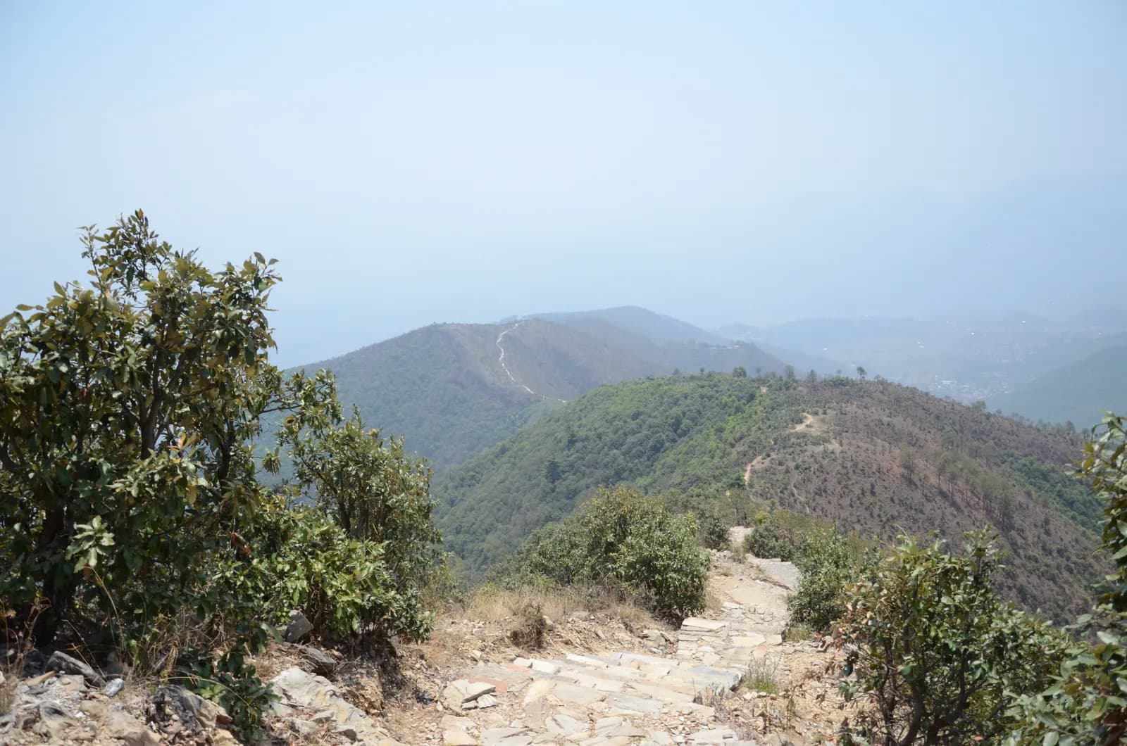
Drive from Kathmandu to Pharping and start walking early. The path climbs through pine forest on stone paving and steps, passes Hattiban Resort about half an hour above the road if you start at Pahiro, and then rises steadily for about three hours to the ridge, where the shrine of Champadevi stands in the open at about 2,285 m. On our map the round trip is 11.2 km with 750 m of climbing from Pharping. Rest at the top for the views of the Langtang and Ganesh Himal ranges, then descend by the same path, or drop steeply to the Champadevi Mai temple and walk about half an hour on the road to Khahare, where your car waits. Carry lunch and water.
Champadevi Day Hike
A one-day hike from Pharping through pine forest to the Champadevi hilltop shrine (about 2,285 m) and back, 11.2 km with 750 m of climbing and views of Langtang, Ganesh Himal and Gaurishankar.
- روز1
- بیشینه ارتفاع۲٬۲۸۵ متر
- مسافت۱۱٫۲ کیلومتر
- صعود۷۴۷ متر
- دشواریمتوسط
- بهترین ماههاOct–Nov, Mar–May
عکس: Pratap Baniya · CC BY-SA 4.0
به انگلیسی نمایش داده میشود — هنوز ترجمه نشده است.
این برنامهٔ سفر پیشنویس است و هنوز بررسی نشده. همیشه مراحل را با راهنمای خود تأیید کنید.
Written by FindTrekkingPartner teamبررسیشده توسط FindTrekkingPartner teamروش بررسی ماFindTrekkingPartner
Champadevi Day Hike یک مسیر پیادهروی 1 روزه در منطقه Kathmandu Valley نپال است که تا ۲٬۲۸۵ متر بالا میرود. پیادهروهای خارجی میتوانند در FindTrekkingPartner با ثبت یک سفر همراه با تاریخ، بودجه و سرعت خود، برای آن همسفر پیدا کنند. تا زمانی که هر دو پیادهرو موافقت نکنند، تطابقها خصوصی میمانند و این سرویس رایگان است. با نرخهای متوسط، یک راهنمای دارای مجوز وقتی چهار پیادهرو سهم میدهند حدود ۹ دلار آمریکا (USD) برای هر نفر در 1 روز هزینه دارد، در مقابل ۳۷ دلار آمریکا (USD) برای یک پیادهرو بهتنهایی. بهترین فصلها Oct–Nov, Mar–Apr هستند. در مسیرهای باز مانند این، راهنمای دارای مجوز اجباری نیست (بررسیشده در 19 اکتبر 2026): شهرداری خومبو از قانون آوریل 2023 هیئت گردشگری نپال کنار کشیده است و پیادهرویهای یکروزه به راهنما نیاز ندارند، اما همچنان داشتن راهنما اکیداً توصیه میشود، پس با آژانس خود تأیید کنید. آخرین بررسی: ۲۷ مهر ۱۴۰۵. منابع: هیئت گردشگری نپال، DNPWC، اداره مهاجرت.
منابع:Department of Immigration, NepalNepal Tourism BoardDepartment of National Parks and Wildlife Conservation
یافتن همسفر برای Champadevi Day Hike
- یافتن همسفر برای Champadevi Day Hikeهنوز سفر بازی نیست
- یافتن همسفر برای Shivapuri Peak Day Hikeهنوز سفر بازی نیست
- یافتن همسفر برای Nagarkot to Changu Narayan Day Hikeهنوز سفر بازی نیست
- یافتن همسفر برای Chisapani Nagarkot Trekهنوز سفر بازی نیست
- یافتن همسفر برای Phulchowki Day Hikeهنوز سفر بازی نیست
- یافتن همسفر برای Namo Buddha Day Hikeهنوز سفر بازی نیست
نمای کلی
شروع از Pharping۱ روز · حداکثر ۲٬۲۸۵ متر
بهترین فصلها: Oct–Nov, Mar–May
The Champadevi hike is a one-day walk from Pharping, on the southern rim of the Kathmandu Valley, through pine forest to the open hilltop shrine of Champadevi at about 2,285 m, and back. On our map the round trip is about 11.2 km with 750 m of climbing, mostly on a stone-paved path and forest track. Operators put the climb from Hattiban Resort at about three hours and the whole climb from the road at three to three and a half hours; the descent takes one to two hours. Allow five to seven hours for the day, with a 45 minute drive each way from Kathmandu. On a clear morning the view runs from Langtang and Ganesh Himal to Manaslu and Gaurishankar. None of our sources lists a park permit for this hill. Bring water and lunch.
The plan follows two operator itineraries that agree on the Hattiban Resort halfway point and the open shrine at the top. Heights vary between 2,278 and 2,285 m in the sources and OpenStreetMap gives 2,241 m for the summit node, so we say about 2,285 m. Operators start at Pahiro or Hattiban to save time; our map starts lower, at Pharping, and is therefore longer.
What the hike is like
The path climbs steadily through pine forest on stone paving and steps, passes Hattiban Resort and continues to a ridge where the shrine of Champadevi stands in the open. From the ridge you see Chandragiri on one side and Phulchowki on the other, with the Bagmati river and Khokana below. An optional extension continues to Bhasmasur hill, which is higher than Champadevi. Pharping, a Newar village, is worth a stop before or after the walk.
Permits and rules
Neither operator lists a park permit or entrance fee for the hill. Monument fees at Pharping or Dakshinkali temples, if you visit them, are separate. Carry your litter out.
Best season
Operators say the hike can be done in every season and advise an early start for clear skies. Autumn (October to November) and spring (March to May) give the sharpest mountain views; in the monsoon the paving is wet and cloud hides the peaks.
Getting there and away
Drive from Kathmandu to Pharping or to Pahiro, about 45 minutes from Thamel, and finish at Khahare or Machhegaun, about 45 minutes back by road, depending on traffic. A taxi or an operator transfer is the simplest way; no fare is published in our sources, so agree it in advance.
Difficulty and fitness
The hike is gentle to moderate: 750 m of climbing, mostly on paved steps, over five to seven hours. Good shoes, two litres of water and a rain jacket are enough. Leave Pharping by 8 am so that you are on top before the haze builds.
Budget notes
There is no permit fee. Budget for a taxi to the trailhead and a return from Khahare or Pharping, plus lunch. The costs section shows the transfers as lines to check.
نکات برجسته
- Champadevi hilltop shrine at about 2,285 m with Himalayan views on clear days
- Stone-paved path and steps through pine forest
- Hattiban Resort halfway up as a rest stop
- Pharping, a Newar village with monasteries and the Dakshinkali temple nearby
- Chandragiri on one side and Phulchowki on the other from the ridge
نقشه مسیر
دادههای مسیر از OpenStreetMap است و هنوز تیم ما آن را بررسی نکرده است. برای برنامهریزی استفاده کنید، نه مسیریابی.
روزبهروز
هزینهها
برآورد هزینه کل برای هر نفر: اقامتگاه و غذا بر اساس ارتفاع، حملونقل، مجوزها، و راهنما و باربرها. هر چه ترکرهای بیشتری راهنما و باربر را تقسیم کنند، سهم هر نفر کمتر میشود. تا تاریخ ۱۴۰۵ مهر.
| سبک | ۱ ترکر | ۲ ترکر با تقسیم هزینه | ۴ ترکر با تقسیم هزینه |
|---|---|---|---|
| اقتصادی | — | — | — |
| میانرده | $۴۰–$۸۰* | $۲۰–$۴۰* | $۱۰–$۳۰* |
| راحت | $۴۰–$۸۰* | $۳۰–$۵۰* | $۲۰–$۴۰* |
راهنما را تقسیم کنید، پول پسانداز کنید
در سطح میانرده، یک ترکر تنها حدود $۴۰–$۸۰ میپردازد؛ چهار ترکر که یک راهنما و دو باربر را تقسیم میکنند هر کدام حدود $۱۰–$۳۰ میپردازند (66٪ کمتر در بالای بازه).
جزئیات برای ۲ ترکر با تقسیم هزینه
| مورد | اقتصادی | میانرده | راحت |
|---|---|---|---|
| راهنما | — | $۱۰–$۳۰ | $۱۰–$۳۰ |
| باربرها | — | $۰–$۲۰ | $۱۰–$۳۰ |
سبک اقتصادی از حملونقل عمومی و بدون باربر استفاده میکند؛ میانرده یک باربر را بین دو ترکر و یک وسیله نقلیه اختصاصی تقسیم میکند؛ راحت برای هر ترکر یک باربر در نظر میگیرد. راهنما در جایی که الزامی است یا سبک میانرده یا راحت باشد لحاظ میشود.
شامل نمیشود
قیمت منتشرشدهای پیدا نشد برای: Kathmandu to Pharping and back by taxi. مجموعهای ستارهدار * این موارد را در نظر نگرفتهاند؛ از آژانس بپرسید. A day hike: no lodging and no permit. A guide is optional.
منابع هزینه
- PriceNepal: Nepal Travel Cost Guide 2026 (2026-05-14)
- Third Rock Adventures: Nepal trek budget planner (2026-05-09)
- Himalayan Partner: Guide and porter price in Nepal 2026 (2026-02-10)
- Shikhar Adventure: Annapurna Circuit trek cost (2026-02-03)
- Nepal Tourism Board: Trekking Permit (2026-10-18)
برآوردها از راهنماهای اپراتورها هستند، نه قیمت قطعی. انعام، بیمه، تجهیزات و هتلهای کاتماندو شامل نمیشود؛ دلار آمریکا با نرخ تبدیل پلتفرم.
عکسها
پرسشهای متداول
Operators give about three to three and a half hours to climb from the road and one to two hours down, so allow five to seven hours for the day. Our map shows 11.2 km and 750 m of climbing from Pharping.
Operators give 2,285 m, or 2,278 to 2,280 m on other pages. OpenStreetMap lists 2,241 m for the summit node. We say about 2,285 m.
Operators start at Pahiro or Hattiban, a 45 minute drive from Thamel, or in Pharping. The Pharping start adds distance but lets you visit the village.
None of our sources lists a permit or park fee for Champadevi. One operator includes a hiking pass in its price but gives no amount. Temple fees at Pharping, if you visit, are separate.
On clear days operators list Langtang, Ganesh Himal, Manaslu and Gaurishankar, with Chandragiri on one side, Phulchowki on the other and the Bagmati river below.
منابع
در طول مسیر
اقامتگاه، کمک پزشکی، آب و جاهای دیدنی در هر روز مسیر.
1. Pharping
- Daksinkali Health Post · پزشکی · ۱٬۵۷۲ متر
- Family Guest House · اقامتگاهها · ۱٬۵۷۴ متر
- Pharphing Homestay and Cafe · اقامتگاهها · ۱٬۵۹۷ متر