

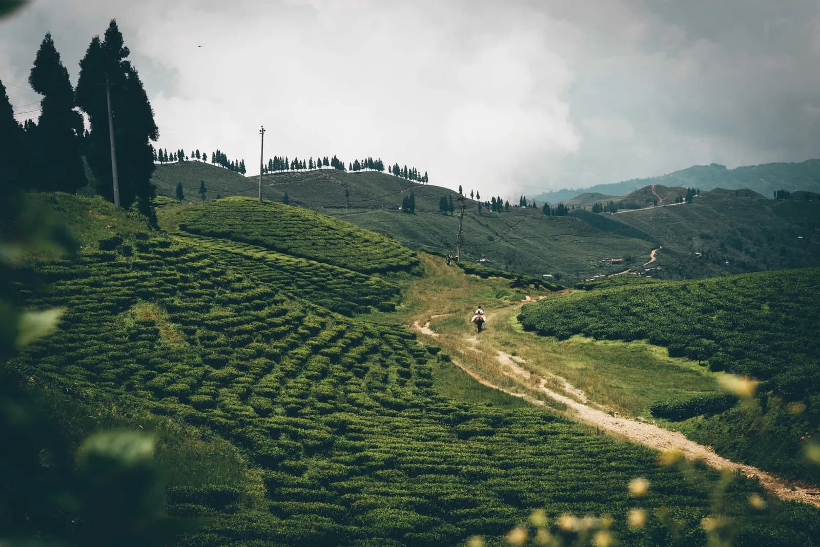
Ilam
Ilam is the tea country of eastern Nepal: easy walks through the Kanyam and Fikkal tea gardens to the Antu Danda sunrise watchtower, plus the Ramsar lake of Mai Pokhari, with no permit and no altitude.
- بیشینه ارتفاعAntu Danda hill (about 2,000 to 2,330 m)
- روز2–3
- دشواریآسان
- بهترین ماههاMar–Jun, Sep–Nov
عکس: Robic Upadhayay · CC BY-SA 4.0
Check that your policy covers helicopter evacuation and trekking at this region's altitude. We don't sell insurance.
What to look forWritten by FindTrekkingPartner teamبررسیشده توسط FindTrekkingPartner teamروش بررسی ماFindTrekkingPartner
Ilam یک منطقه پیادهروی در نپال است با مسیرهای 3 روزه که تا ۲٬۳۲۸ متر بالا میروند. پیادهروهای خارجی میتوانند در FindTrekkingPartner با ثبت یک سفر همراه با تاریخ، بودجه و سرعت خود، برای پیادهروی در اینجا همسفر پیدا کنند. تا زمانی که هر دو پیادهرو موافقت نکنند، تطابقها خصوصی میمانند و این سرویس رایگان است. با نرخهای متوسط، یک راهنمای دارای مجوز وقتی چهار پیادهرو سهم میدهند حدود ۲۸ دلار آمریکا (USD) برای هر نفر در 3 روز هزینه دارد، در مقابل ۱۱۲ دلار آمریکا (USD) برای یک پیادهرو بهتنهایی. بهترین فصلها Mar–Jun, Sep–Nov هستند. در مسیرهای باز مانند این، راهنمای دارای مجوز اجباری نیست (بررسیشده در 19 اکتبر 2026): شهرداری خومبو از قانون آوریل 2023 هیئت گردشگری نپال کنار کشیده است و پیادهرویهای یکروزه به راهنما نیاز ندارند، اما همچنان داشتن راهنما اکیداً توصیه میشود، پس با آژانس خود تأیید کنید. آخرین بررسی: ۲۷ مهر ۱۴۰۵. منابع: هیئت گردشگری نپال، DNPWC، اداره مهاجرت.
منابع:Department of Immigration, NepalNepal Tourism BoardDepartment of National Parks and Wildlife Conservation
نمای کلی
- راهنمای دارای مجوز
- قوانین محلی فعلی را بررسی کنید
- حداقل اندازهٔ گروه
- ۱ ترکر
No restricted area, and the walks here do not lie inside a national park or conservation area, so the Nepal Tourism Board guide rule of April 2023 (written for parks and conservation areas) does not apply; a local guide is optional (checked 19 October 2026).
ترکهای محبوب
نقاط شروع
Ilam Bazaar, Fikkal, Kanyam, Shree Antu
چگونه برسیم
Ilam Bazaar is about 700 km east of Kathmandu, roughly 16 hours by bus. Most visitors fly to Bhadrapur or Chandragadhi in Jhapa and drive north, and a 74 km stretch of the Mechi highway links Ilam to the East-West highway.
Ilam is the tea country of eastern Nepal: a district of rolling green hills in Koshi Province, near the Indian border, where the country's first tea estates were planted in the 1860s and where Kanyam, Fikkal and Antu Danda give easy walks through tea gardens to a Himalayan sunrise. The 11 to 17 km walk from Fikkal to the Antu Danda watchtower (about 2,000 m) looks across to Kanchenjunga, Makalu and, on the best days, Everest, and Mai Pokhari, a Ramsar-listed lake at about 2,100 m, is a short drive from Ilam Bazaar. There is no pass, no restricted-area permit and no altitude problem, which makes Ilam a gentle, low-risk region for families, slow walkers and anyone adding easy days to a longer trip. The best seasons are March to June and September to November, and the easiest way in is a flight to Bhadrapur and a drive north.
Ilam and its tea hills
Ilam is a long way from the trekking crowd. The district headquarters, Ilam Bazaar, sits in the Mahabharat hills about 700 km east of Kathmandu, and the surrounding country is a patchwork of tea terraces, cardamom and ginger fields, forest and villages of Limbu, Rai, Yakkha, Lepcha and Newar families. Wikipedia says the name comes from the Limbu words for winding and way, and the roads and trails do wind: the area is known for winding paths crisscrossing the hills. At the 2021 census the municipality had 50,085 residents. Ilam calls itself the home of six crops that begin with A in Nepali: potato, milk, cardamom, ginger, broom grass and the round Akabare chilli, alongside tea, bamboo, flowers and silk.
Nothing about the walking here is technical. The trails are lanes, village roads and tea-garden tracks between 1,200 and 2,300 m, so Ilam suits families, slow walkers and anyone who wants a gentle week after a big trek. The reward is the quality of the light on the tea in the morning and, from the high points, a skyline that runs from Kanchenjunga to Everest.
Tea country
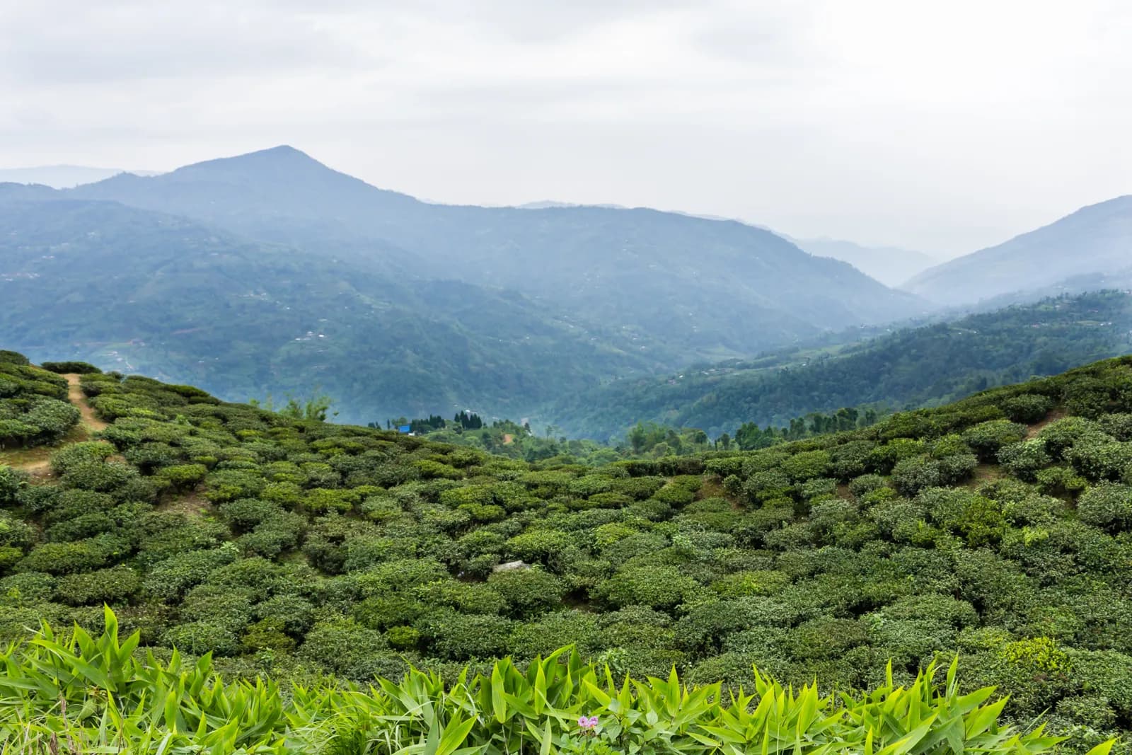
Wikipedia dates tea in Ilam to 1863, when the Chinese government gave then Prime Minister Jung Bahadur Rana tea saplings that were planted here. The Ilam tea factory opened in 1868 with plantations over 135 acres, but it was privatised in 2010 and no longer runs, although tea production continues in other forms. In 2010 Nepal produced about 16.2 million kg of tea a year, mostly in Ilam. The two gardens visitors usually walk through are Kanyam and Fikkal. Hop Nepal says the shrubs there were planted more than 140 years ago, and Nepal Traveller puts Kanyam at about 6,000 ft (about 1,830 m) with the tea factory at 5,500 ft, a 240 ha garden producing about 125,000 kg a year. Fikkal (also written Phikkal) is the commercial hub of the area, with a weekly haat on Thursdays.
An operator itinerary suggests sunrise at Kanyam, a tea factory visit, a half-hour drive to Pashupatinagar on the Indian border and a cheese factory before returning to Fikkal. Kanyam is also the start of our walking route, which runs down through the estates to Fikkal.
Antu Danda and the Himalayan sunrise
Shree Antu, also written Antu Danda, is the hill and village east of Fikkal where visitors climb a watchtower for sunrise. Two figures appear in sources for its height: about 1,997 m on one operator's itinerary and 2,328 m in Hop Nepal and Nepal Traveller, which describe the hill itself, so we give about 2,000 to 2,330 m. From the tower, sources list Kanchenjunga (8,586 m), Makalu (8,463 m) and Everest (8,848 m), and on a clear day the hills around Darjeeling. Visitors sleep nearby so that they can reach the tower before the sun comes up.
An operator gives the walk from Fikkal to Antu Danda as 11 km and 3 to 4 hours, and the return as 5 to 6 hours. OpenStreetMap shows the mapped route as 16.7 km, mostly on village roads with about 610 m of climbing, which suits the longer return time and is the number our map uses. A vehicle can take over at Shree Antu at any point, and sources give a drive of about 1 hour from Pashupatinagar and about 3 hours from Ilam Bazaar.
Mai Pokhari
Mai Pokhari lies about 15 km north of Ilam town according to Wikipedia and 18 km by road according to Hop Nepal, which gives about 30 minutes by private taxi. It sits at about 2,100 m, covers 90 ha and was designated a Ramsar wetland on 28 October 2008. The lake has a circumference of about 1 km, boats operate on it, and a botanical garden on its shore has a rock garden and an orchid house. Nepal Traveller says the nine corners of the lake are dedicated to nine gods, and a Bhagwati temple stands beside it; it is a pilgrimage centre for Hindus and Buddhists. Wikipedia lists about 300 bird species at the wetland. Hop Nepal adds an annual fair between October and November. The lake is only about 1 km around, so it makes a half-day addition rather than a trek, and sources also place it on the longer trail towards Sandakpur.
Wildlife and conservation at Mai Pokhari
The wetland's forest is mostly Schima, Castanopsis and laurel oak with epiphytic orchids, and Wikipedia adds water lilies, rhododendron and herbs. Recorded animals include the white-rumped vulture, the leopard cat, the Eurasian otter and the endemic variegated mountain lizard, and about 300 bird species have been logged there. The wetland is also fragile: Wikipedia names invasive species, building near the shore, settlement on the tracks leading to it and pesticide use in the tea plantations of its catchment as threats, and describes a code of conduct and a management plan drawn up with local eco-clubs. Treat the lake as a protected place: take rubbish out, keep to the paths and leave the water lilies alone.
Beyond the tea gardens
Ilam rewards a few extra days. Sandakpur, on the Indian border, is listed at 3,636 m or 3,665 m depending on the source, and is reached by a longer trail through Mai Pokhari, Maimajhuwa, Mabu and Kala Pokhari Bikhe, or by a private cab to Maimajhuwa Khorsanitar and a trek of about five hours; Nepal Traveller notes that a maintained road now lets vehicles reach it. Hop Nepal lists Gajurmukhi at 500 m on the Deumai river about 40 km from Ilam Bazaar, with a fair on Kartik Purnima in November, Siddhi Thumka at 1,693 m, Hangetham at 2,170 m and Todke Falls, 85 m high. Ilam also has a record of environmental firsts: in 2010 its municipality became the first in Nepal to ban plastic bags from the market.
Getting there
By road Ilam is 700 km from Kathmandu, and Wikipedia gives about 16 hours by bus from Koteshwor or Kalanki. Most visitors fly instead, to Bhadrapur or to Chandragadhi in Jhapa, a flight of about 45 minutes from Kathmandu according to Nepal Traveller, and continue by road: Wikipedia notes that a 74 km stretch of the Mechi highway links Ilam to the East-West highway. From Fikkal, Kanyam is a short ride and Antu Danda a longer one. Ilam Bazaar has a haat on Sundays and Thursdays. We found no fares we could confirm, so we show transport as items to check.
Best season
Spring and autumn are best. An operator gives March to June and September to November. Autumn has the clearest air for the Himalayan view. In the monsoon the hills are cloudy and the roads can be muddy, and Wikipedia describes Ilam as cold in winter, mild in summer and foggy in the monsoon season.
Where to stay
Operator itineraries put guests in hotels around Fikkal and in a guesthouse at Antu Danda, and OpenStreetMap lists an Antu homestay close to the viewpoint, which is the one to book if you want to see the sunrise without a long approach. We have no sourced room prices for the district, so our cost lines use Nepal-wide low-altitude ranges for lodging and meals and say so.
Permits, guides and rules
No trekking permit and no TIMS card is needed. Ilam is not a restricted area and our walks do not enter a national park or conservation area, so the Nepal Tourism Board rule of April 2023 for those areas does not apply here. Mai Pokhari is a Ramsar wetland, not a national park. A local guide is optional, mainly for the lanes between tea estates where signs are rare. See our guide rule page for the rule in full.
Altitude and safety
The highest point on our walks is about 2,330 m, so altitude is no concern. The main risks are heat and humidity in the lower tea gardens, slippery clay lanes in the rain, and mist that hides the views and the road. Start early for the sunrise and carry a headlamp.
Practical tips
- Sleep at Antu Danda if you want the sunrise; the walk up is easier the evening before.
- Use Fikkal as the base for Kanyam and Antu Danda; the Thursday haat is worth timing.
- Carry water and snacks: the mapped lanes pass few shops between villages.
- Ask the homestay to confirm the best viewing time, which moves with the seasons.
- Carry enough cash: we could not confirm cash machines outside Ilam Bazaar.
Sources and how we checked them
Tea history, population and road facts come from Wikipedia, the elevation and walking times for Antu Danda from Eternal Himalaya, the distance to Mai Pokhari from Hop Nepal (updated April 2026) and Nepal Traveller, and the Mai Pokhari description from Wikipedia. Where sources disagree on the height of Antu Danda or on the walking distance, we give both. Distances and climbing for our walking route are from our own map of OpenStreetMap roads and terrain data, checked on 19 October 2026.
همه مسیرهای این منطقه
هر مسیر استانداردی که اینجا پوشش میدهیم. روی یک مسیر بزنید تا برنامه روزبهروز آن باز شود.
مقایسه مسیرها
مسیرها را بر اساس طول، ارتفاع، دشواری یا هزینه برآوردی مرتب کنید تا مناسب خودتان را پیدا کنید.
مرتبشده بر اساس روز ↑
| مسیر | |||||
|---|---|---|---|---|---|
| Ilam Tea Gardens and Antu Danda | 3 | ۲٬۳۲۸ متر | آسان | ۳۸٫۸ کیلومتر | از NPR ۱۲٬۰۰۰ |
هزینه برآوردی است: نرخ روزانه سبک اقتصادی منطقه ضرب در تعداد روزها، بدون پرواز و مجوز.
بهترین زمان برای ترک
ماههای پررنگشده فصلهای پیشنهادی ترکینگ هستند. Mar–Jun · Sep–Nov
بهترین فصلسایر ماهها
Live conditions
Notes entered by our team from the sources linked on each item. Conditions change quickly, so confirm with your guide or lodge before you set off.
Best seasons: Mar–Jun · Sep–Nov
Nothing recent on file. Check with your guide or lodge before you go.
مجوزها و هزینهها
هزینهها برای هر نفر است و به گروه ملیتی شما بستگی دارد.
هزینههای روزانه
برای هر نفر در هر روز در ترک تیهاوسی. هزینهٔ راهنما برای هر گروه و باربر برای هر باربر در روز است. تا تاریخ ۱۴۰۵ مهر.
مجموع معمول Ilam Tea Gardens and Antu Danda، ۲ ترکر با تقسیم هزینه
- اقتصادی
- $۳۰–$۶۰
- میانرده
- $۱۱۰–$۱۸۰
- راحت
- $۱۵۰–$۲۴۰
| سبک | در روز | راهنما / روز | باربر / روز | جمع نمونه |
|---|---|---|---|---|
| اقتصادی | NPR ۲٬۹۰۰–۴٬۸۰۰ | NPR ۵٬۰۰۰ | NPR ۲٬۷۵۰ | NPR ۴٬۲۰۰–۶٬۸۰۰ |
| میانرده | NPR ۴٬۱۰۰–۶٬۵۰۰ | NPR ۵٬۰۰۰ | NPR ۲٬۷۵۰ | NPR ۵٬۸۰۰–۹٬۴۰۰ |
| راحت | NPR ۵٬۵۰۰–۸٬۴۰۰ | NPR ۵٬۰۰۰ | NPR ۲٬۷۵۰ | NPR ۸٬۰۰۰–۱۲٬۴۰۰ |
اقتصادی: Ilam Bazaar is about 700 km east of Kathmandu, roughly 16 hours by bus (Wikipedia). Most visitors fly to Bhadrapur or Chandragadhi in Jhapa, a flight of about 45 minutes, and continue by road. No fares for taxis, buses or the flight were found in our sources, so transfers are shown as lines to check.
میانرده: Ilam Bazaar is about 700 km east of Kathmandu, roughly 16 hours by bus (Wikipedia). Most visitors fly to Bhadrapur or Chandragadhi in Jhapa, a flight of about 45 minutes, and continue by road. No fares for taxis, buses or the flight were found in our sources, so transfers are shown as lines to check.
راحت: Ilam Bazaar is about 700 km east of Kathmandu, roughly 16 hours by bus (Wikipedia). Most visitors fly to Bhadrapur or Chandragadhi in Jhapa, a flight of about 45 minutes, and continue by road. No fares for taxis, buses or the flight were found in our sources, so transfers are shown as lines to check.
قوانین و رفتار درست
راهنماها
- همهٔ مناطق
Foreign trekkers must trek with a licensed guide in national parks and conservation areas (in force since April 2023). Enforcement varies by region, so verify the current rule before you go.
مجوزها
- همهٔ مناطق
Carry your permits at all times; they are checked at several checkpoints along every route.
ایمنی و ارتفاع
- همهٔ مناطق
Buy travel insurance that covers helicopter rescue to at least 6,000 m.
- همهٔ مناطق
Climb high, sleep low: above 3,000 m, avoid raising your sleeping altitude by more than about 500 m per day, and add rest days.
حفاظت محیط
- همهٔ مناطق
Carry out all non-burnable waste (batteries, plastic, wrappers) and use a refillable water bottle.
فرهنگ
- همهٔ مناطق
Respect monasteries: walk clockwise around stupas and mani walls, and remove shoes where asked.
- همهٔ مناطق
Ask before photographing people, especially at religious sites and ceremonies.
پهپادها
- همهٔ مناطق
No drones without prior permission from the relevant authority.
عکسها
پرسشهای متداول
Kanyam is the best known, with long views over the estates, and Fikkal is the commercial centre nearby. Our route walks down from Kanyam to Fikkal on tea-estate roads.
An operator gives 11 km and 3 to 4 hours for the walk up and 5 to 6 hours back. Our map shows 16.7 km, mostly on village roads, so we allow 4 to 6 hours each way.
An operator lists Kanchenjunga, Makalu and Everest from the watchtower at sunrise, and on a clear day the hills around Darjeeling. Visibility depends on the season; autumn is clearest.
Sources differ: about 1,997 m on one itinerary and 2,328 m for the hill in two other sources. Either way it is far below the altitude where symptoms start.
A Ramsar-listed wetland at about 2,100 m, 15 to 18 km from Ilam town, with a lake about 1 km around, a botanical garden and a Bhagwati temple. It is a half-day visit, not a trek.
No trekking permit is needed. Ilam is not a restricted area, and the walks avoid national parks and conservation areas, so the guide rule does not apply. A guide is optional.
March to June and September to November, according to an operator. Autumn is clearest for views, and the monsoon is cloudy and muddy.
The bus takes about 16 hours. Most visitors fly to Bhadrapur or Chandragadhi in Jhapa, a flight of about 45 minutes, and then drive north through the hills.
سفرهای باز
راهنماهای Ilam
منابع
آماده ترک Ilam هستید؟
برای این تاریخها همراه ترکینگ پیدا کنید یا برنامهریزی مسیر خودتان را شروع کنید.