

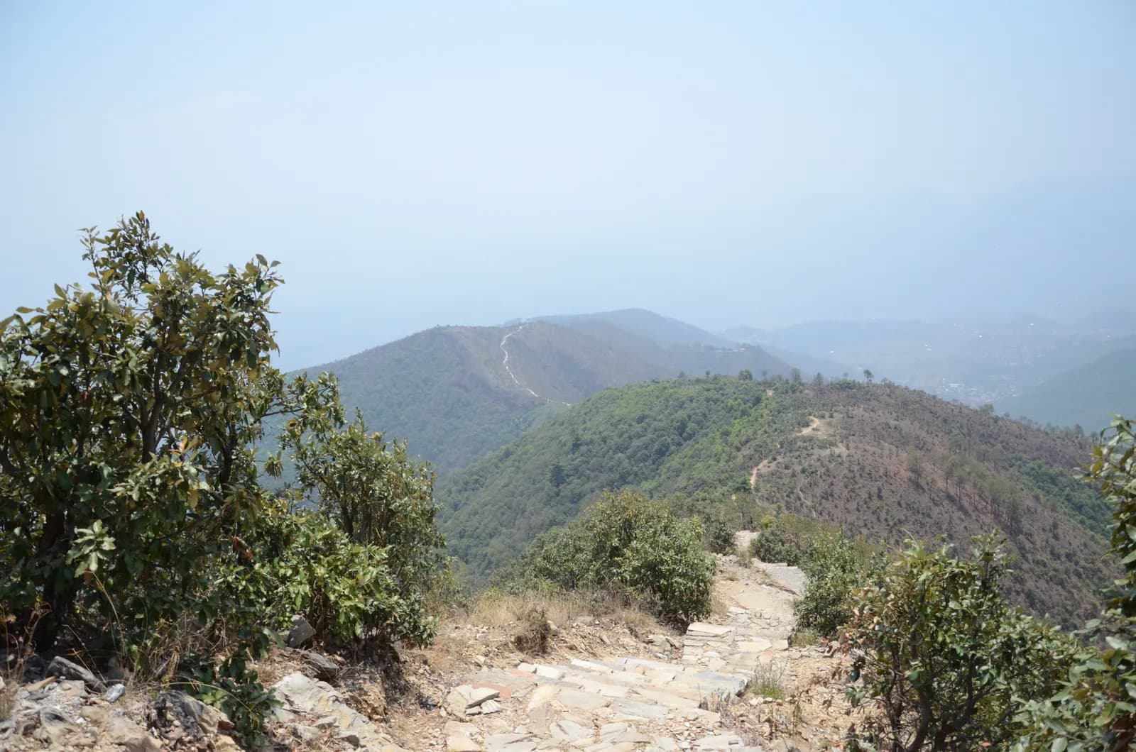
Drive from Kathmandu to Pharping and start walking early. The path climbs through pine forest on stone paving and steps, passes Hattiban Resort about half an hour above the road if you start at Pahiro, and then rises steadily for about three hours to the ridge, where the shrine of Champadevi stands in the open at about 2,285 m. On our map the round trip is 11.2 km with 750 m of climbing from Pharping. Rest at the top for the views of the Langtang and Ganesh Himal ranges, then descend by the same path, or drop steeply to the Champadevi Mai temple and walk about half an hour on the road to Khahare, where your car waits. Carry lunch and water.
Champadevi Day Hike
A one-day hike from Pharping through pine forest to the Champadevi hilltop shrine (about 2,285 m) and back, 11.2 km with 750 m of climbing and views of Langtang, Ganesh Himal and Gaurishankar.
- الأيام1
- أقصى ارتفاع2,285 م
- المسافة11.2 كم
- الصعود747 م
- الصعوبةمتوسطة
- أفضل الأشهرOct–Nov, Mar–May
الصورة: Pratap Baniya · CC BY-SA 4.0
معروض بالإنجليزية — لم يُترجم بعد.
خط السير هذا مسودة ولم يُتحقق منه بعد. أكّد المراحل دائمًا مع مرشدك.
Written by FindTrekkingPartner teamراجعه FindTrekkingPartner teamكيف نراجعFindTrekkingPartner
Champadevi Day Hike رحلة ترحال مدتها 1 يومًا في منطقة Kathmandu Valley في نيبال، وتصعد إلى ارتفاع 2,285 م. يمكن للمتجولين الأجانب العثور على شريك لها عبر FindTrekkingPartner بنشر رحلة بتواريخهم وميزانيتهم ووتيرتهم. تبقى المطابقات خاصة حتى يوافق المتجولان معًا، والخدمة مجانية. بالأسعار المتوسطة، يكلف المرشد المرخص نحو 9 دولار أمريكي (USD) للشخص خلال 1 أيام عندما يتشاركه أربعة متجولين، مقابل 37 دولار (USD) لمتجول واحد بمفرده. أفضل المواسم هي Oct–Nov, Mar–Apr. لا يُفرض المرشد المرخص على المسارات المفتوحة مثل هذا المسار (تم التحقق في 19 أكتوبر 2026): فقد انسحبت بلدية خومبو من قاعدة هيئة السياحة النيبالية الصادرة في أبريل 2023، ولا تتطلب رحلات اليوم الواحد مرشدًا، لكن يُنصح بشدة بمرشد، فتأكد مع وكالتك. الرحلات المفتوحة لهذا المسار مدرجة أدناه مع شهر البدء وحجم المجموعة والأماكن المتبقية. آخر تحقق: 19 أكتوبر 2026. المصادر: هيئة السياحة النيبالية، DNPWC، إدارة الهجرة.
المصادر:Department of Immigration, NepalNepal Tourism BoardDepartment of National Parks and Wildlife Conservation
ابحث عن شريك لمسار Champadevi Day Hike
- ابحث عن شريك لمسار Champadevi Day Hikeلا توجد رحلات مفتوحة بعد
- ابحث عن شريك لمسار Shivapuri Peak Day Hikeلا توجد رحلات مفتوحة بعد
- ابحث عن شريك لمسار Nagarkot to Changu Narayan Day Hikeلا توجد رحلات مفتوحة بعد
- ابحث عن شريك لمسار Chisapani Nagarkot Trekلا توجد رحلات مفتوحة بعد
- ابحث عن شريك لمسار Phulchowki Day Hikeلا توجد رحلات مفتوحة بعد
- ابحث عن شريك لمسار Namo Buddha Day Hikeلا توجد رحلات مفتوحة بعد
نظرة عامة
يبدأ من Pharping1 يومًا · الأقصى 2,285 م
أفضل المواسم: Oct–Nov, Mar–May
The Champadevi hike is a one-day walk from Pharping, on the southern rim of the Kathmandu Valley, through pine forest to the open hilltop shrine of Champadevi at about 2,285 m, and back. On our map the round trip is about 11.2 km with 750 m of climbing, mostly on a stone-paved path and forest track. Operators put the climb from Hattiban Resort at about three hours and the whole climb from the road at three to three and a half hours; the descent takes one to two hours. Allow five to seven hours for the day, with a 45 minute drive each way from Kathmandu. On a clear morning the view runs from Langtang and Ganesh Himal to Manaslu and Gaurishankar. None of our sources lists a park permit for this hill. Bring water and lunch.
The plan follows two operator itineraries that agree on the Hattiban Resort halfway point and the open shrine at the top. Heights vary between 2,278 and 2,285 m in the sources and OpenStreetMap gives 2,241 m for the summit node, so we say about 2,285 m. Operators start at Pahiro or Hattiban to save time; our map starts lower, at Pharping, and is therefore longer.
What the hike is like
The path climbs steadily through pine forest on stone paving and steps, passes Hattiban Resort and continues to a ridge where the shrine of Champadevi stands in the open. From the ridge you see Chandragiri on one side and Phulchowki on the other, with the Bagmati river and Khokana below. An optional extension continues to Bhasmasur hill, which is higher than Champadevi. Pharping, a Newar village, is worth a stop before or after the walk.
Permits and rules
Neither operator lists a park permit or entrance fee for the hill. Monument fees at Pharping or Dakshinkali temples, if you visit them, are separate. Carry your litter out.
Best season
Operators say the hike can be done in every season and advise an early start for clear skies. Autumn (October to November) and spring (March to May) give the sharpest mountain views; in the monsoon the paving is wet and cloud hides the peaks.
Getting there and away
Drive from Kathmandu to Pharping or to Pahiro, about 45 minutes from Thamel, and finish at Khahare or Machhegaun, about 45 minutes back by road, depending on traffic. A taxi or an operator transfer is the simplest way; no fare is published in our sources, so agree it in advance.
Difficulty and fitness
The hike is gentle to moderate: 750 m of climbing, mostly on paved steps, over five to seven hours. Good shoes, two litres of water and a rain jacket are enough. Leave Pharping by 8 am so that you are on top before the haze builds.
Budget notes
There is no permit fee. Budget for a taxi to the trailhead and a return from Khahare or Pharping, plus lunch. The costs section shows the transfers as lines to check.
أبرز المعالم
- Champadevi hilltop shrine at about 2,285 m with Himalayan views on clear days
- Stone-paved path and steps through pine forest
- Hattiban Resort halfway up as a rest stop
- Pharping, a Newar village with monasteries and the Dakshinkali temple nearby
- Chandragiri on one side and Phulchowki on the other from the ridge
خريطة المسار
بيانات المسار من OpenStreetMap ولم يتحقق منها فريقنا بعد. استخدمها للتخطيط لا للملاحة.
يوماً بيوم
التكلفة
التكلفة الشاملة التقديرية للفرد: النزل والطعام حسب الارتفاع، والنقل، والتصاريح، والمرشد والحمّالون. كلما زاد عدد المتنزهين المتقاسمين لمرشد وحمّالين، قلّ ما يدفعه كل فرد. اعتباراً من أكتوبر 2026.
| النمط | متنزه واحد | 2 متنزهين يتقاسمون | 4 متنزهين يتقاسمون |
|---|---|---|---|
| اقتصادي | — | — | — |
| متوسط التكلفة | 40 US$–80 US$* | 20 US$–40 US$* | 10 US$–30 US$* |
| مريح | 40 US$–80 US$* | 30 US$–50 US$* | 20 US$–40 US$* |
تقاسم مرشداً ووفّر المال
في الفئة المتوسطة، يدفع المتنزه المنفرد نحو 40 US$–80 US$؛ ويدفع أربعة متنزهين يتقاسمون مرشداً وحمّالين اثنين نحو 10 US$–30 US$ للفرد (أقل بنسبة 66% في أعلى النطاق).
التفاصيل لمتنزهين يتقاسمان
| البند | اقتصادي | متوسط التكلفة | مريح |
|---|---|---|---|
| المرشد | — | 10 US$–30 US$ | 10 US$–30 US$ |
| الحمّالون | — | 0 US$–20 US$ | 10 US$–30 US$ |
تعتمد الميزانية على النقل العام وبلا حمّال؛ وتتقاسم الفئة المتوسطة حمّالاً واحداً بين متنزهين ومركبة خاصة؛ وتمنح فئة الراحة كل متنزه حمّالاً. يُدرج المرشد حيث يكون مطلوباً أو عندما يكون النمط متوسطاً أو مريحاً.
غير مشمول
لم نجد سعراً منشوراً لـ: Kathmandu to Pharping and back by taxi. الإجماليات المعلّمة بـ * لا تشمل هذه البنود؛ اسأل وكالتك. A day hike: no lodging and no permit. A guide is optional.
مصادر التكاليف
- PriceNepal: Nepal Travel Cost Guide 2026 (2026-05-14)
- Third Rock Adventures: Nepal trek budget planner (2026-05-09)
- Himalayan Partner: Guide and porter price in Nepal 2026 (2026-02-10)
- Shikhar Adventure: Annapurna Circuit trek cost (2026-02-03)
- Nepal Tourism Board: Trekking Permit (2026-10-18)
تقديرات مستمدة من أدلة المشغلين وليست عروض أسعار. لا تشمل البقشيش والتأمين والمعدات وفنادق كاثماندو؛ الدولار الأمريكي بسعر صرف المنصة.
الصور
الأسئلة الشائعة
Operators give about three to three and a half hours to climb from the road and one to two hours down, so allow five to seven hours for the day. Our map shows 11.2 km and 750 m of climbing from Pharping.
Operators give 2,285 m, or 2,278 to 2,280 m on other pages. OpenStreetMap lists 2,241 m for the summit node. We say about 2,285 m.
Operators start at Pahiro or Hattiban, a 45 minute drive from Thamel, or in Pharping. The Pharping start adds distance but lets you visit the village.
None of our sources lists a permit or park fee for Champadevi. One operator includes a hiking pass in its price but gives no amount. Temple fees at Pharping, if you visit, are separate.
On clear days operators list Langtang, Ganesh Himal, Manaslu and Gaurishankar, with Chandragiri on one side, Phulchowki on the other and the Bagmati river below.
المصادر
على امتداد المسار
أماكن الإقامة والمساعدة الطبية والمياه والمعالم في كل يوم من المسار.
1. Pharping
- Daksinkali Health Post · الخدمات الطبية · 1,572 م
- Family Guest House · أماكن الإقامة · 1,574 م
- Pharphing Homestay and Cafe · أماكن الإقامة · 1,597 م